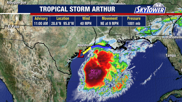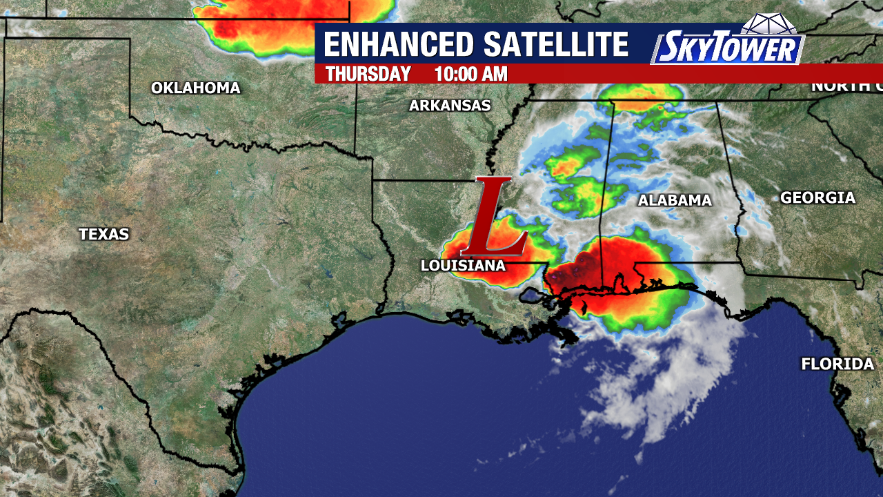
After becoming the first named storm of the 2026 Atlantic hurricane season, Arthur has dissipated into a post-tropical low-pressure system as it moves across parts of Louisiana and Mississippi.
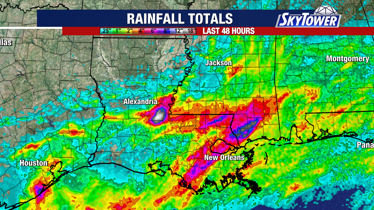
While Arthur never became a particularly strong tropical storm, it brought widespread heavy rainfall to communities along the northern and western Gulf Coast. The storm has been blamed for multiple flash flood emergencies and at least one fatality, highlighting that even weaker tropical systems can produce significant impacts. Local radar has estimated that over a foot and a half of rain has fallen over parts of Louisiana within the last two days.
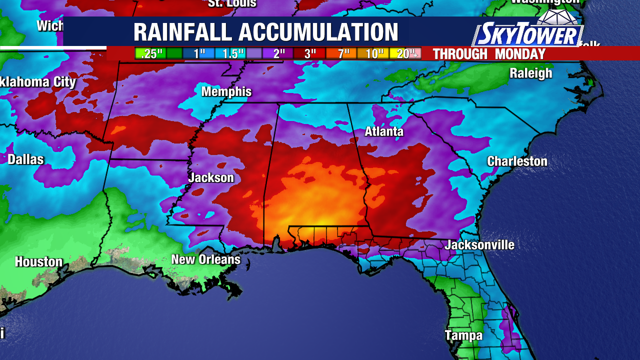
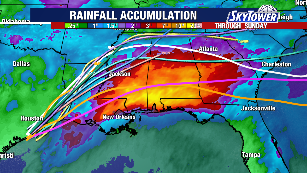
The remnants of Arthur will continue tracking eastward over the next couple of days, spreading periods of heavy rain and increasing rain chances across portions of Mississippi, Alabama, Georgia, and the Carolinas. Life-threatening flash flooding will remain a concern during this period.
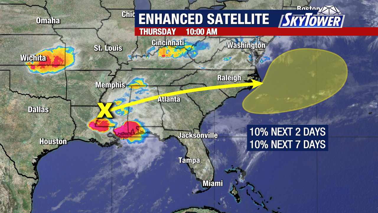
Environmental conditions may allow the remnants to briefly reorganize over the Atlantic late Friday or Saturday. If redevelopment occurs, the system would likely remain offshore and move away from the East Coast. The National Hurricane Center has given a 10% chance of development within the yellow shaded region within the next two days.
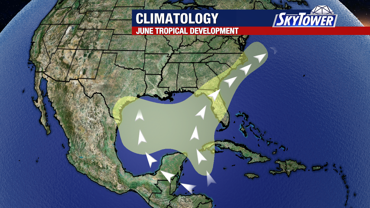
Arthur’s evolution was consistent with what is often observed during the month of June. Early-season tropical systems frequently develop close to the Gulf Coast or Southeast coastline and are more likely to be disorganized rain-producing storms than major hurricanes.
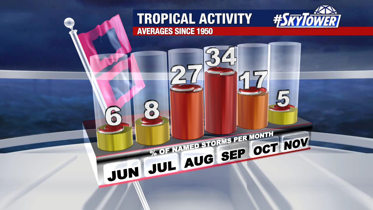
Historically, June accounts for only about six percent of all named storms in an average Atlantic hurricane season. While the month marks the beginning of hurricane season, it is typically not when the basin experiences its most active or intense tropical activity. Even so, Arthur serves as an early reminder that tropical systems do not need to be strong hurricanes to create dangerous flooding and life-threatening conditions.