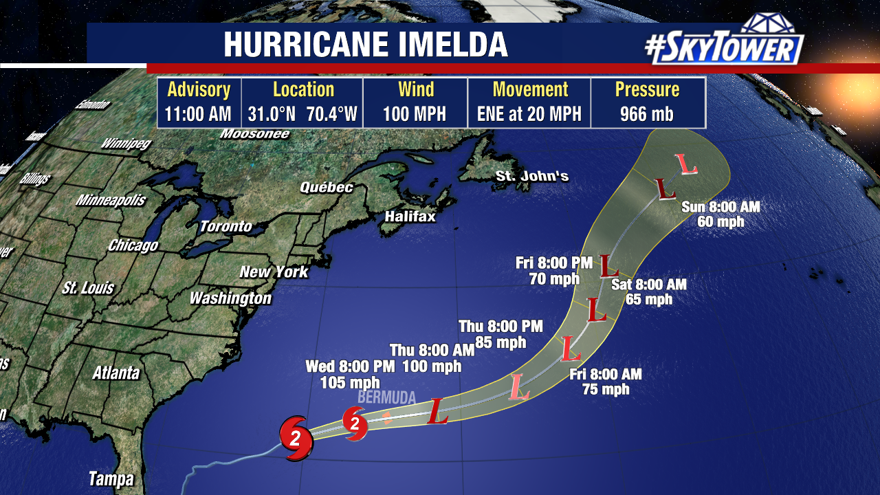
Bermuda is bracing for Hurricane Imelda with back-to-back storms impacting the island this week.
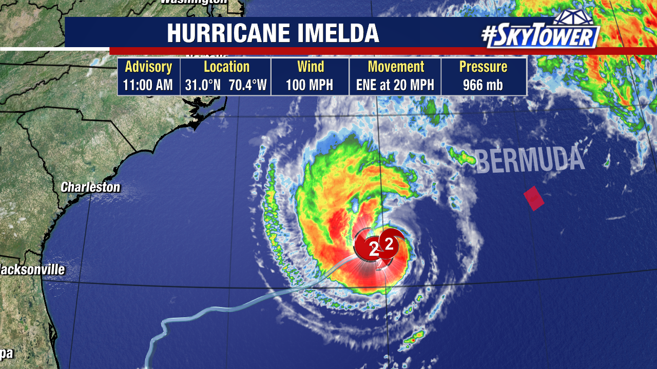
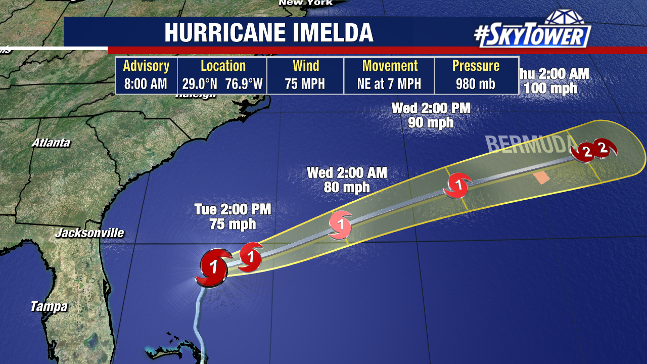
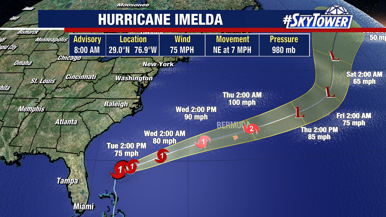
Imelda has been strengthening, now a Category 2 storm with 100 mph sustained winds.
A Hurricane Watch is up for Bermuda with impacts starting today. Imelda is about 500 miles west-southwest of the island, moving at a very fast clip of 20 mph.
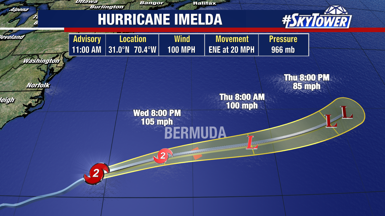
Imelda is moving to the east-northeast and Bermuda is right in the middle of the forecast cone. Hurricane-force-winds will spread across the small island today, with the worst of the weather tonight.
From there, Hurricane Imelda will gradually weaken and become extratropical through the remainder of the week as it continues moving through the Atlantic.
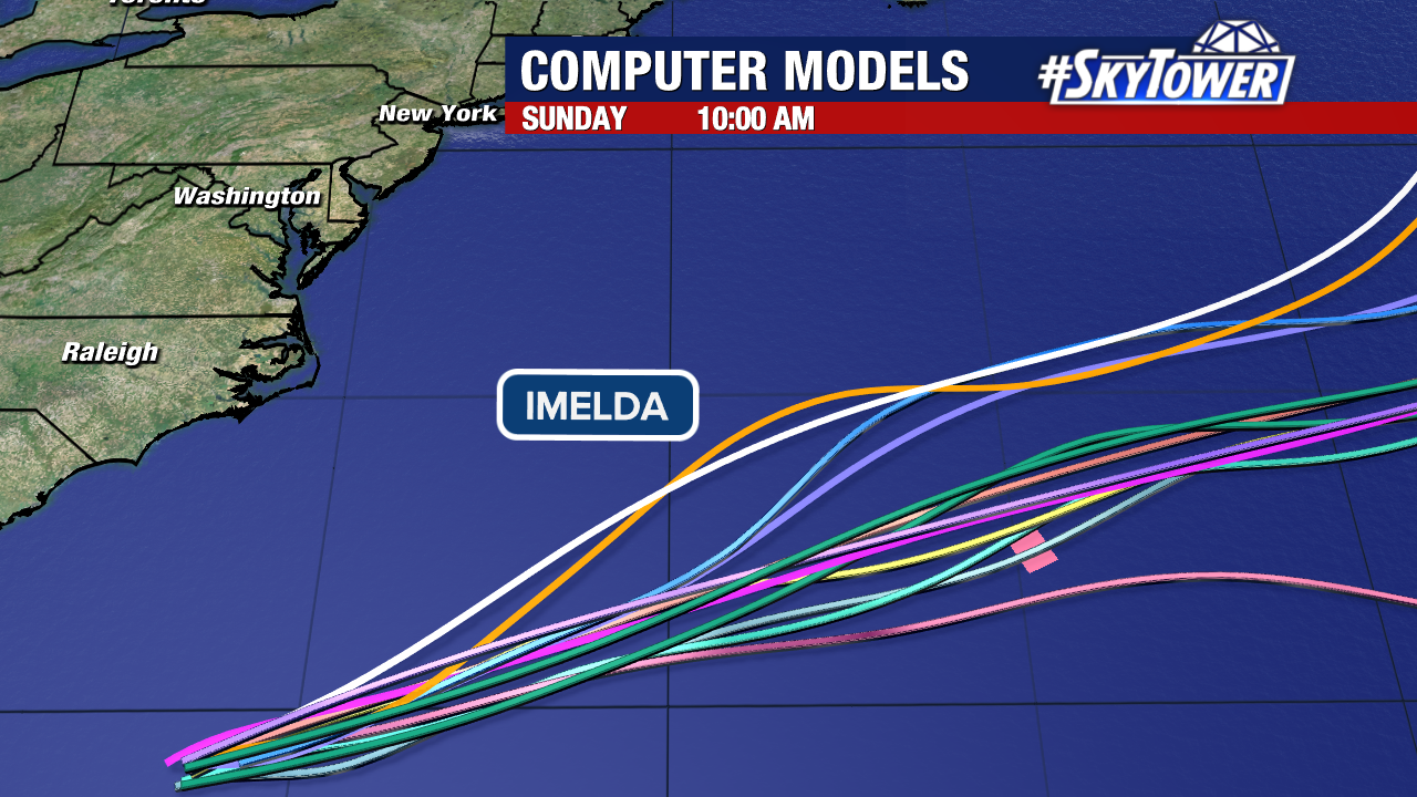
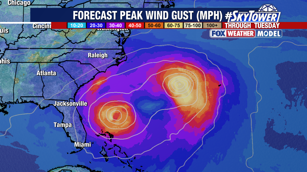
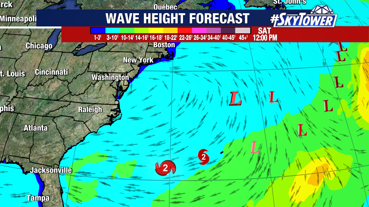
Dangerous surf, rip current and large waves will continue to impact the East Coast into this weekend as the energy remains high in the Atlantic.
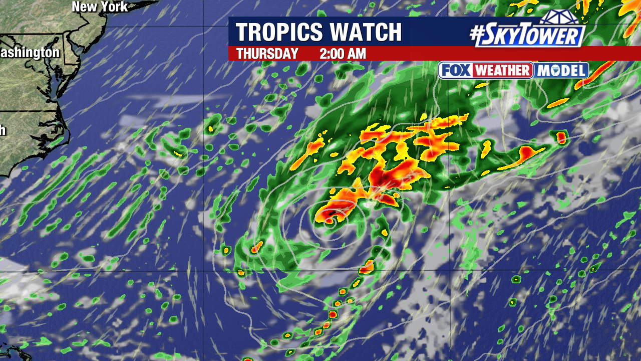
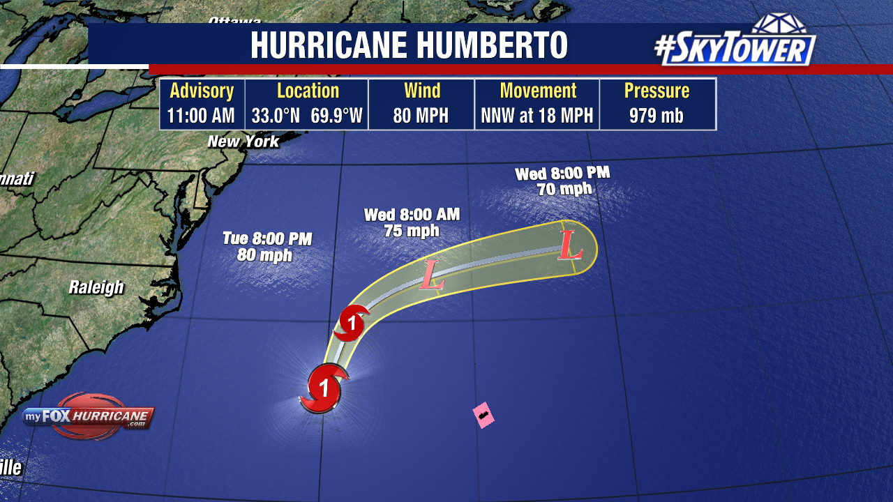
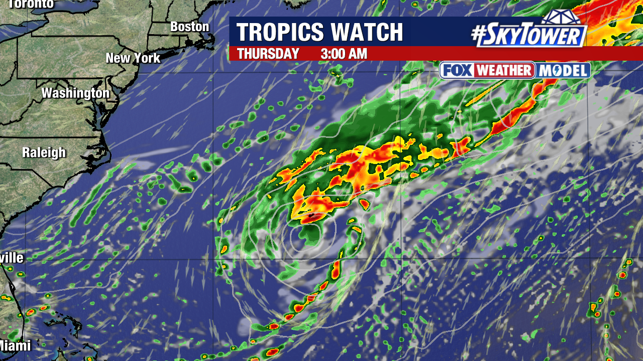
After Hurricane Humberto passed Bermuda the last few days, the remnants of the storm have merged with a front in the northern Atlantic.
There are no other areas we are currently watching in the Atlantic Basin. We’ll keep you updated!