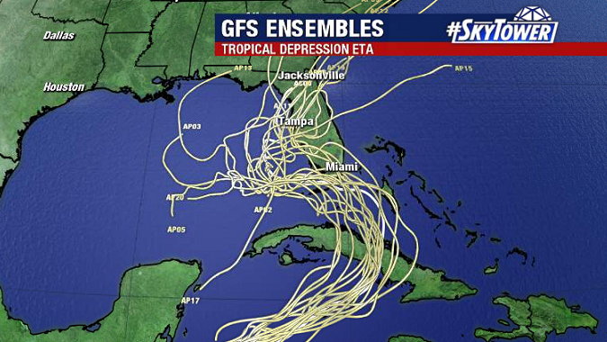
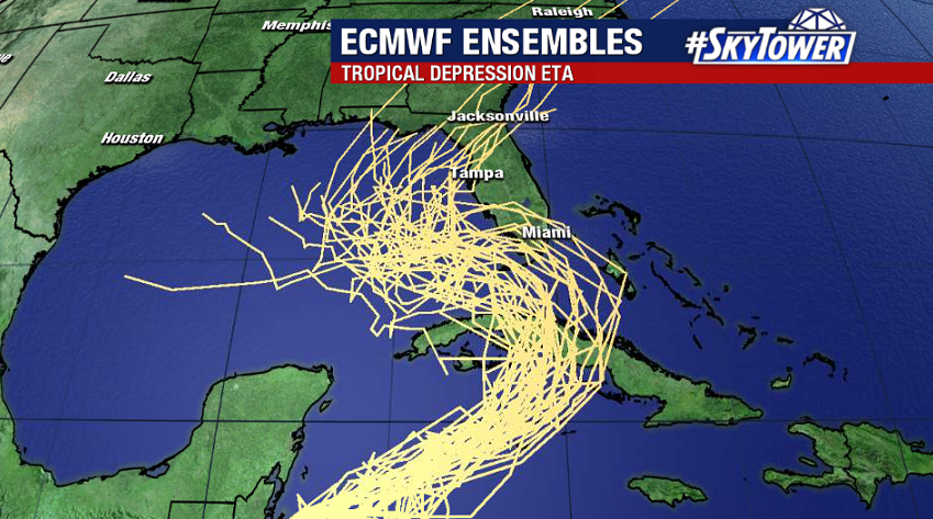
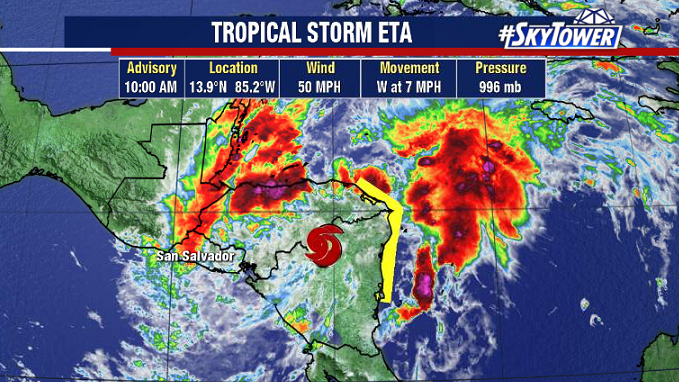
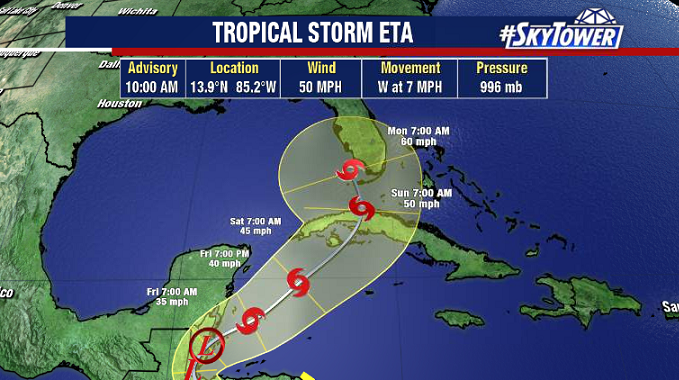
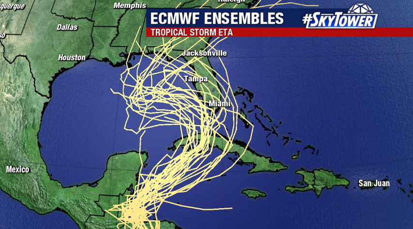
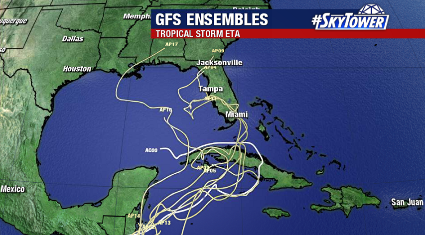
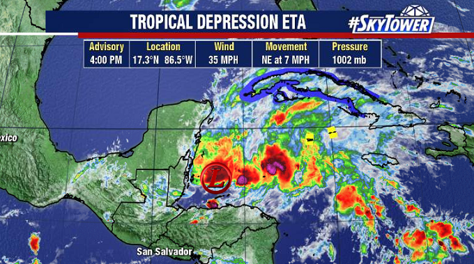
‘Eta’ is now back out over open water in the northwestern Caribbean, and should become a tropical storm again soon. It’ll be moving northeast through most of the weekend, first crossing Cuba on its way toward South Florida and the Keys.
Every storm is different, and this one has a lot of factors in play that will determine its intensity and track as it moves north. Overall, what we’re expecting is basically a big ‘S’ turn track. That is to say, after being steered by a trough to the northeast over the next 48 hours or so, a ridge building in off the Atlantic will steer Eta back to the west and into the Gulf. Finally, another trough will then turn the storm back to the north-northeast.
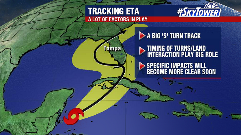
What will ultimately determine the timing/location/severity of any impacts across Florida is the timing of these turns, land interaction, and how the storm’s intensity changes under the influence of the previously mentioned steering features. It’s safe to say that this is a tricky forecast puzzle to put together, so we need to be patient and take it day by day.
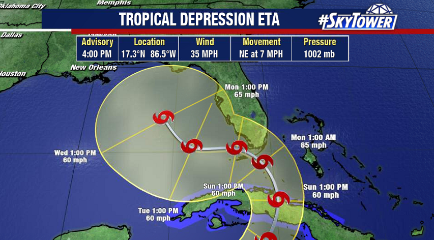
Over the weekend things will become more clear, but for now folks in South Florida need to be preparing for the possibility of tropical storm conditions beginning as early as Sunday evening. Check back with us often through the weekend for updates.