A Couple Areas Of Interest In The Atlantic; No Immediate Concerns

Claudette moved through the Southeast about a week ago, and things have been fairly quiet since then. That being said, we are keeping an eye on a couple areas in the Atlantic. As it stands right now, neither of these look like they’re going to be a threat.

First, we have a disturbance located a couple hundred miles south of Bermuda that will be moving toward Georgia and the Carolinas over the weekend. While some slow development is possible, this will most likely just assist in bumping up rain chances for parts of the southeastern U.S. Atlantic coast early next week.

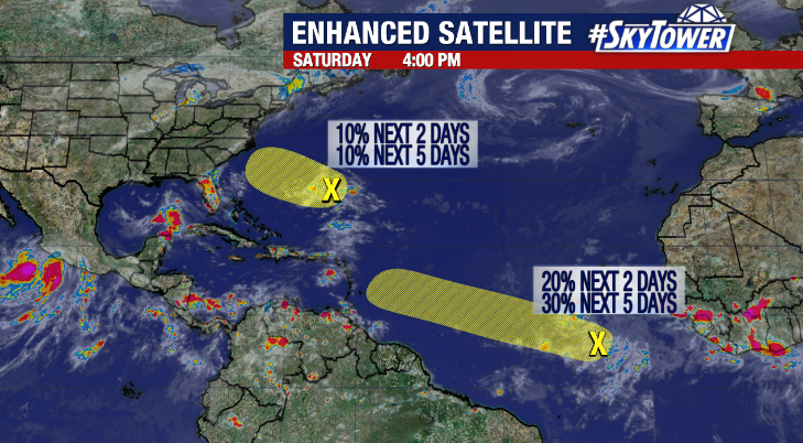
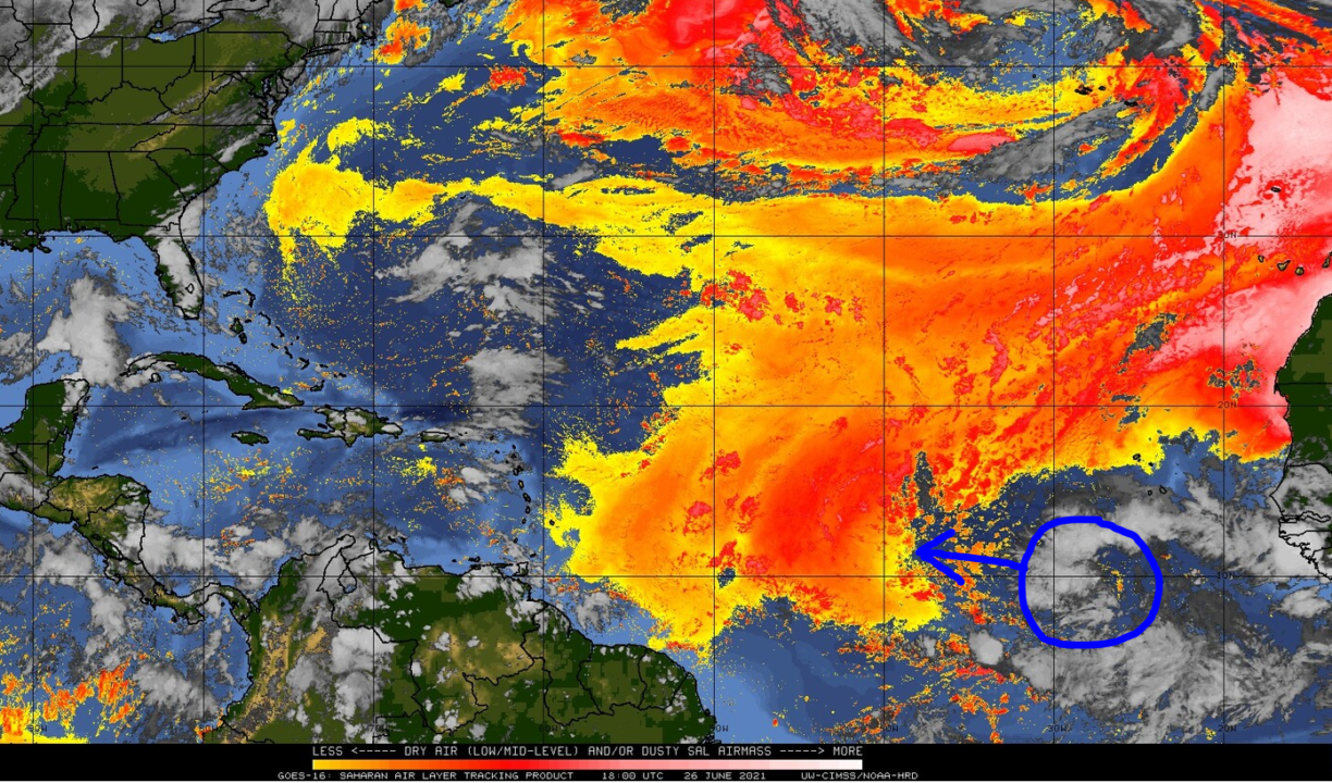
We’ve also been keeping tabs on a robust tropical wave in the far eastern Atlantic. While this has shown signs of better organization at times over the last few days, it will be moving into a large area of dry air and Saharan dust in the coming days that will make any significant development very difficult.

Courtesy: CIMSS/University of Wisconsin – Madison

Tropical Storm Claudette Expected To Form Friday; Heavy Rain Threat For Northern Gulf Coast

The National Hurricane Center began issuing advisories on Potential Tropical Cyclone 3 in the western Gulf of Mexico late Thursday afternoon. This is something they started doing a few years ago, as it allows them to issue tropical storm watches/warnings when a storm is expected to form close to land. A tropical depression is expected to form tonight or on Friday, and it has a good chance of strengthening into Tropical Storm Claudette before coming ashore in Louisiana early Saturday.

Regardless of strength, the biggest threat is going to be heavy rainfall and localized flash flooding for parts of the northern Gulf Coast up through the Southeast over the weekend. This is going to be a lopsided system with the heaviest rain falling east of the center. Several inches are likely to fall over a widespread area; with isolated maximum amounts up to 12 inches.

A tropical storm warning is in effect from Intracoastal City, LA to the AL/FL border.