Elsa Will Cross Cuba Tonight Through Monday Afternoon; Various Impacts Expected Across Central And South Florida

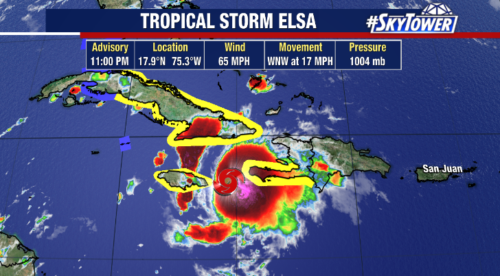
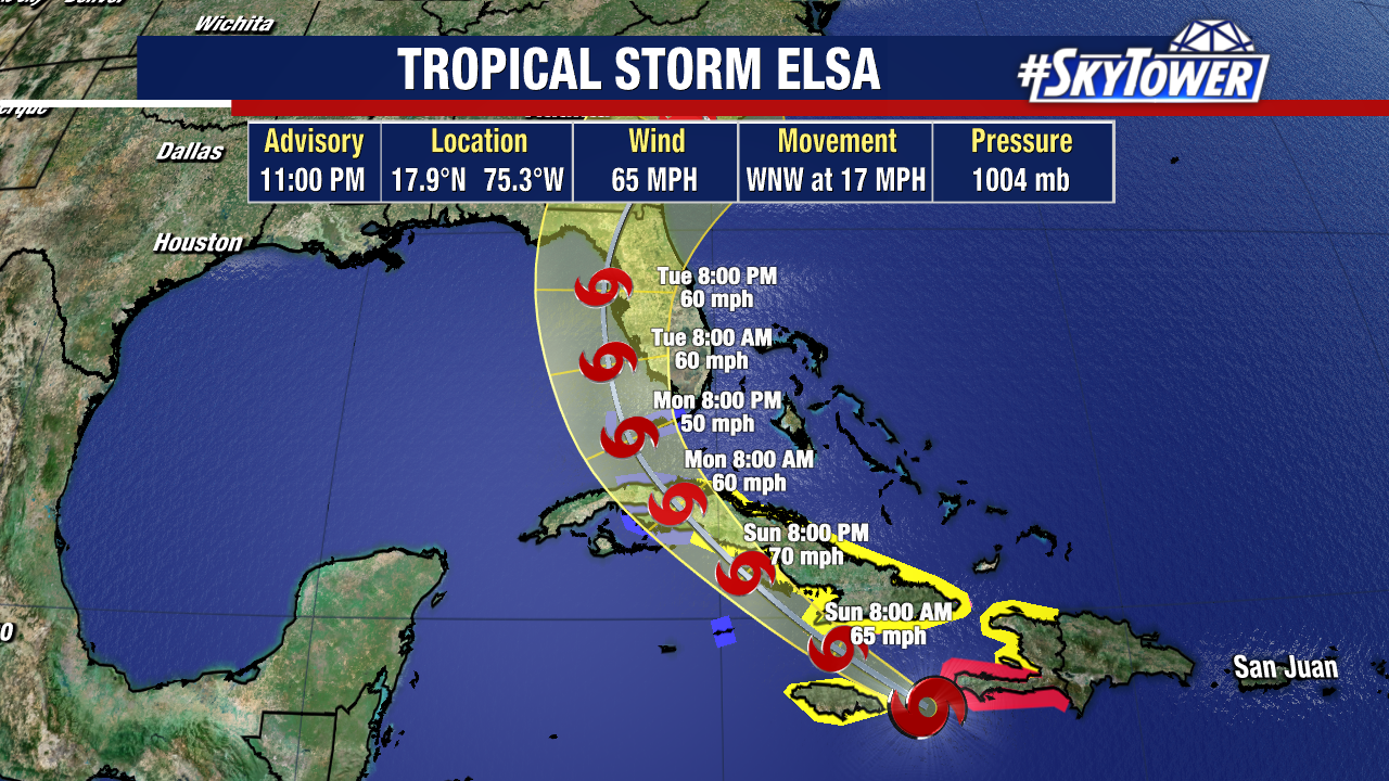
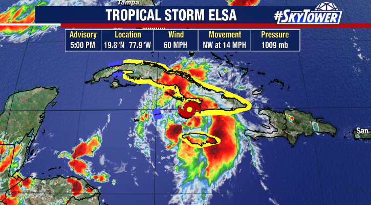
We have a ragged looking Elsa south of Cuba Sunday afternoon. It’s been a challenge for the Hurricane Hunters to keep track of low-level center, and this may be a case where we have a new center form under one of the many areas of convection. That could play a big in the ultimate track toward and over Florida.

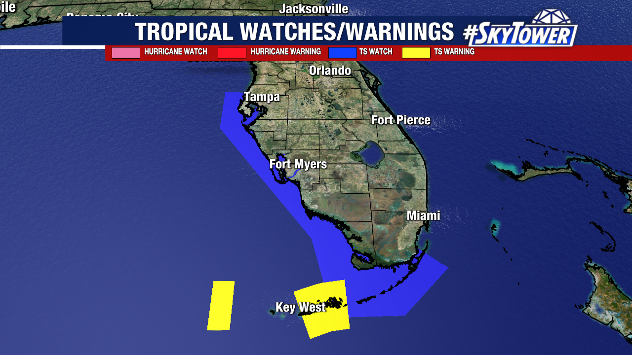
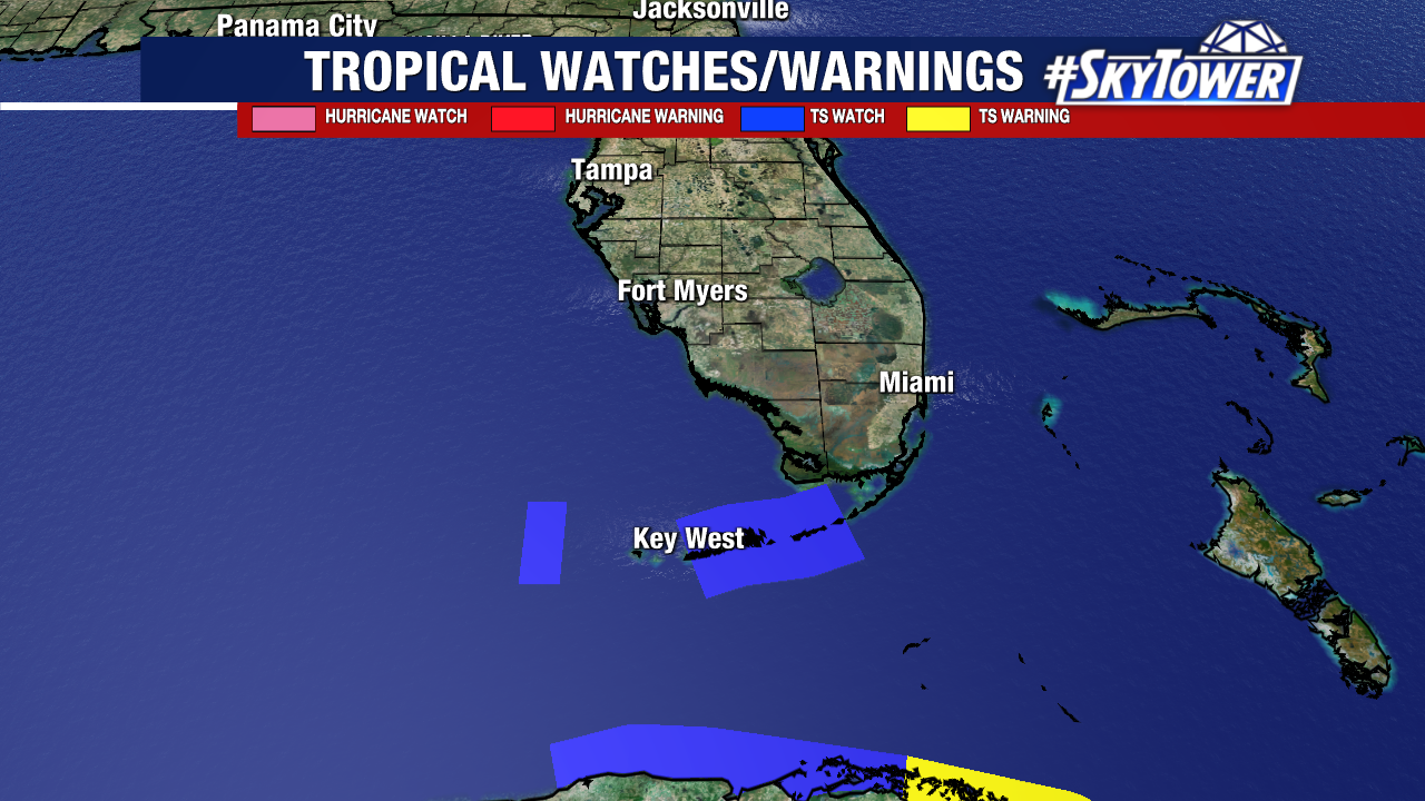
At this point, we certainly expect impacts across most of central and south Florida in some form. For South Florida that would come during the day Tuesday… Central Florida Tuesday night… and northeast Florida Wednesday morning. Those impacts will include tropical storm wind gusts, locally heavy rainfall, and isolated tornadoes. Coastal flooding from storm surge (likely 2-4 ft above normal tide levels) will also be possible near and south of where the center of the storm comes ashore. Due to most of the impacts being east of the center of the storm, the exact track will determine location specific impacts. This is something we should get a really good idea of over the next 24 hours or so.

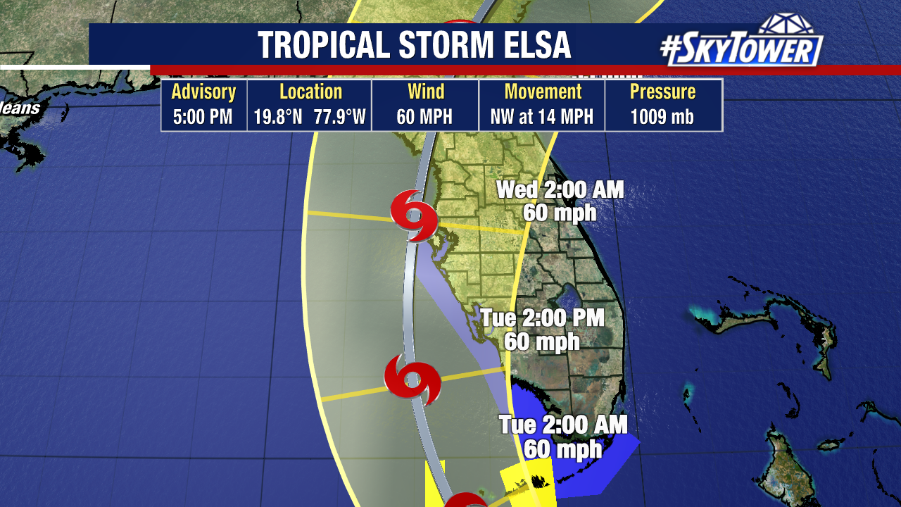
If you live anywhere in central or south Florida, you should be preparing for possible tropical storm conditions for at least a period time. As a comparison, this could end up being very similar to Tropical Storm Eta last November. The best way to get ready for tropical storm conditions is simply by securing loose items around your house (trash cans, pool toys/chairs, etc.). We’ll keep you posted.

Elsa heading Toward Cuba; Tropical Storm Watch In Effect For The Lower Florida Keys

As of 11pm Saturday evening, Tropical Storm Elsa was located about 175 miles ESE of Montego Bay, Jamaica. It remains a strong tropical storm with max winds of 65 mph.

In the last 24 hours, self-induced wind shear created by the storms fast forward motion has weakened the storm, along with land interaction as it passed just south of Haiti. The forward speed should has begun to slow down as it approaches western side of the Bermuda ridge, so that self-induced shear should weaken. However, there is also a lot more land interaction that lies ahead as it approaches and passes over Cuba on Sunday night. Taking all this into account, the net effect should be some gradual weakening through the rest of the weekend.

In terms of track, the window of possible paths is shrinking. At this point it’s very likely that Elsa will approach Florida’s west coast Monday into Tuesday, with tropical storm conditions possible in parts of the Keys as early as Monday afternoon. Where exactly the storm decides to come ashore will determine location of impacts. There will also be an opportunity for re-strengthening once the storm moves into the Gulf, so we’ll have to see what kind of shape its in once it comes off the northern coast of Cuba. While it’s possible this becomes a very weak, almost non-eventful storm, we have to be prepared for the flip side of things with the possibility of coastal flooding, heavy rain, and isolated tornadoes Monday evening through Tuesday night. For those that experienced Tropical Storm Eta last November, the impacts could certainly be very similar.