As of 11pm Saturday evening, Tropical Storm Elsa was located about 175 miles ESE of Montego Bay, Jamaica. It remains a strong tropical storm with max winds of 65 mph.
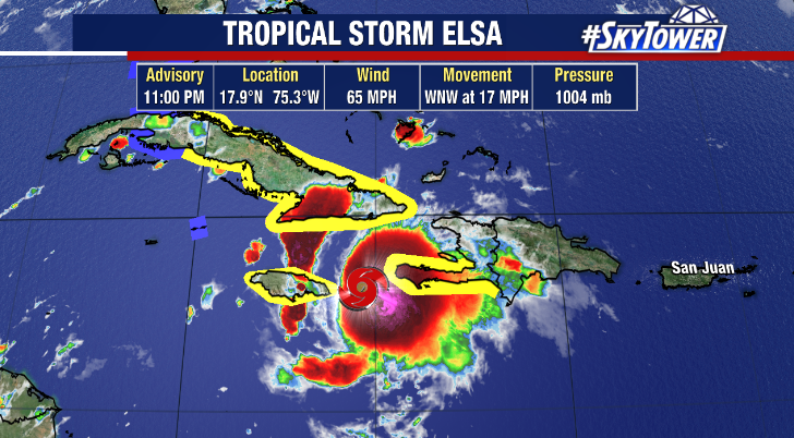
In the last 24 hours, self-induced wind shear created by the storms fast forward motion has weakened the storm, along with land interaction as it passed just south of Haiti. The forward speed should has begun to slow down as it approaches western side of the Bermuda ridge, so that self-induced shear should weaken. However, there is also a lot more land interaction that lies ahead as it approaches and passes over Cuba on Sunday night. Taking all this into account, the net effect should be some gradual weakening through the rest of the weekend.
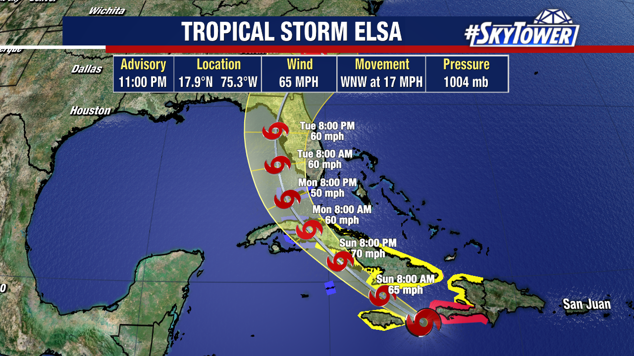
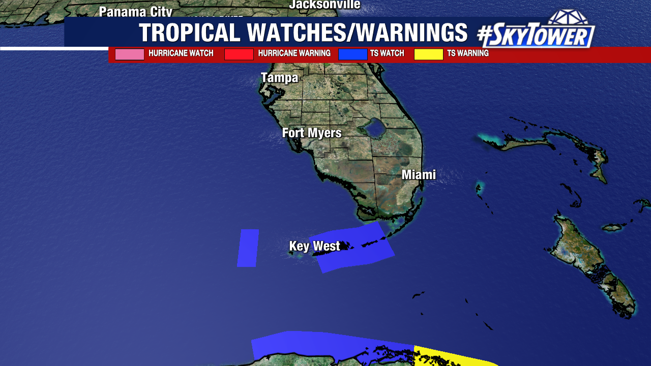
In terms of track, the window of possible paths is shrinking. At this point it’s very likely that Elsa will approach Florida’s west coast Monday into Tuesday, with tropical storm conditions possible in parts of the Keys as early as Monday afternoon. Where exactly the storm decides to come ashore will determine location of impacts. There will also be an opportunity for re-strengthening once the storm moves into the Gulf, so we’ll have to see what kind of shape its in once it comes off the northern coast of Cuba. While it’s possible this becomes a very weak, almost non-eventful storm, we have to be prepared for the flip side of things with the possibility of coastal flooding, heavy rain, and isolated tornadoes Monday evening through Tuesday night. For those that experienced Tropical Storm Eta last November, the impacts could certainly be very similar.