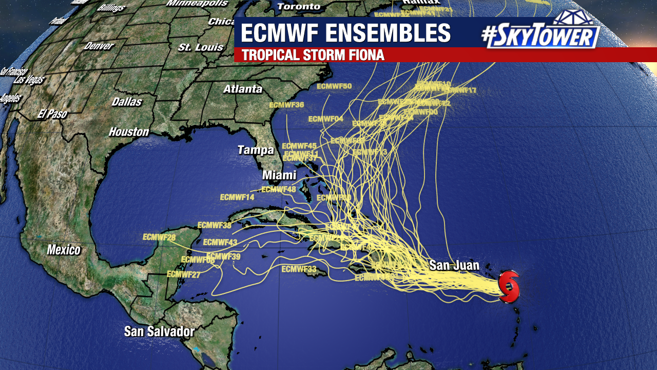
Fiona nearing hurricane strength, flash flooding and mudslides expected for Puerto Rico and Dominican Republic

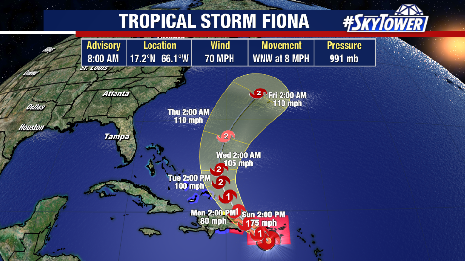
Fiona continues to show signs of organization Sunday morning as the center of the storm closes in on Puerto Rico. Maximum sustained winds have increased to 70 mph and the pressure has decreased to 991 mb, indicating a strengthening storm. 
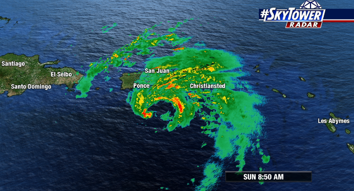
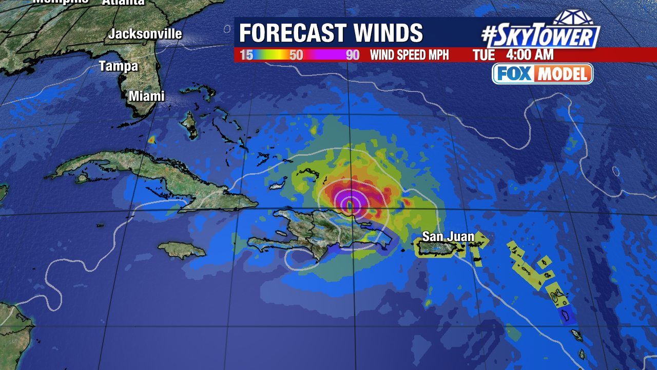
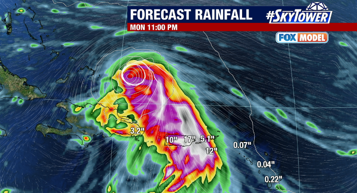
Hurricane Warnings remain in effect for Puerto Rico as well as parts of the Dominican Republic this morning. Fiona is expected to continue to bring strong winds, heavy rain and flash flooding to the region as well as landslides and mudslides in areas of higher terrain. Rainfall totals could exceed a foot in Puerto Rico while widespread 4-8 inches are expected in parts of Dominican Republic.
While Fiona will continue to battle westerly wind shear, the storm is expected to continue to intensify in the coming days due to warm water temperatures and favorable environmental conditions.

Fiona is currently moving west northwest at 8 mph. A more northwest track is expected later today, then a turn to the north early this week as an approaching trough steers the storm away from the Bahamas and the eastern U.S.

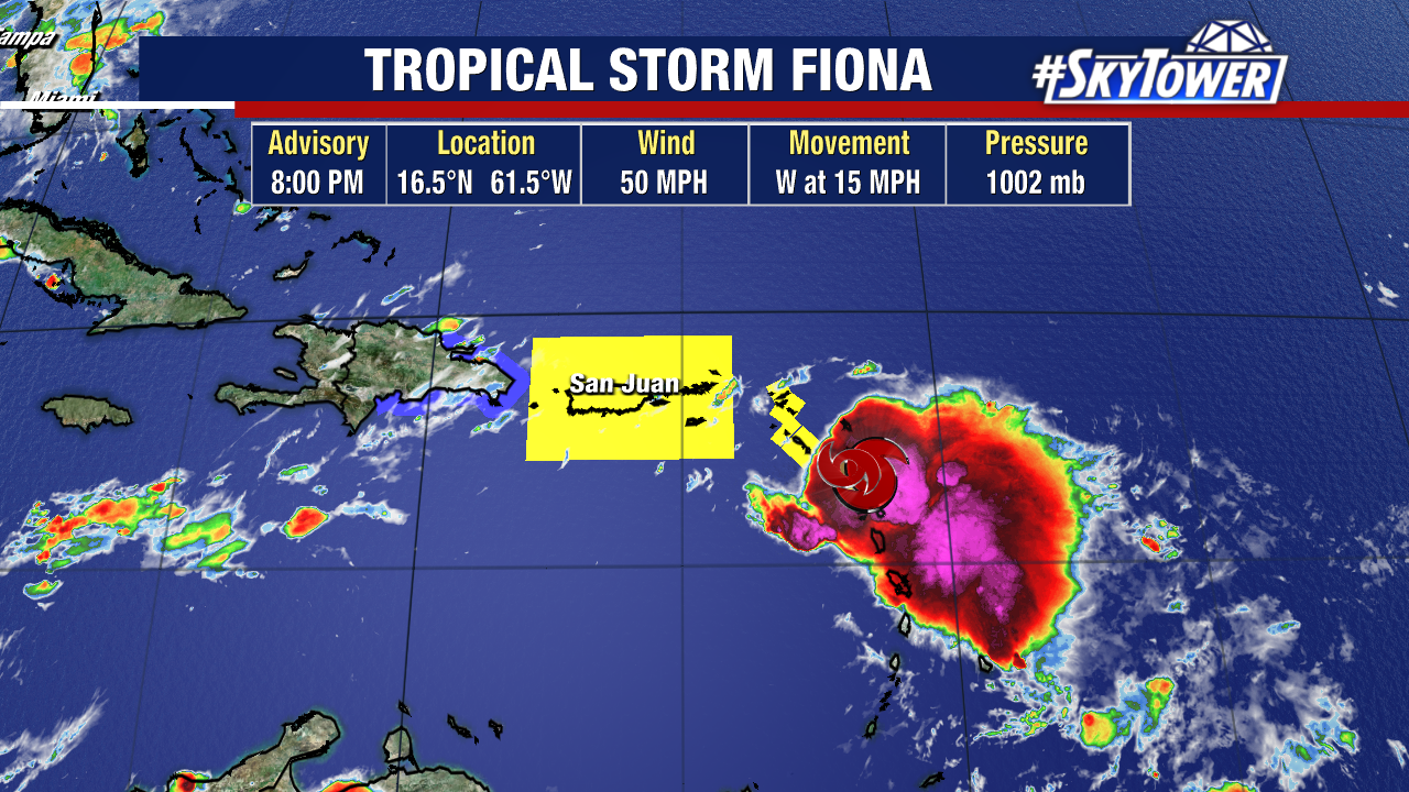
Tropical Storm Fiona Bringing Heavy Rain To Virgin Islands, Puerto Rico, Dominican Republic This Weekend

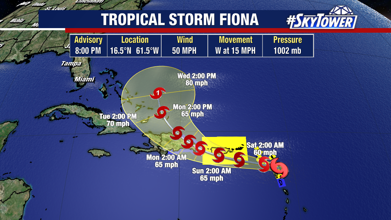
Tropical Storm Fiona is closing in on the northern Leeward Islands Friday evening. As expected the storm is struggling to strengthen due to continued westerly shear. This shear shear is displacing majority of the rain and storms east of the center of circulation. While this westerly shear should prevent strengthening for the most part over the next couple of days, Fiona is still going to present the threat of heavy rain for several Caribbean islands through the weekend. Several inches of rain could lead to flooding, and even mudslides in areas of higher terrain.

Land interaction is likely to affect the storm’s circulation to at least some degree until Fiona moves north of the Dominican Republic on Monday. Regardless of what shape it is in at that point, further organization and strengthening is likely. The National Hurricane Center forecast currently has Fiona reaching hurricane intensity near or just east of the Bahamas early next week.

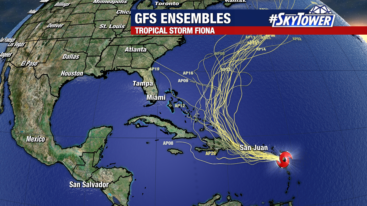
The good news is that model guidance is starting to come into better agreement that Fiona should be steered out to sea, staying well east of Florida and the U.S. East Coast. That being said, it’s still a little too early to write it off completely and it bears watching over the next few days.