What to expect from the tropics in October

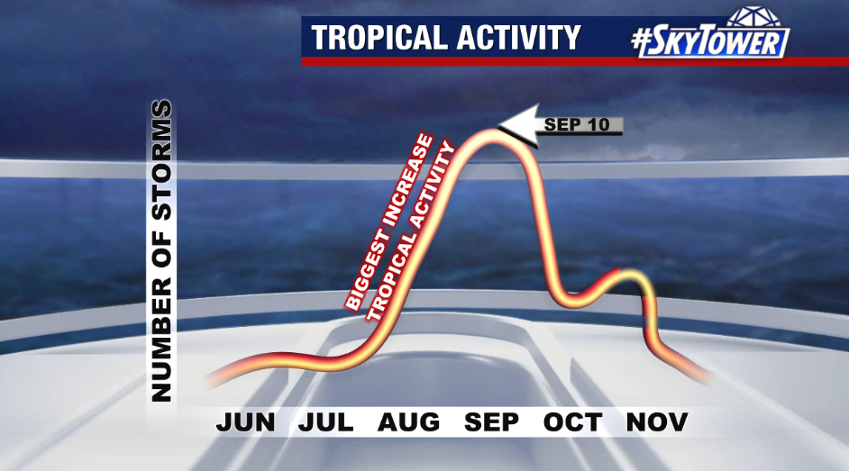
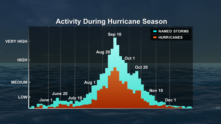
In what’s already proven to be an active hurricane season 4 months in, we are far from its curtain call heading into October.

So far, we’ve already seen 18 named storms and six hurricanes.

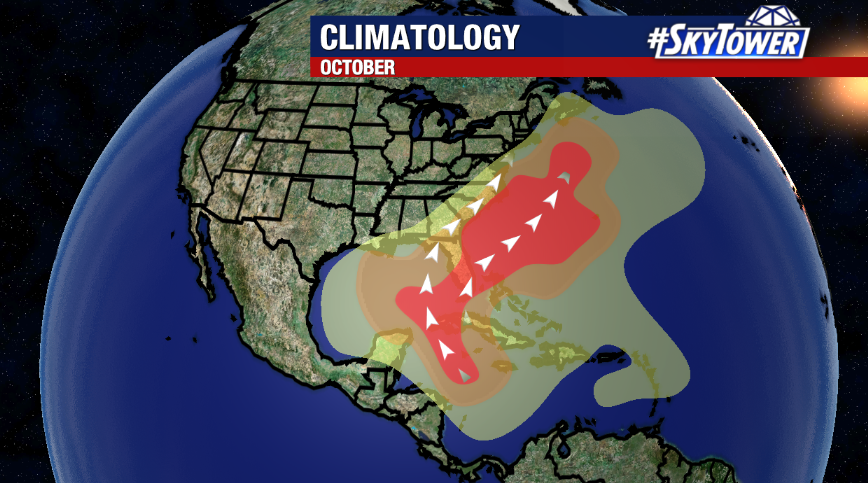
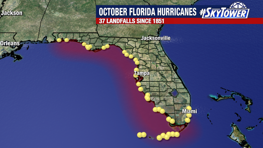
And while we’re past the official peak of the season, it’s no time to let our guard down. October can prove to be busy for Florida as we shift our focus to storms potentially sneaking up on us from the Gulf of Mexico and being steered in our direction by troughs of low pressure that swing across the eastern United States. Meanwhile, waters are still warm in the Gulf of Mexico and Caribbean Sea during the month which can support tropical development.

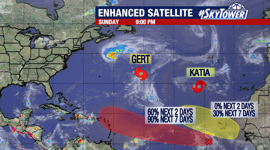
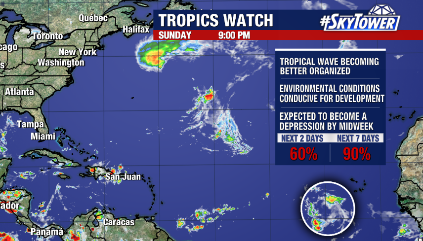
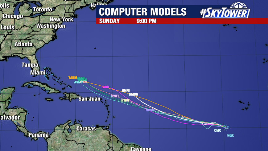
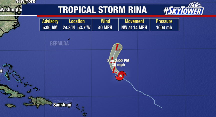
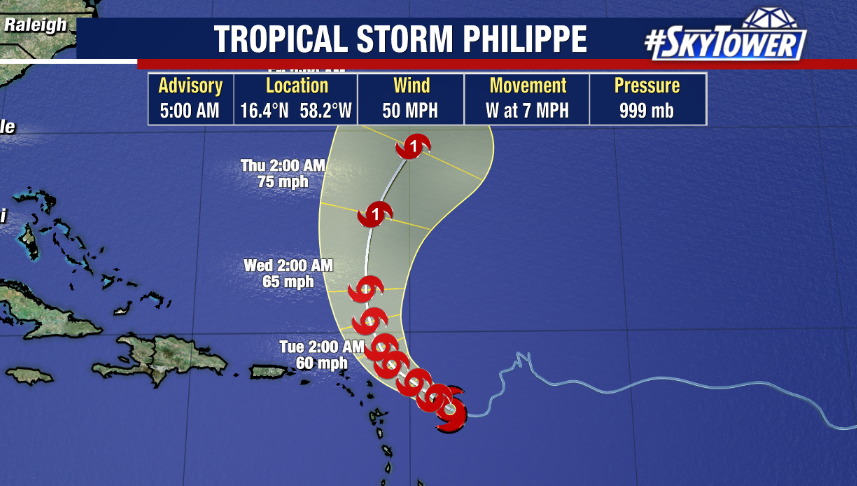
To kick off the month, we’re still tracking Tropical Storms Rina and Philippe in the Atlantic. Rina is a weakening tropical storm, while Philippe is still expected to strengthen and potentially reach hurricane status later this week. Neither are forecast to impact the United States.

Beyond these storms, there doesn’t appear to be any signs of immediate development right now. However, that could change. The next name on the list is Sean. Hurricane season runs through November 30th. Typically, November sees much less activity than October.

Watching area of possible development heading into peak of hurricane season

The peak of hurricane season is fast approaching – officially September 10th – and right on cue, things are very active in the tropics. After Idalia slammed into the Big Bend of Florida last week as a major hurricane, we’ve seen Jose and Katia form in the Atlantic. Meanwhile, Gert remains a weakening tropical storm. Thankfully, none of those systems will pose a threat to land.

However, more easterly waves coming off the coast of Africa will need to be monitored as conditions appear favorable for development across much of the Atlantic. While the area furthest east will likely remain a fish storm and won’t pose a threat, Invest 95L is moving into an area with warm water, weak wind shear and is poised to organize.

Right now, Invest 95L is located several hundred miles southwest of the Cabo Verde Islands. The National Hurricane Center is giving it a 60% chance of development over the next 2 days and 90% chance over the next 7 days as of Sunday evening.

A depression is likely to form by midweek in the central Atlantic and if it becomes a tropical storm, it would be named Lee. While most models do show a strengthening storm in the medium to long range, it is still too early to accurately determine where Invest 95L will ultimately go. We will continue to watch it closely and encourage you to keep checking back in for updates.