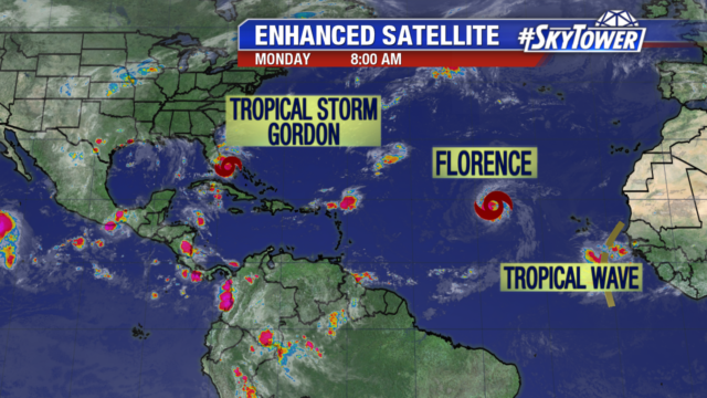
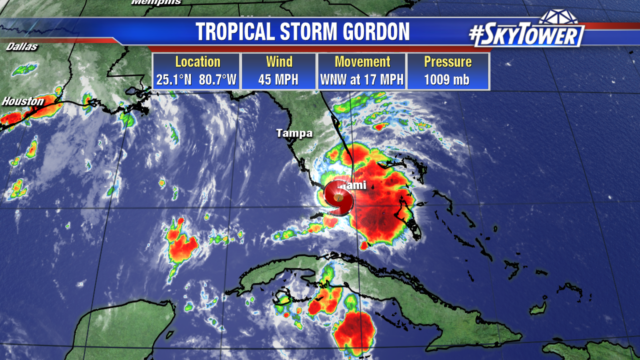
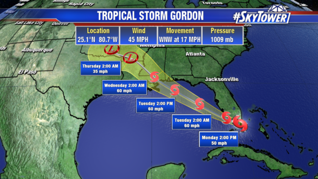
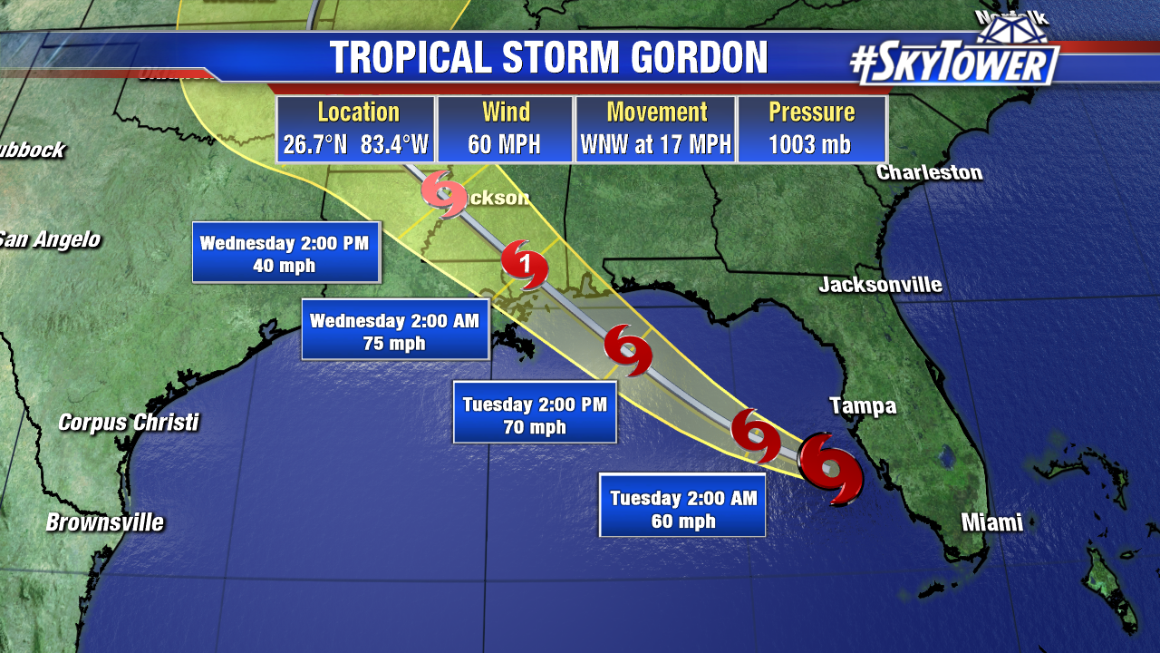
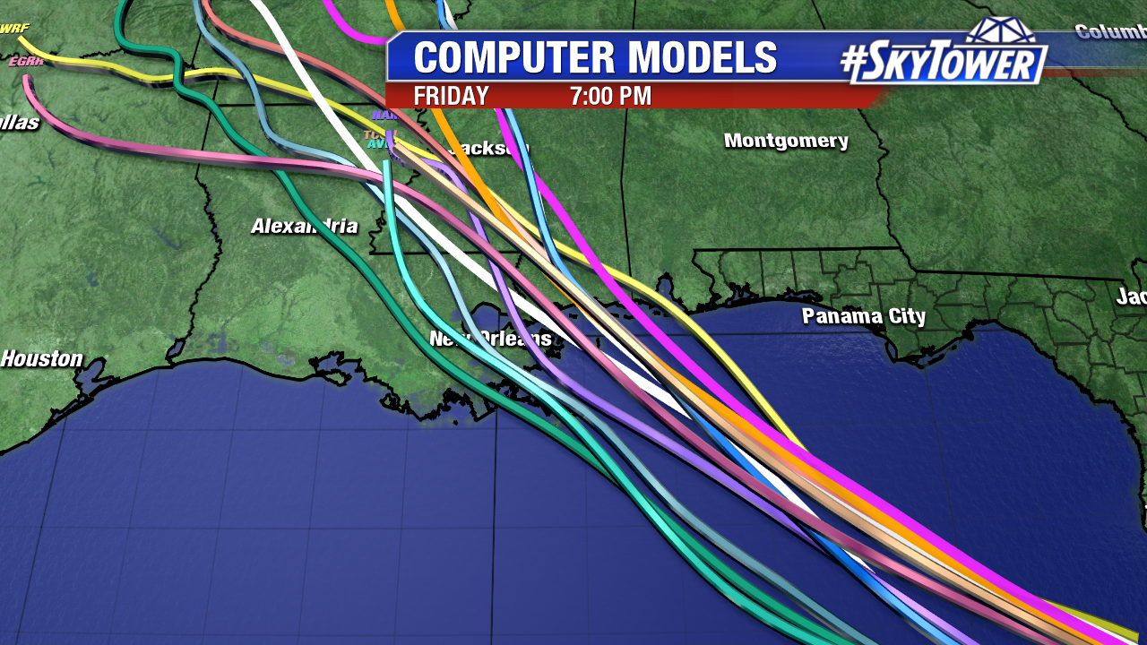
As of 8pm EST Monday evening, Tropical Storm Gordon was located about 95 miles west of Ft. Myers, FL. Max sustained winds were at 60 mph. The storm has shown signs of strengthening as it has moved out over the Gulf of Mexico today. It has pretty favorable environment to work with – low wind shear and very warm water – as it heads toward the northern Gulf Coast over the next 24 hours. At this point, it would not be surprising to see it reach hurricane intensity before making landfall somewhere between New Orleans, LA or Mobile, AL late Tuesday night. The current forecast from the National Hurricane Center has max sustained winds of 75 mph by landfall.
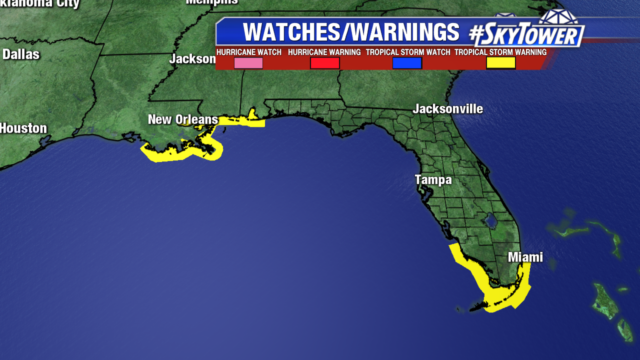
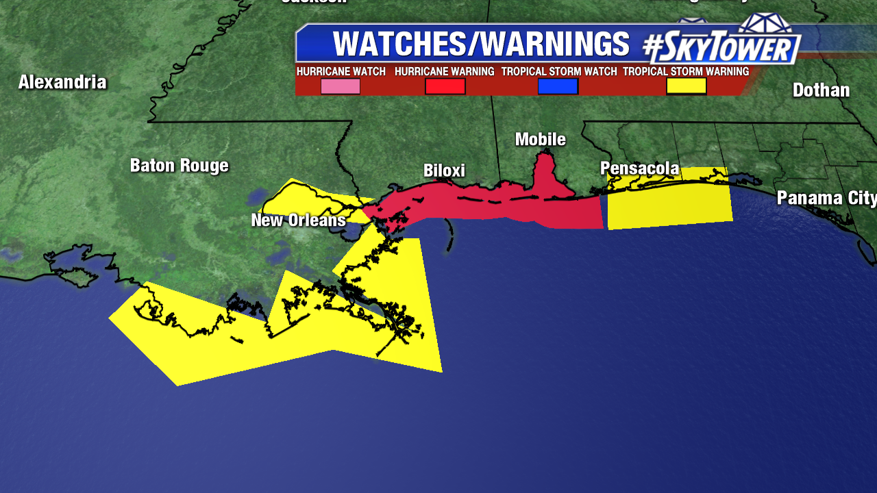
Tropical storm warnings are in effect along the northern Gulf Coast from Morgan City, LA eastward to Destin, FL. Hurricane warnings are in effect from the Mississippi/Louisiana state line eastward to the Alabama-Florida state line.
Storm Surge:
Shell Beach, LA to Dauphin Island, AL… 3-5 feet
Navarre, FL to Dauphin Island, AL… 2-4 feet
Shell Beach, LA to Mouth of Mississippi River… 2-4 feet
Mouth of Mississippi River to Texas-Louisiana border… 1-2 feet
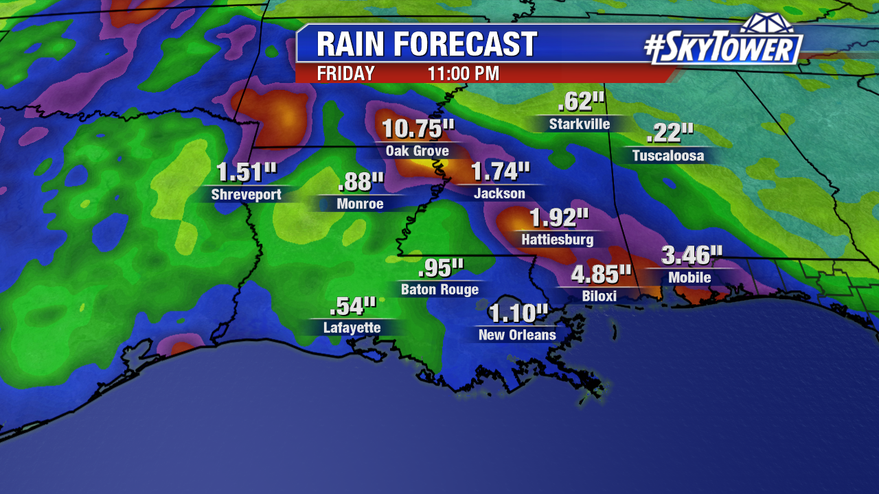
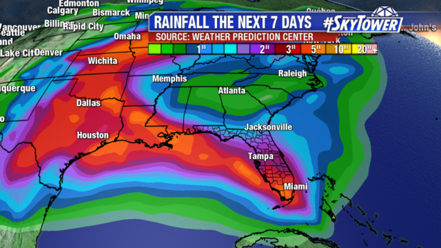
Rainfall:
Total rainfall accumulations of 3-6″ across southern Alabama, southern and central Mississippi, southeastern and northeastern Louisiana. Isolated amounts up to 8″ are possible.