The end of hurricane season is quickly approaching, but it looks like we’ll probably end up adding one more named storm to the tally for the 2018 season.
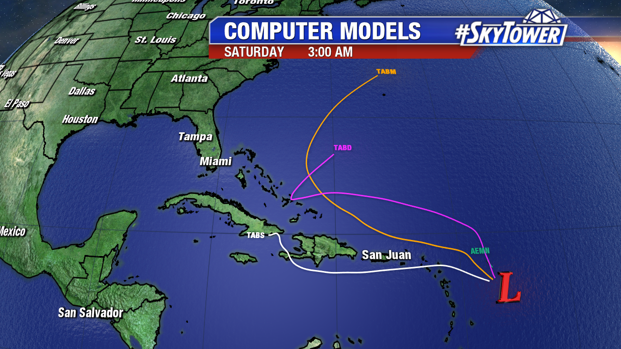
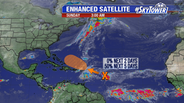
On Sunday evening, a large area of showers and storms was centered a few hundred miles east of the Lesser Antilles. This disturbance has been battling strong upper-level winds for the past couple days, but it’ll be moving northwestward into a better environment this week and the National Hurricane Center has a 70% of development over the next 5 days. Should a tropical storm form, it would get the name ‘Patty’.
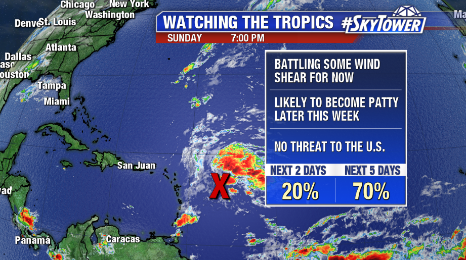
There is potential for some minimal impacts across the northern Caribbean and Bahamas later in the week, but this time of year it’s pretty tough for a storm to reach the U.S. Storm or not, there is quite a bit of model agreement at this point that this will ultimately get picked up by our next East Coast trough, and ushered out to sea. For now, it’s something we’ll watch, but there isn’t much to be concerned about. We’ll keep you updated through the week.