Tropical Storm Barry Forms In The Gulf; Expected To Cause Major Flooding

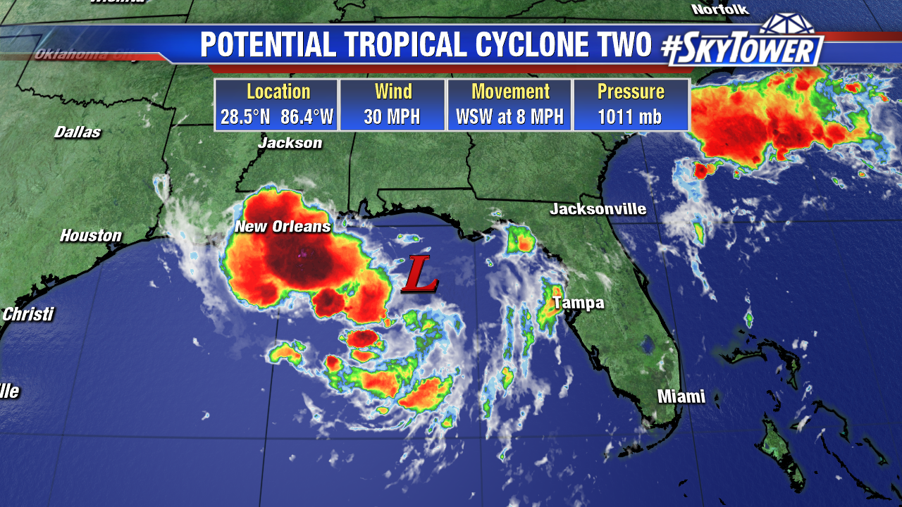
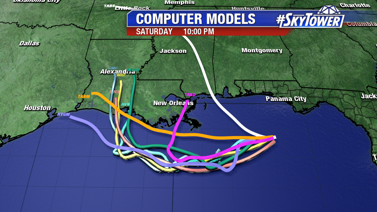
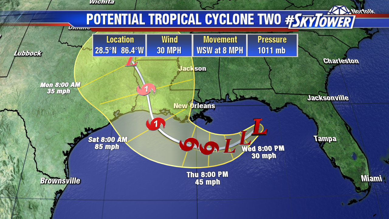
11am Thursday: Tropical Storm Barry has now formed about 95 miles south of the mouth of the Mississippi River. It is expected to slowly strengthen over the next 36 hours or so as environmental conditions become more favorable. Current intensity forecast from the National Hurricane Center has Barry becoming a category 1 hurricane with winds of 75 mph prior to landfall.

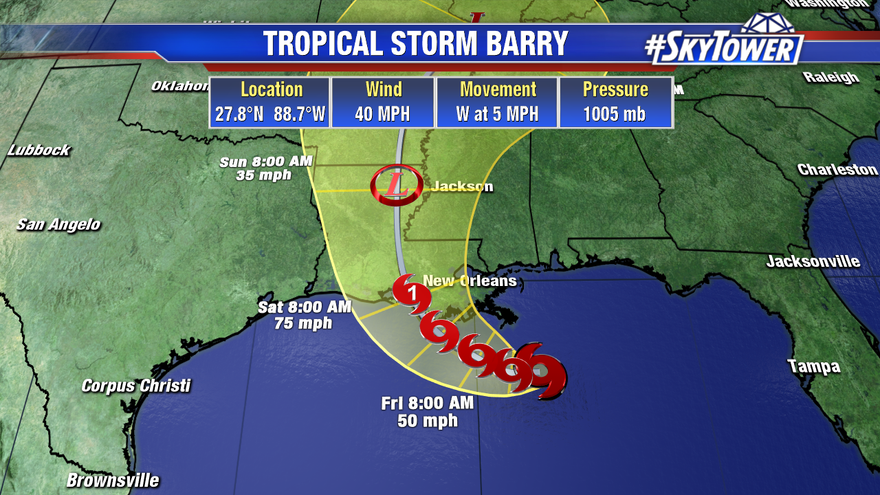
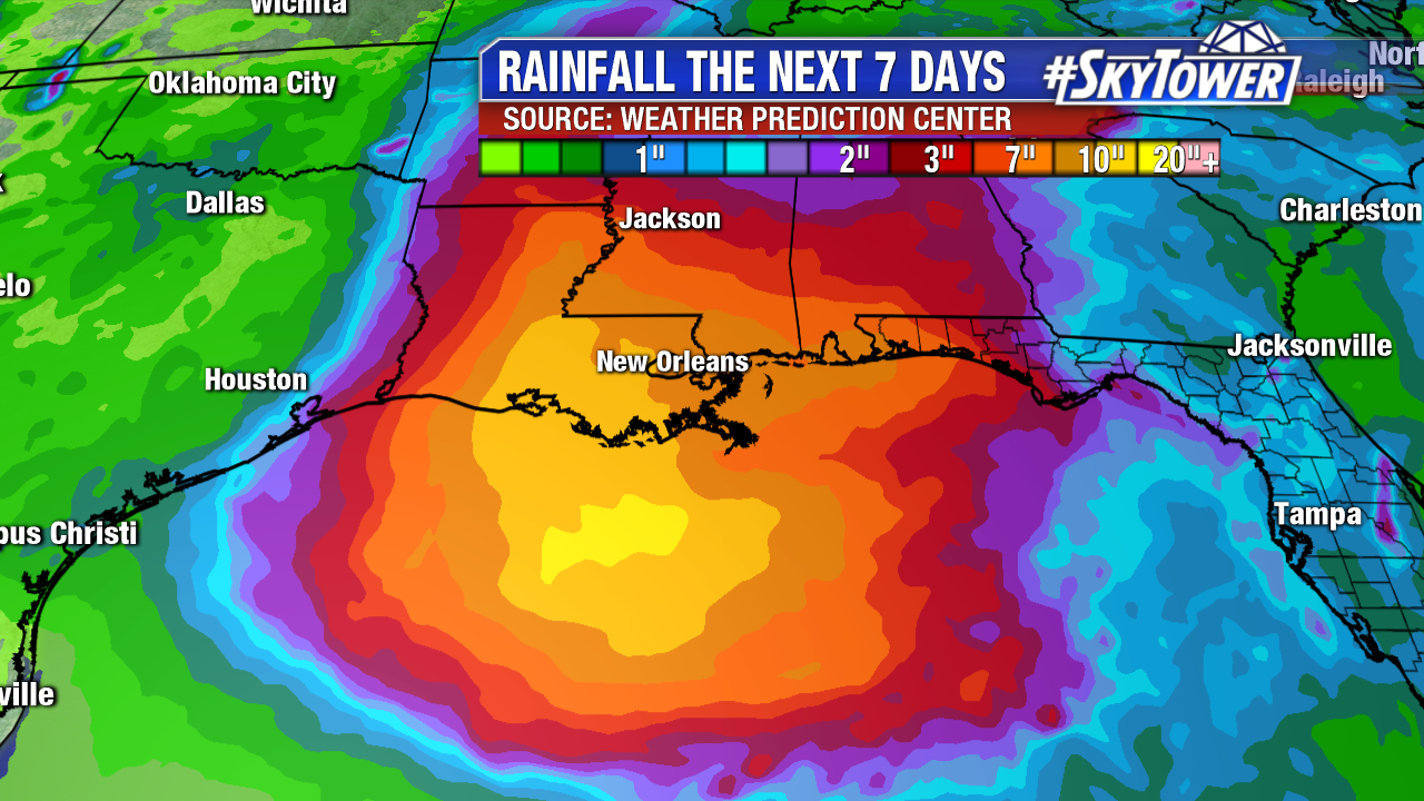
Regardless of whether or not this intensity forecast comes to fruition, Barry will create a dangerous flooding threat across much of the lower Mississippi Valley over the weekend into early next week. The Mississippi is already swollen from springtime flood waters flowing south, as well as recent heavy rains. Adding to that, a swath of 10-20″ of rain is expected to fall across southern Louisiana and parts of Mississippi over the next few days.

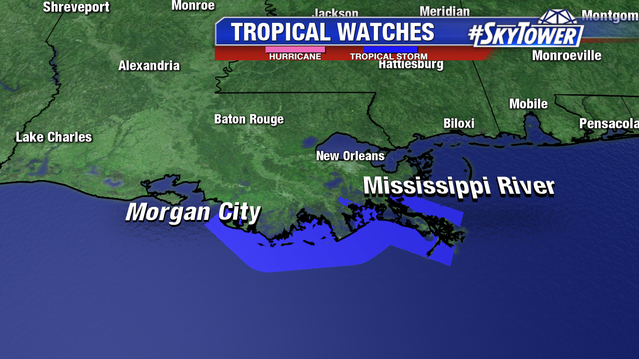
This could be a particularly dangerous situation in places like New Orleans. Along the Mississippi, Levees protect to an average of 20 feet in the city. Current forecast river height in this area is 19 feet by Saturday night. Levees will be tested and there is likely to be water spilling over in some areas.

For the latest watches/warnings visit the National Hurricane Center or your local National Weather Service website.


Tropical Depression Soon To Form; Likely To Strengthen And Move West

As of 11am Wednesday, a broad area of low pressure was located about 170 miles east-southeast of the mouth of the Mississippi River. Hurricane Hunter aircraft is scheduled to investigate this area this afternoon. We’ll likely see a tropical depression form late today or on Thursday. This is now being referred to as Potential Tropical Cyclone Two – which signifies the expectation of a tropical storm forming and affecting land areas within 48 hours.

Models are in very good agreement that this disturbance will move west toward Louisiana/Texas over the next 2-3 days, before making a northward turn. Current guidance leaves little question that Tropical Storm Barry will form, but how much it will intensify thereafter remains to be seen. We should get a better idea of this once recon gathers more data and an actual system forms. It should be noted that the current forecast from the National Hurricane Center intensifies this into a category 1 hurricane.

Tropical Storm watches are now up from the mouth of Mississippi River to Morgan City, LA, meaning that tropical storm conditions are possible within 48 hours. The watches will likely be expanded in the coming days.

It’s important to note that regardless of intensity, the main threat from this is going to be heavy rainfall that will likely lead to flooding in some areas of the central and western Gulf Coast. Interests in these area should monitor the progress of this storm closely and check back in with us here at MyFoxHurricane.com