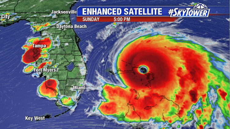
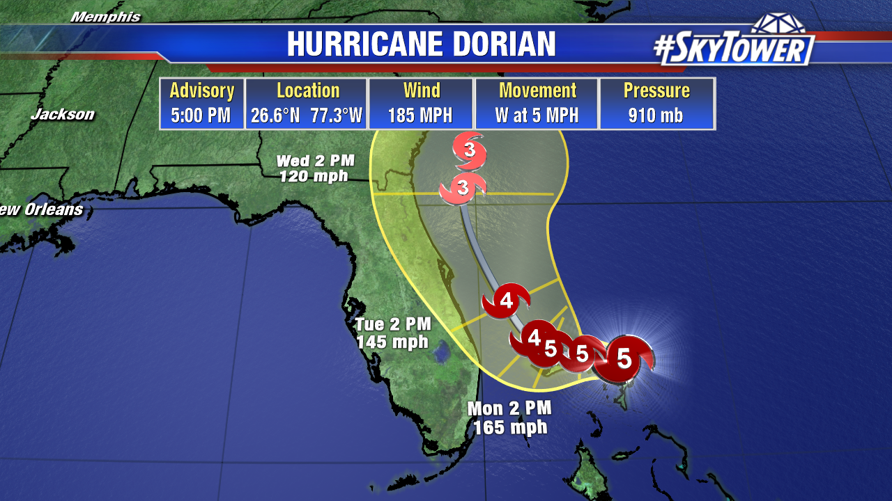
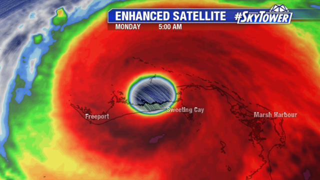
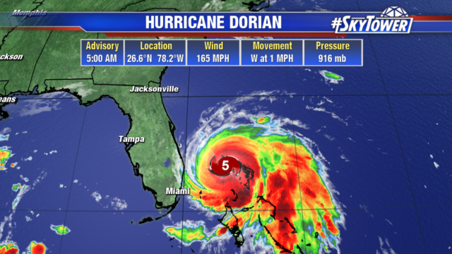
Dorian is still a category 5 hurricane with 165 mph winds and gusts to 200 mph. It has become almost stationary over Grand Bahama island only moving west at 1 mph. The islands will continue to see hurricane force winds for the next 18 to 24 hours. They are also dealing with dangerous storm surge of 18 to 23 feet above normal tide levels with higher destructive waves.
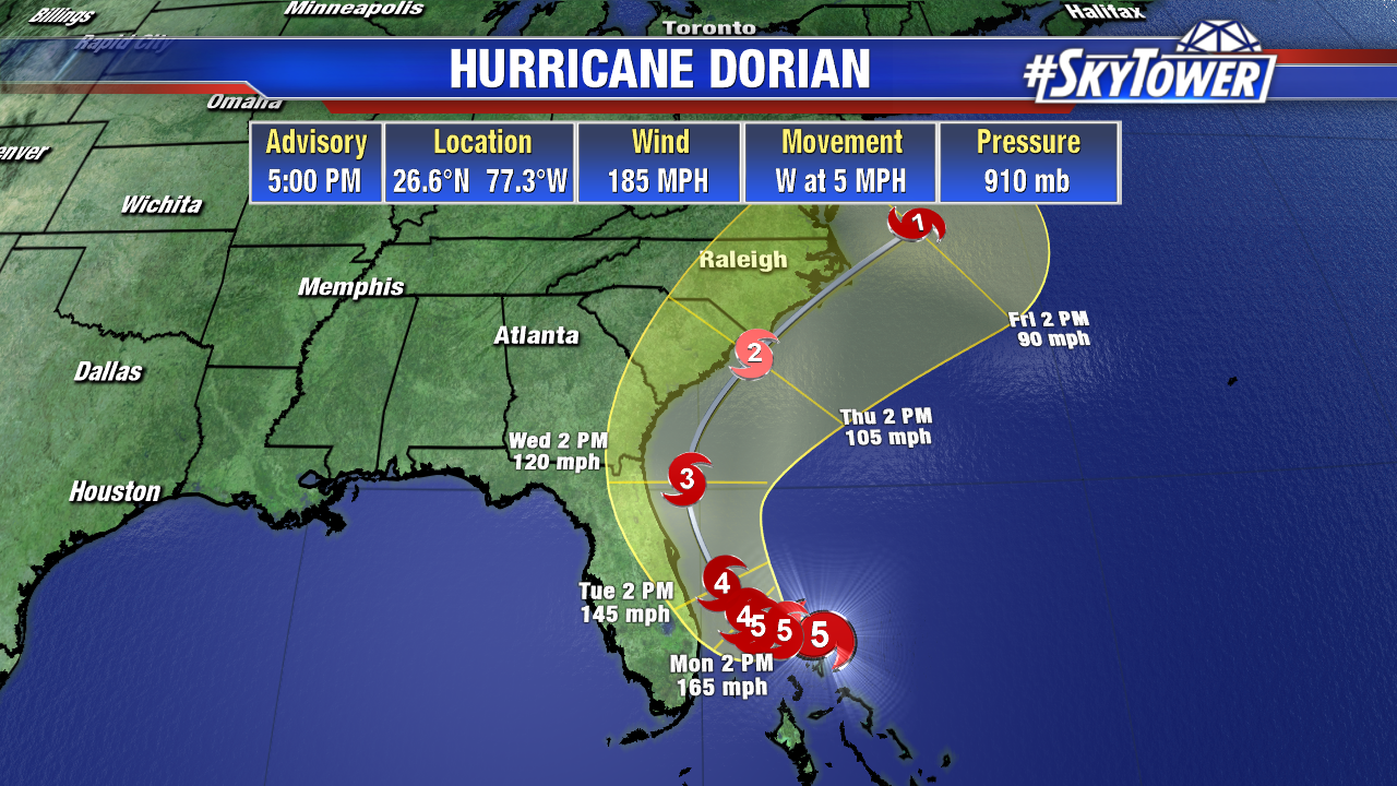
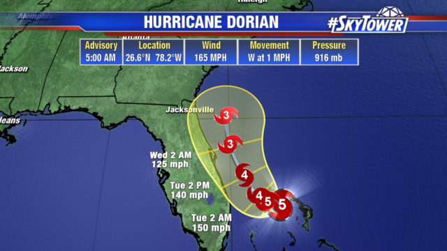
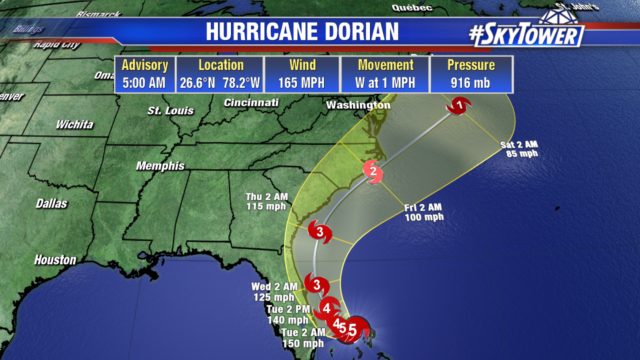
The latest track continues to keep the center of Dorian offshore as it parallels the east coast. It will still be a powerful category 4 storm with steady weakening as it moves northwest.
Georgia and Carolina coastlines should closely monitor the progress of Dorian as they could see impacts later this week.
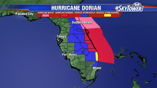
On Dorian’s current path with the center passing east of the coastline, Tampa Bay is looking at gusty 30 mph winds and tropical downpours Tuesday. Polk & Highlands counties are under tropical storm watches for the potential of tropical storm force wind gusts.
The most significant impacts will be felt along the east coast as hurricane force winds extend out 45 miles from the center. A shift further to the east will lessen the impacts of storm surge, coastal flooding and wind speeds. But the closer to the coastline it passes the greater the impacts will be.
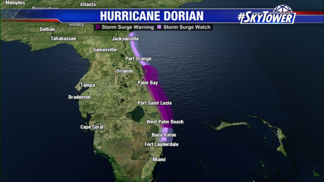
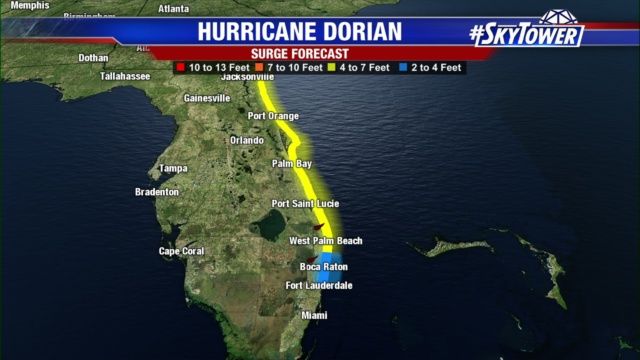
Storm surge watches and warnings are posted for the east coast. From Jacksonville to West Palm Beach they could see 4 to 7 feet storm surge. While Fort Lauderdale to north of Boca Raton is looking at potentially 2 to 4 foot storm surge.
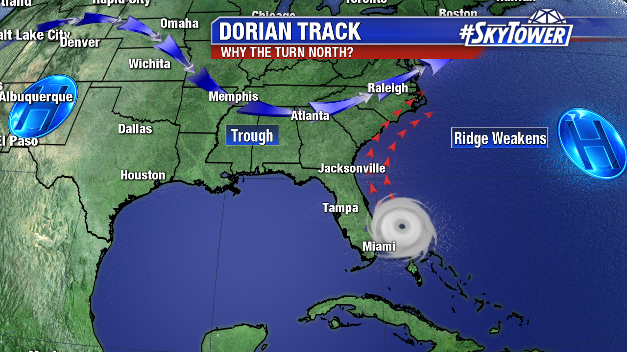
The ridge that has been steering Dorian westward has weakened, causing the slowdown over the northwest Bahamas. A trough heading to the east coast will help steer it northwest and then northeast.