
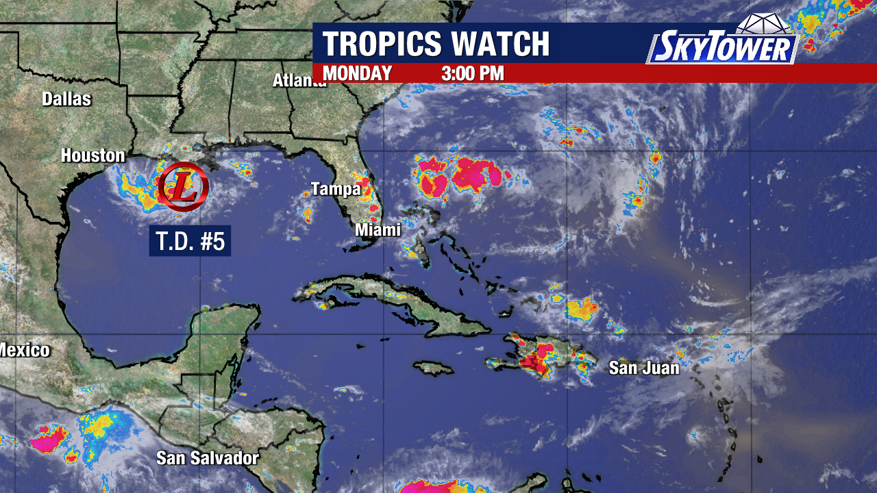
Tropical Storm Warning is up for Texas and Louisiana as Tropical Depression Five gets better organized 130 miles off the coast of Louisiana.
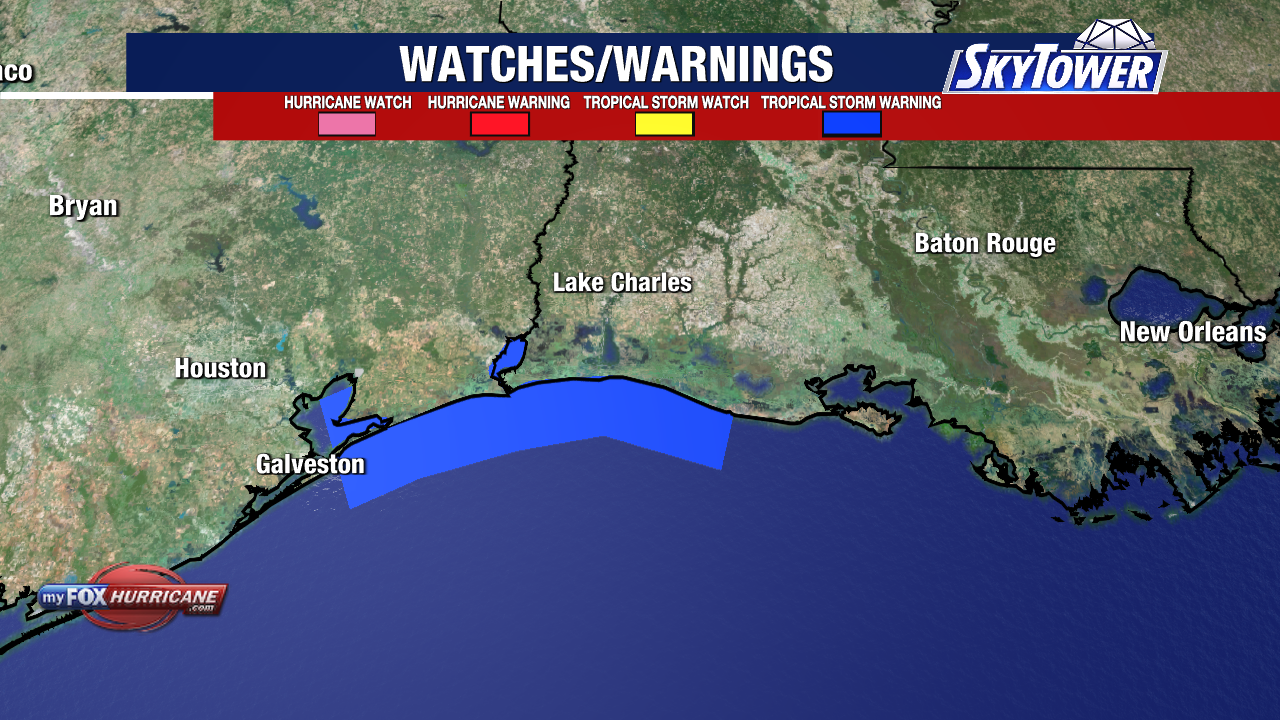
The warning runs from Port Bolivar, Texas to the Vermilion/Cameron Parish line in Louisiana.
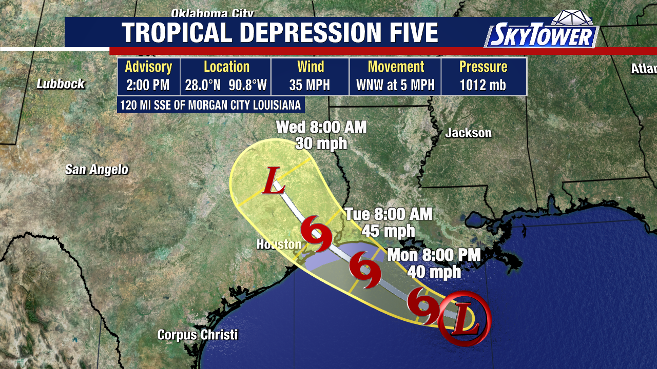
We’ll likely see this strengthen into Tropical Storm Edouard late today into Tuesday. Once sustained winds reach 39 mph, this will officially become our 5th named storm of the season.
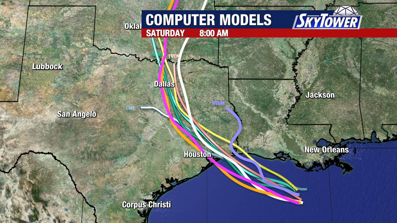
The system will reach the upper Texas or southwestern Louisiana coast Tuesday, bringing heavy rain and storms to the region through Wednesday.
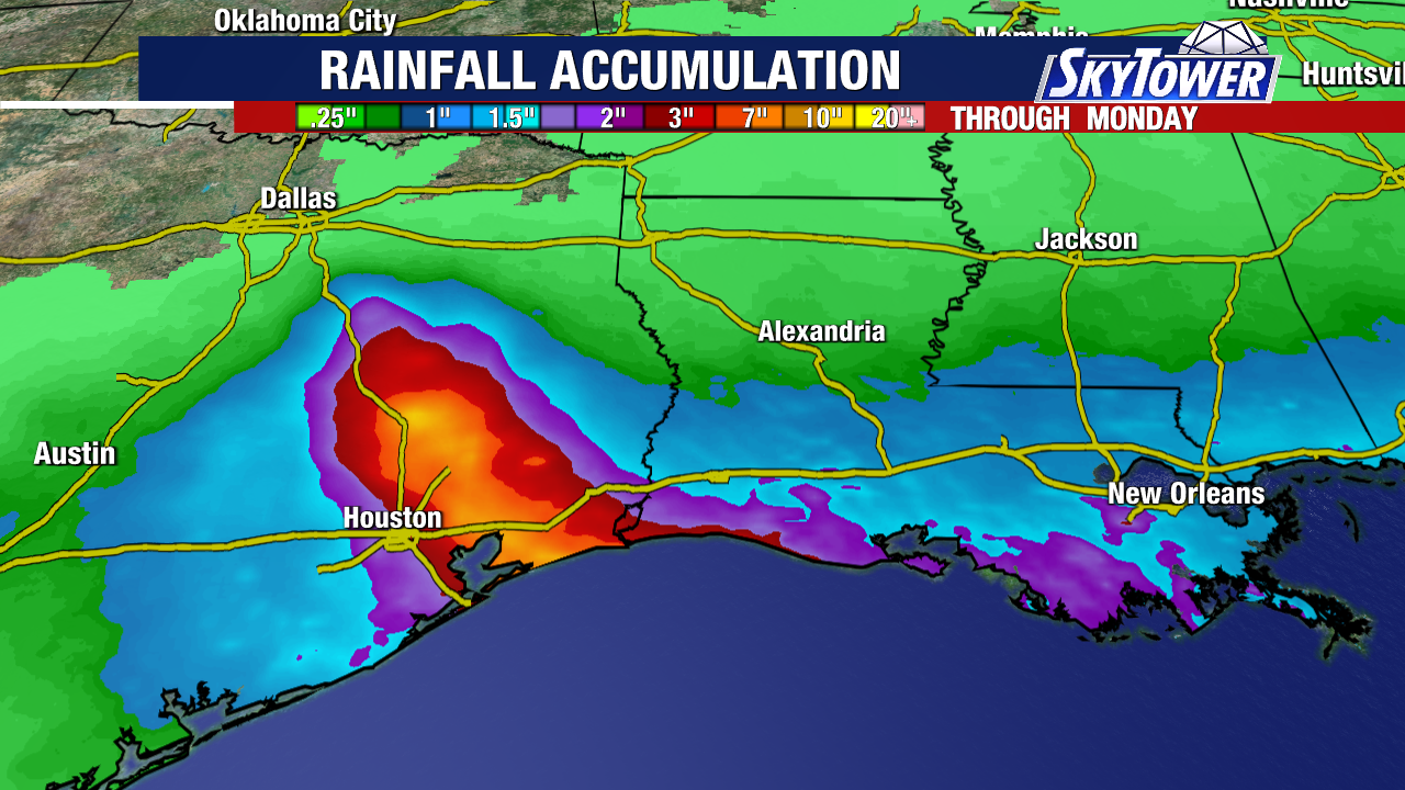
Houston could be in the bullseye for 3 to 6 inches of rain from the system. Heavy rain and flash flooding are the main threats, with isolated areas getting up to 9″ of rain.
Peak storm surge of 1 to 3 feet above normal tide will be possible along with rough surf along the Gulf Coast.
This is the same low pressure area we’ve been watching the last few days in the northern Gulf (formerly Invest 97L). High pressure to its north is guiding this system west away from Florida.
The remnants of Dolly are no longer being watched for tropical development.