
A strong tropical wave just moved off the coast of Africa with formation odds climbing to 70% over the next 2 days.
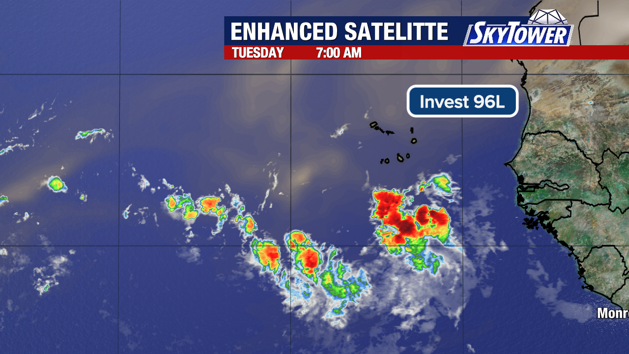
The area of low pressure is south-southeast of the Cabo Verde Islands. It’s carrying a good amount of moisture and has a decent chance to fight off Saharan dust and wind shear enough to develop into a tropical depression or storm.
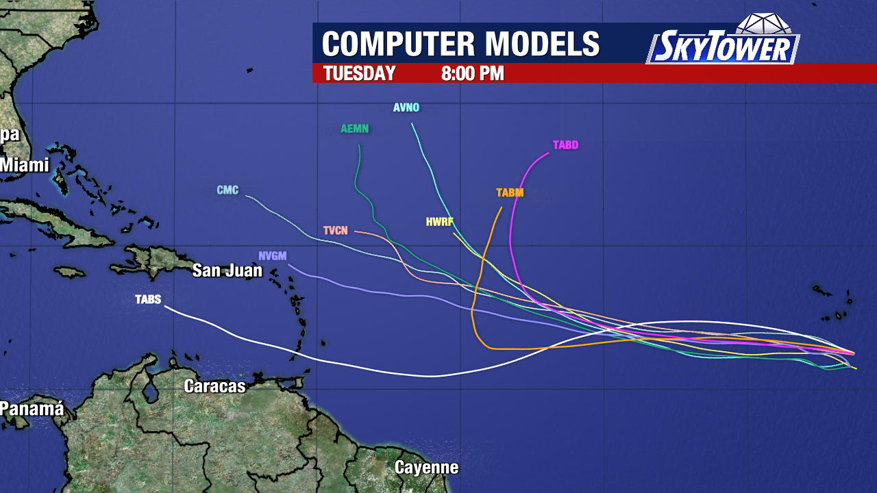
As it moves in the general direction of the Caribbean Islands through this week, some models strengthen into a tropical system.
If it develops, there is a strong chance it will curve north of the Caribbean and many models have been favoring that idea. Some models keep it weaker and more south with a closer pass to the northeast islands.
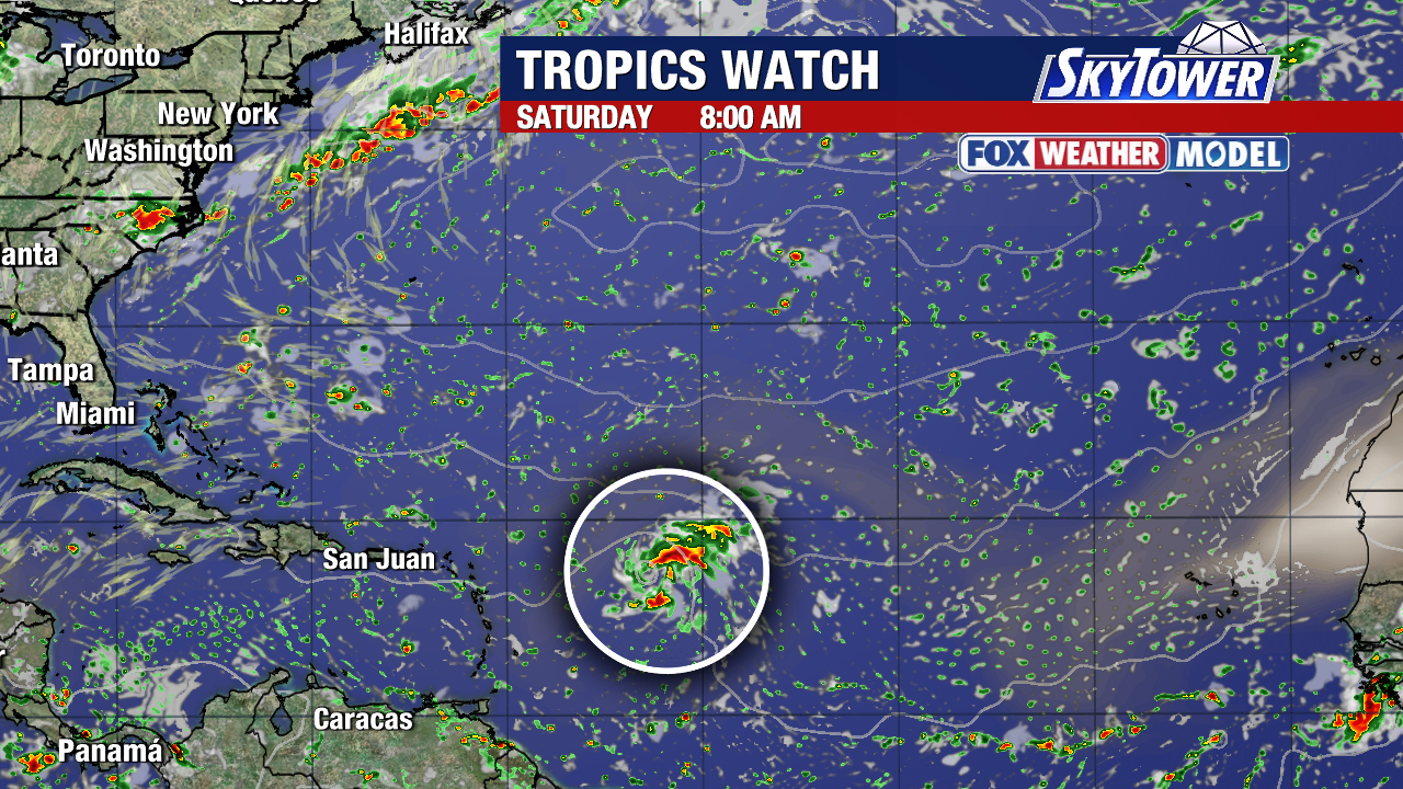
There is a chance Invest 96L dies out before it reaches the islands, or arches north before then. We’ll see if warm ocean waters allow for strengthening despite Saharan dust and hostile winds it encounters.
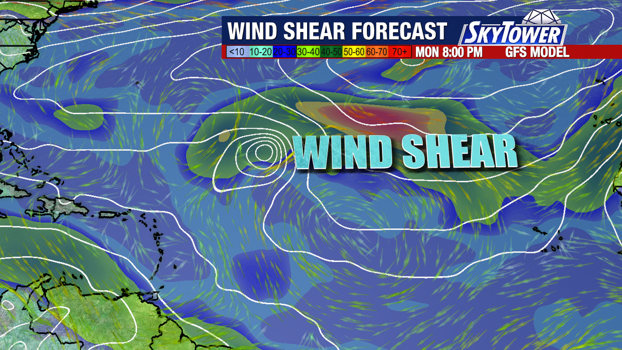
Keep in mind, nothing has formed yet and models tend to struggle before a system has organized. This is something we’ll be tracking this week into next.
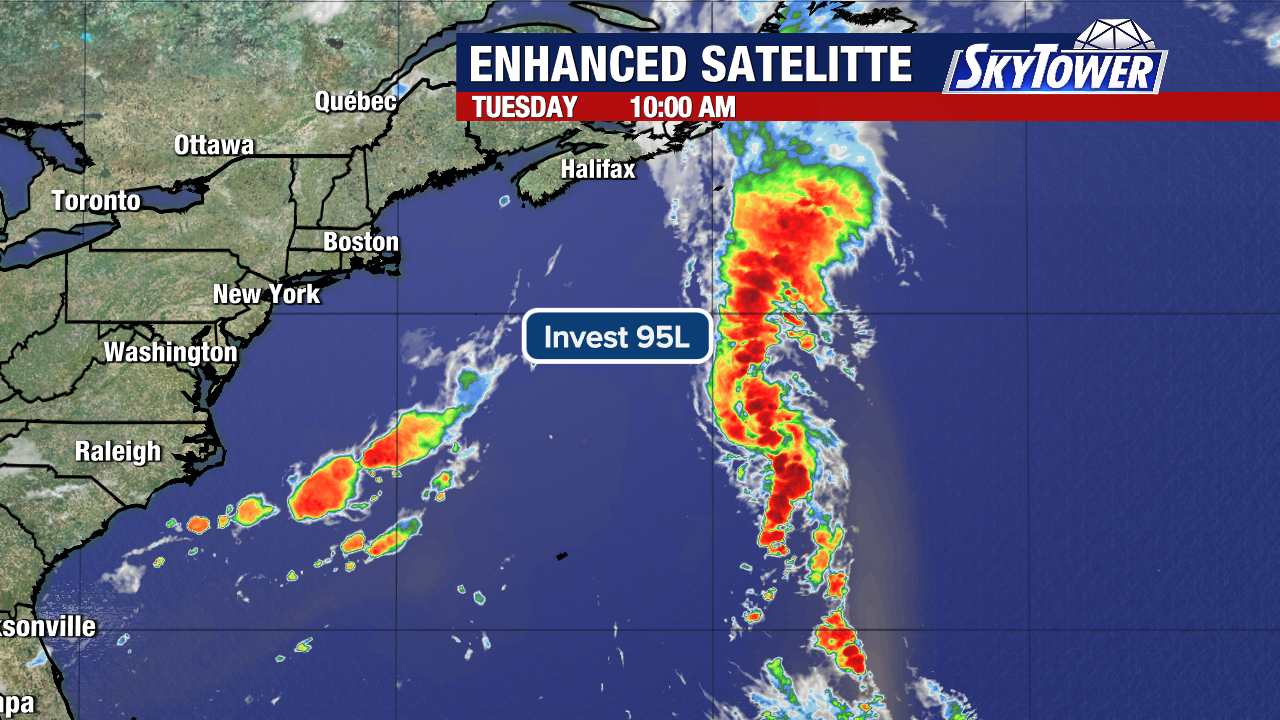
The other area in the Atlantic, Invest 95L, is a broad low pressure area a few hundred miles east-southeast of Bermuda. It has a medium (40% chance) to develop but the window of opportunity is short.
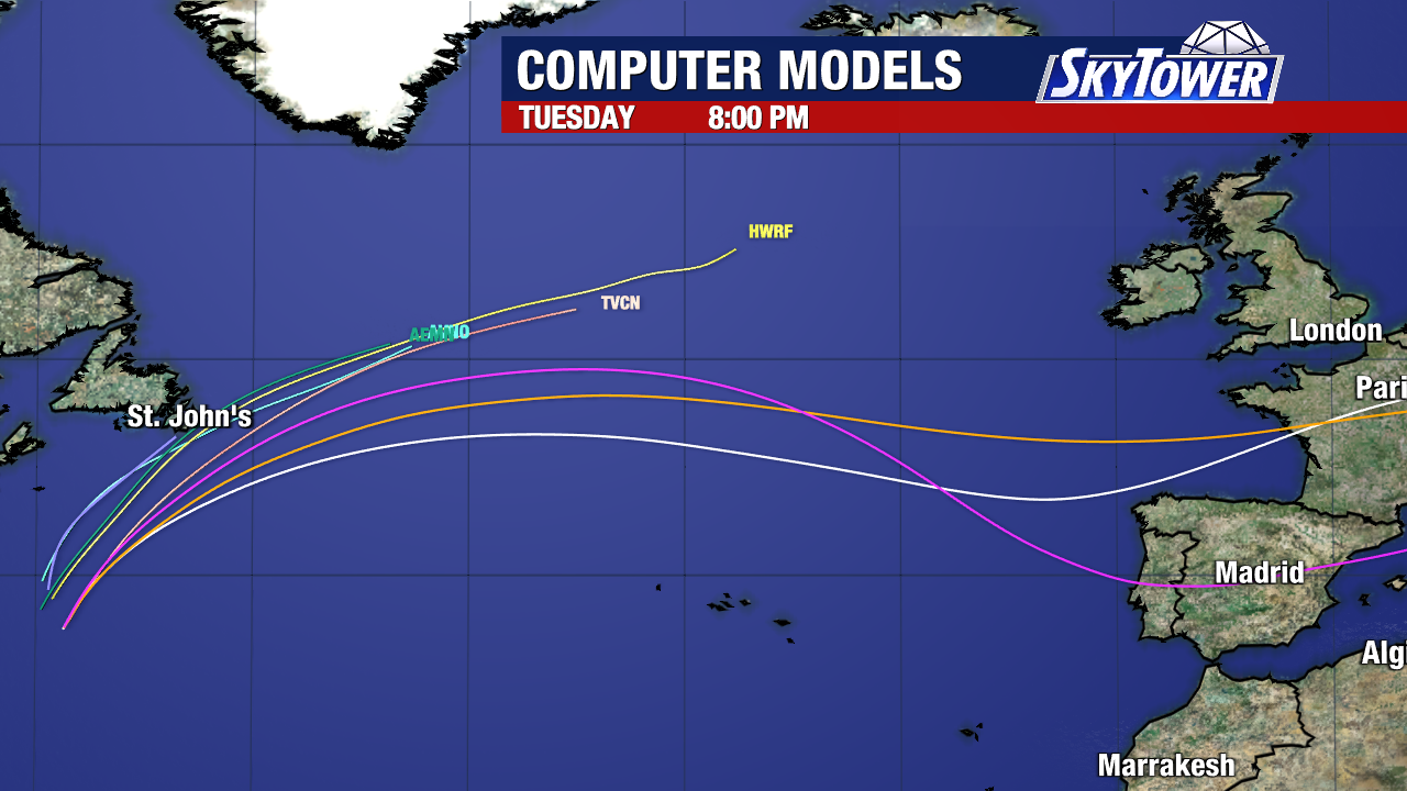
If it can get organized today or tomorrow as it moves north-northeast, this could become a depression or short-lived Tropical Storm Dolly.
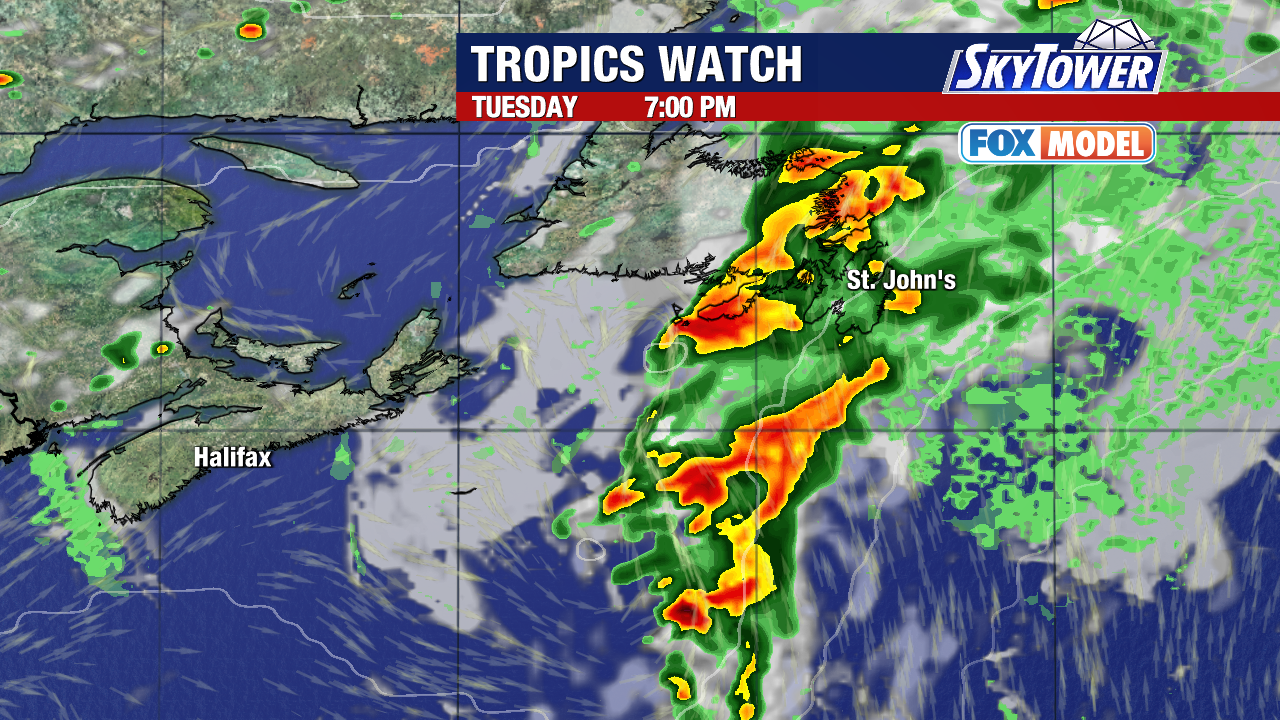
Regardless of development, this system will bring rain to Newfoundland, Canada on Tuesday before running into cooler waters and hostile winds.