
There is a new named storm churning just east of the Northern Leeward Islands. Tropical Storm Rina is now the 18th named storm of the season.
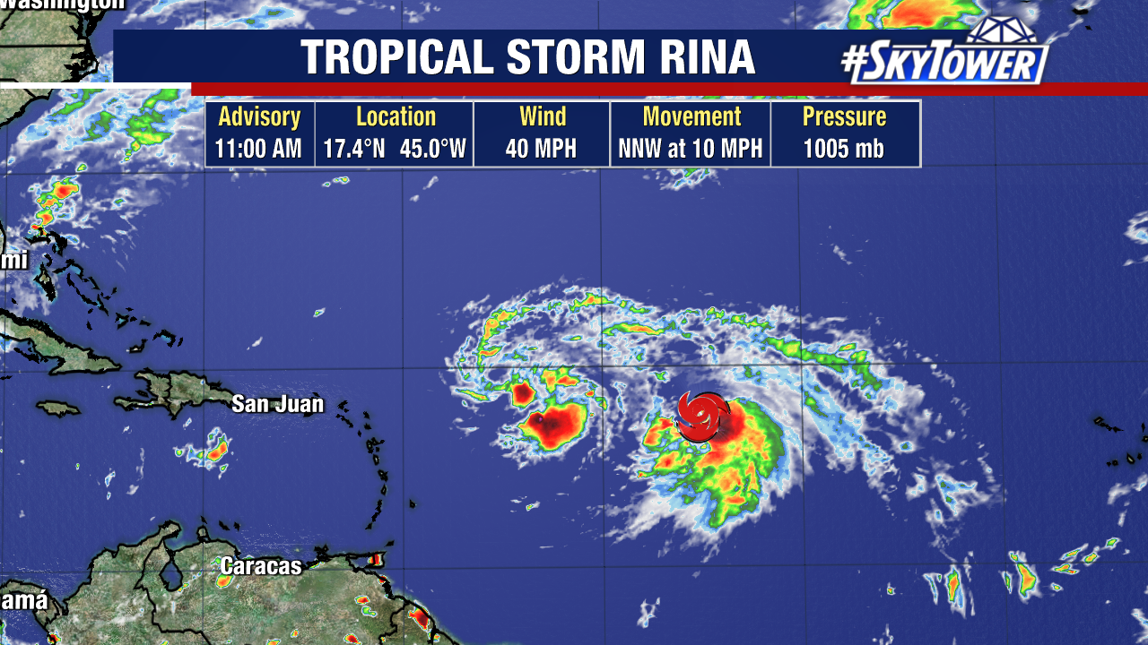
Rina has been slowly strengthening over the last few days and was upgraded from Invest 91L to a tropical storm on Thursday, with sustained winds of 40 mph.
Tropical Storm Rina is expected to start taking a harder turn to the west, before turning more northerly this weekend.
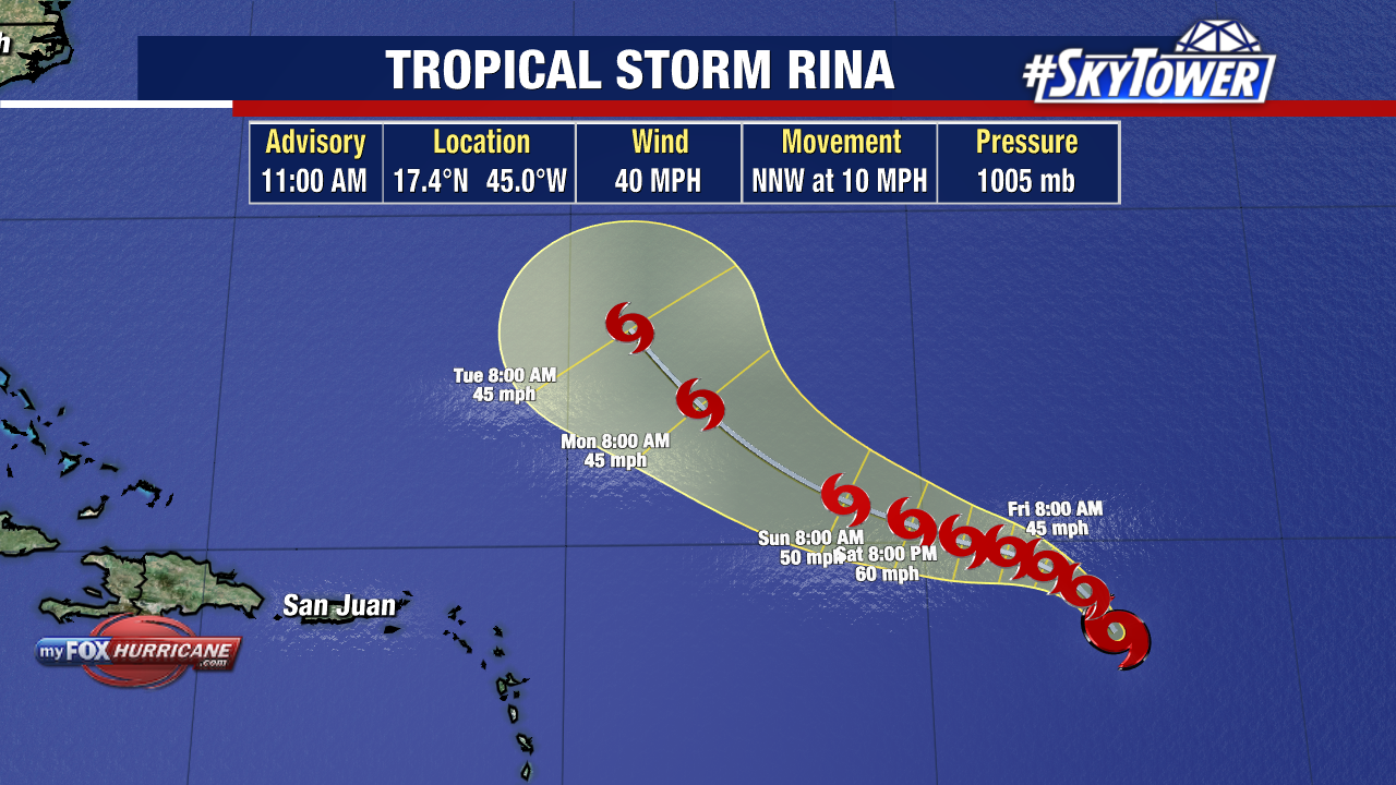
It doesn’t look likely that Rina will impact land as its path stays in the open Atlantic. Currently, Tropical Storm Rina is more than 1,000 miles east of the Leeward Islands.
There is one interesting factor at play: how close Rina is to Tropical Storm Philippe. When tropical systems are close to each other like these two are, they can interact in unique ways and become more unpredictable.
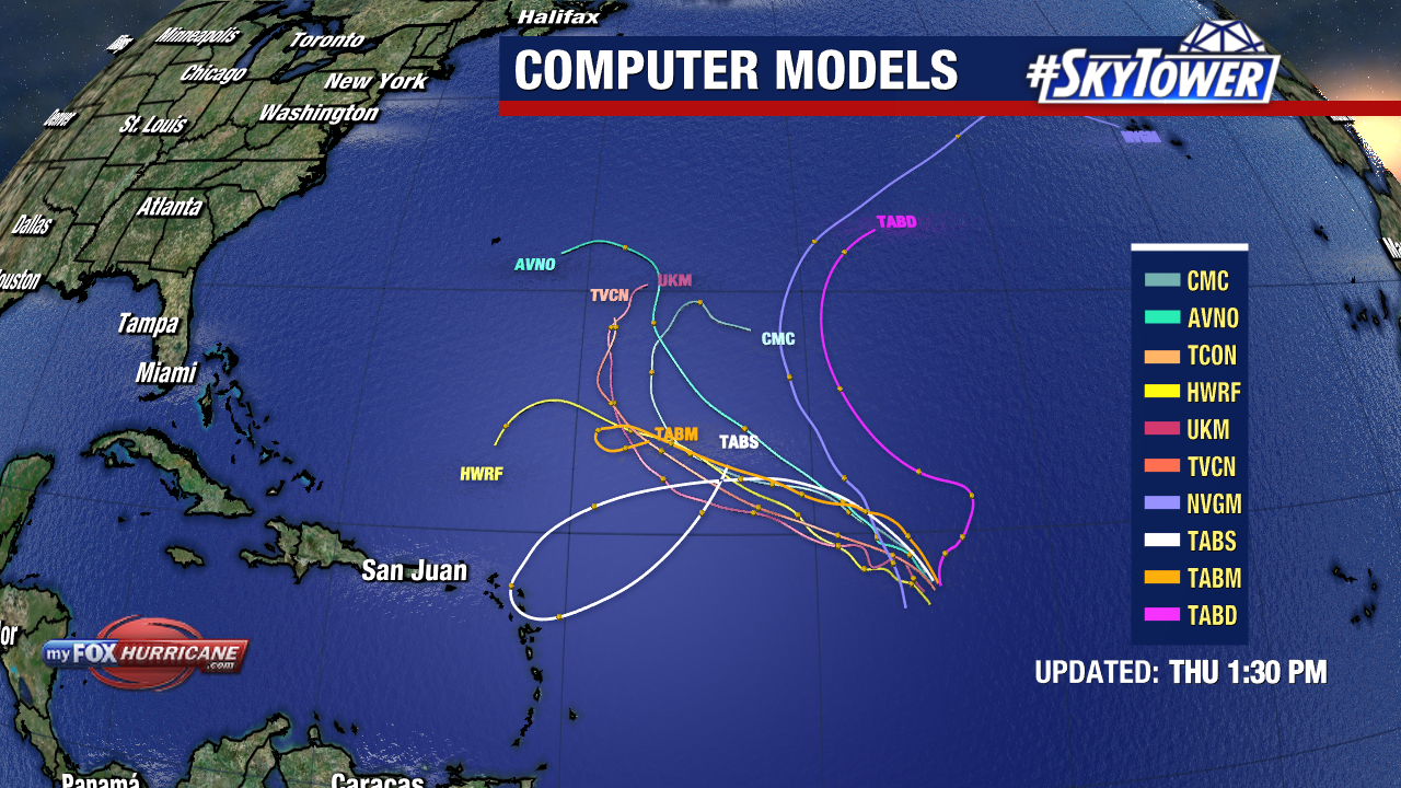
Notice how one of the models, the white line, sends Rina on a loop and back out to open waters? Sometimes storms will swivel and dance around each other when they are this close. We call it the Fujiwhara Effect when this happens.
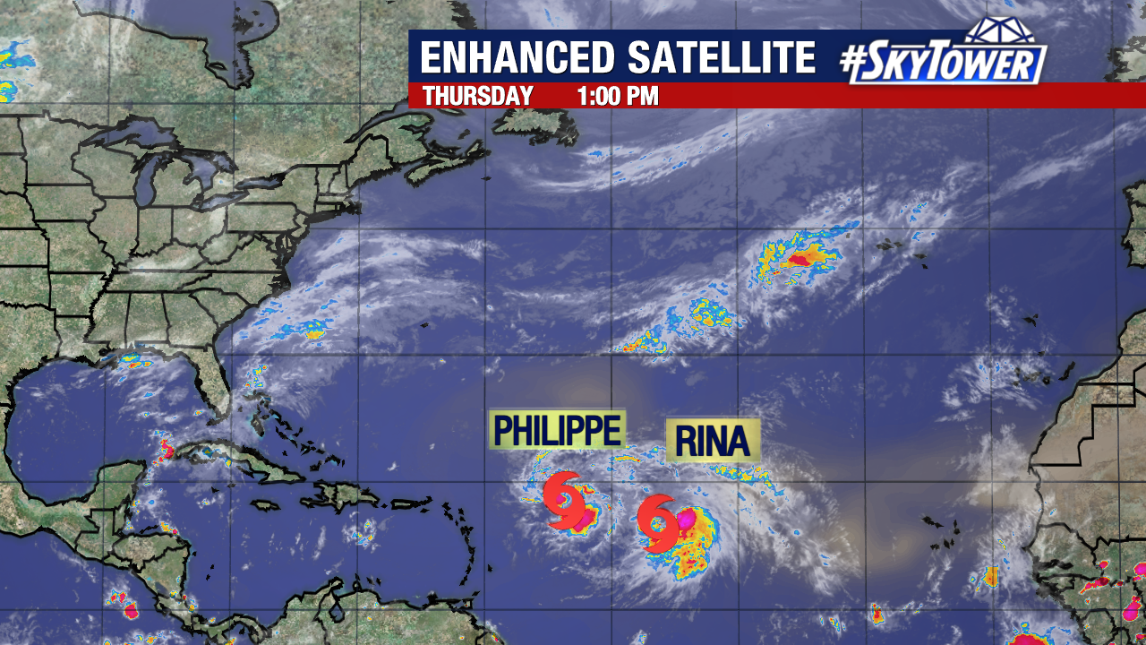
Tropical Storm Philippe is less than 700 miles away from Rina, so it’s not out of the question that they will pivot around each other and the tracks could change.
Winds from one storm can impact the other tropical system, causing one to spin and change its track. In some cases, the stronger storm will overtake and engulf the weaker one.
As of now, neither are expected to hit the Caribbean but we will continue to watch both systems closely.
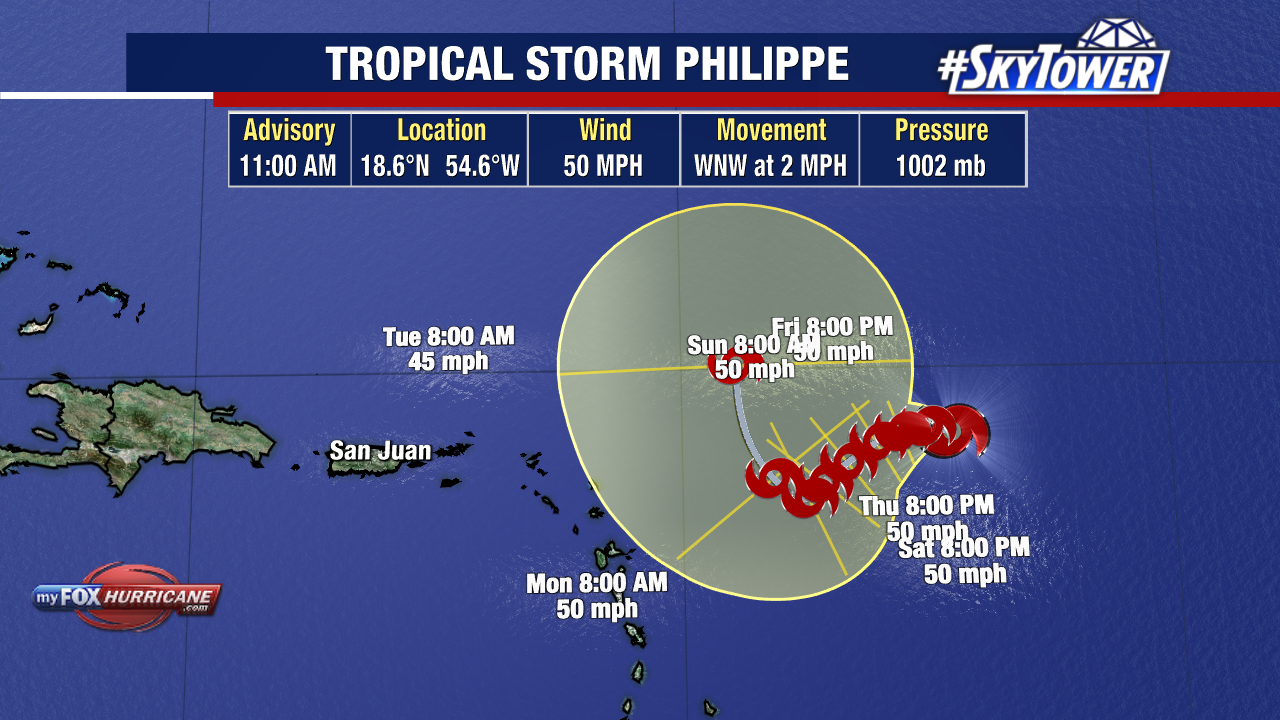
Tropical Storm Philippe’s track gets the storm closer to land compared to Rina, but the storm will likely remain east of the Caribbean Islands as it slowly crawls along at 2 mph. No coastal watches/warnings are in effect.