It’s June after all, so you wouldn’t expect to see much happening in the tropics quite yet. Just like many recent years we had a quick start to the season with a short-lived Tropical Storm Arlene form on back on June 2, and not much since then. As of now, no development is expected across the Atlantic basin over the next 7 days.

On Thursday, NOAA declared that sea-surface temperature anomalies in critical parts of the Pacific Ocean have warmed enough that an El Nino event is now officially underway.
El Niño is one of three possible phases of the El Niño-Southern Oscillation (ENSO), and forms when sea surface temperature anomalies reach at least 0.5 °C warmer than normal values. NOAA says their latest measurements recorded the anomaly at 0.8°C above average.
This is the first time we’ve been in El Niño territory since 2019, and if past events are any indication, we’ll likely end up with a quieter than normal hurricane season when all is said and done.
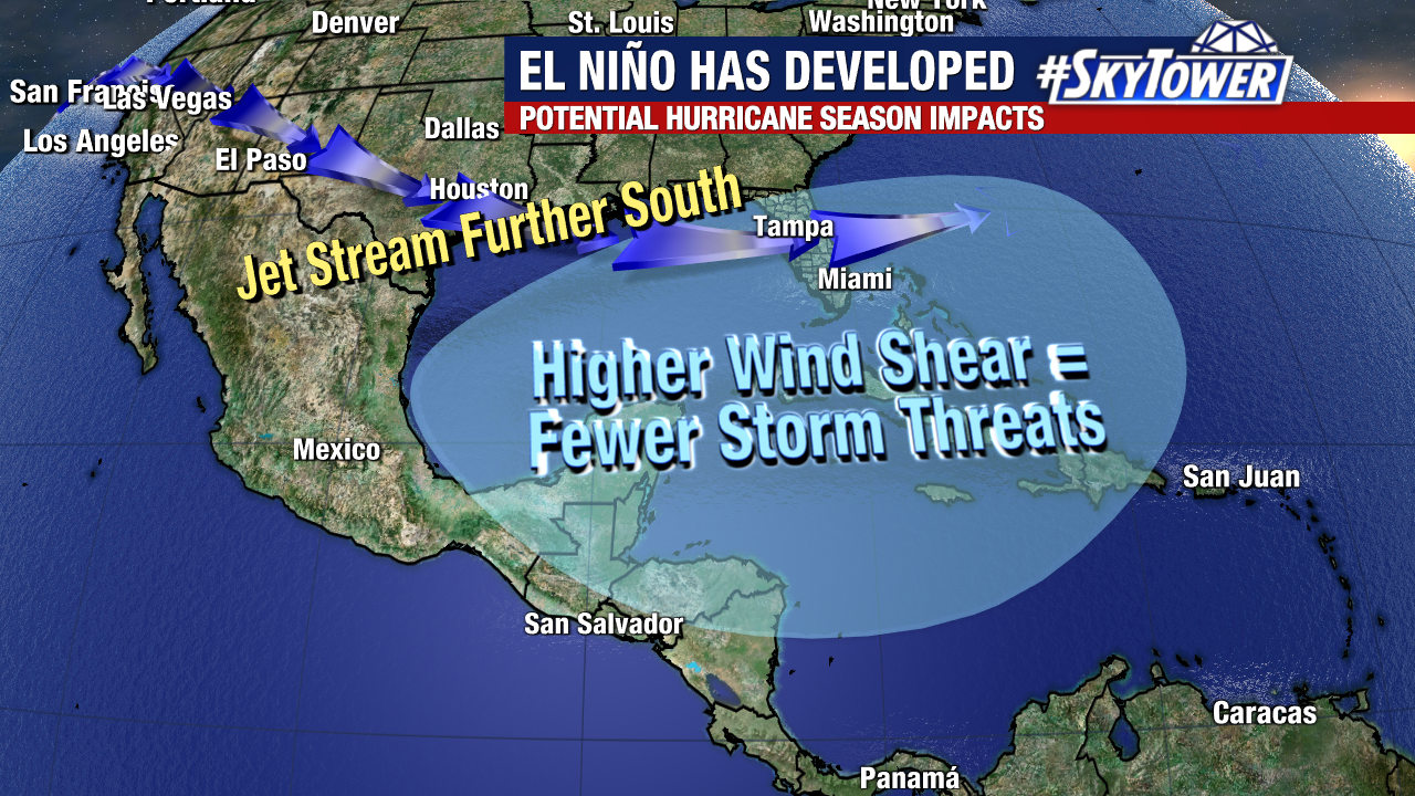
The reason for that is during an El Nino pattern, the polar jet is typically resides much further south, and our subtropical jet is much more active. Ultimately this leads to higher than normal wind shear across the Gulf of Mexico, Caribbean Sea, and parts of the Atlantic.
Of course, quiet season or not, we need to prepare the same way. All it takes is one storm hitting your area to make it a bad year for you.