Hurricane Ian’s sustained winds have now increased 55 mph over the last 24 hours – far surpassing the criteria to qualify for rapid intensification. Further intensification is expected as the storm remains in a very favorable environment. It’ll likely become a major hurricane at some point tonight.
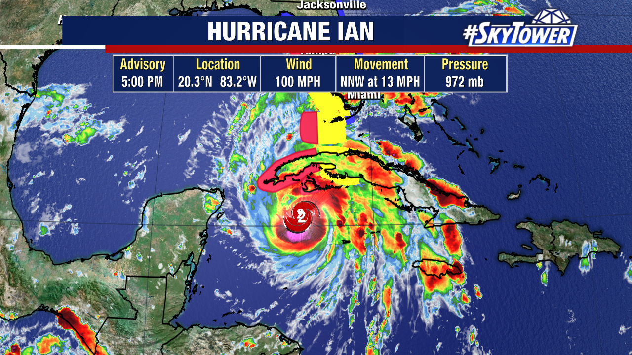
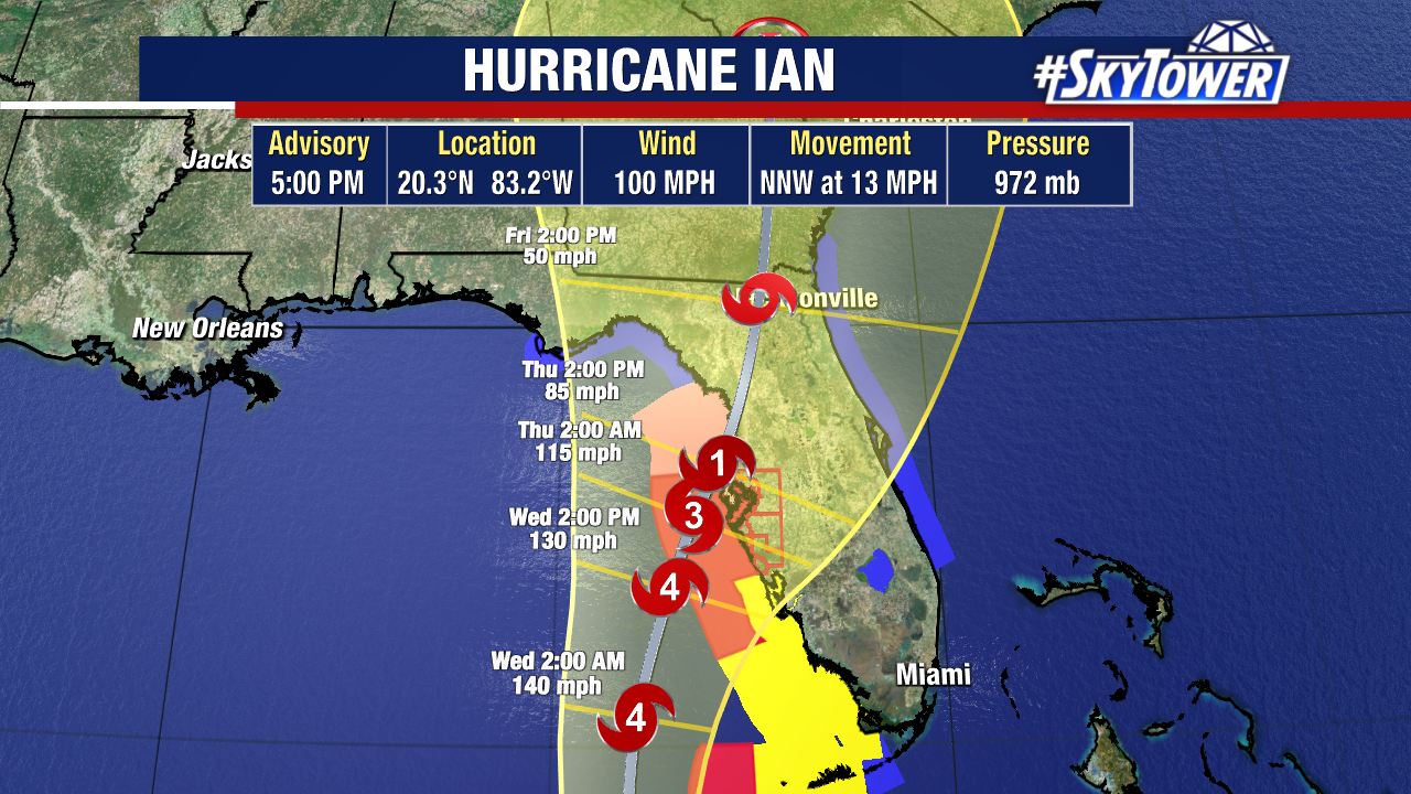
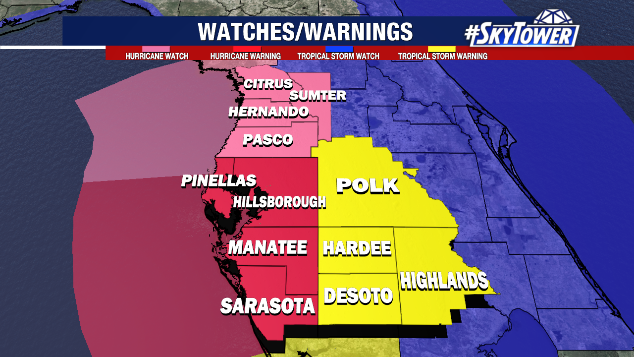
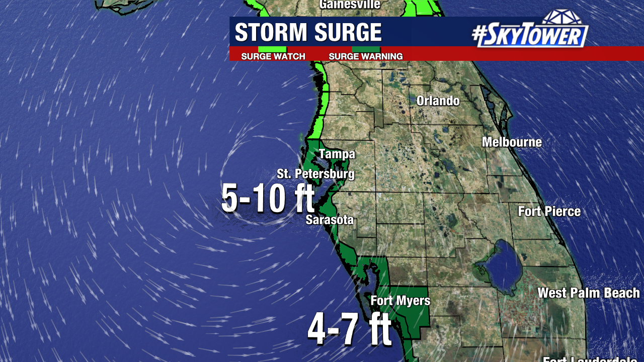
Hurricane watches and warnings are now posted up and down Florida’s west coast, along with storm surge watches and warnings.
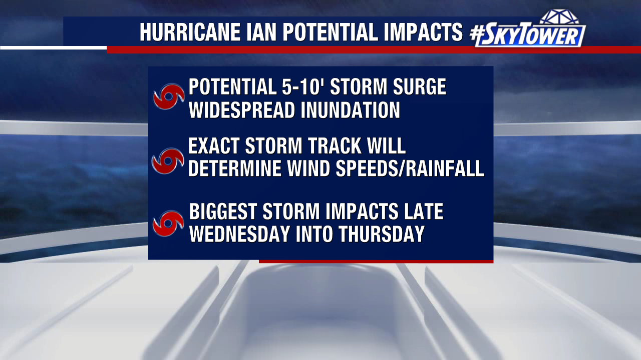
Storm surge is most confident part of the impact forecast at this point. The highest expected surge as of now will be on the order of 5-10′ from Anclote Key to Longboat, with lesser totals elsewhere. Additionally, the storm’s slow forward motion could add to these expected surge totals. This type of prolonged surge event poses a significant threat to life and property along the coast. If told to evacuate, you need to go.
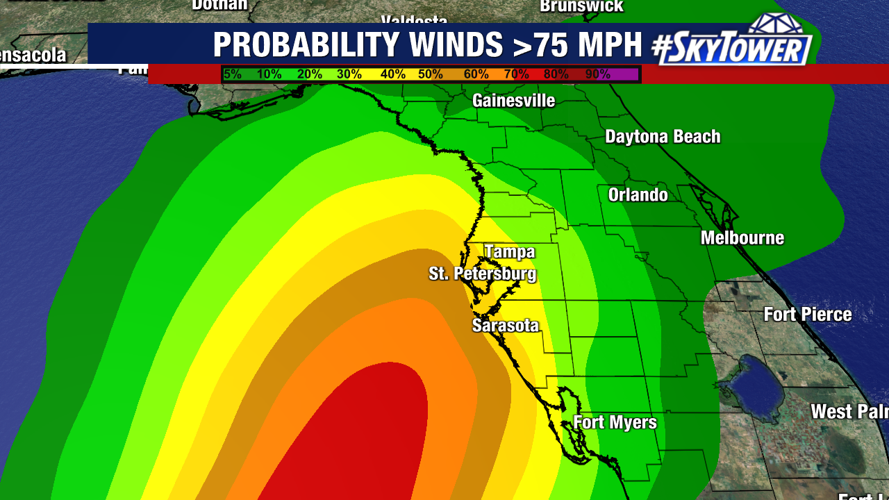
With respect to expected wind speeds and rainfall, things are a bit more complicated due to the roughly parallel shore track. If the track is a little further offshore, expected wind speeds could be greatly reduced, If the track is closer to shore, they may greatly increased. If you are under a hurricane warning, prepare for at least a period of hurricane-force wind gusts. If under a tropical storm warning, know that your wind speeds could be higher than tropical-storm force if the storm track closer to shore. The hope of course is for a track further offshore, but you must prepare for the worst case scenario.
