Tropical Storm Ian is gradually looking better on satellite presentation this morning including the overall circulation and center of the storm. As of the 11 AM Advisory, Ian had maximum sustained winds of 50 mph and was moving WNW at 14 mph with a pressure of 1001 mb. While its strength has not changed much, Ian is expected to go through a process of rapid intensification later today as it passes well southwest of Jamaica in an environment of light wind shear and deep, warm water.
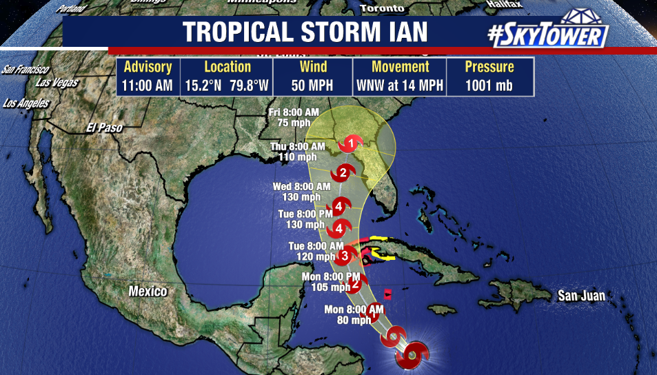
Ian will then slowly turn more NW around the western side of the subtropical ridge taking the center southwest of Grand Cayman by Monday morning likely as a hurricane. As Ian taps into the favorable environment of the northern Caribbean Sea Monday, we could see the storm ramp up to category 3 major hurricane strength by the time Ian slams into western Cuba 24 hours later. A Hurricane Warning has been issued for parts of Cuba.
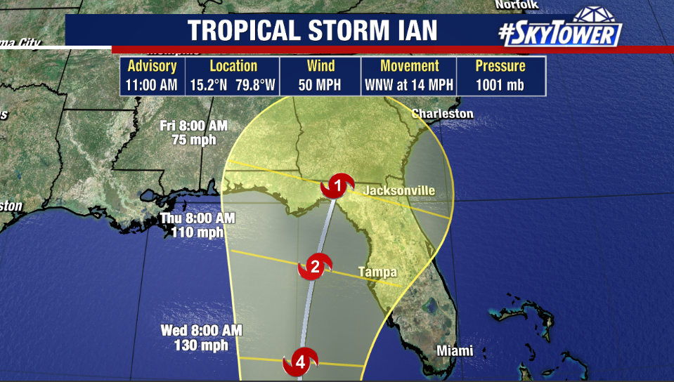
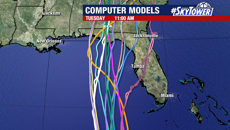
While we have a good handle on that part of the forecast, it is beyond Tuesday that things get a bit murky. Long range forecasts continue to disagree with a large degree of spread leading to ‘significant uncertainty’ in the eventual track and local impacts from the storm. While the GFS solution still favors a track further west that parallels the Peninsula, the Euro solution remains adamant on a path farther east into west-central Florida. Either way, we could be looking at a significant hurricane passing to our west, which would put the Tampa Bay region on the east side of the storm, where potential impacts could include dangerous storm surge, hurricane force winds, heavy rain, and severe weather. However, the magnitude of those impacts would depend on how closely the storm comes to the state.
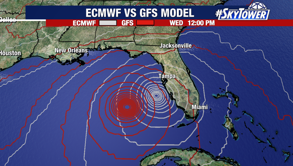
The further north Ian travels in the Gulf, the less favorable the environment it’ll move into, causing the storm to weaken some. The other consideration is the timing. Because the storm will appear to slow down before emerging into the Gulf, local impacts wouldn’t be felt until Tuesday night at the earliest and more likely on Wednesday and Thursday.
The takeaway remains the same: the forecast track will continue to change and improve with time. Folks along the west coast of Florida, including the Tampa Bay region should plan and prepare for the possibility of a hurricane. Stay tuned as we continue to refine the forecast.