
Tropical Storm Ian has an asymmetric appearance on satellite this morning due northerly shear which continues to plague the storm. As of the 11am Advisory, Ian has maximum sustained winds of 45 mph and is moving west at 15 mph. Pressure is 1003 mb. Ian is expected to strengthen this weekend as it passes south of Jamaica and approaches the Cayman Islands, where a Hurricane Watch has been issued.
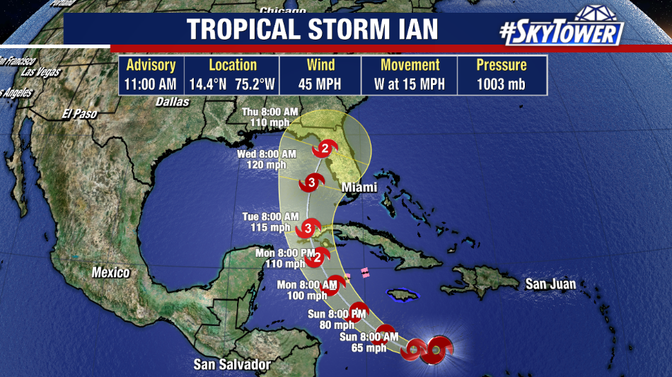
By Monday, Ian is forecast to reach hurricane intensity as it approaches the western portion of Cuba. Ian is expected to move into an environment favorable for rapidly intensification due to the light wind shear and above average water temperatures in its path. With only limited land interaction over Cuba, Ian could reach major hurricane status as it emerges in the southeastern Gulf of Mexico next week.
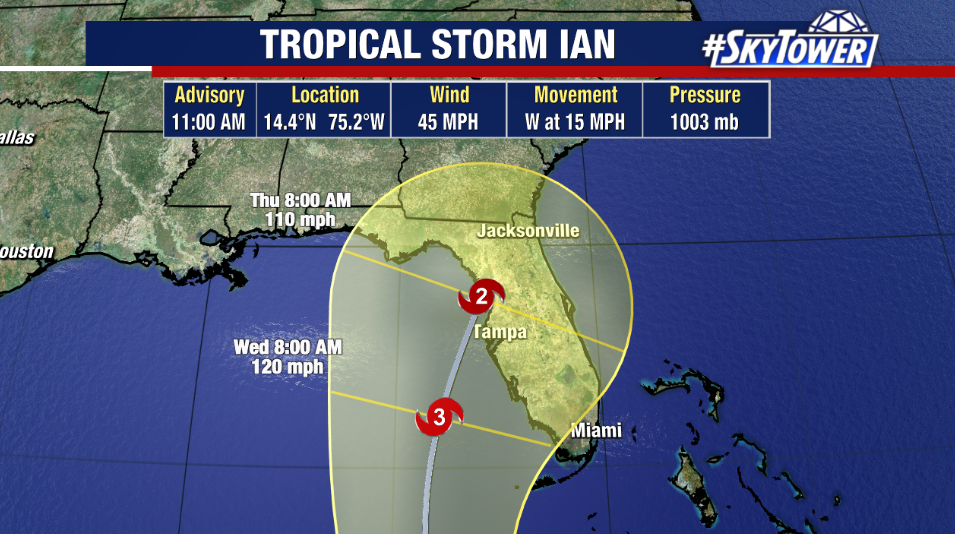
While a direct impact somewhere in Florida is becoming more and more likely next week, it is still difficult to know exactly where this will be. The latest official track has shifted slightly to the west with the latest update from the National Hurricane Center. However, nearly the entire state of Florida remains in the cone of uncertainty. It’s important to keep in mind the long-term average day 4 and 5 track errors are around 150-200 miles.
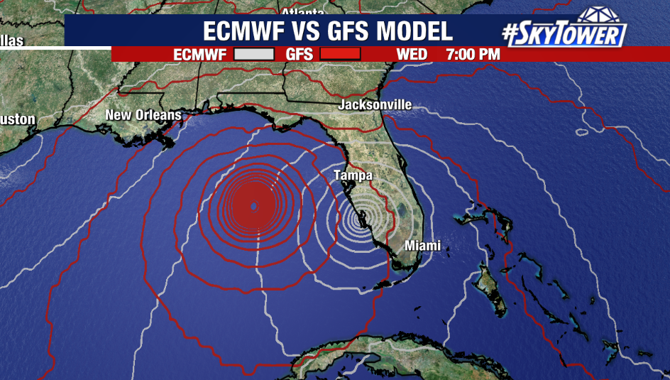
The exact impacts we will see will be determined by the exact track Ian takes. While that is not set in stone, it is still a good idea to finalize plans this weekend, in the event they will need to be implemented.