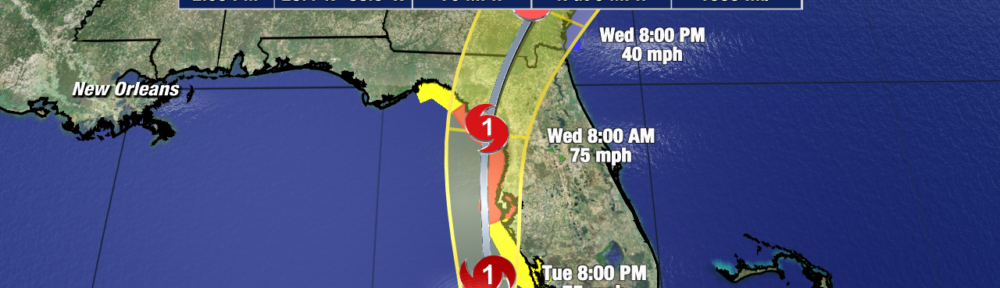
Elsa has been battling some westerly shear today, that has so far prevented the storm from being vertically aligned – key component needed for strengthening. Despite this, Hurricane Hunters this afternoon found wind speeds of 70mph and Elsa is now expected to become a hurricane as it moves up Florida’s west coast tonight into early Wednesday. This isn’t going to change much though when it comes to expected impacts.

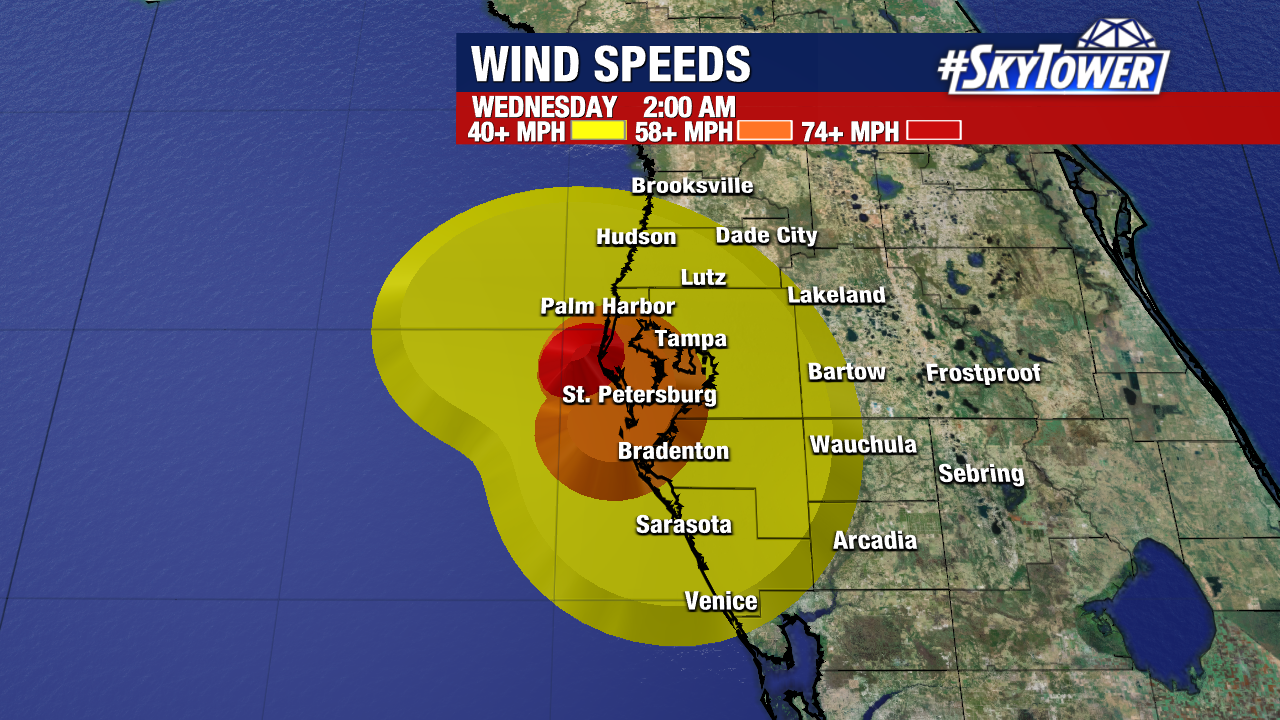
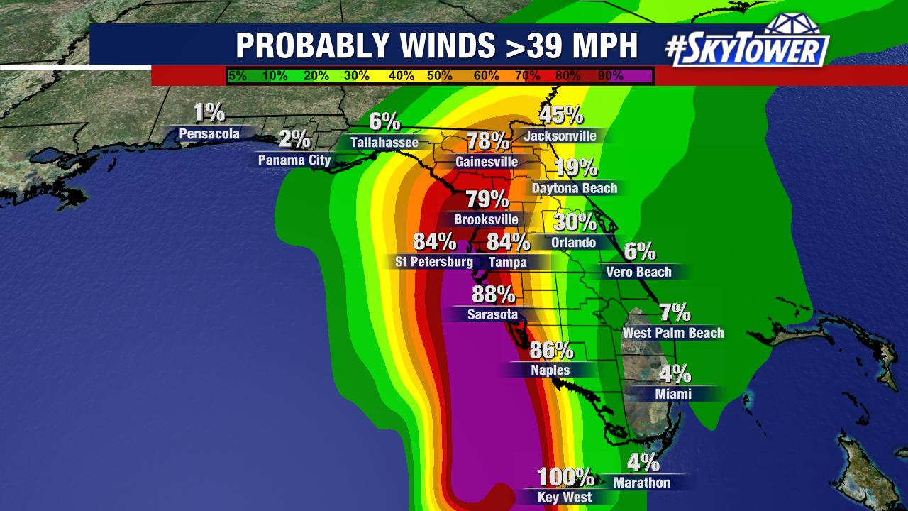
Hurricane warnings have now been posted from Tampa Bay northward to the Steinhatchee River. In these areas, hurricane-force wind gusts will be possible. Areas further inland are likely to experience a few tropical storm-force (40+ mph) wind gusts.
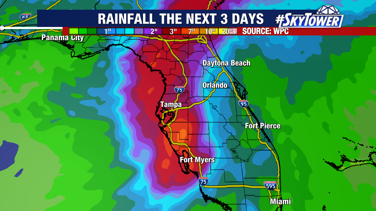
Elsa will bring periods of heavy rain as this evening through the overnight that could amount to 3-7″ with isolated higher amounts when all is said and done. This will likely cause areas of urban and river flooding, especially because it has been so wet recently.
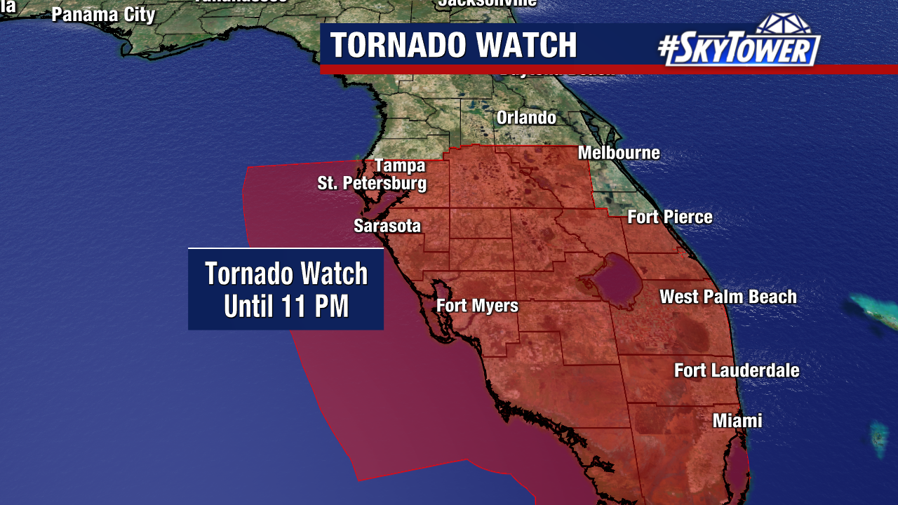
A tornado watch is out until 11pm Tuesday. Tornadoes in tropical systems are often an afterthought, but can pose a serious threat. Have a way to get alerted of any warnings. A new watch will likely be issued this evening for the Nature Coast as well.
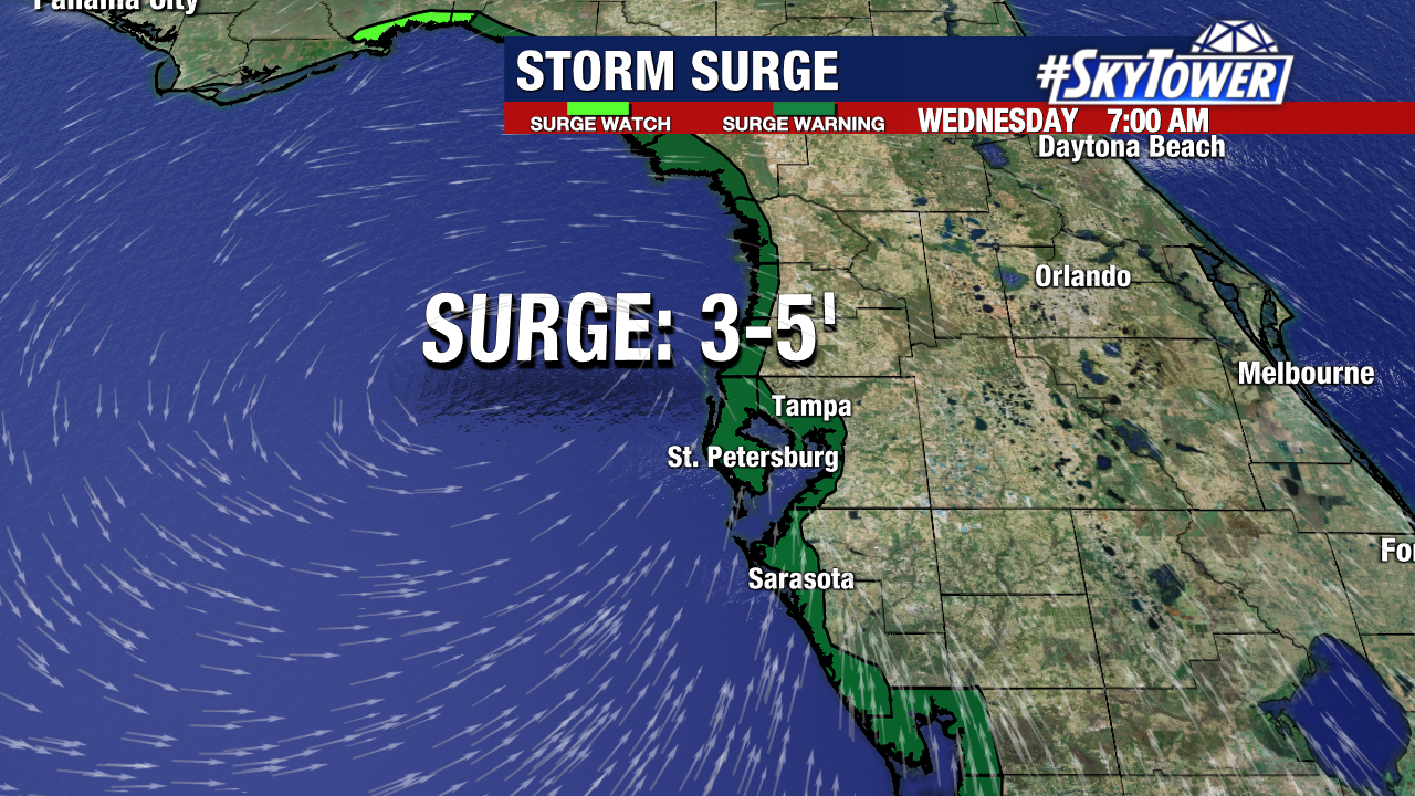
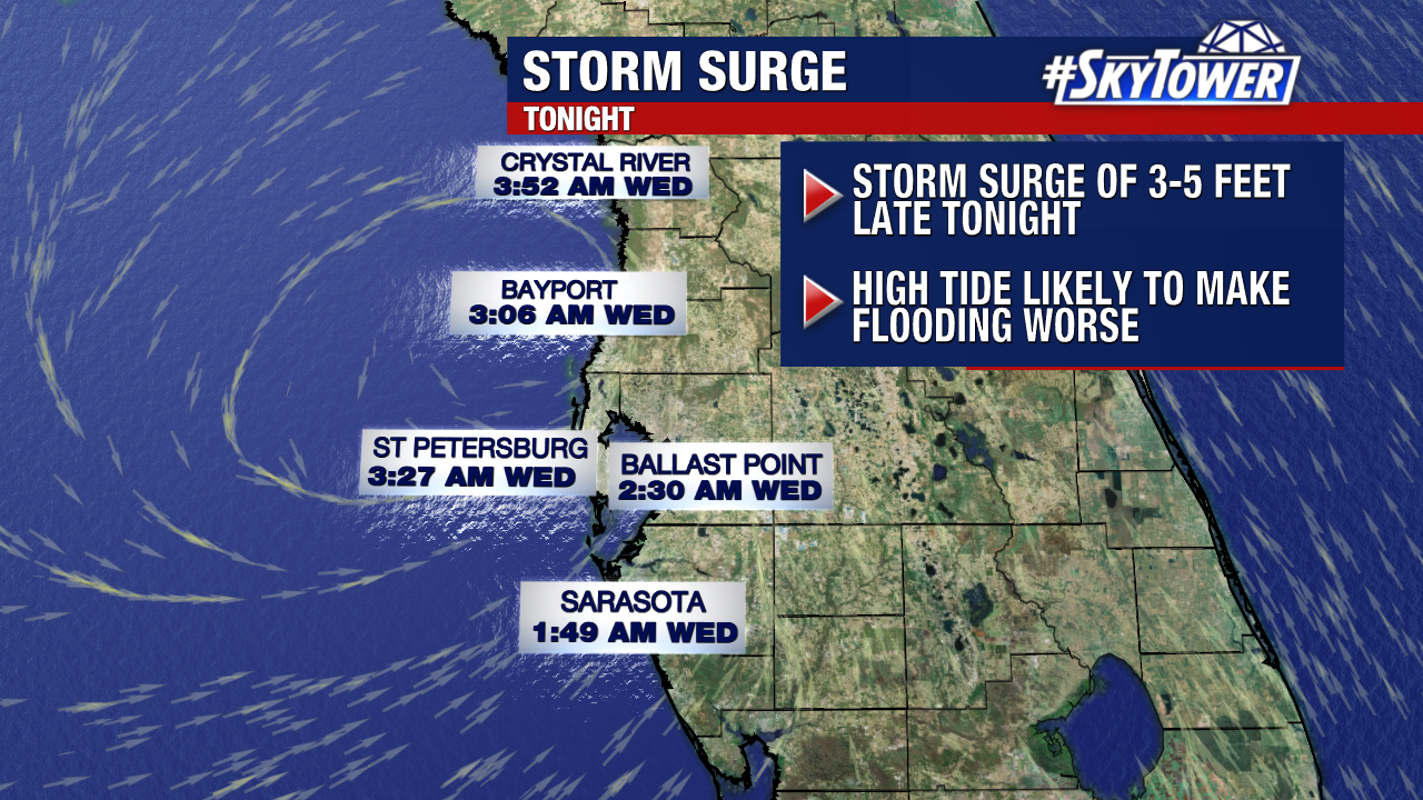
Storm surge is going to be a serious problem beginning after midnight tonight. 3-5 feet of surge around time of high tide time is not a good combo.