
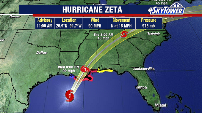
Here we go again. Yet another hurricane on its final approach toward the northern Gulf Coast. Hurricane Zeta will likely be making landfall in southeast Louisiana by late afternoon or early evening. This will be the third hurricane to make landfall in Louisiana this season. It will also be the latest calendar year hurricane to hit the U.S. since Kate (1985).
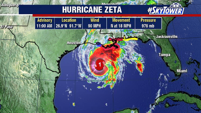
As of 10am EDT, Zeta had max winds of 90 mph and some additional strengthening is likely to occur as it approaches the coast. The center of the storm was located about 220 miles SW of the mouth of the Mississippi River. It’s current forward speed is 18 mph, but it will be accelerating leading up to landfall. Any final preparations for residents in SE Louisiana or the Mississippi Gulf Coast should be wrapped up by early this afternoon at the latest.
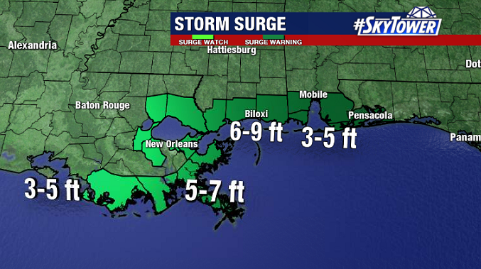
This fast storm motion should keep rainfall totals limited to only a few inches, which will largely rule out any freshwater flooding. However, storm surge flooding and wind damage/power outages will be widespread. Near and just east of where Zeta makes landfall, storm surge will be highest. Particularly from the mouth of the Pearl River, eastward to Dauphin Island, AL, surge of 6-9 feet can be expected.
Much cooler, sunnier weather will set in once the storm passes.