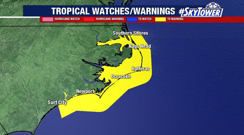
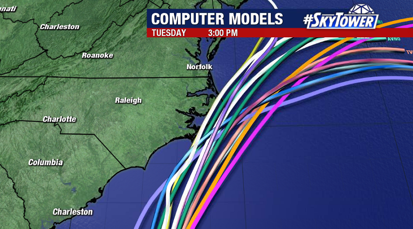
As of 2pm Sunday, Arthur was located about 300 miles SSW of Cape Hatteras, NC. It will continue moving NNE over the next 24-48 hours while picking up forward speed. On the current track it will pass near or just east of the North Carolina coast on Monday. A tropical storm warning is in effect from Surf City to Duck, NC.
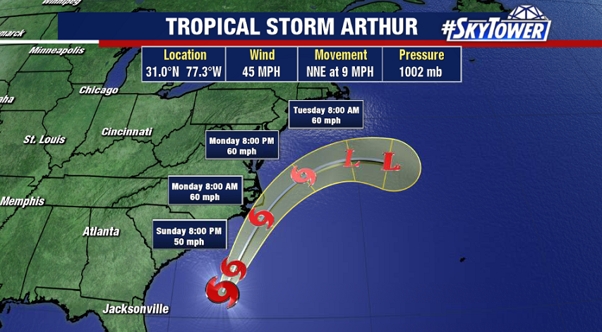
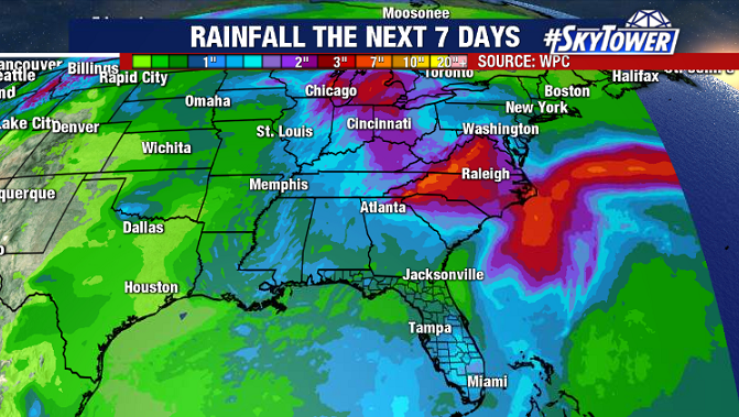
Arthur is a lopsided storm, with the worst of the weather on its eastern side. So, with the current track, the strongest winds should stay offshore. That being said, tropical storm force winds will still be possible along the immediate coast. In addition, 1-3″ of rain is likely for parts of coastal NC. It should be noted though that much of the Eastern U.S. will have quite a bit of rain around anyway over the next few days thanks to an upper-level spinning over the Southeast.
Arthur will continue to generate large swells along the Southeast U.S. coast up through the mid-Atlantic over the next 2-3 days, which may lead to rough surf and a high rip current risk for beachgoers.