
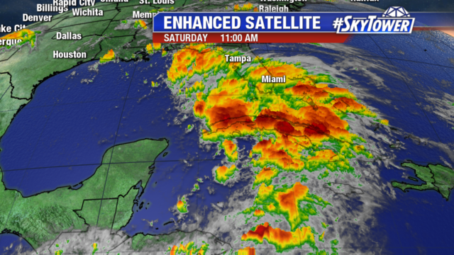
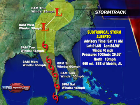
Subtropical Storm Alberto is still a disorganized system with convection focused on the east side of the storm. The latest track has shifted a little east but still keeps Alberto well offshore in the Gulf.
As Alberto moves north into an area of lower wind shear it will likely strengthen and become more tropical in nature. After landfall along the northern Gulf Coast as a possible tropical storm, Alberto will steadily weaken.
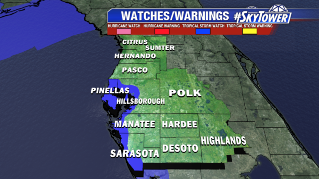
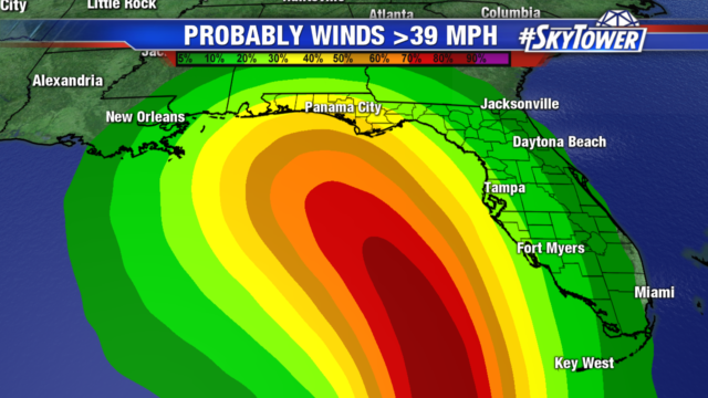
Tropical Storm Watches have been issued for coastal areas from Pinellas to Sarasota counties. Winds will increase Sunday with gusts to 40 mph possible along the coast. The strongest winds remain offshore close to the center of circulation.
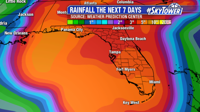
Expect heavy rain and thunderstorms tonight through Sunday with localized flooding. An additional 4-8″ of rain is possible over the next 7 days. The ground is already saturated from recent rainfall and rivers are running high. If you encounter a roadway covered in water, Turn Around, Don’t Drown. Isolated weak and brief tornadoes are possible tonight into Sunday.
Dangerous boating conditions with a high risk of rip currents continues through Memorial Day. Tides one to two feet above normal.