The 2025 Atlantic hurricane season has officially wrapped up, and this year Florida caught a break.
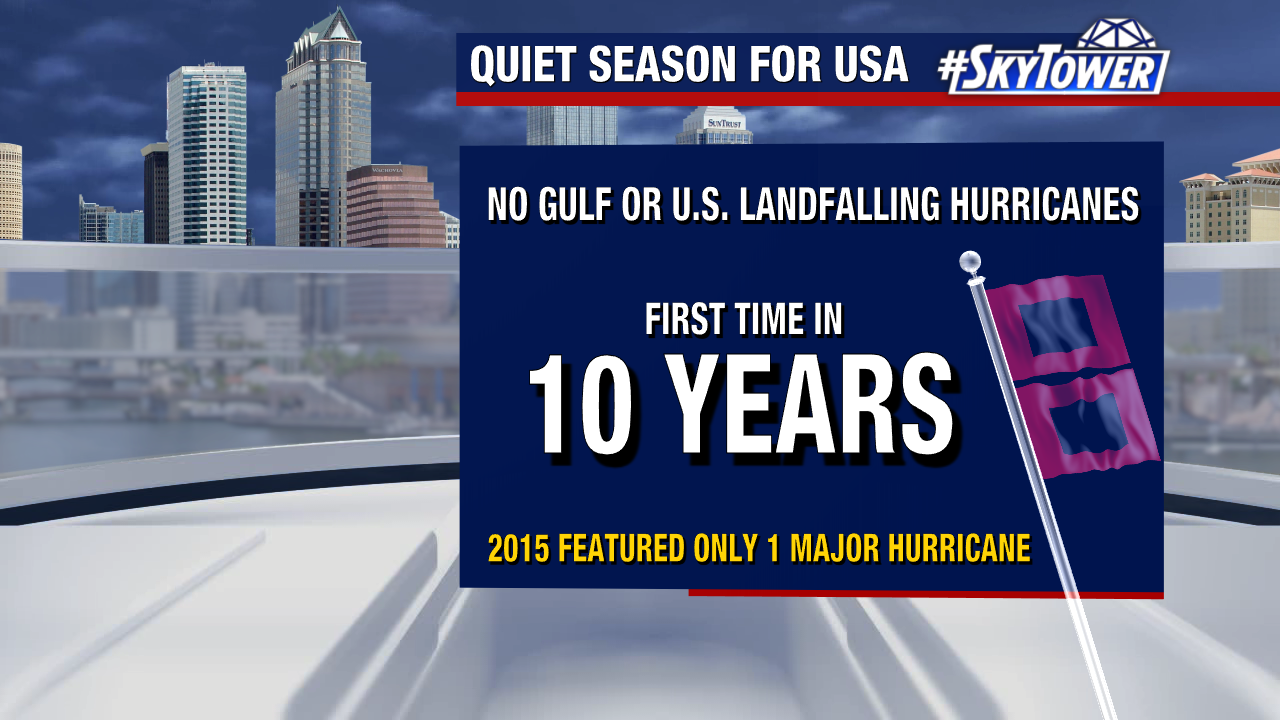
2025 brought no U.S. or Gulf Coast hurricane landfalls, marking a shift from the high-impact seasons we’ve experienced recently.
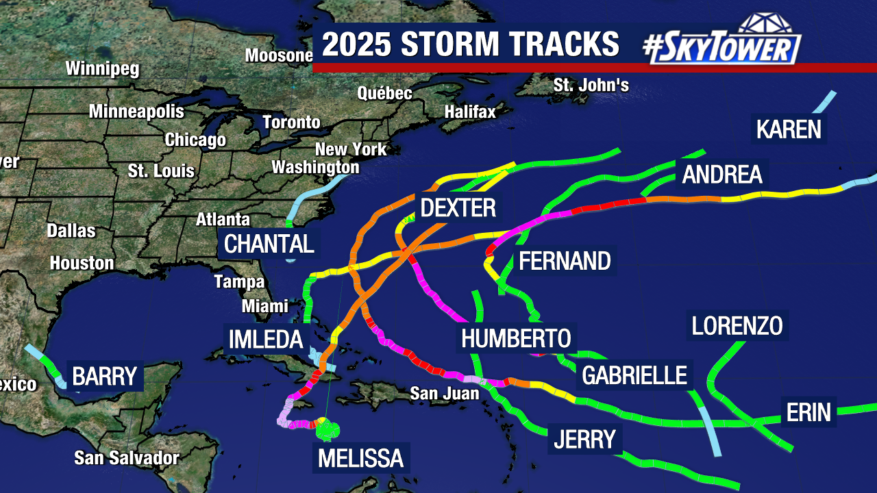
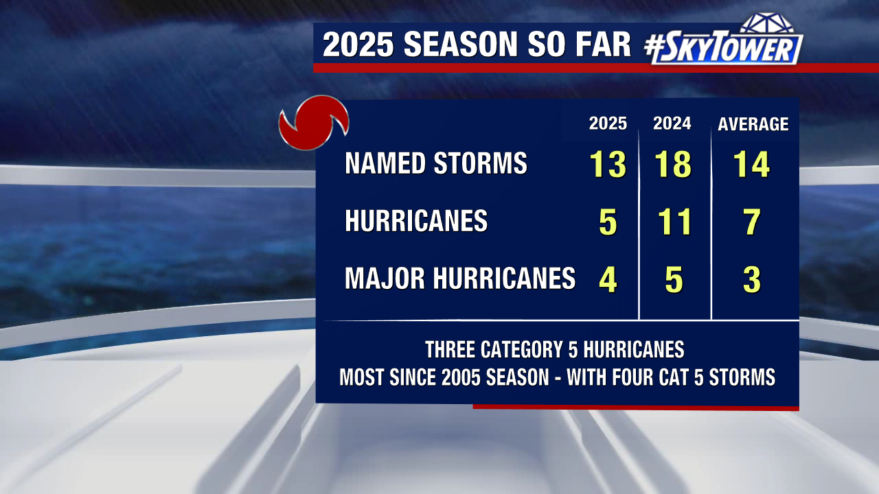
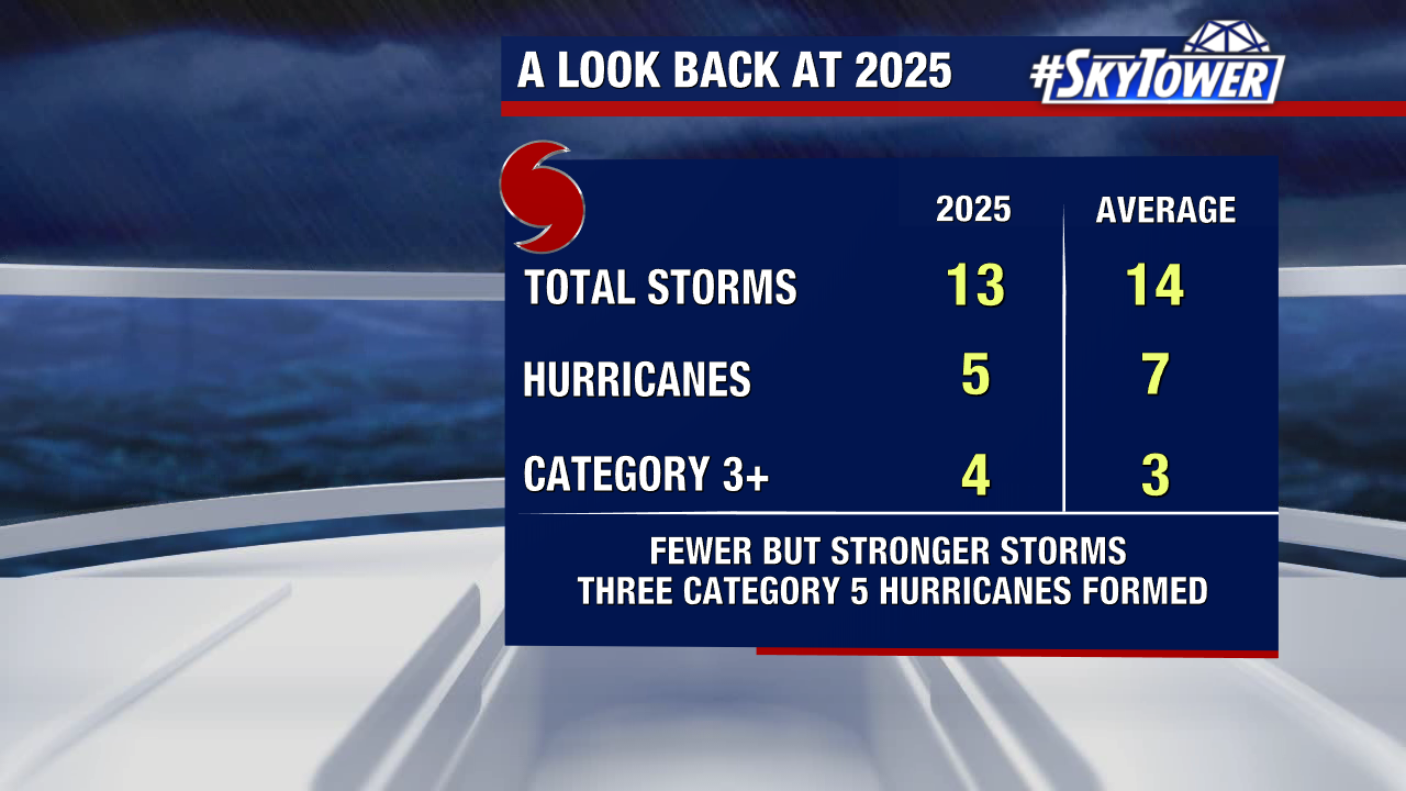
While Florida stayed quiet, the Atlantic Basin still saw five hurricanes, three of which were Category 5 storms. The season ended with above normal ACE (Accumulated Cyclone Energy) or overall storm energy.

When comparing 2025 to the 2024 season, the difference is stark. 2024 had far more named storms and hurricanes.

Hurricane Melissa, a late-season Category 5 hurricane, was the most impactful storm of 2025. It made its first landfall in Jamaica as one of the strongest land falling storms ever recorded in the Atlantic. Melissa was also the first storm to either form or travel over the unseasonably warm waters of the Caribbean Sea this year.