The start of the 2026 Atlantic hurricane season is days away, starting June 1 and running through Nov. 30.
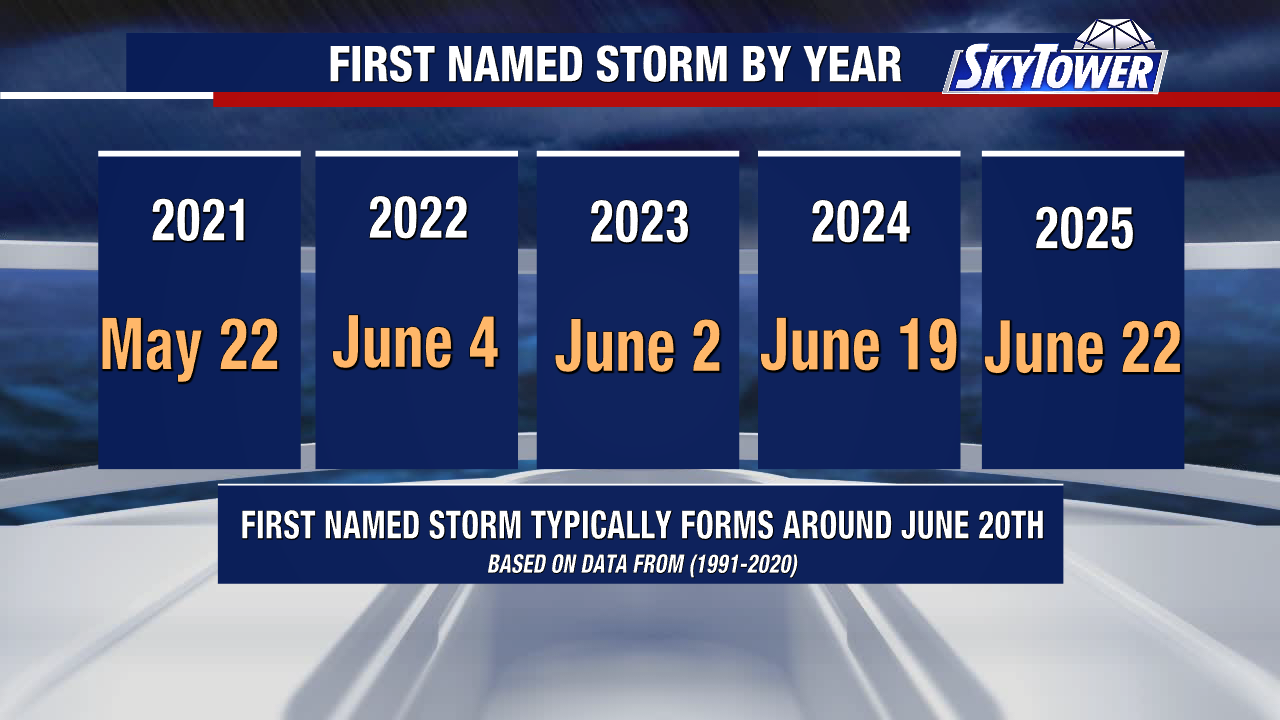
June 20 is the average date the first named storm of the season forms. But storms can form earlier than that, and they have in recent years.
The average date the first hurricane forms is August 11. The first major hurricane, Category 3 or stronger with 111+ mph winds, typically forms Sept 1.
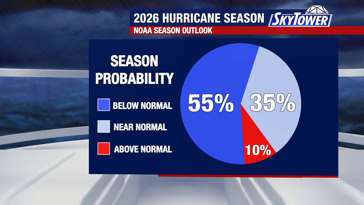
Predictions from NOAA call for a below-normal season but it only takes one storm to make a season impactful.
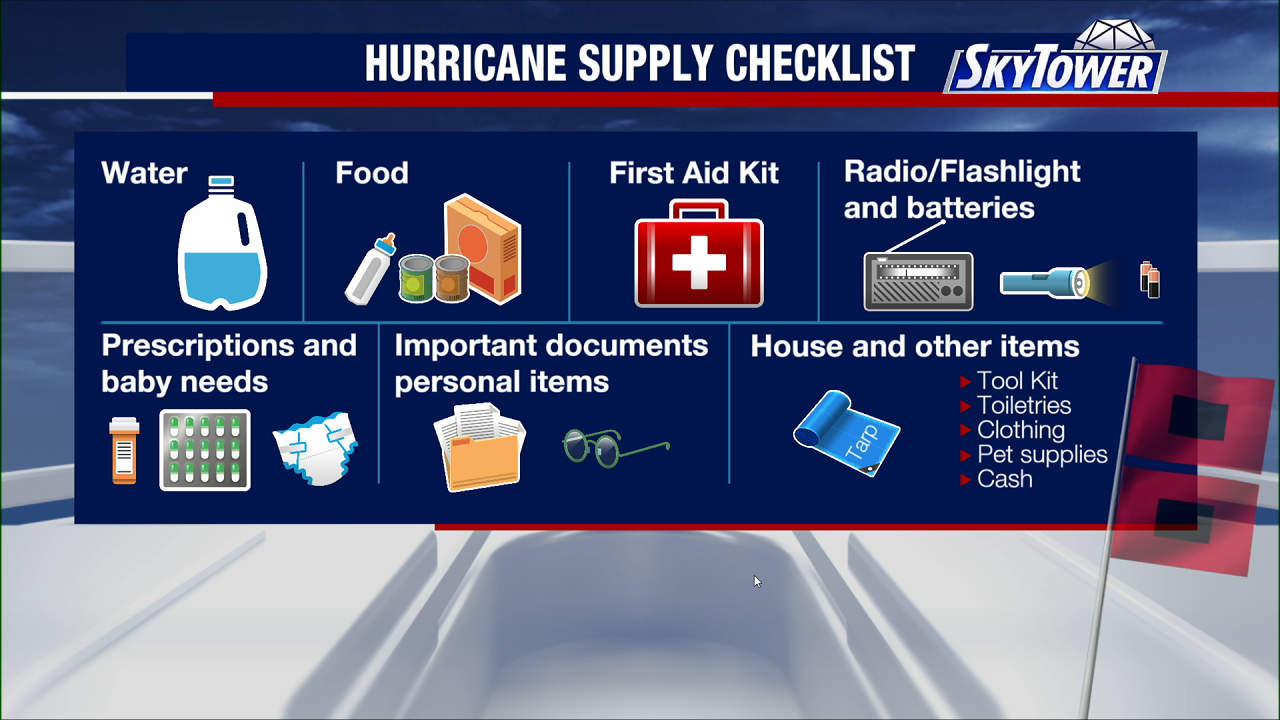
Plan and prepare as you would for any other season.
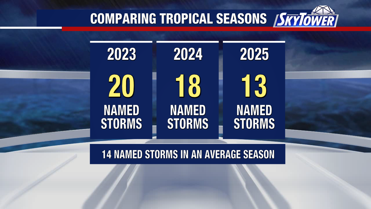
Here’s a look back at the last three hurricane seasons:
As we head into the heart of May, our Atlantic hurricane season is right around the corner. Today marked the release of the first official tropical outlook from the National Hurricane Center.
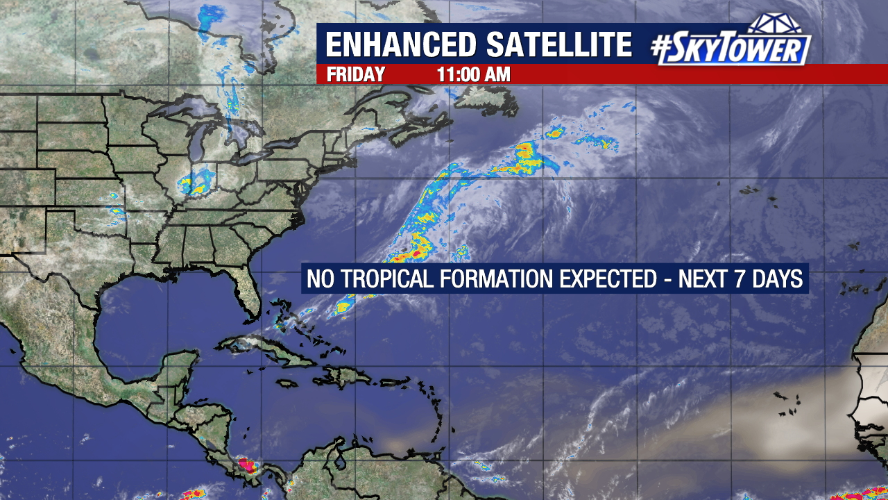
While there are no immediate concerns in the Atlantic Basin, meteorologists are already beginning to analyze early clues that could give us an early indication of this season’s activity.
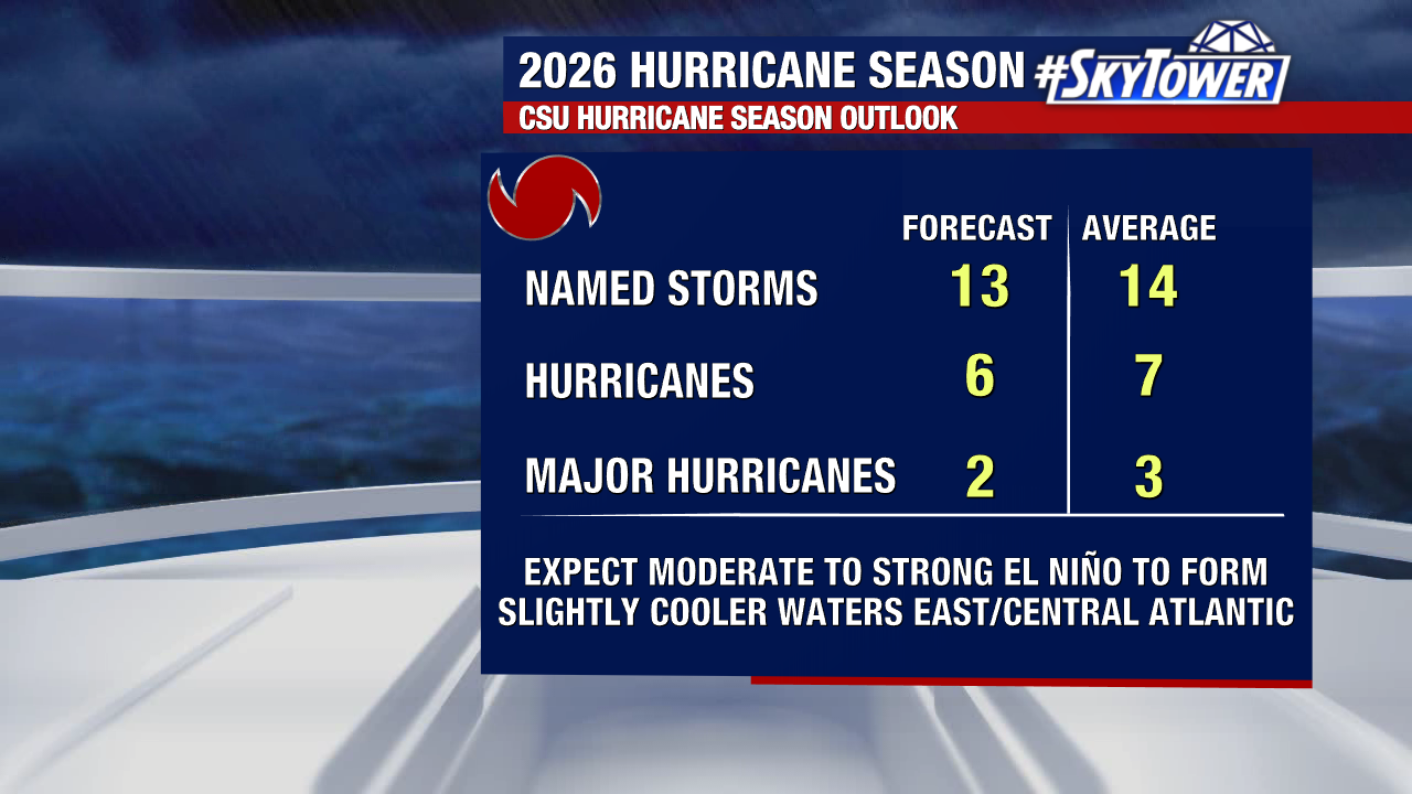
One of the most closely watched preseason forecasts comes from Colorado State University. Their seasonal outlook calls for a near or below-average Atlantic hurricane season, with a large reason being the increasing likelihood of a El Niño pattern developing soon.
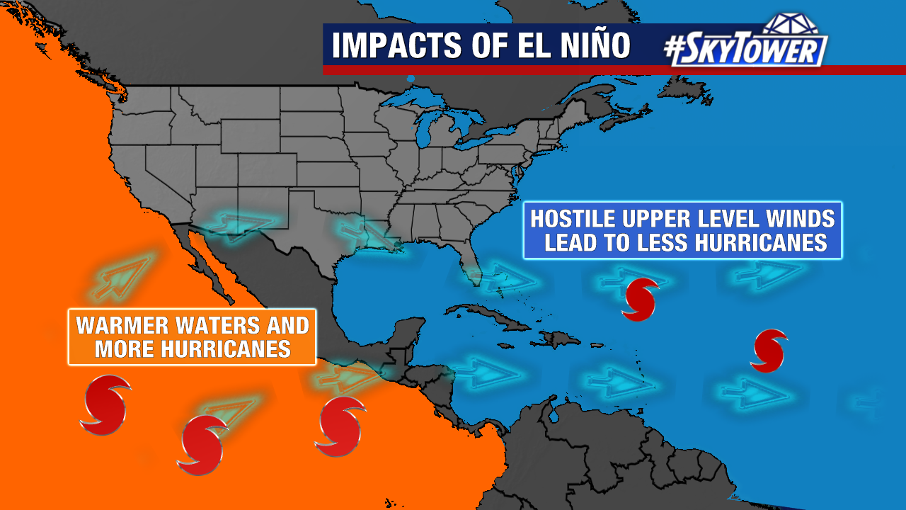
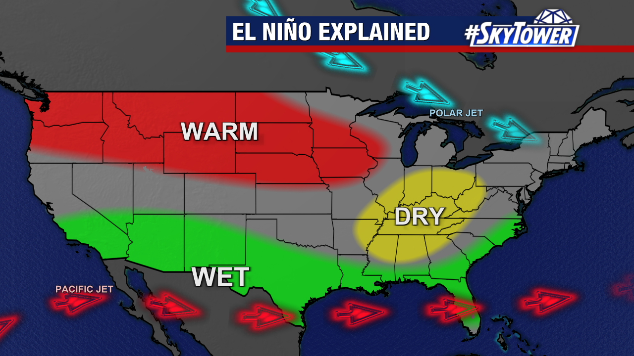
El Niño is a natural warming of the equatorial Pacific Ocean that influences weather patterns across the globe. For hurricane season, one of its biggest impacts is increasing upper-level wind shear across the Atlantic Basin. That matters because hurricanes thrive in environments with low wind shear. Strong winds at different levels of the atmosphere can tear storms apart, often leading tropical systems struggle to organize and intensify.
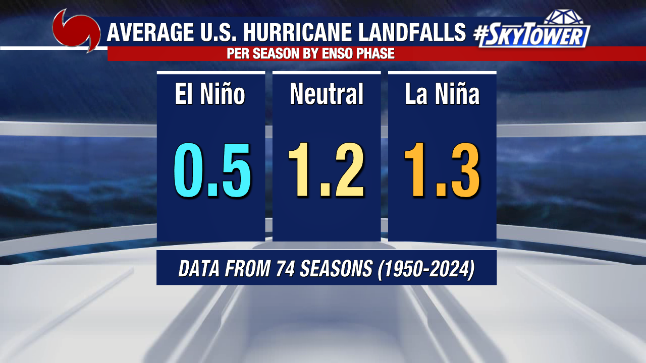
Statistically, the numbers support that relationship. During El Niño seasons, the average number of U.S. landfalling hurricanes tends to decrease compared to neutral or La Niña years.
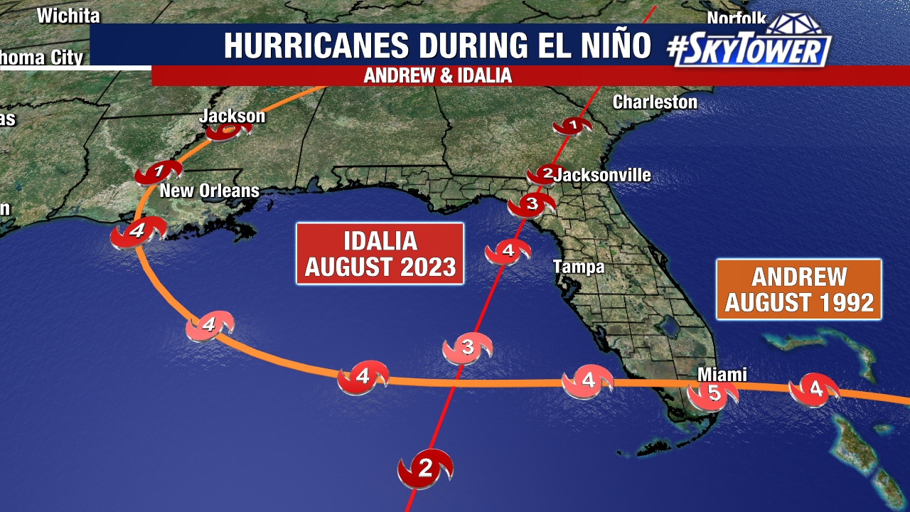
However, El Niño does not eliminate hurricane risk. Some of the most destructive and memorable hurricanes in modern history still occurred during El Niño years. Storms like Hurricane Andrew and Hurricane Idalia each developed despite the presence of El Niño conditions, proving it only takes one storm in the wrong place at the wrong time to create a disaster.
While El Niño can suppress Atlantic hurricane activity, it often shifts Florida’s winter pattern in the opposite direction. Historically, El Niño winters bring more frequent storm systems, cooler stretches, increased rainfall across Florida, and a higher severe weather and tornado potential. That’s mainly because the subtropical jet stream becomes stronger and more active across the Gulf Coast and Southeast.
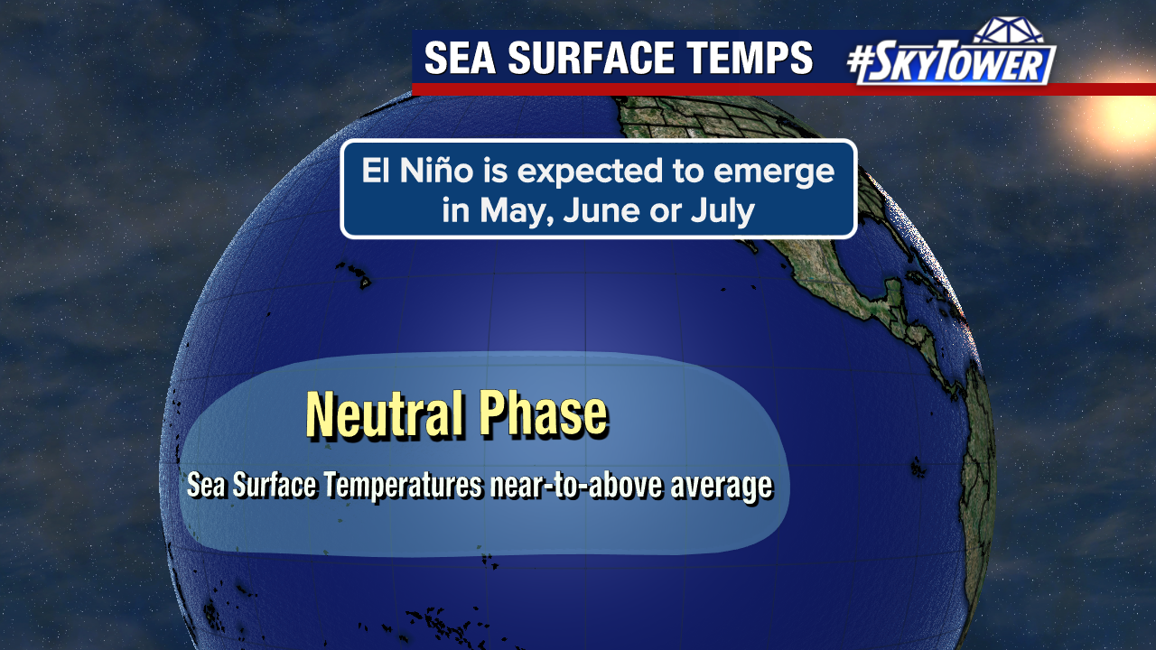
Right now, the Pacific Ocean remains in a neutral ENSO phase, meaning neither El Niño nor La Niña is currently dominant.
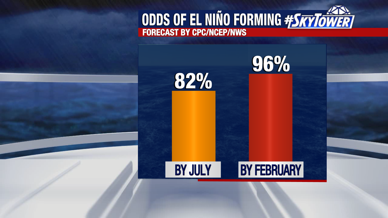
That phase may not last long. Weather forecast models continue to show a very high likelihood that El Niño could emerge in the coming months.
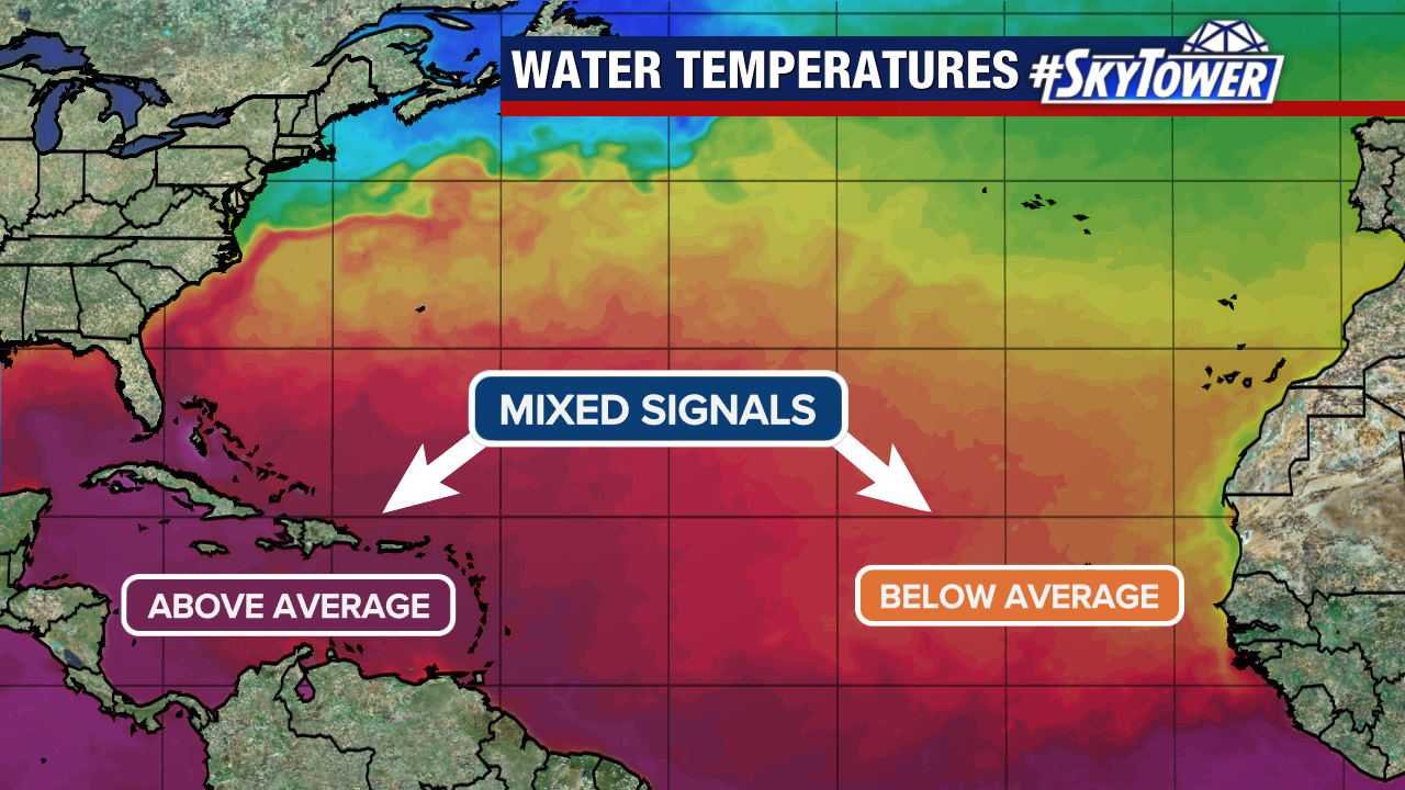
Complicating that forecast, are the mixed signals our ocean temperatures are providing. We have above-average warm water temperatures in the Gulf and Caribbean and below-average water temperatures in the central and eastern Tropical Atlantic. This is another variable that may play a roll in the amount and location of future storms.
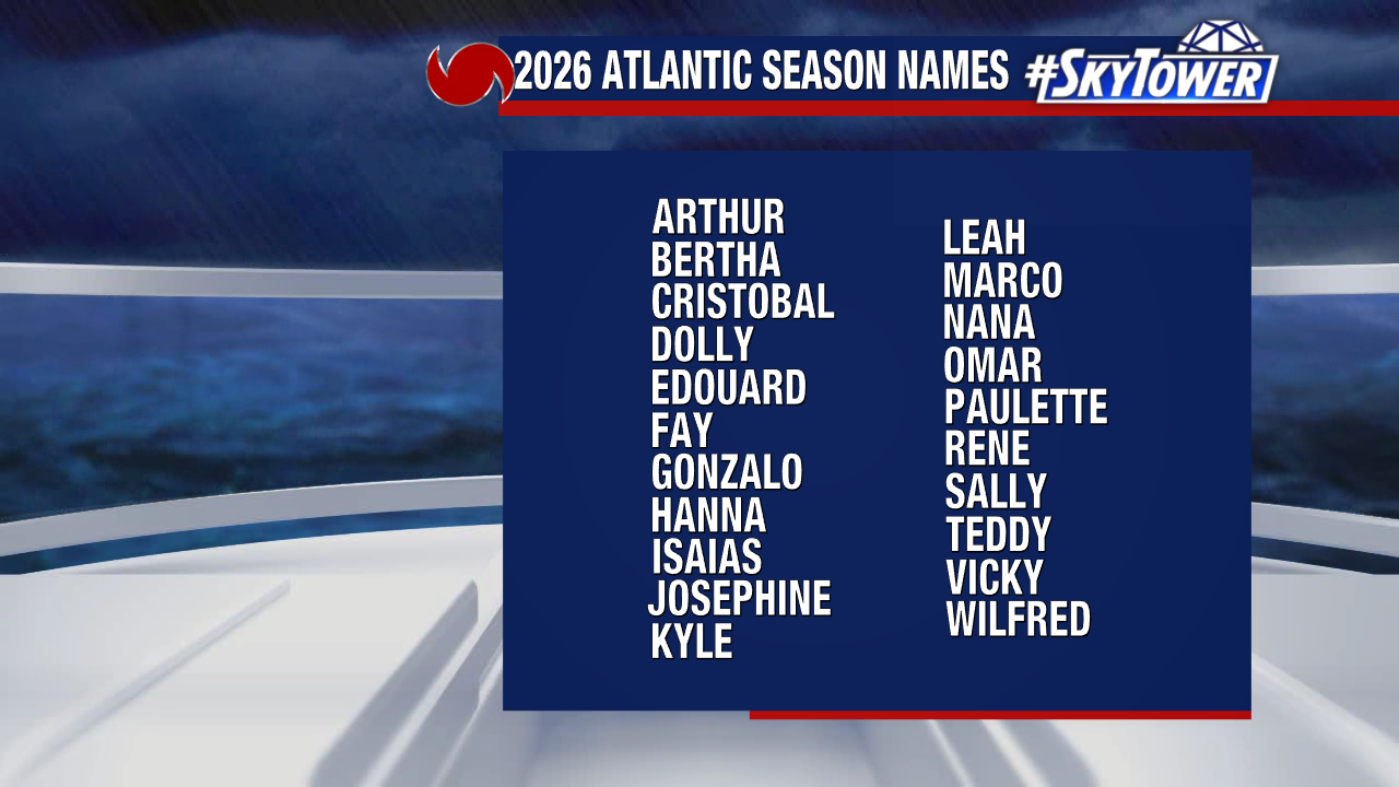
Each season brings us a new naming list. These cycle every six years and the World Meteorological Organization retires names when storms become so deadly or costly that reusing the name would be inappropriate. “Leah” now replaces “Laura”, which was retired after causing over 23 billion dollars worth of damage as a major hurricane in 2020.
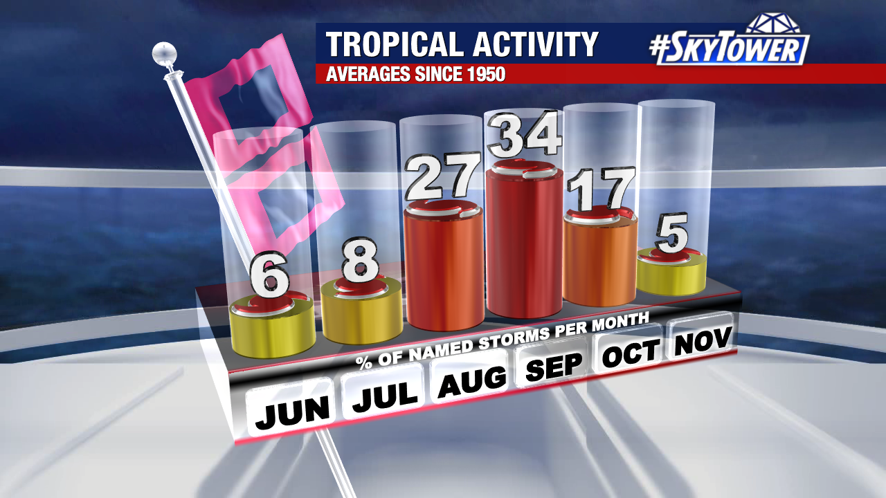
Even though hurricane season officially begins June 1st, it’s typically a quiet start. Activity usually ramps up gradually through the summer before peaking in late August through September. While preseason forecasts and climate patterns can help paint the bigger picture, preparation remains the most important step regardless of how active a season is expected to be. It only takes one storm to make it an impactful season where you live.