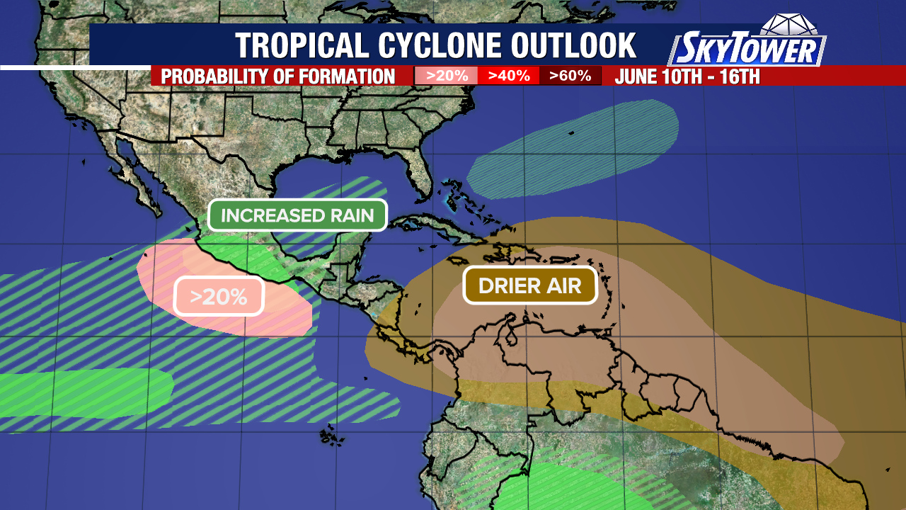
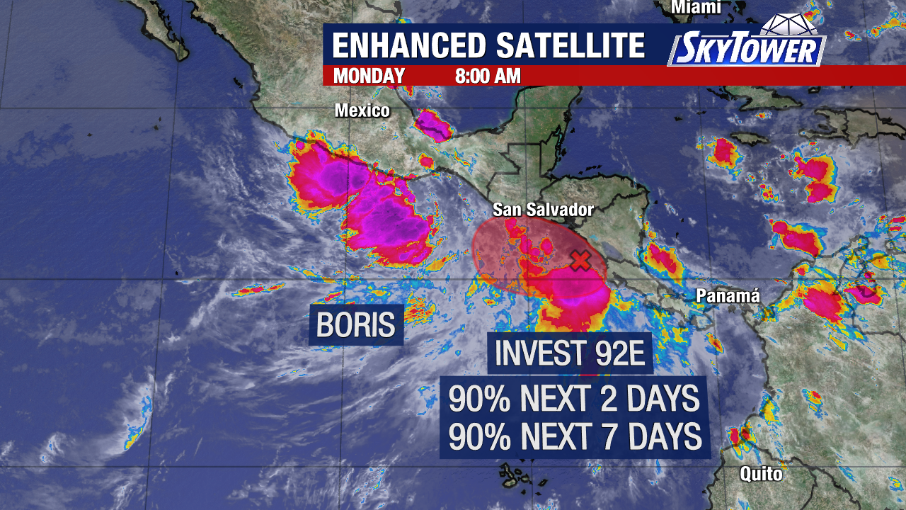
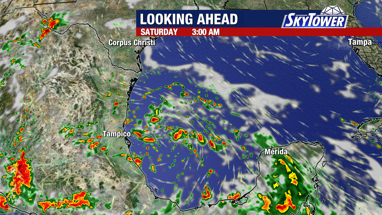
A tropical wave moving across the Yucatan Peninsula will enter the Bay of Campeche over the next couple of days, and have a small chance of development. Any impacts from it are expected to remain well away from Florida.
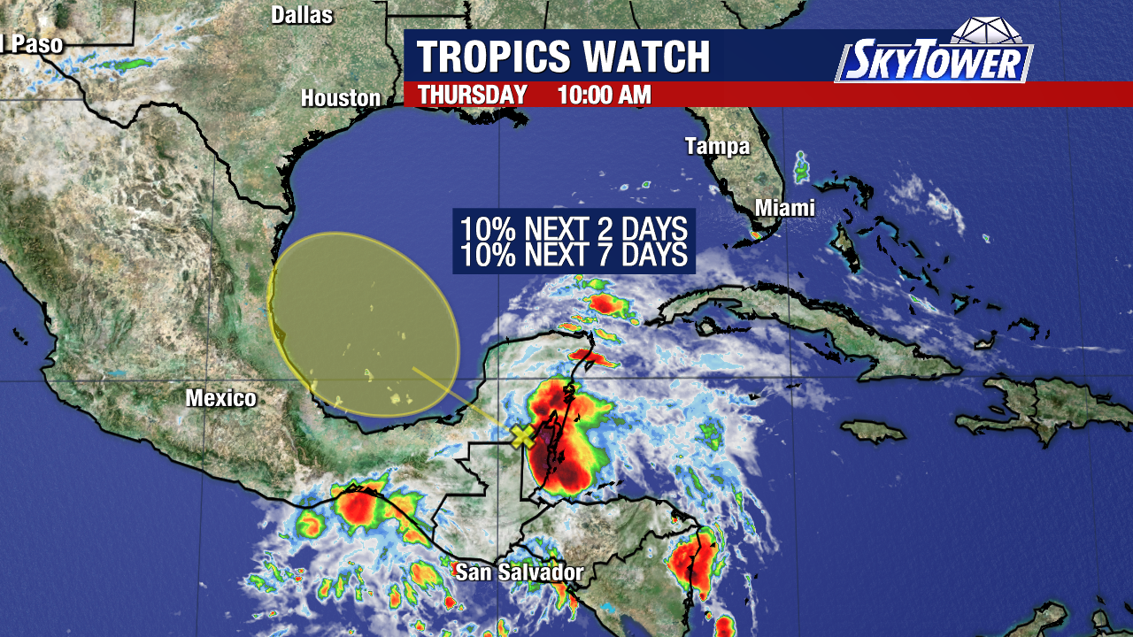
The National Hurricane Center has given the system a 10% chance of forming within the next seven days.
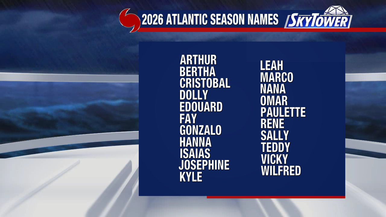
If it becomes a tropical storm, it would take the name “Arthur”. Regardless if the system organizes into a tropical storm, it will likely be a gusty rainmaker as it moves onshore the coast of Mexico late Saturday or Sunday.
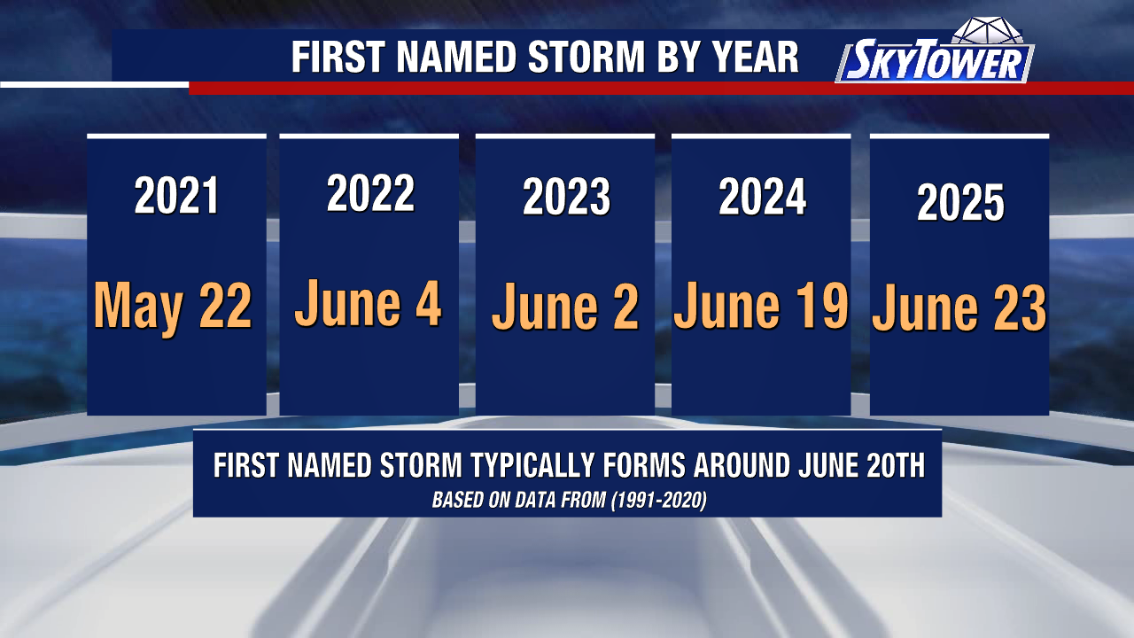
The middle of June is when the Atlantic typically receives its first named storm of the year. Recent seasons have started near or weeks before the average start date of June 20th.
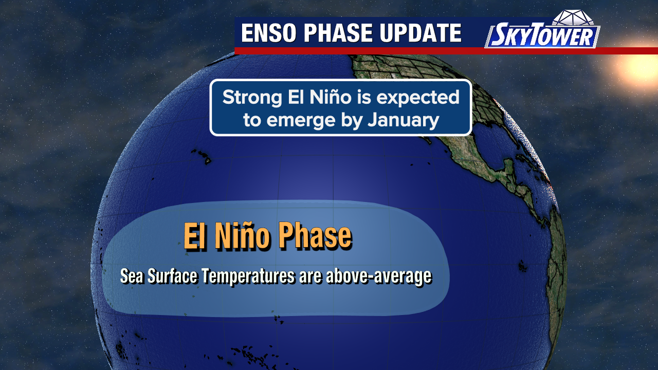
The Climate Prediction Center has just confirmed that El Niño conditions are now officially present in the Pacific.
El Niño has historically led to less named storms during past Atlantic hurricane seasons.
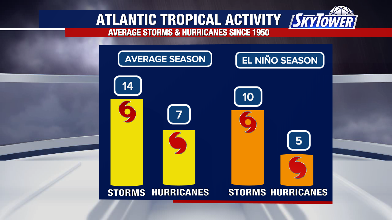
El Niño often increases upper-level winds across parts of the Atlantic Basic. Those hostile winds can disrupt tropical systems, often leading to fewer of them forming.
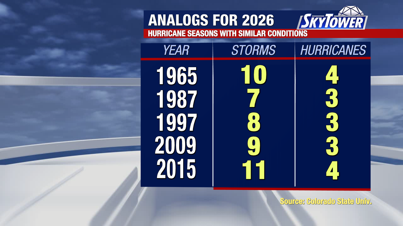
Historic hurricane seasons that with similar characteristics to 2026 produced fewer named storms and hurricanes than an average season. While no two seasons are exactly alike, these analog years support the idea that overall activity may be lower this year. Despite this, it only takes one storm to make it an impactful season. Every quiet stretch is a great time to review your hurricane plans and supplies for the year.