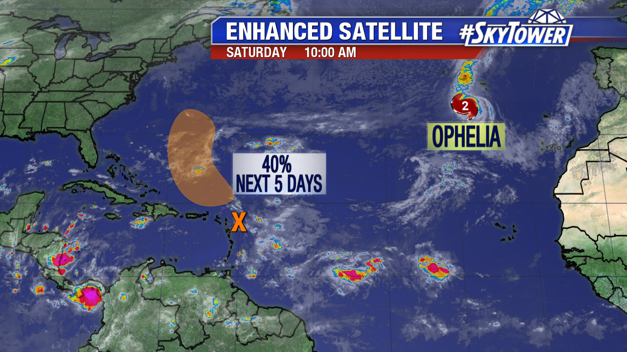
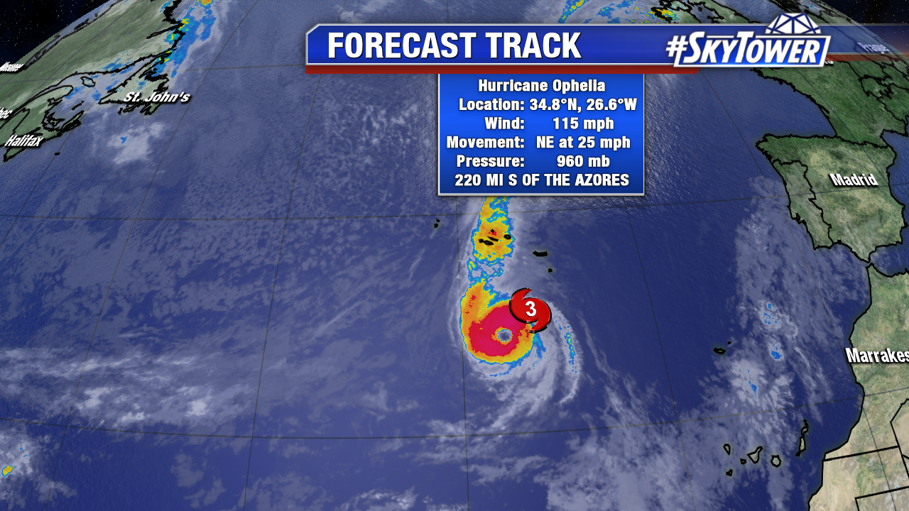
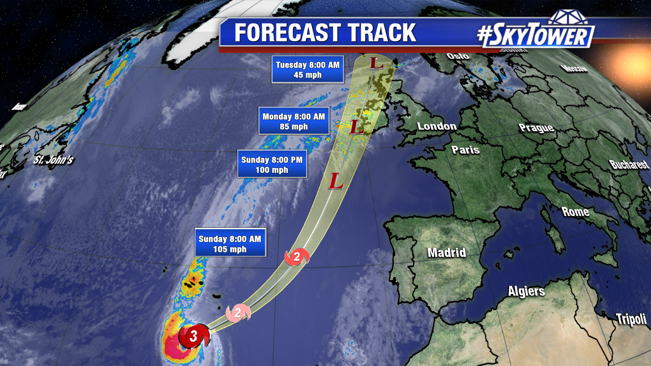
Ophelia became the 10th consecutive hurricane of the hyperactive 2017 Atlantic hurricane season mid-week over the north Atlantic. It is rare for hurricanes to form this far east. On Saturday morning Ophelia is the furthest east Atlantic major hurricane in history. This is according Dr. Phil Klotzback of Colorado State University. Ophelia is the sixth major hurricane of the season. As 11 AM EST Saturday max sustained winds are at 115 mph. The core of the storm will pass south of the Azores Saturday evening and early Sunday, but squalls will reach the Southeast Azores. Ophelia will transition to a non tropical system over cooler waters as it approaches Ireland Monday. While it will be an extra tropical system during this time, it will still bring tropical impacts. Hurricane force wind gusts and heavy rainfall are likely Monday and early Tuesday EST.
We’re also watching a broad area of low pressure near the Leeward Islands. Upper level winds are hostile in the short-term. As of Saturday morning there is a 40% chance this becomes a tropical depression/Tropical Storm Philippe over the next 5 days. It may pass near Bermuda this work week, but is no threat to the U.S..