A rare summer cold front settles into Central Florida Sunday and stalls late in the day. Low pressure will develop along this boundary in the Eastern Gulf and brings the threat for periods of heavy rain to Central Florida early this work week. Anytime low pressure sits over warm water temperatures in the upper 80s to near 90 it is worth watching for tropical development. The odds of this low gaining any tropical characteristics are low over the next 5 days. Wind shear is enhanced near this frontal boundary and upper level winds are only marginally favorable for tropical development. Development or not, this feature is a rainmaker for parts of the Sunshine State.
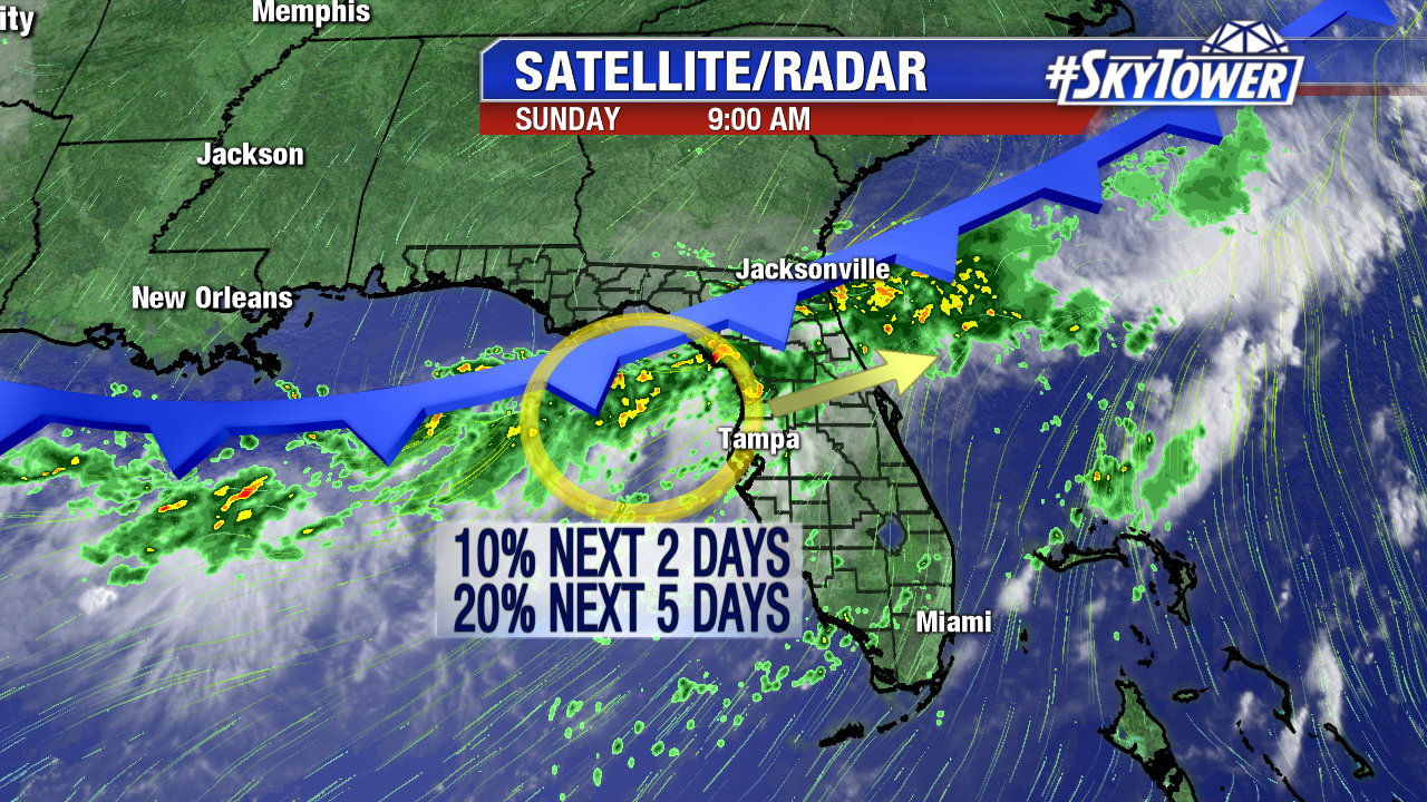
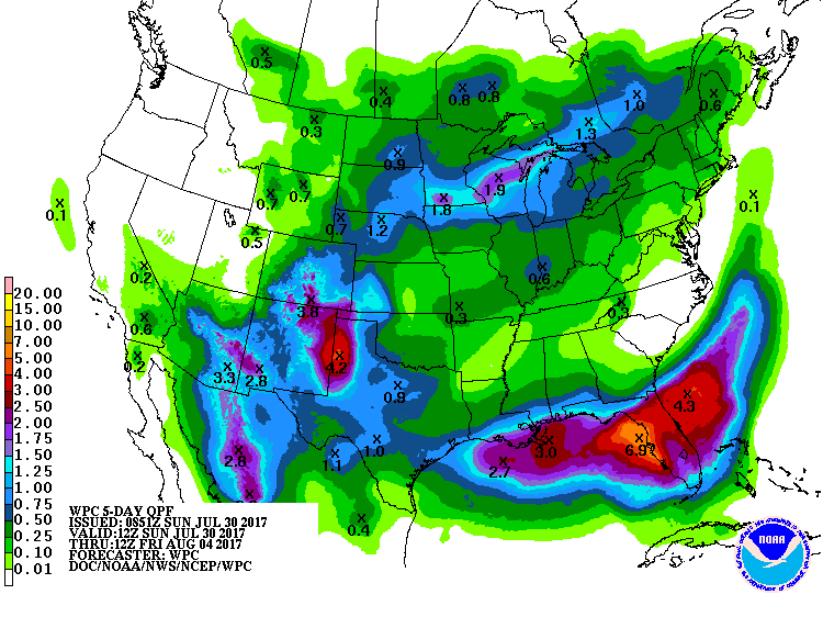
The Weather Prediction Center shows Central Florida, North Central Florida, and Southwest Florida will see the heaviest rainfall in the days ahead. The heaviest will fall where the frontal boundary stalls and lingers. 2-4″+ is expected in Tampa Bay, with isolated higher amounts near the coast. This will be spread out through mid-work week. Localized flooding is possible at times, especially when training sets up.
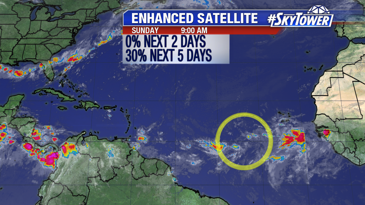
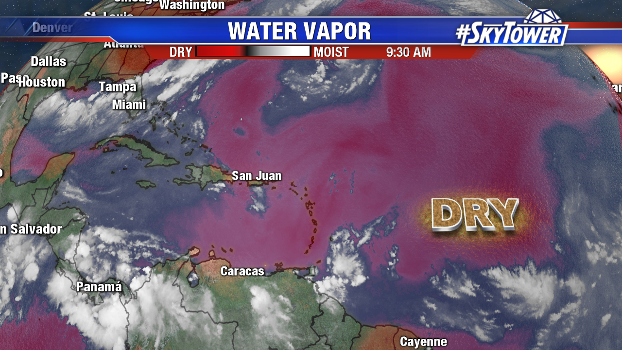
We are also watching a tropical wave southwest of the Cabo Verde Islands. Convection is disorganized Sunday with some dry air nearby. Slow development is possible in the days ahead as the disturbance moves west at 10-15 mph. Models aren’t too impressed with development of this feature. Officially as of Sunday morning there is a 30% chance of tropical cyclone development the next 5 days. The next name is Emily.