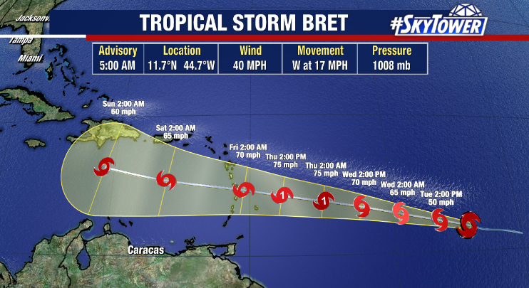
Tropical Storm Bret, the 3rd storm of the season, formed Monday in the central Atlantic and it could become the first hurricane of the season. As of Tuesday morning, Bret has winds up to 40 mph and is moving west at 17 mph. Additional strengthening is expected in the coming days and Bret could reach hurricane strength on Thursday before approaching the Lesser Antilles. The eventual track of Bret depends on how strong it gets, where a stronger storm could be steered by high pressure to the north and a weaker storm would drift into the Caribbean Sea and battered by wind shear. Regardless, Bret is not expected to pose a threat to Florida weather.
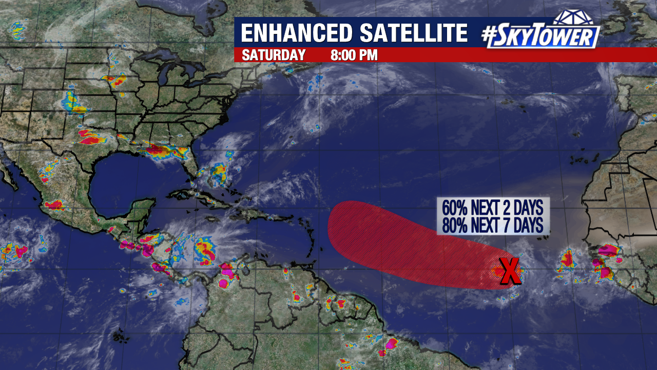
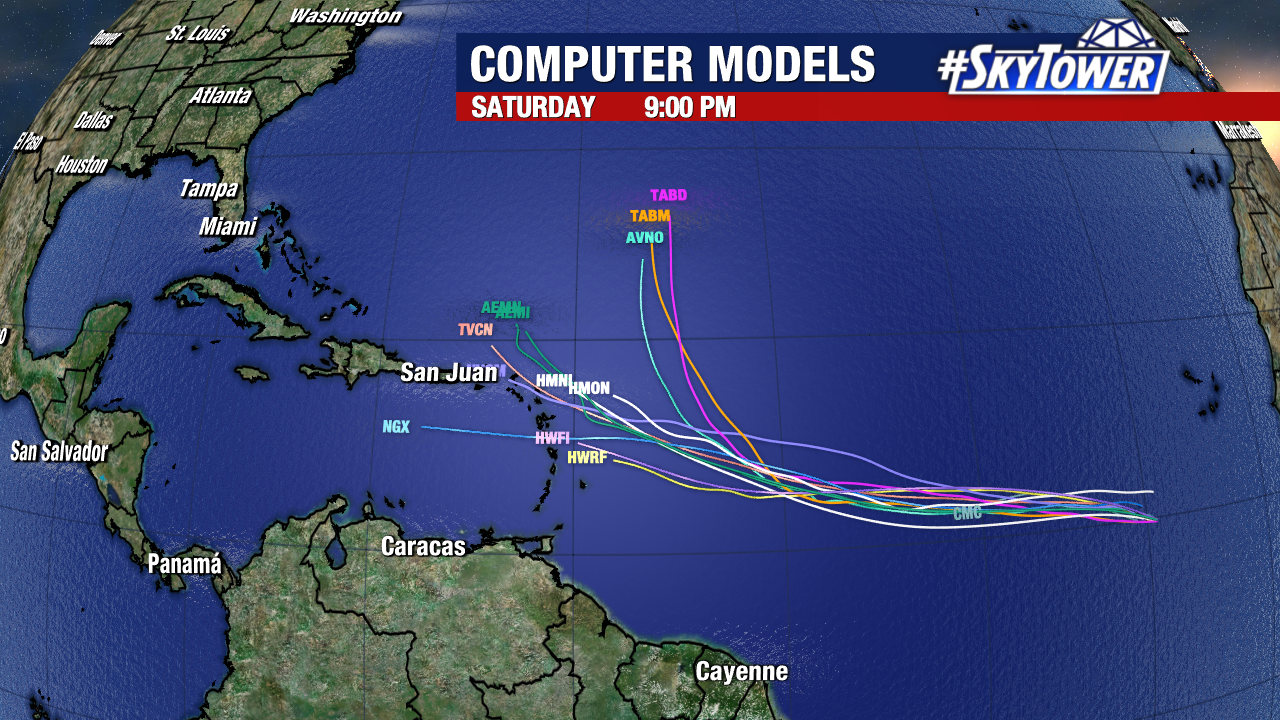
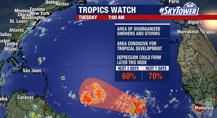
Not far behind Bret, another disturbance dubbed Invest 93L is showing some promise. The disorganized area of showers and storms has been given a 60% chance of formation over the next 2 days and a 70% chance of formation over the next 7 days by the National Hurricane Center. 93L is following closely behind Bret into an environment conducive for tropical development and a depression could form by the end of the week. If it strengthened to a tropical storm, it would be named Cindy.
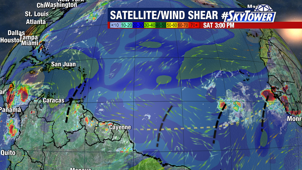
If it seems unusual we’re seeing so much tropical activity in the Atlantic right now, it’s because it is. Bret and 93L are spinning in areas typically more active later in the season. In fact, if Bret became a hurricane, it’ll only be the second time on record that one has formed in the Atlantic in the month of June. It also be far sooner than the average date of August 11th for the first hurricane of the season. The increased activity is driven by above average water temperatures in the region and a lack of inhibiting factors like dry air and wind shear.