Record warm waters in the Atlantic Ocean aided in an active 2023 hurricane season for the Atlantic basin.
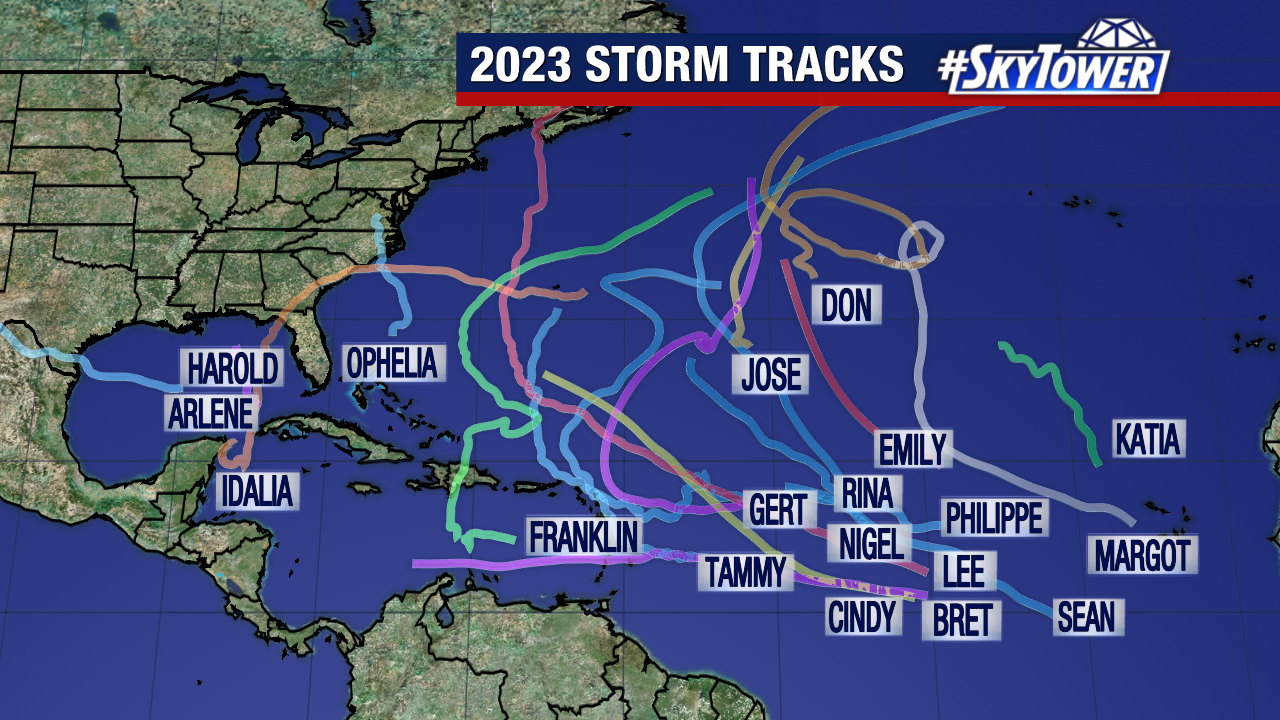
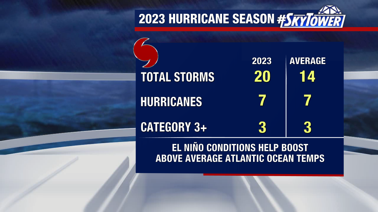
With a total of 20 named storms, the season now ranks 4th for the most named storms in a year since 1950.
Despite an active hurricane season and a hit to Florida’s Big Bend, the majority of storms stayed in open waters without bringing impacts to land.
Of those 20 storms, 7 became hurricanes with 3 strengthening into major hurricanes (category 3 or higher).
An average season has 14 named storms, 7 hurricanes and 3 major hurricanes.
While this season reaches into the record books for the number of named storms, only one hurricane made landfall in the U.S. And that storm hit close to home.
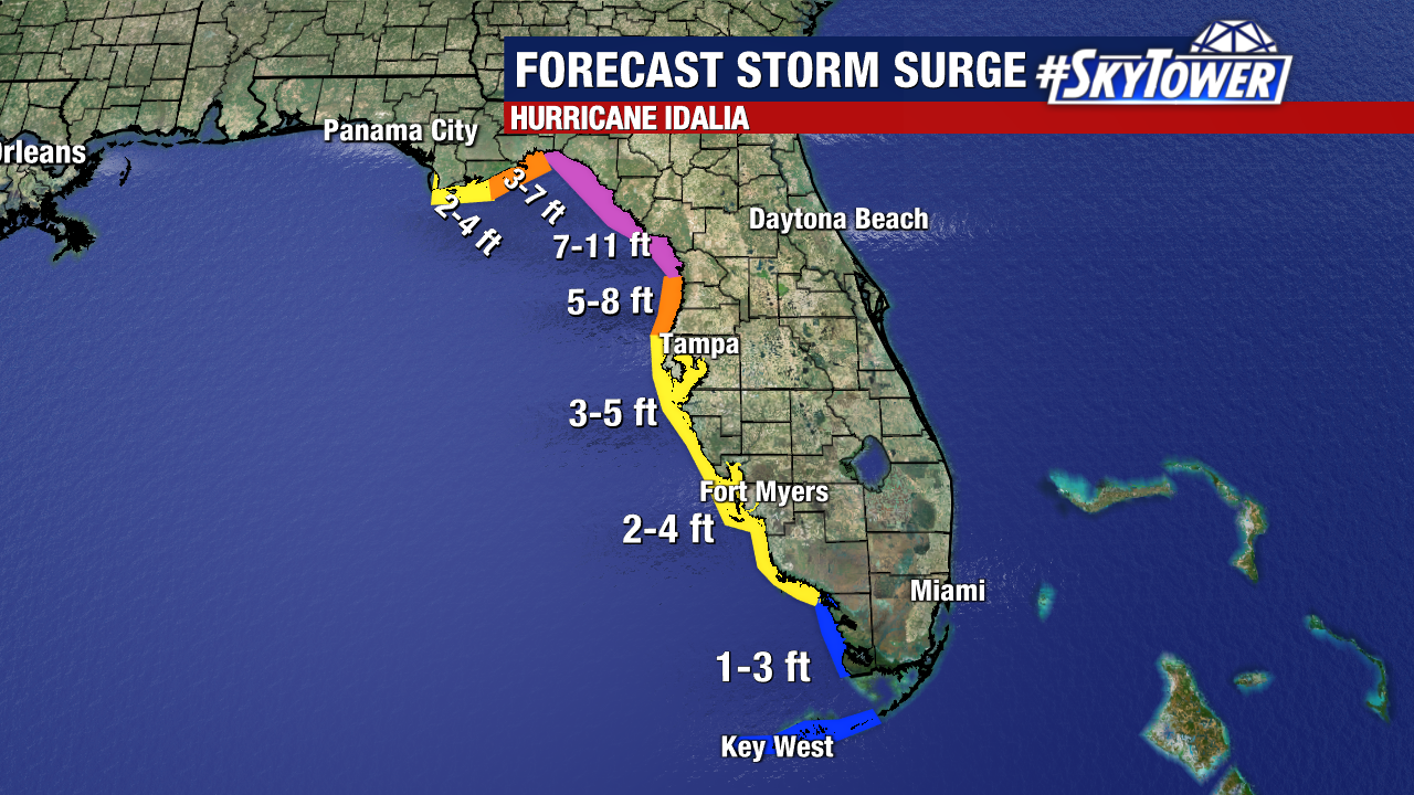
Hurricane Idalia made landfall as a Category 3 hurricane on Florida’s Gulf Coast, near Keaton Beach, on August 30.
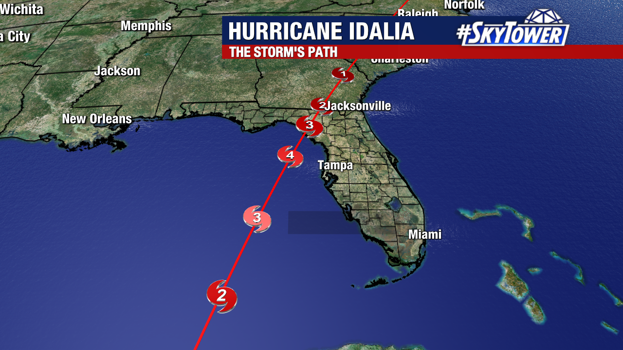
Idalia is the first major hurricane on record to make landfall in this portion of the Big Bend. The storm had maximum sustained winds around 125mph and storm surge between 7 and 12 feet across coastal counties.
Idalia formed in the northwestern Caribbean and strengthened into a Category 4 hurricane as it moved over extremely warm sea surface temperatures. Just before making landfall, the storm dropped to Category 3 strength.
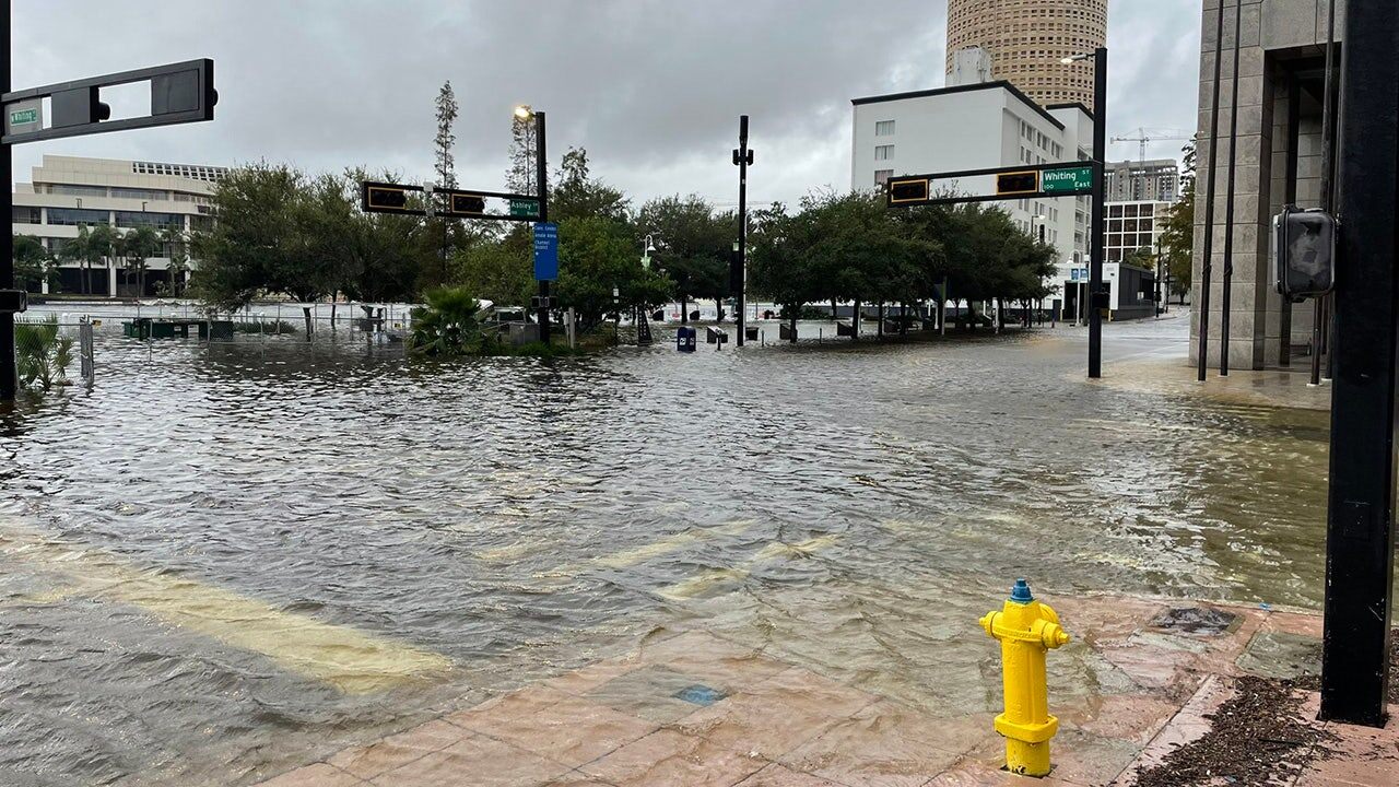
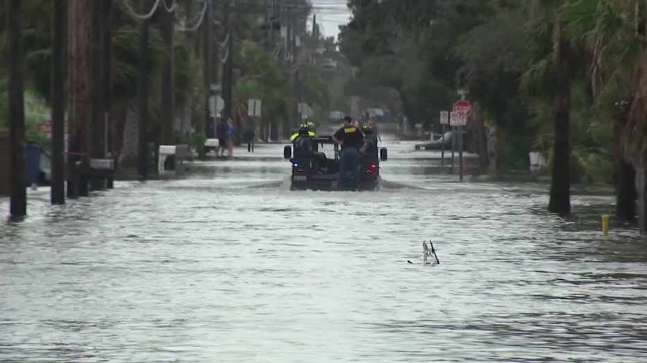
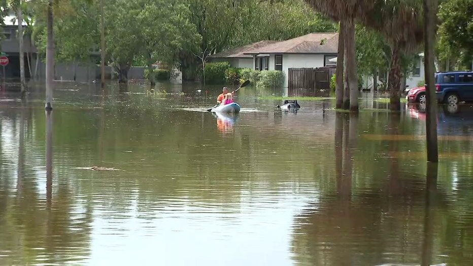
Hurricane Idalia caused serious flooding across Tampa Bay as the storm skirted by, but impacts could have been worse as the area didn’t get extreme storm surge.
Check out some pictures around the Tampa Bay area after Hurricane Idalia:


October 1921 is last time Tampa was hit by a major hurricane, known as the Tarpon Springs storm, which brought storm surge estimated to be 11 feet.
Hurricane Tammy is the other that made landfall during the 2023 Atlantic season. It hit Barbuda in the Leeward Islands as a Category 1 storm with 85 mph winds.
The 2023 Atlantic hurricane season fell pretty close in line with forecasts from NOAA’S Climate Prediction Center. In August, forecasters increased their prediction to a 60% chance for an above-normal Atlantic hurricane season due to a strong El Niño.
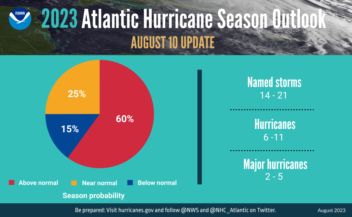
NOAA’s outlook called for 14-21 named storms through November 30, with 2-5 becoming major hurricanes.
Other landfalls during the 2023 season were Tropical Storm Harold, Tropical Storm Ophelia and Hurricane Lee.

Tropical Storm Harold, which never reached hurricane strength, made landfall on the Texas Gulf Coast near South Padre Island on August 22.
Hurricane Lee made landfall in Nova Scotia, Canada as a post-tropical cyclone on September 16. The storm tracked across the Atlantic coast, causing dangerous surf and rip currents for many eastern states before moving onshore.
Hurricane Lee rapidly intensified into a Category 5 hurricane and made records based on where it developed. Lee is the farthest southeast a Cat 5 hurricane has been observed in the Atlantic on record.
On September 23, Tropical Storm Ophelia made landfall on Emerald Isle, North Carolina. The tropical storm delivered 70mph winds, damaging winds, along with coastal flooding and overflowing rivers.
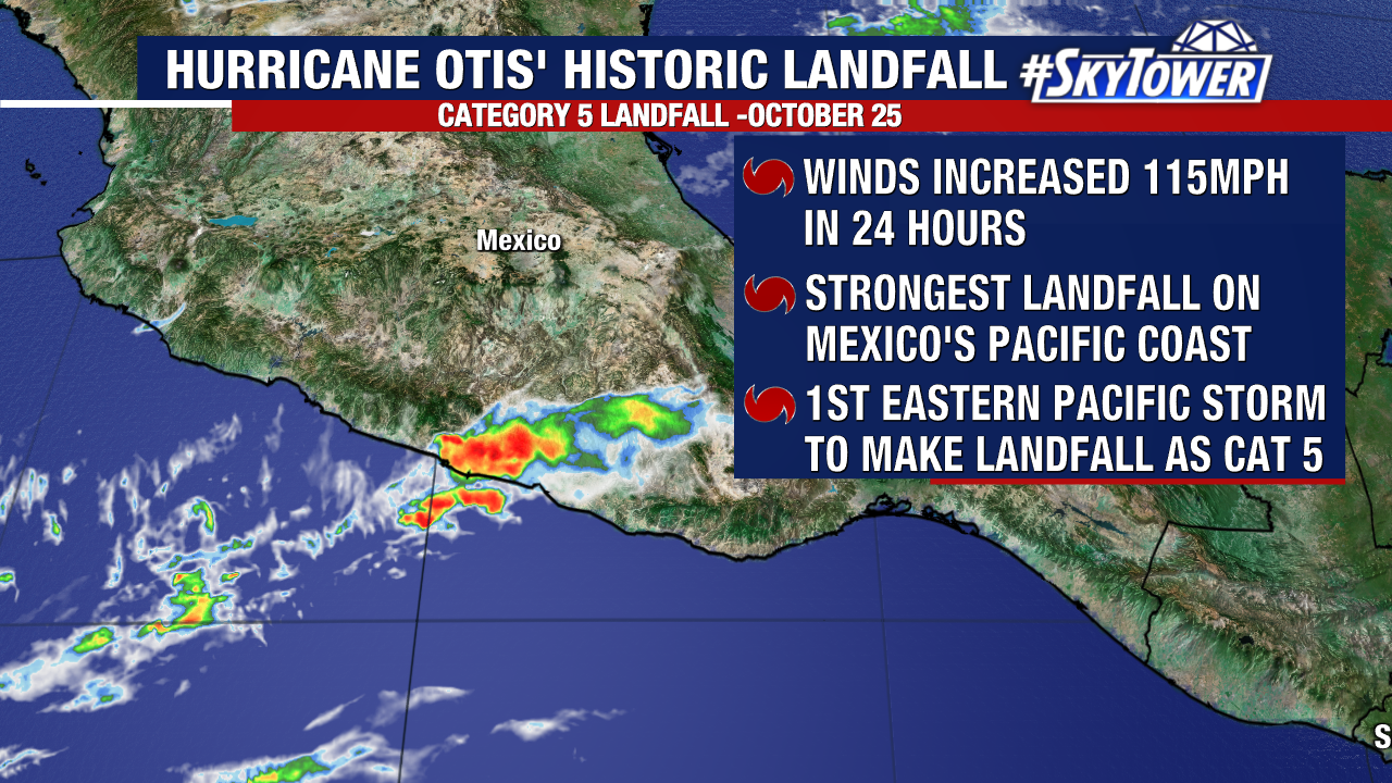
We even had to turn our attention to the eastern Pacific, where the strongest hurricane of 2023 hit southern Mexico. Hurricane Otis made landfall as a Category 5 hurricane on October 25 in Acapulco after rapidly intensifying 110mph in just a day.
The first forecasts for the 2024 Atlantic hurricane season are expected in April 2024, as hurricane season starts June 1 and runs through Nov 30.