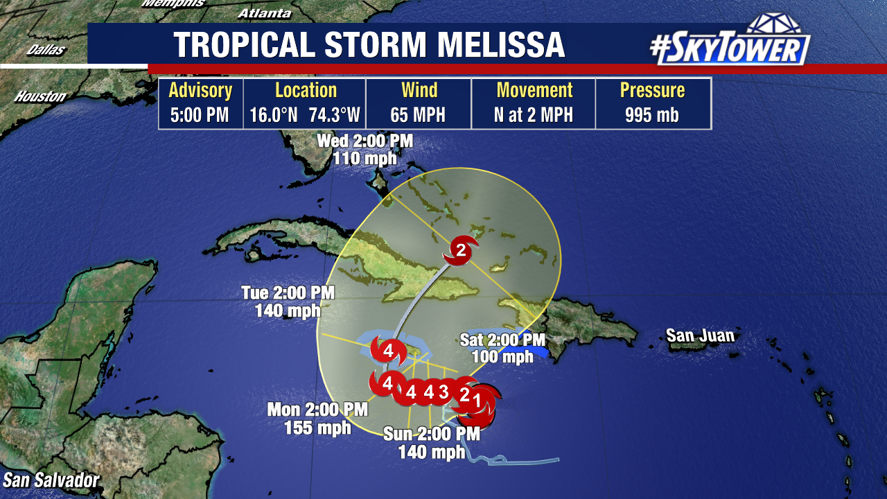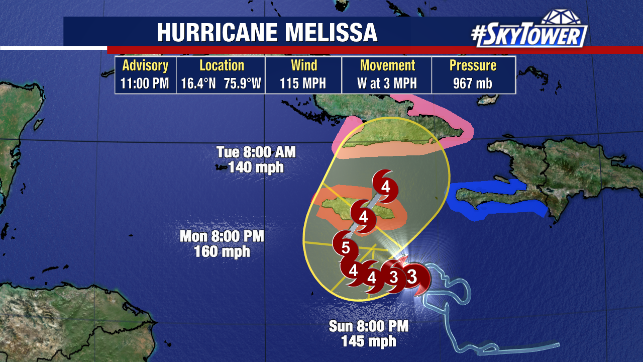
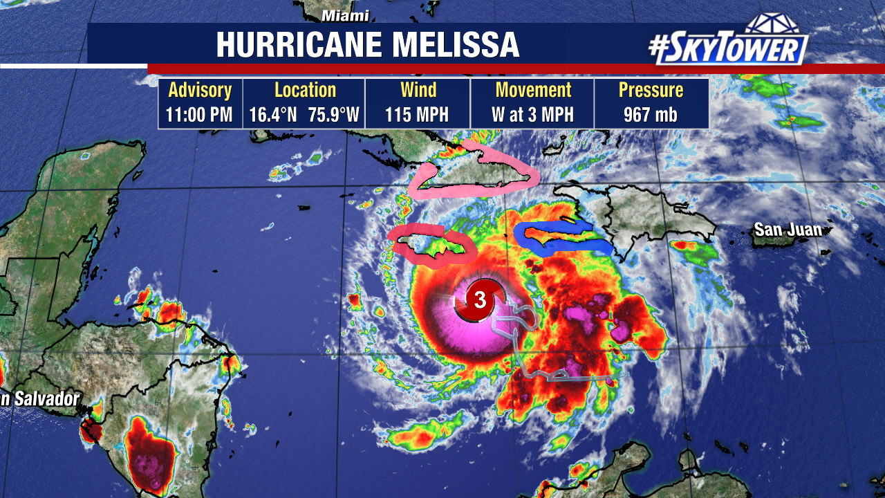
Melissa is now a stronger hurricane, with winds likely exceeding 100 mph. It is now forecast to strengthen into a Category 5 hurricane by Monday.
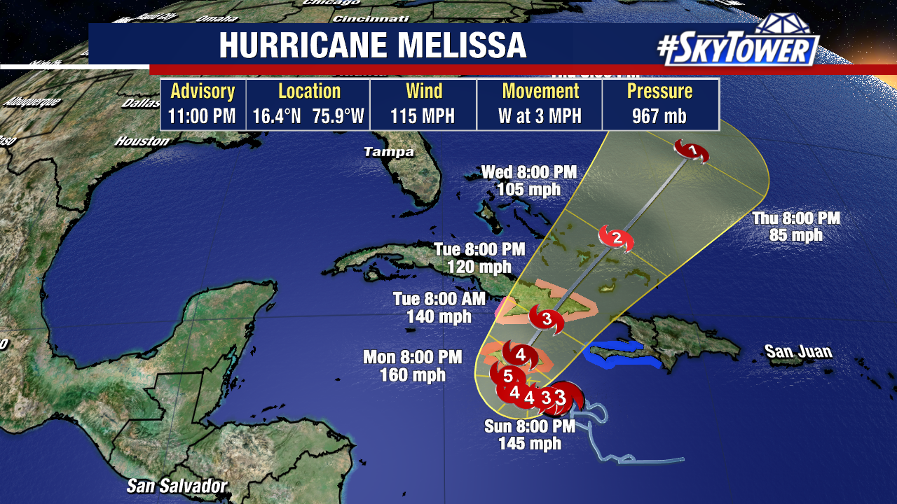
This hurricane will remain south of Florida and is not a threat to the United States.
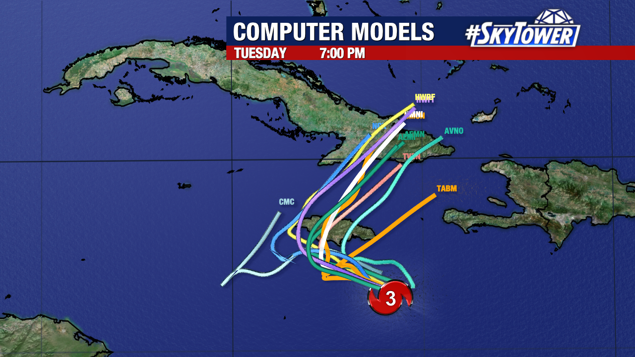
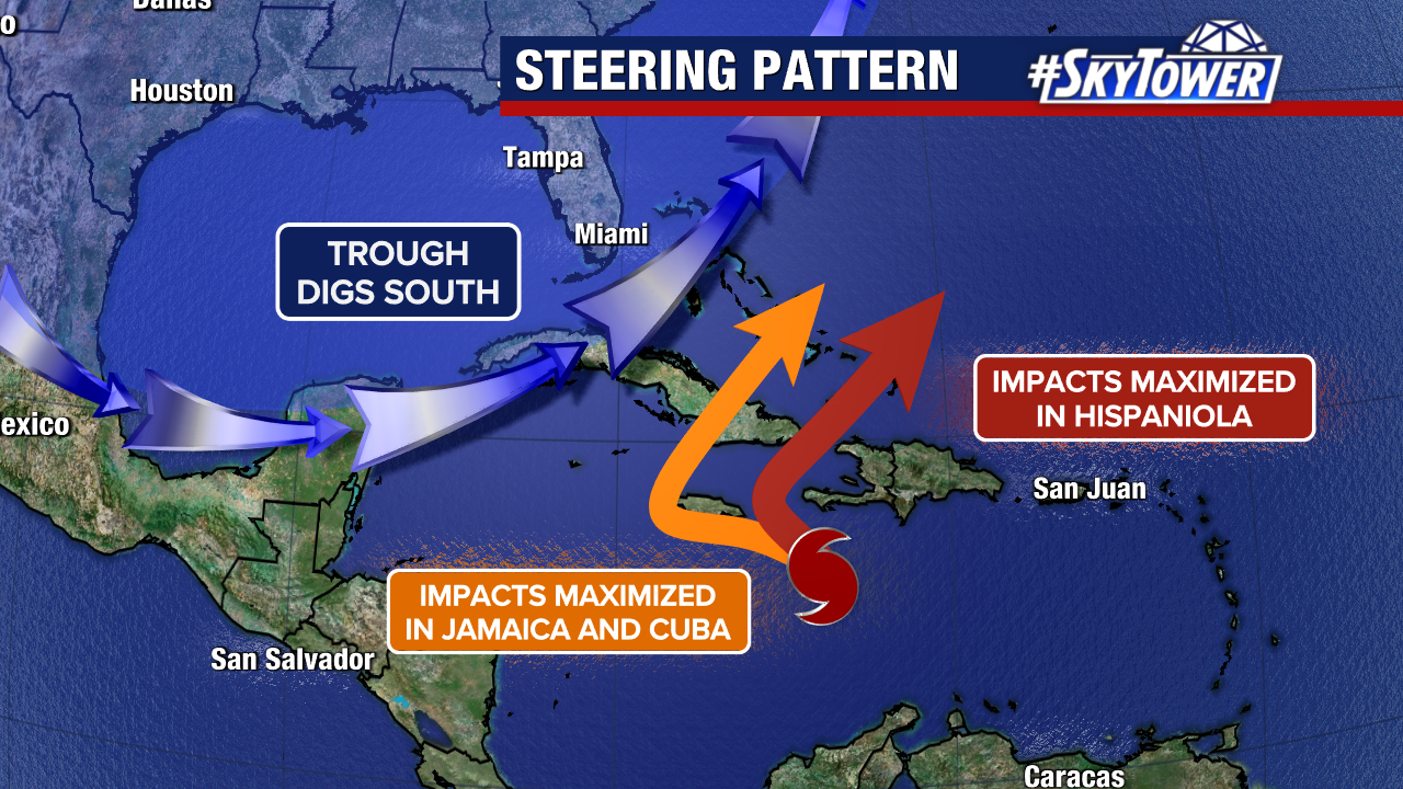
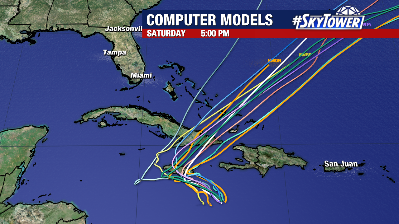
Jamaica remains within the forecast cone, with many weather models suggesting an eventual landfall on the island early next week.
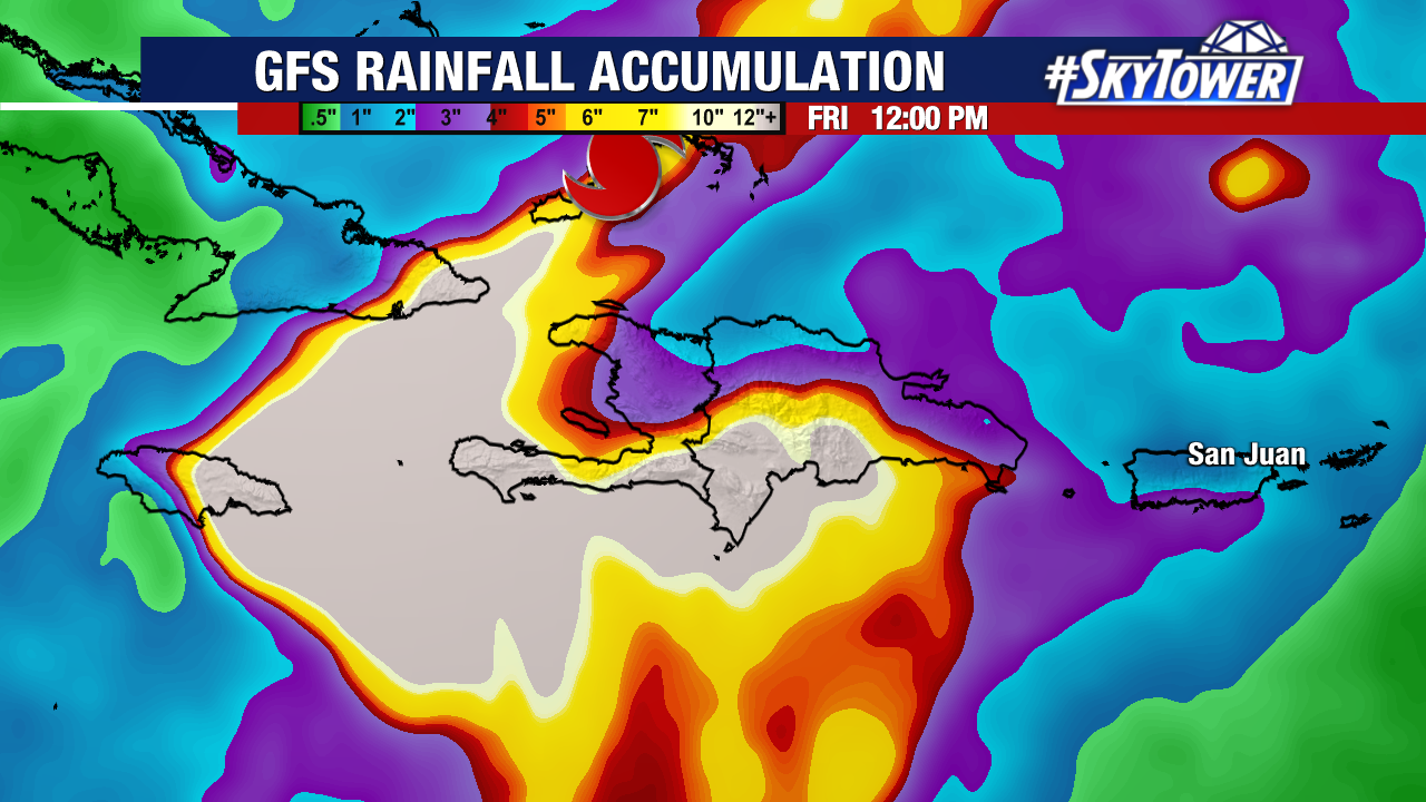
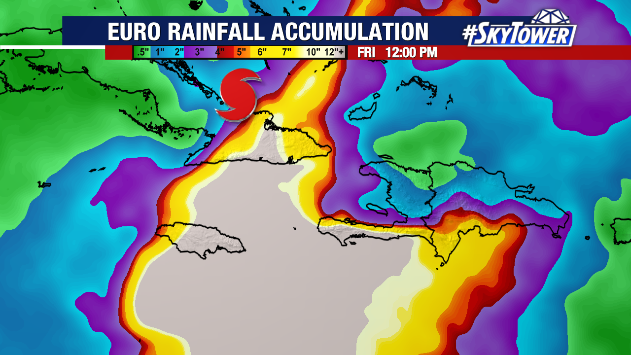
A multi-day (potentially catastrophic) rain event begins tonight for Jamaica.
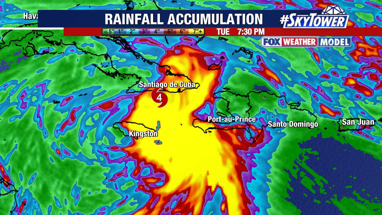
Flash flooding and landslides will be the primary threat, alongside a life-threatening storm surge on the southern coast early next week. Multiple feet of rainfall will be possible in some spots due to the hurricane’s slow movement. Southwestern Haiti and eastern Cuba will likely experience the same flash flooding and landslide concerns from this storm.
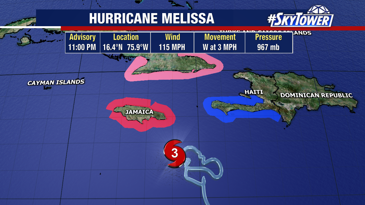
A hurricane warning remains in effect for Jamaica. The storm’s most damaging winds will be found near Melissa’s center given a close pass or landfall on the island. A tropical storm warning continues for southwestern Haiti, with hurricane watches in effect for that same area and parts of Cuba.
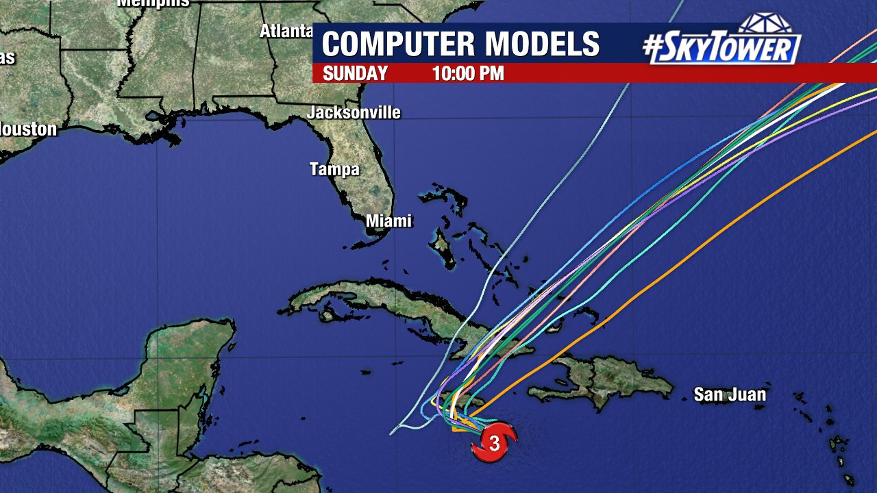
The Bahamas, the Turks and Caicos Islands, and Bermuda will need to carefully monitor Melissa’s progress over the next few days.