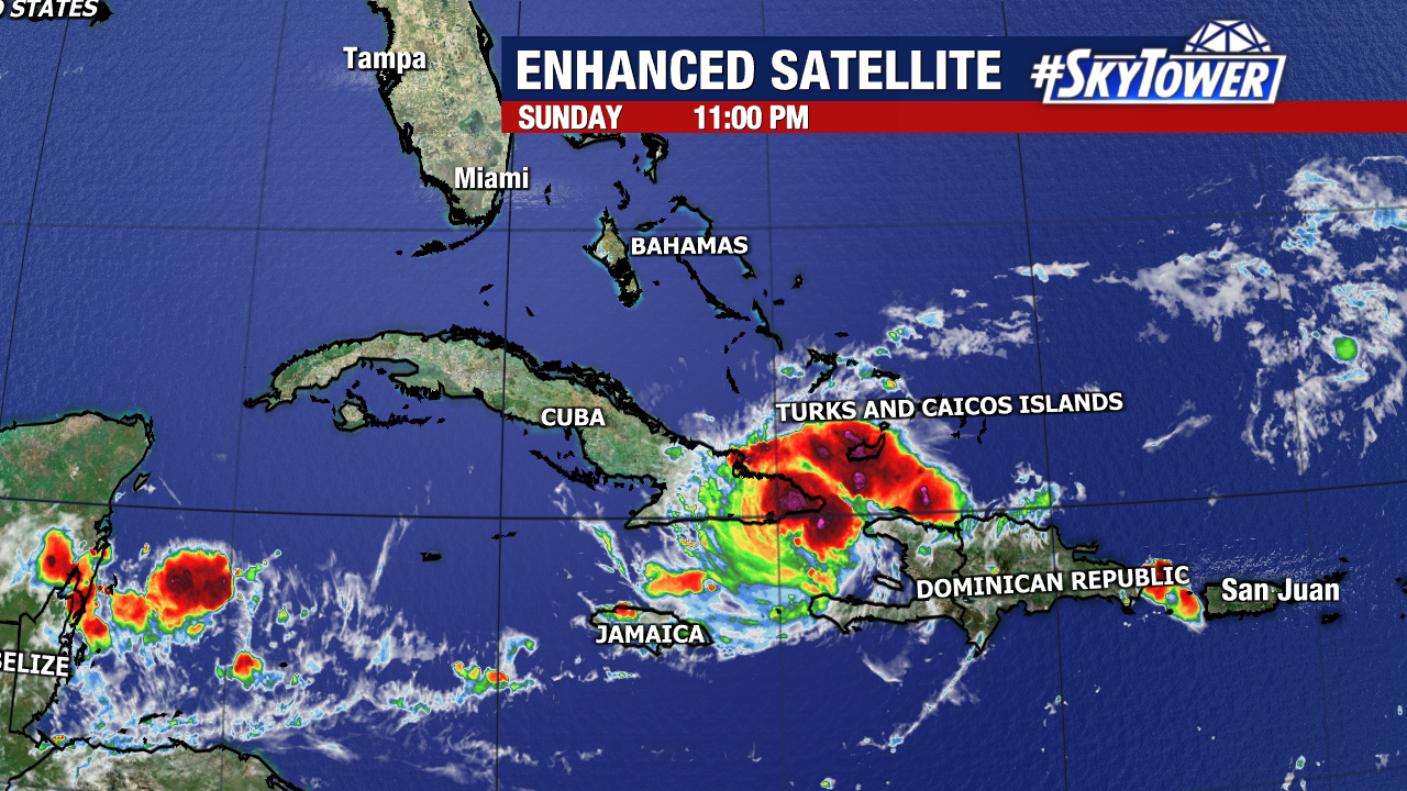
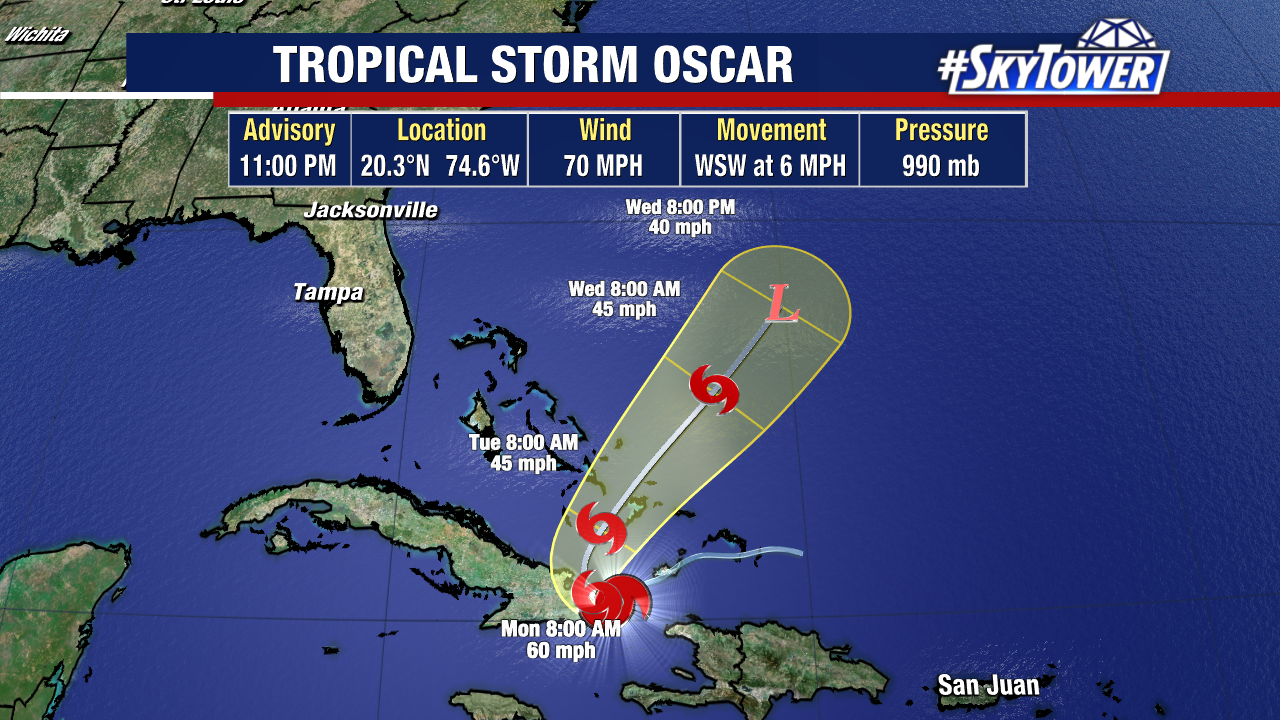
Oscar has weakened to a tropical storm after making landfall as a Category 1 hurricane in Cuba this evening. Increasing wind shear and interaction with the mountainous terrain of Eastern Cuba contributed to the storm’s weakening.
This will not be a threat to Florida. Upper-level winds will eventually steer this system to the northeast by Tuesday morning. From there, it will likely maintain that general trajectory, keeping it away from the United States. Bermuda will still need to monitor the progress of Oscar.
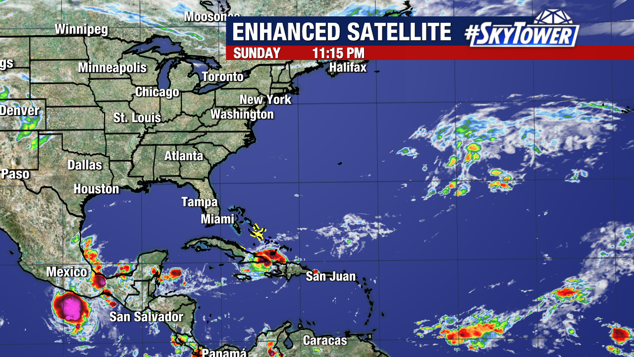
There are no additional named storms or areas of disturbed weather in the Atlantic at this time.
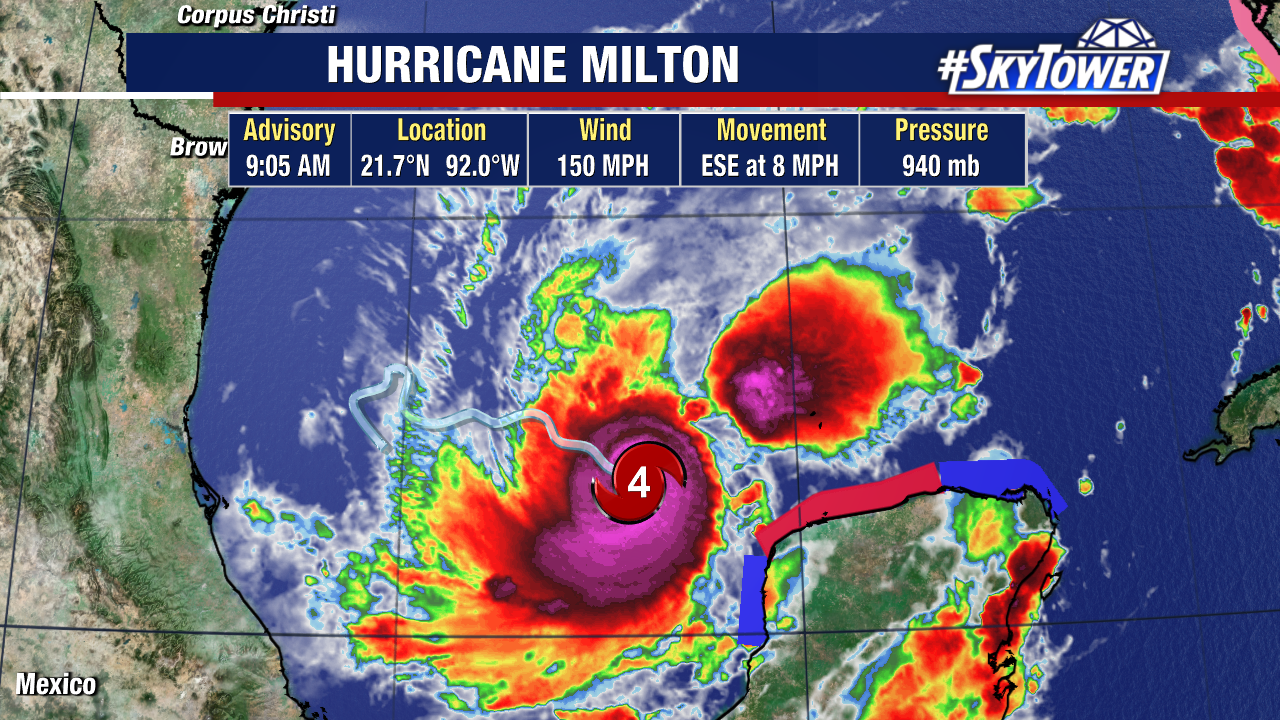
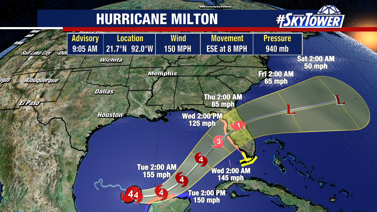
Hurricane Milton just reached Category 4 strength with 150 MPH winds. Pressure has dropped to 940 mb as Milton continues on an ESE path.
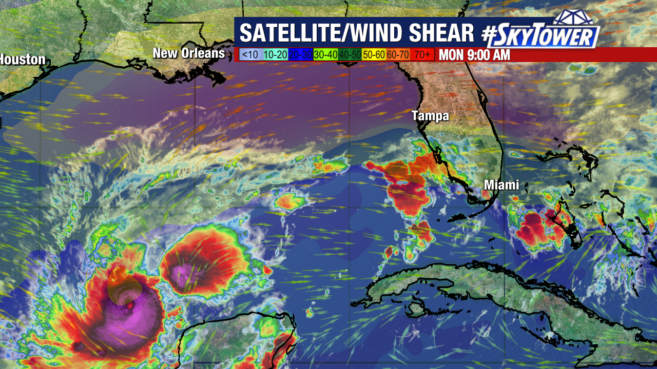
This storm has been taking advantage of the warm water and low wind shear environment it’s been moving through.
The latest track has dipped the storm slightly south, bringing it even closer to the Yucatan Peninsula, where a Hurricane Warning is in effect for Celestun to Rio Lagartos.
We anticipate landfall later in the day Wednesday, possibly even closer to sunset, as the trend has slowed down some. The latest cone from the National Hurricane Center calls for a Category 3 with 120 MPH winds ahead of landfall.
One silver lining is the possibility that this storm weakens slightly ahead of landfall. Once it starts to jog NE, it will run into a harsh environment with strong wind shear.
The thinking is this will interact with the storm enough to knock it down in strength from Tuesday – Wednesday. While this is overall good news, it won’t make a big impact to the overall threats this storm birngs.
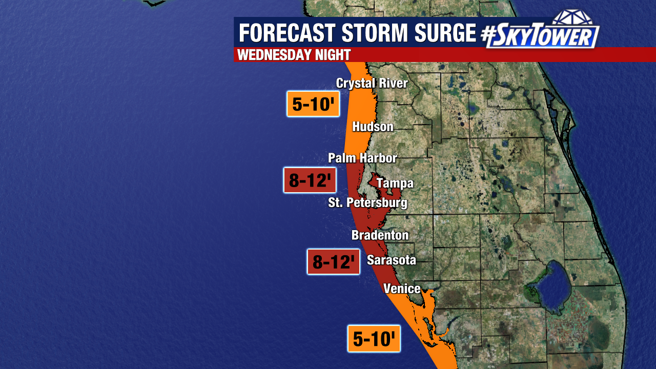
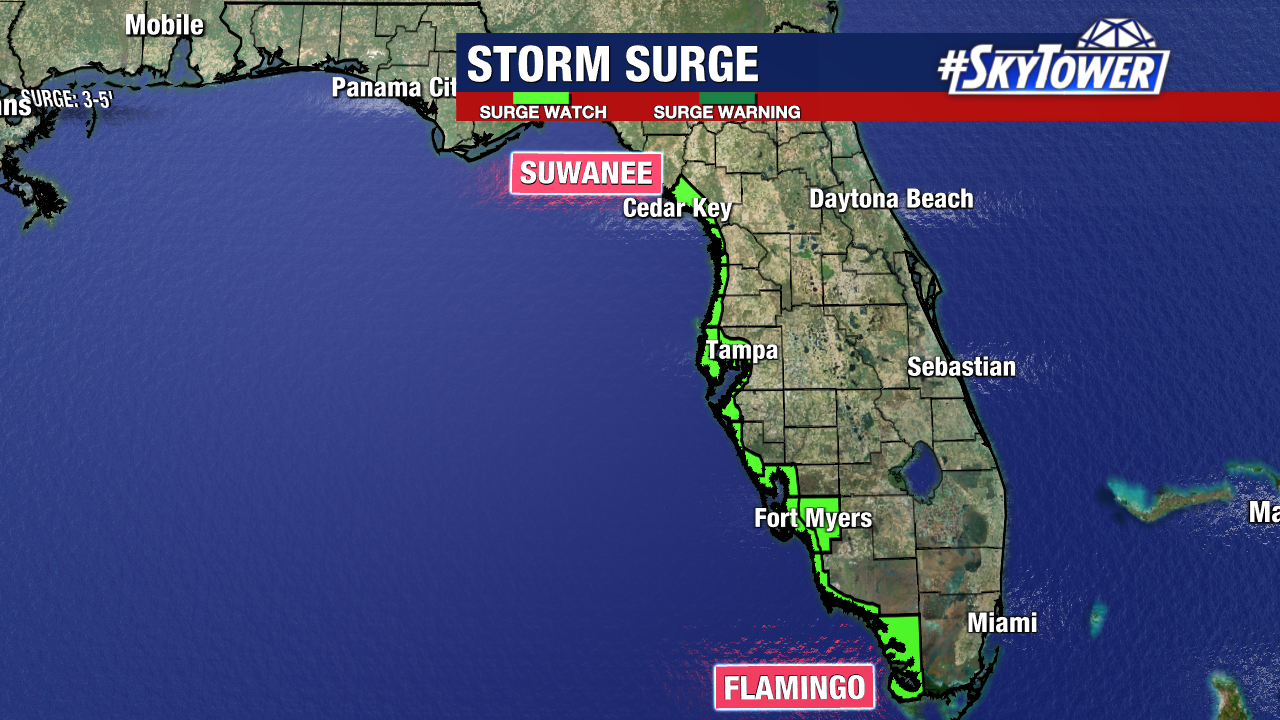
Here’s the initial storm surge forecast:
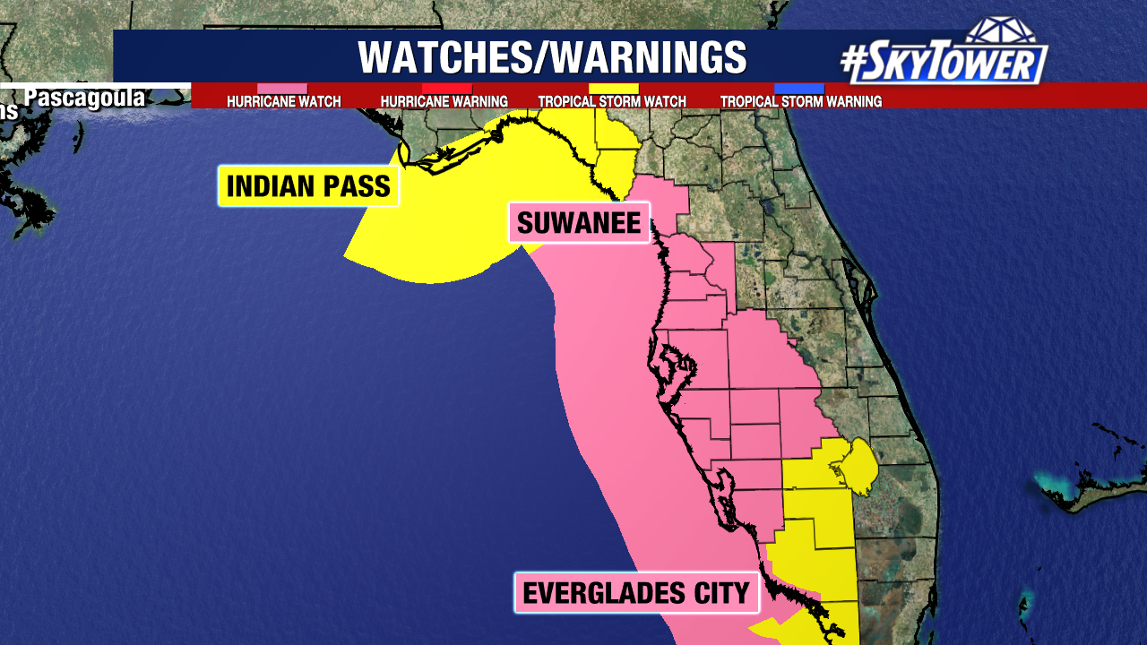
This paints the worst case scenario but it’s a scenario we need to be ready for. Storm Surge Watch runs along the coast from Suwanee to Flamingo.
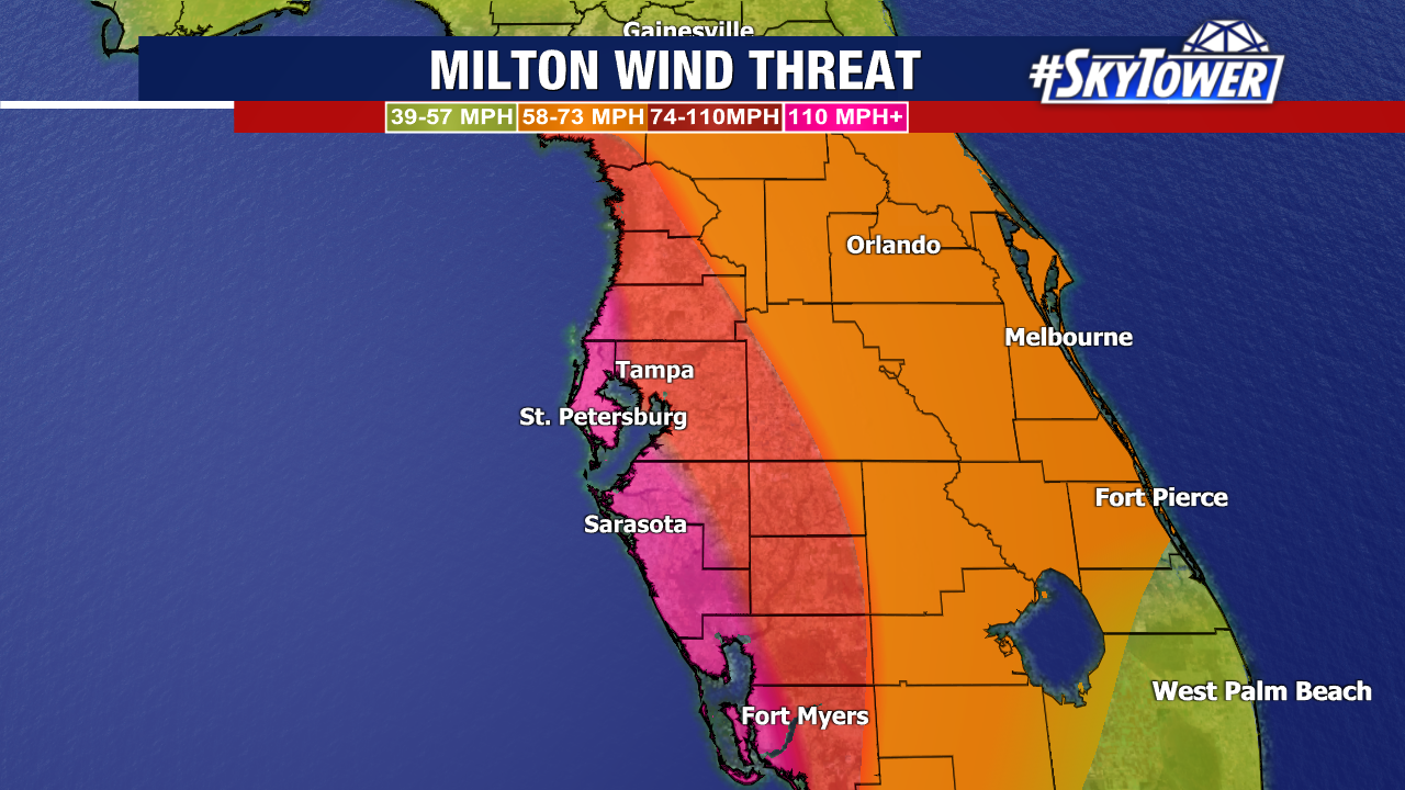
Since this is a smaller storm, hurricane-force-winds will be focused across a small area around the storm’s eye. Here’s the latest thinking:
The pink color along the coast is the potential from 110+ MPH winds. Red color highlights 74-110 MPH winds. Orange is the potential for 58-73 MPH winds.
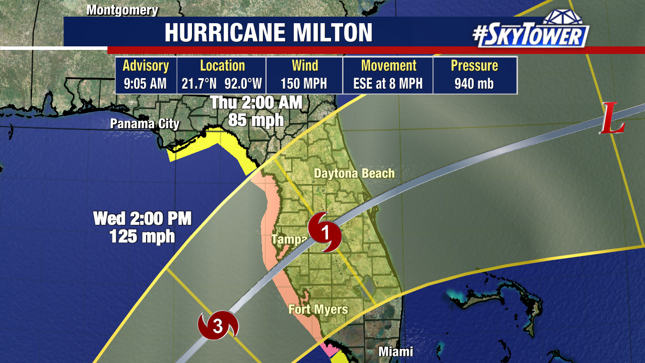
Unlike Helene, this storm is not just a coastal concern.
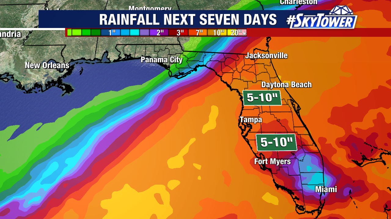
Milton is forecast to slice across the Peninsula, so tropical-storm conditions are expected inland, along with heavy rainfall.
Rainfall of 5-10″ looks likely for most of central Florida, with areas closer to landfall getting closer to a foot of rain.
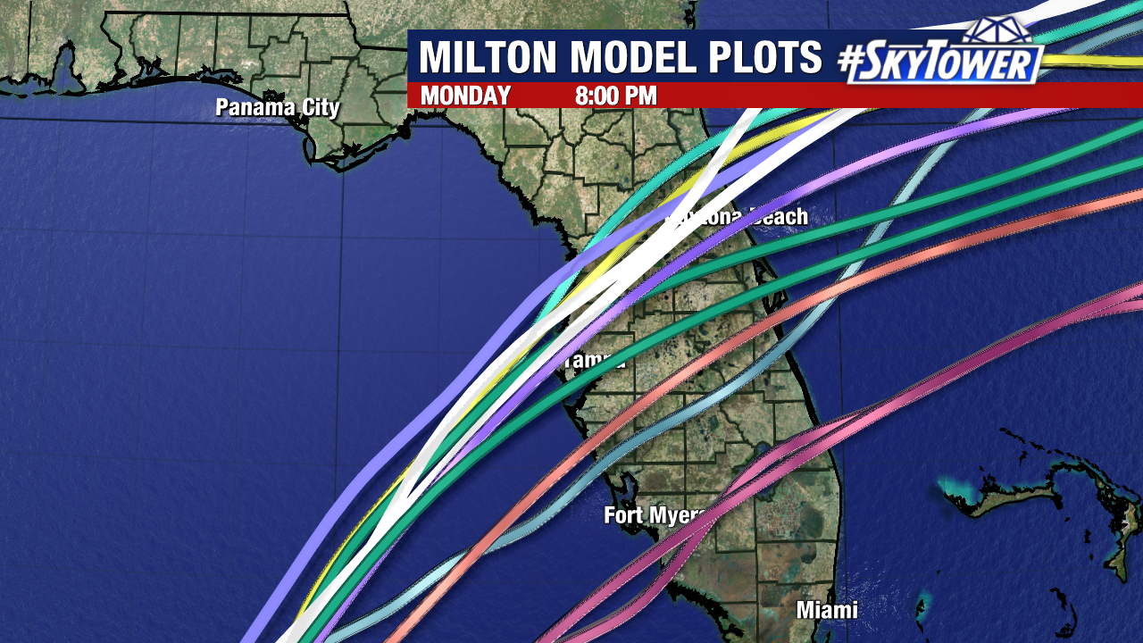
The latest model trends continue to lean towards Tampa, and unfortunately some now are bumped even farther north. This would be the worst scenario as storm surge would funnel directly into Tampa Bay.
There are still models that track Milton south of Tampa Bay. This is critical to who will see the worst of the storm surge. If it hits south of Tampa, winds will be moving offshore and storm surge will be a big concern around Sarasota.
We’re talking a 10 mile difference in Milton’s track making a HUGE different for impacts here in Tampa Bay.