We are keeping tabs on only one disturbance in the Atlantic after Rafael weakened into a Post-Tropical Cyclone in the Gulf of Mexico.
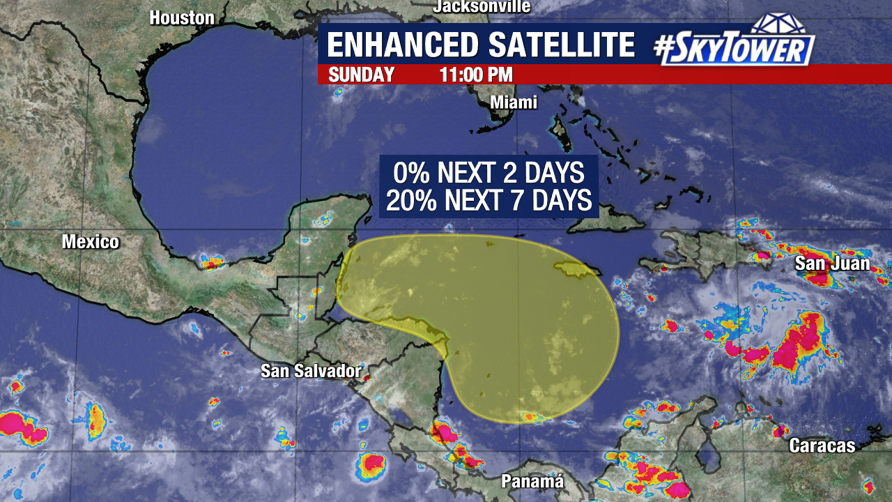
A broad area of low pressure is expected to form in the southwestern Caribbean Sea later this week. The National Hurricane Center is giving this spot a low (20%) chance of developing into a tropical depression or tropical storm within the next seven days as it drifts westward. It’s too early to speculate on the exact path this system would take if it forms.
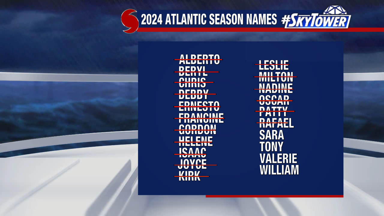
The next name on this year’s storm naming list is Sara.
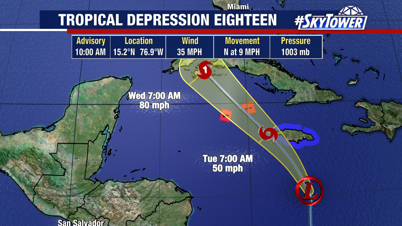
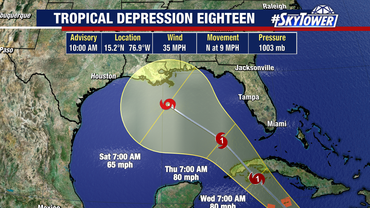
Tropical Depression Eighteen is now spinning in the south-central Caribbean Sea. This is expected to become Tropical Storm Rafael Monday or early Tuesday on approach to Jamaica and the Cayman Islands.
The depression has jogged a bit more right compared to the initial track – but winds have held at 35 mph.
It will start to turn northwest, taking the center near/south of Jamaica Monday night and passing the Caymans by late Tuesday. A Hurricane Warning is in effect for the Cayman Islands, Tropical Storm Warning for Jamaica, and a Hurricane Watch for parts of Cuba.
Tropical Depression 18 is forecast to strengthen into a Category 1 hurricane and move across western Cuba Wednesday.
Hurricane conditions will start in the Cayman Islands by Tuesday afternoon, and across western Cuba early Wednesday.
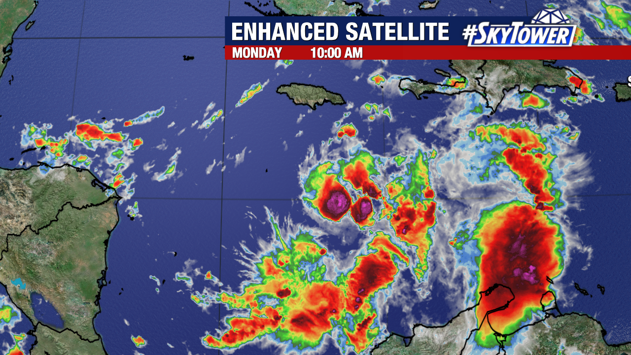
This low pressure area has developed a well-defined center and deep convection is slowly becoming more organized, especially on the south and east side of the circulation.
This is expected to steadily strengthen until it reaches Cuba as low wind shear, high moisture along with warm waters are all there.
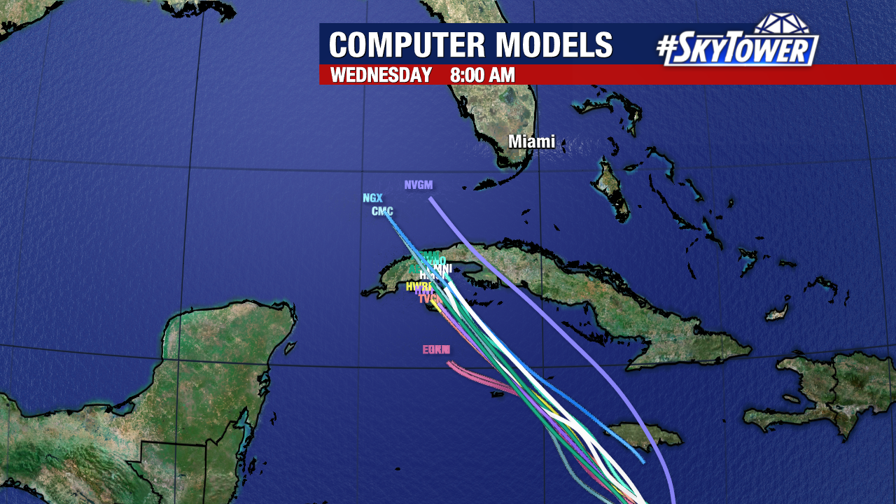
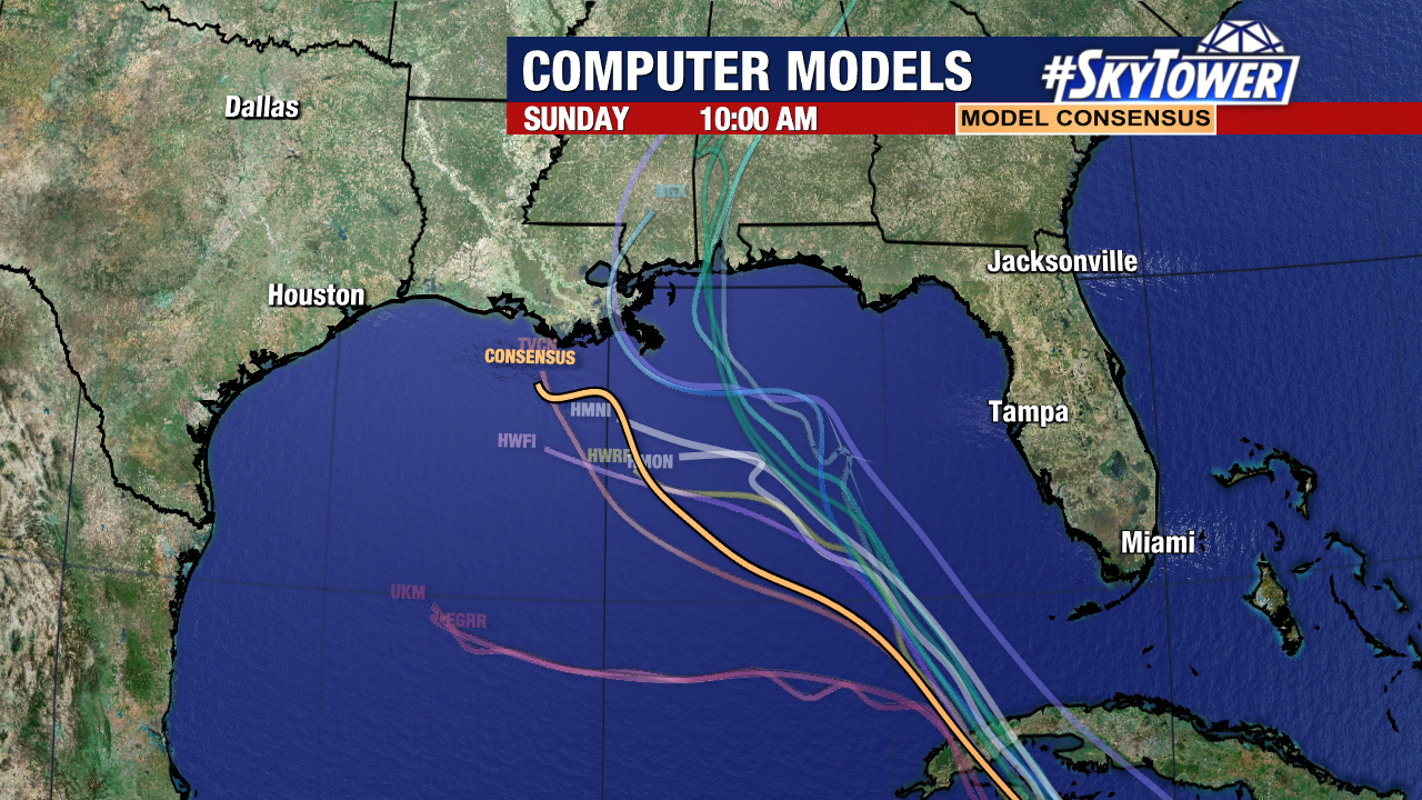
Models remain in solid agreement with the storm’s track towards Cuba through Wednesday.
When the system reaches the Gulf of Mexico at the end of this week, the steering currents get a bit tricky. That’s why we see the models start to spread out and confidence is lower.
The model consensus takes this towards Louisiana.
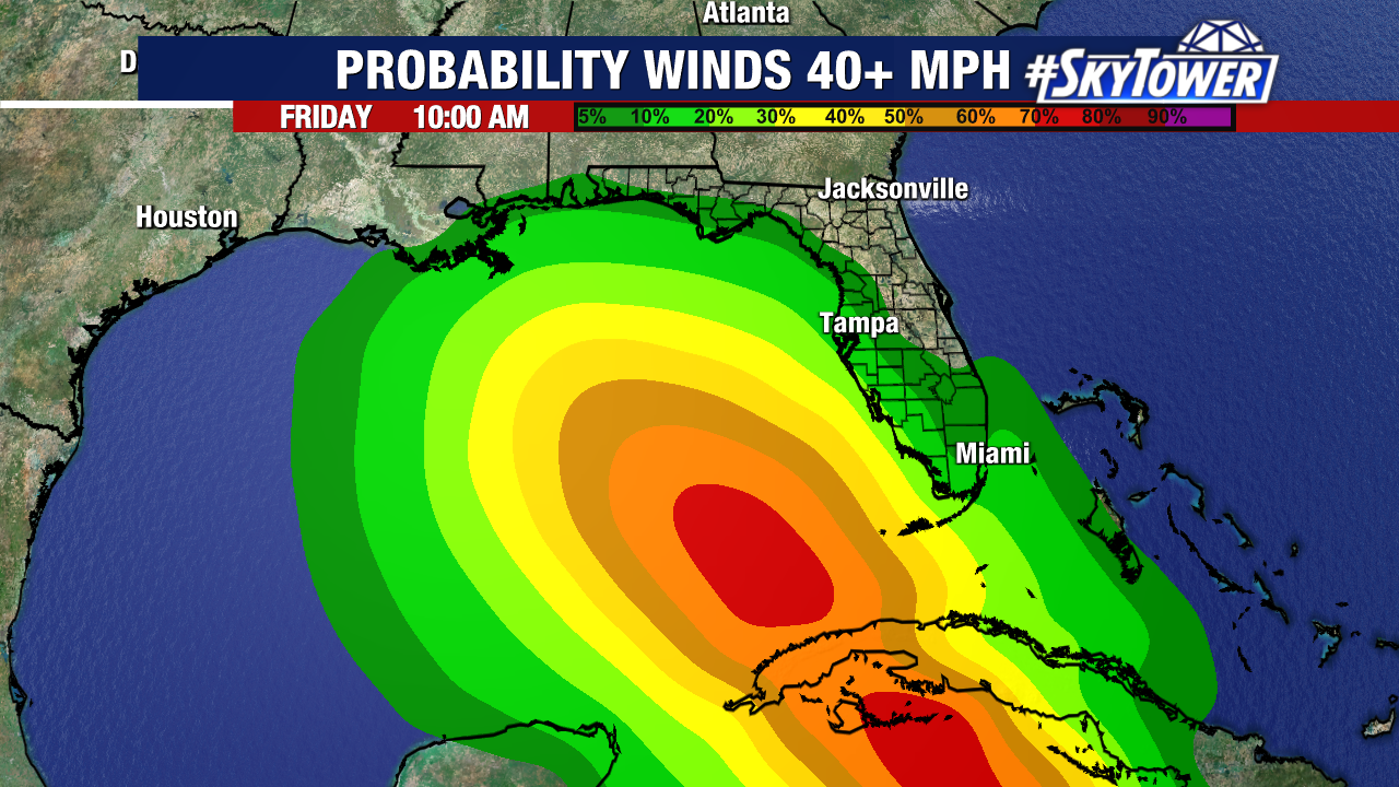
On this current track, winds and surge are not a concern for the Florida west coast. Scattered gusty rain and storms will move across the state Wednesday and Thursday.
The overall trend west through the Gulf will mean fewer impacts in Florida but we will watch this for any changes.
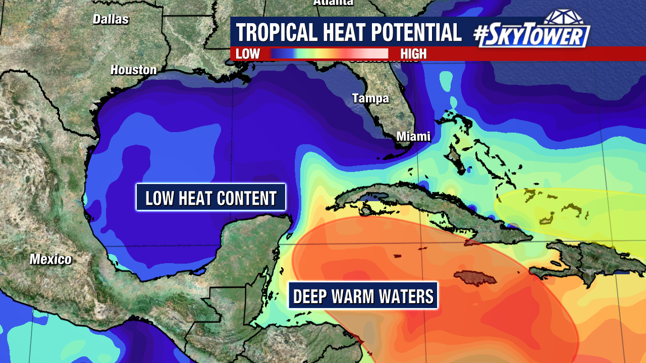
The good news is heat content is much lower in the Gulf compared to the Caribbean, and in some spots sea surface temperatures are in the upper 70s. Tropical systems thrive in 80° waters or warmer.
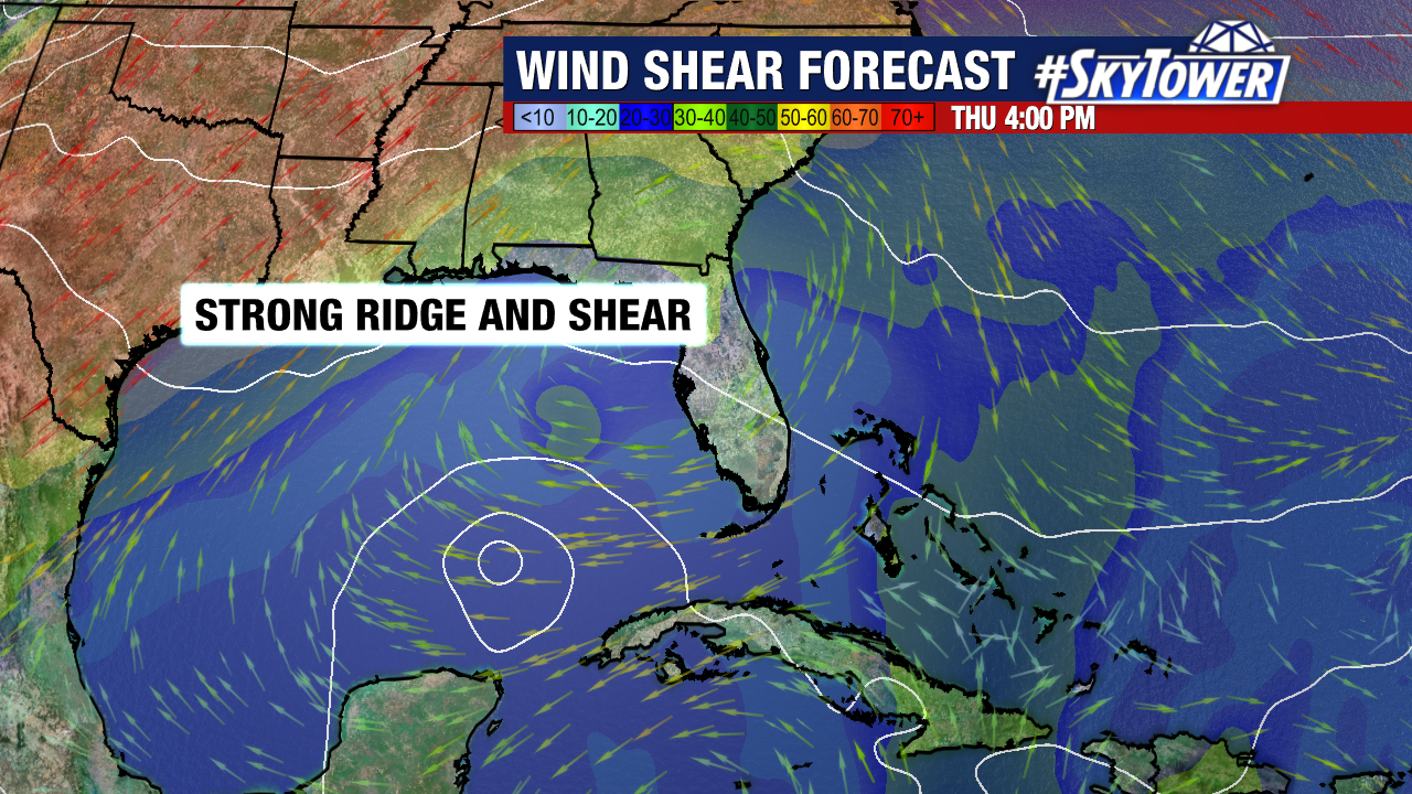
The storm will also run into strong shear and dry air in the Gulf, which is expected to weaken it ahead of landfall.
We could see Tropical Storm Watches issued for the Florida Keys later today. More updates to come!