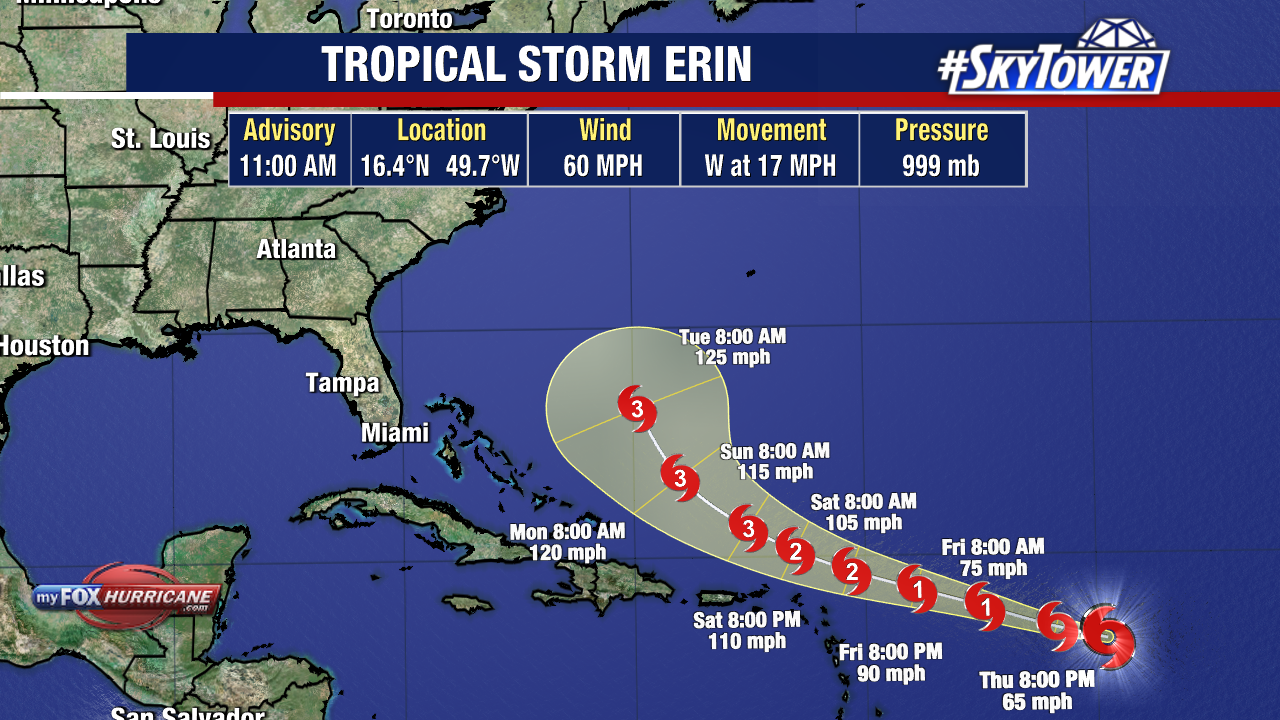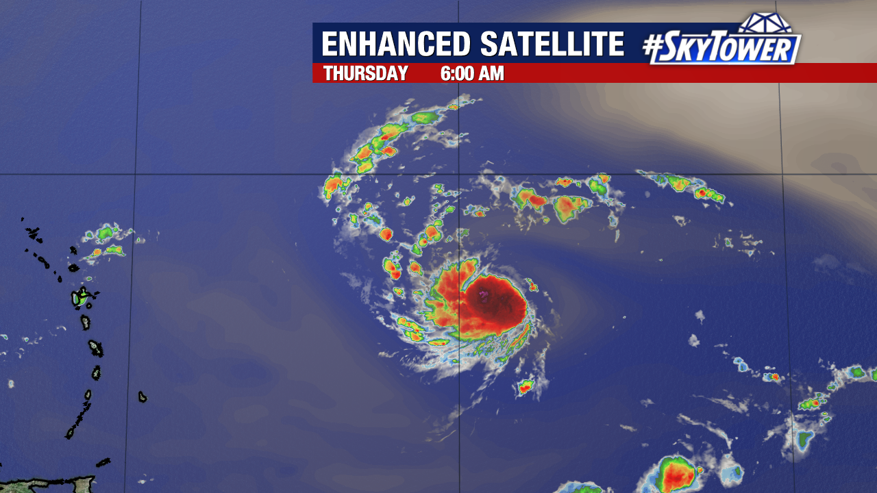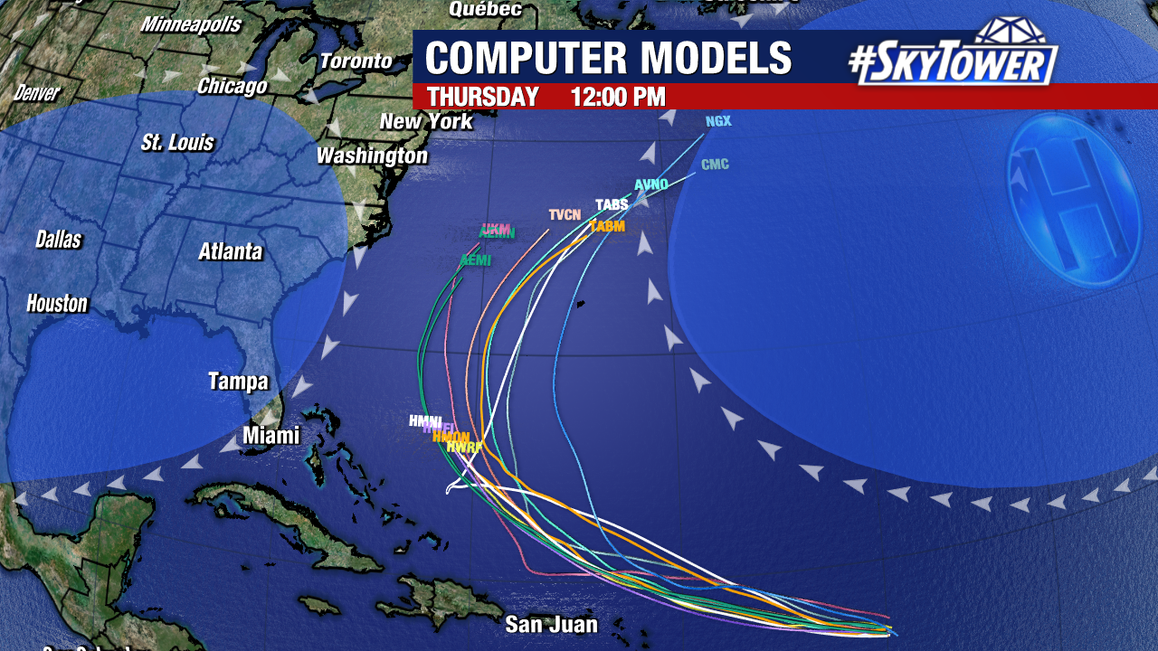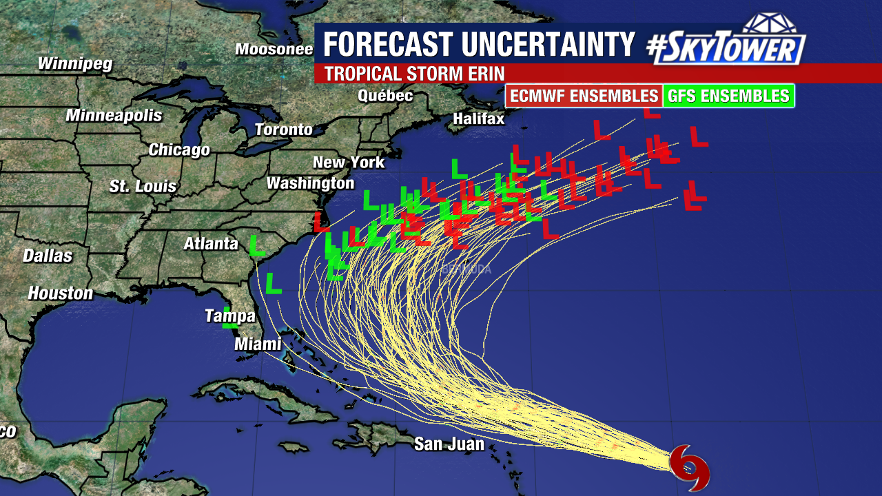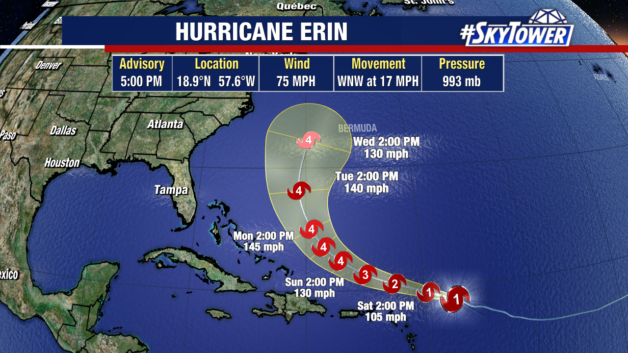
Erin strengthened into a hurricane late this morning. There have been no major shifts in its projected path. The National Hurricane Center’s latest forecast cone strengthens this hurricane into a Category 4 storm.
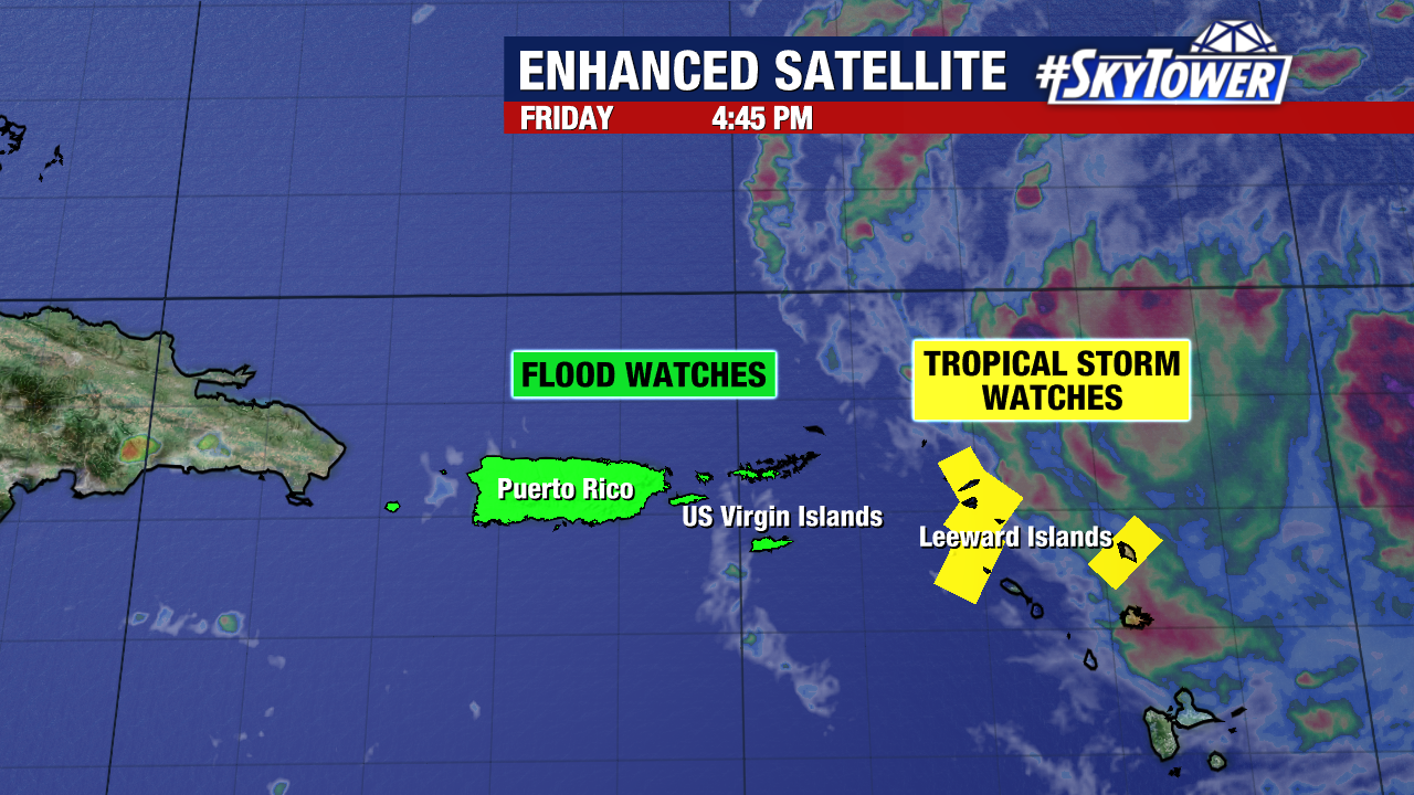
Erin is expected to remain north of the Leeward Islands, but could bring tropical storm-force-winds and flooding to the islands it closely passes. Puerto Rico and the US Virgin Islands have been included within flood watches, as isolated rain totals surpassing 5 inches (through Monday) will be possible. Additionally, tropical storm watches have been issued for many of the Leeward Islands.
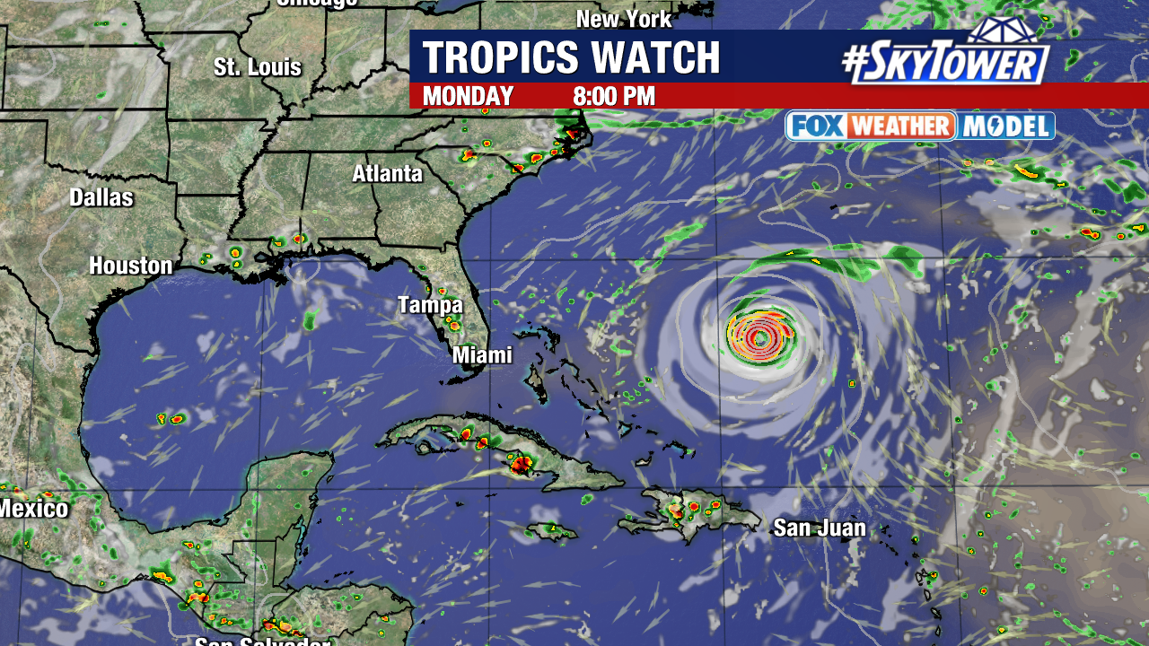
This hurricane is expected to pass well east of Florida early next week.
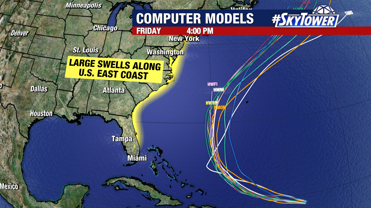
Confidence is growing that Erin will remain well off the coastline of the United States. Regardless, life-threatening rip tide and large swells are expected along the east coast as it passes. Bermuda will need to carefully monitor the progress of this storm.
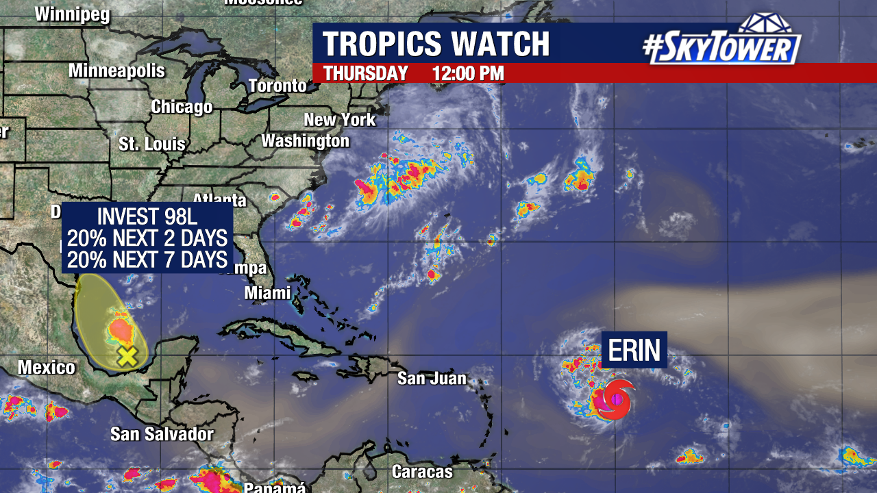
There are currently no other spots to monitor in the Atlantic. Invest 98L pushed onshore Texas this afternoon and no longer poses any threat of development.