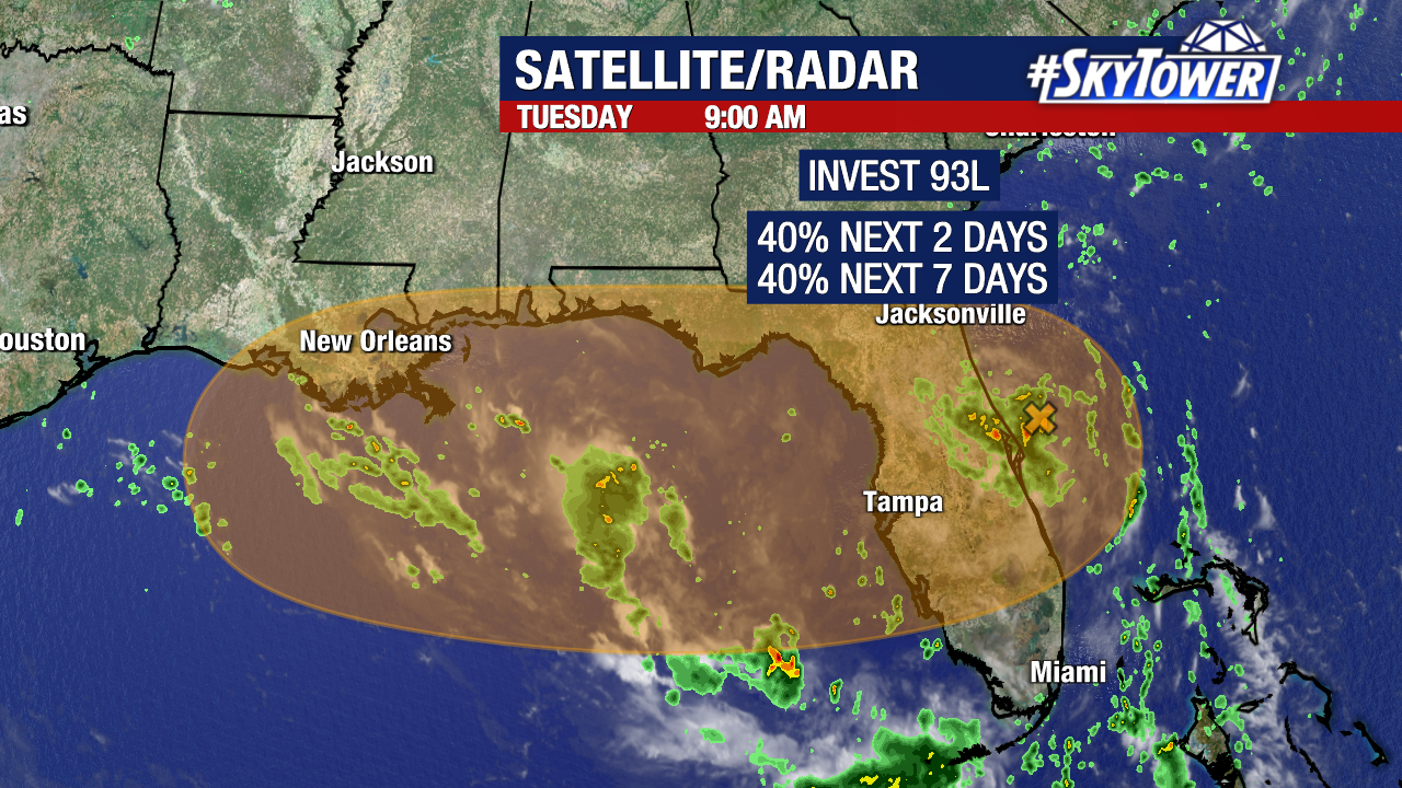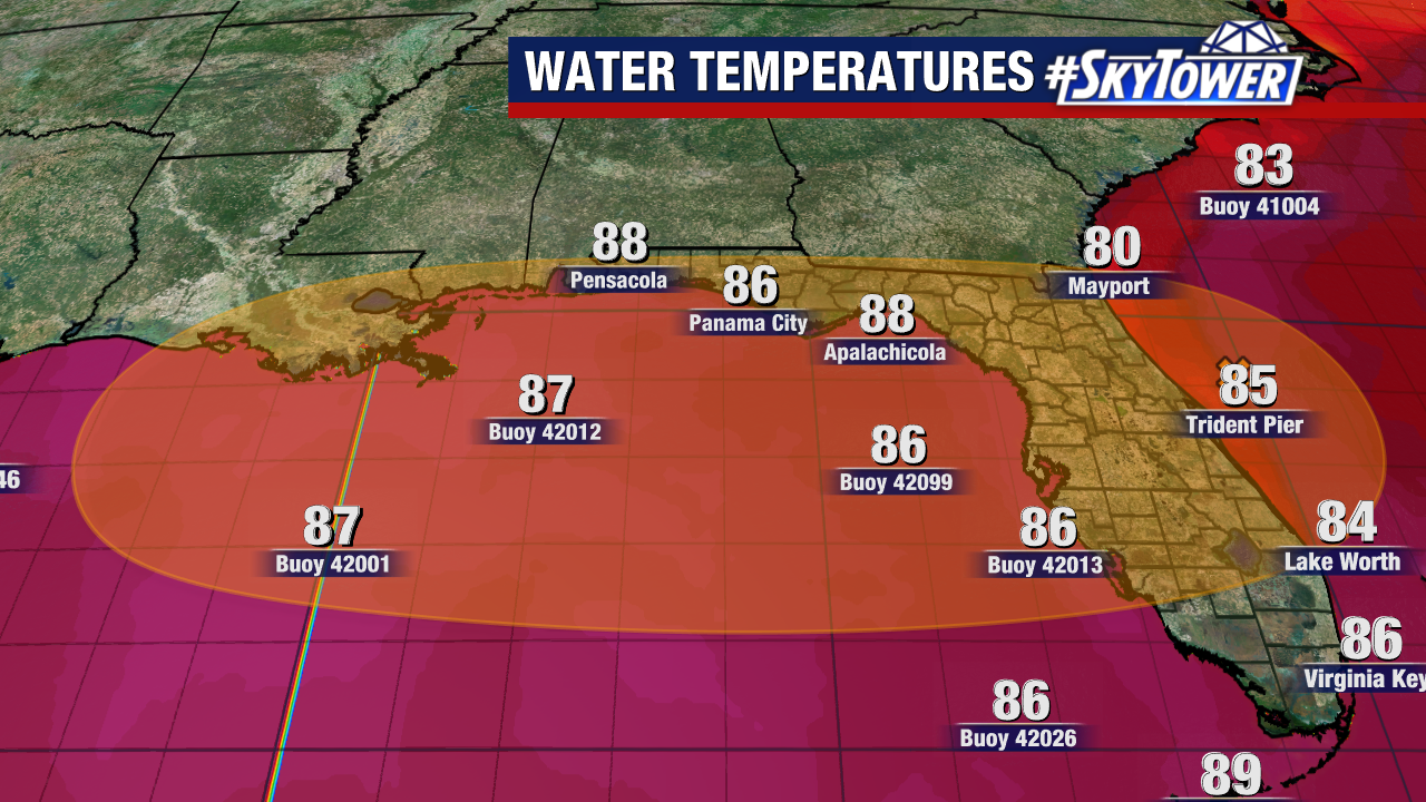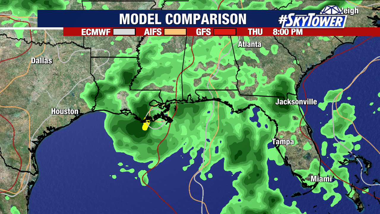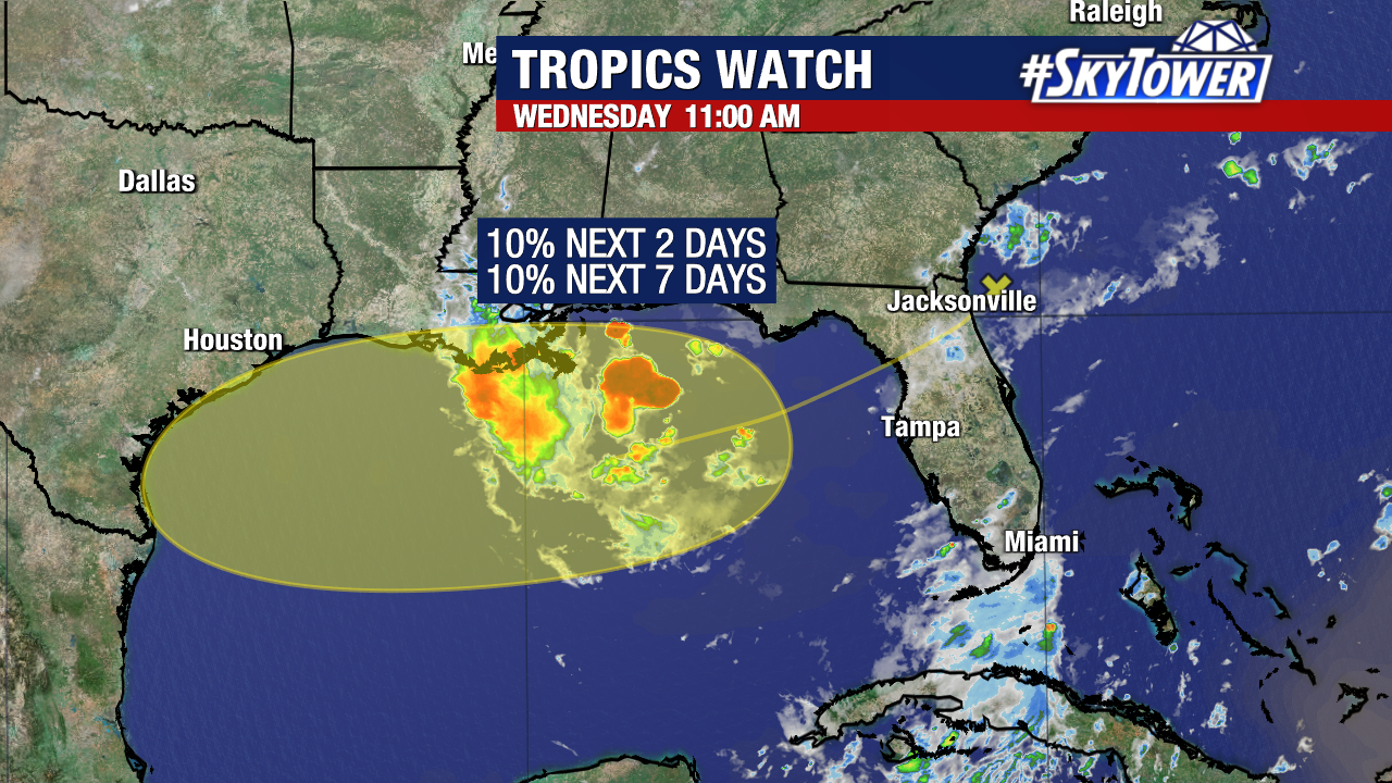
We’re keeping an eye on a broad area of low pressure currently over Florida. As it moves into the northern Gulf over the next day or so, it will have a brief window for possible development heading into the end of the workweek and the start of the weekend.The National Hurricane Center is giving it a low 10% chance of formation within the yellow-shaded area on their outlook.

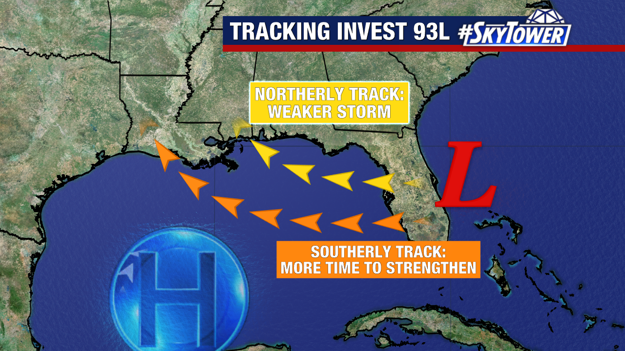
One of the main limiting factors is moderate wind shear, which is expected to persist in that region over the next few days.
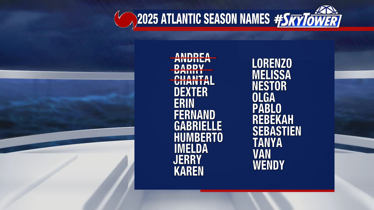
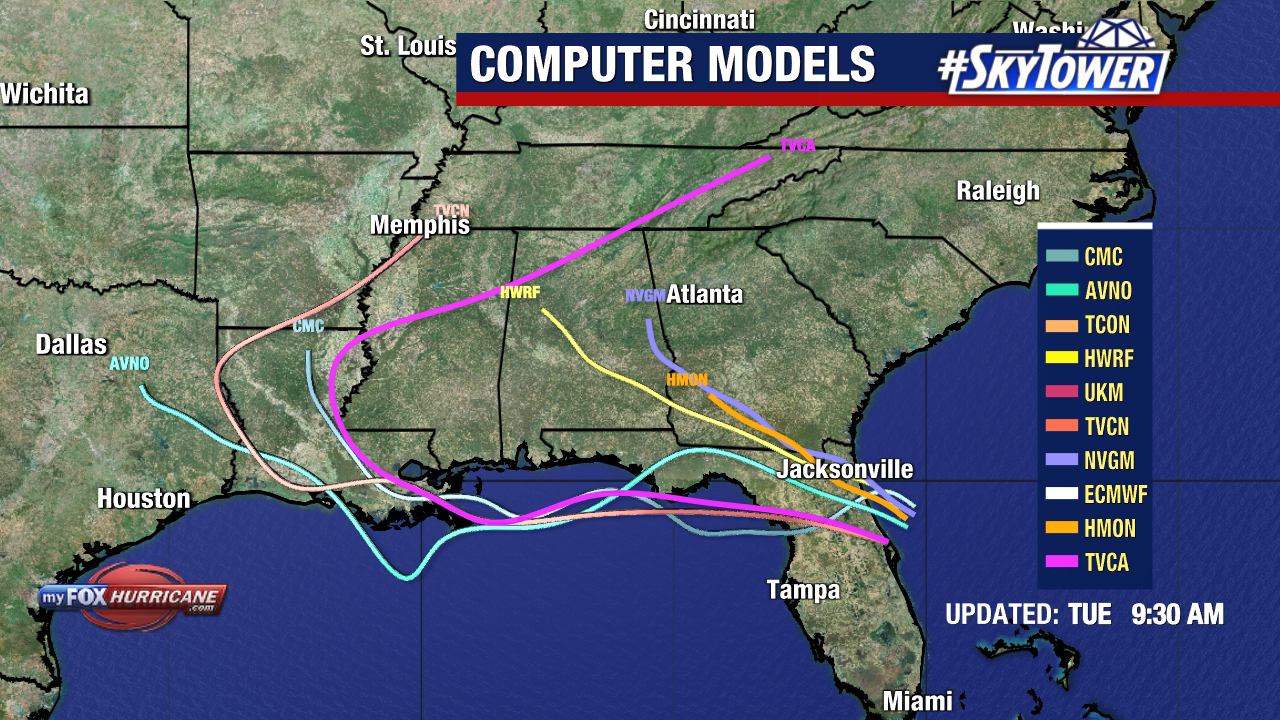
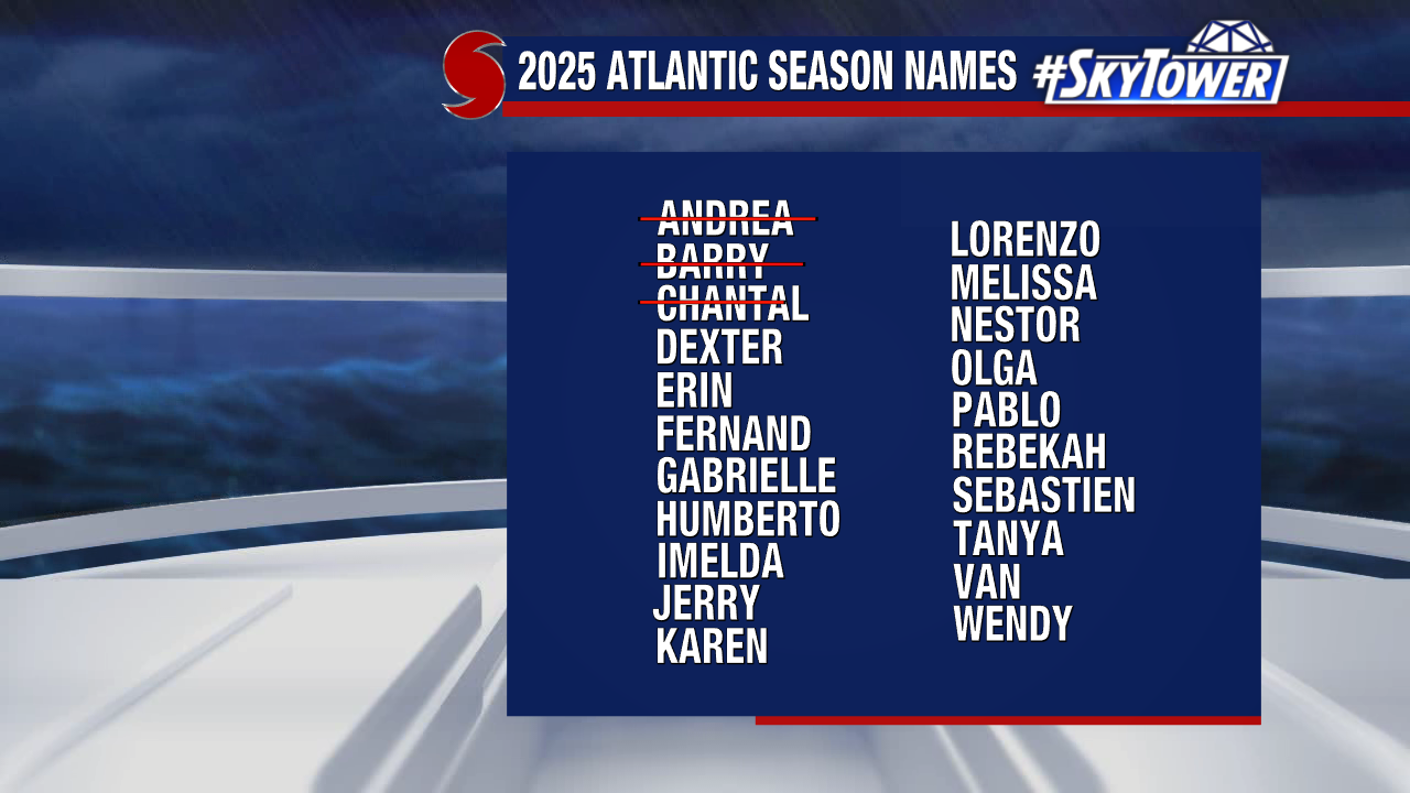
If development were to occur, the system would take the name Dexter and would likely track away from Florida.
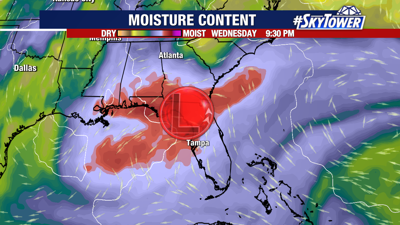
Regardless of development, this disturbance will continue drawing deep tropical moisture over the state, boosting rain chances.
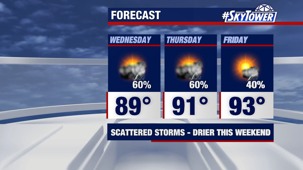
As it shifts westward this weekend, it will also help pull in drier air behind it. This gives many of us a much-needed break from the rain and a better chance to enjoy some sunshine.