Disorganized Tropical Depression Emily Headed Out to Sea in the Atlantic

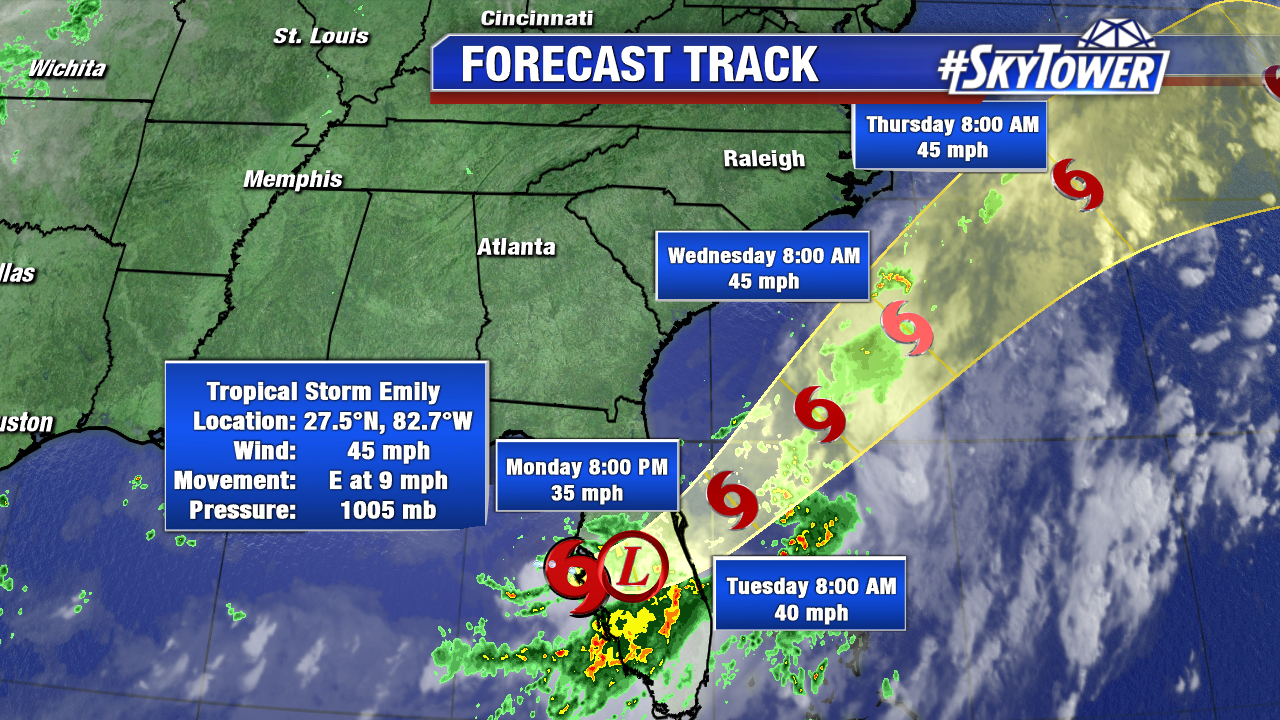
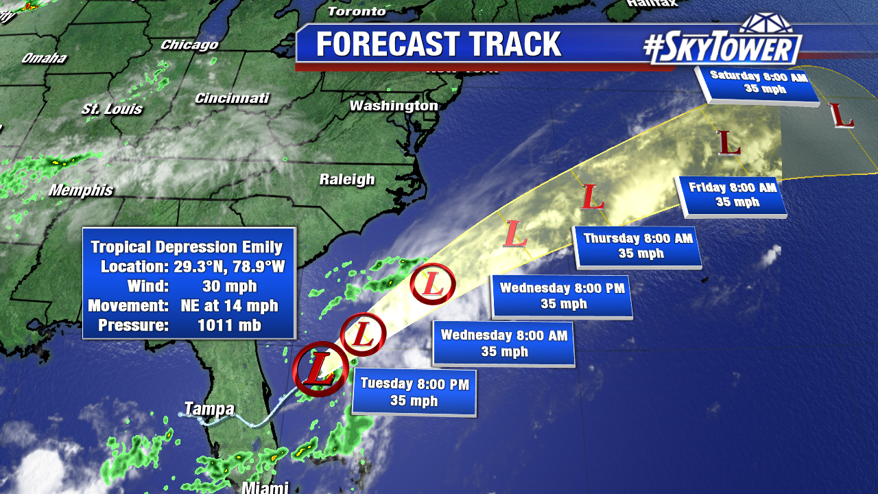
Emily barely hangs on as a Tropical Depression Tuesday over the warm western Atlantic. The sheared disturbance combats drier air aloft and will stay disorganized as it heads northeast and out to sea. Wind shear near a stalled frontal boundary will take a toll on Emily and it will lose tropical characteristics mid week, if not sooner. It is no threat to land in the days ahead.

colin-png4e545

florida-wv-icon

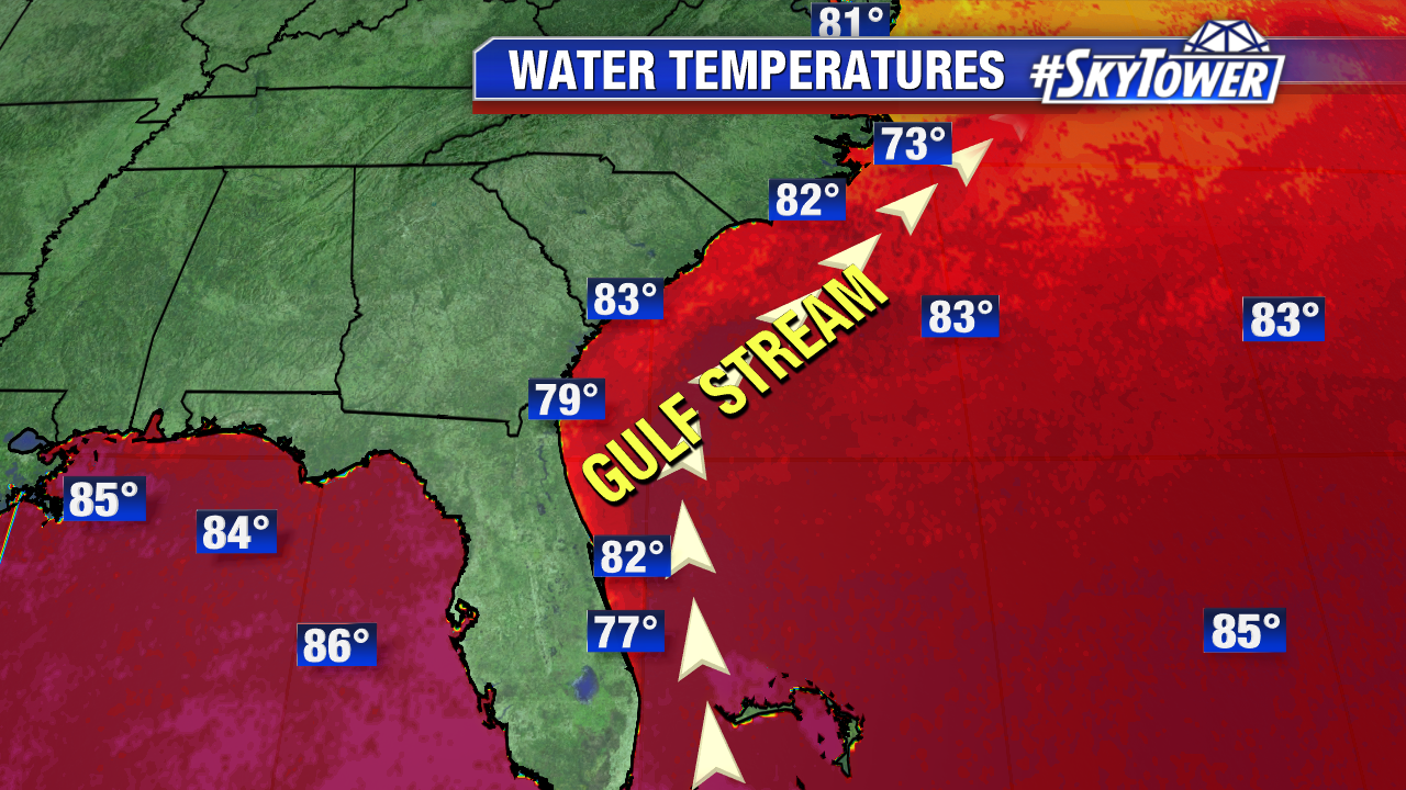
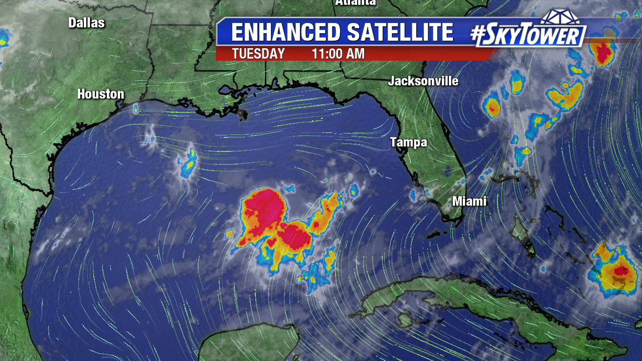
As we saw with Emily, any areas of convection sitting over Gulf of Mexico temperatures in the mid to upper 80s are always worth keeping an eye on. An area of disturbed weather has flared up early Tuesday over the central Gulf of Mexico. While there are no signs of tropical development, we will monitor this feature. An old frontal boundary across the north central Gulf could guide these showers and storms toward Florida in the days ahead.

gulf-of-mexico-ir-enhanced

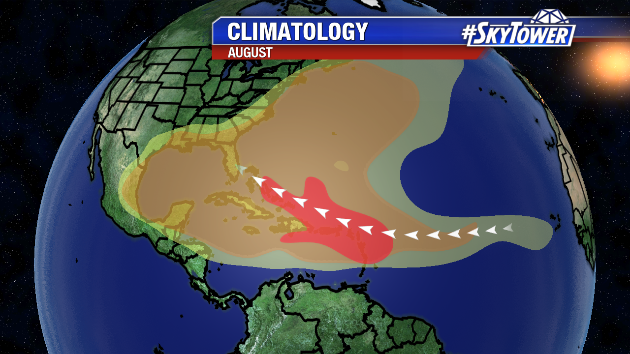
Tuesday is the start of the third month of the Atlantic hurricane season. On average, the first hurricane in the Atlantic forms on August 10th. It is a month where tropical wave activity ramps up off the coast of Africa and moistens the Main Development Region between the Caribbean and Africa. The Gulf of Mexico, Caribbean, western Atlantic and central and eastern Atlantic are all fair game for tropical cyclone development. While on average only 8% of named storms form during July, 27% of named storms form in August.

climatology-august

We’re watching a few disorganized tropical waves in the south central Atlantic Tuesday. They are all situated just south of the most extensive dry Saharan air and are headed westward. Some gradual development of the tropical wave circled in white is possible over the next day or two.

atlantic-wide-2d-ir-enhanced

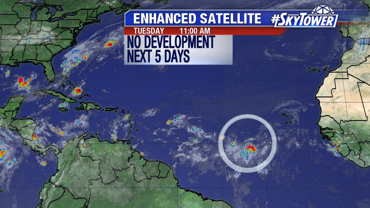
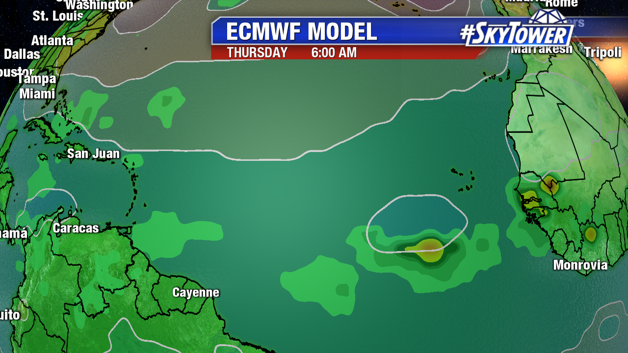
Long-range computer models have been back and forth the past 2 days . A tropical wave in the next week/week and a half could strengthen as it approach the Caribbean. Below is the 0Z Euro for next Thursday. It shows a healthy tropical wave southwest of the Cabo Verde Islands. The latest GFS shows a disturbance enters the Caribbean mid-week next week and eventually dissipates. The bottom line is we are entering the time in hurricane season to be tropical weather aware, especially as storms enter the Caribbean.

ecmwf-msl-and-precip-rate


Tropical Storm Emily Makes Landfall on Anna Maria Island; Wet Monday in Central Florida

Tropical Storm Emily made landfall on Anna Maria Island at 10:45 AM Monday morning with 45 mph winds. Strong rotation northeast of the center was spotted near the Sunshine Skyway Bridge during the time, which prompted a Tornado Warning for Manatee county, including Bradenton.  As Emily moves further east away from the Gulf, it will weaken further Monday afternoon and evening.

vipir-png2323

Emily drenched the I-4 corridor southward early Monday.  As of midday Valrico in eastern Hillsborough county saw over 8 inches of rain. St Pete had almost 6″ of rain and Bradenton had nearly 5″.The hardest hit areas were eastern Hillsborough, southern Pinellas, coastal Manatee and coastal Sarasota county. Wrap around moisture will fuel additional downpours through Monday evening as Emily moves east across the area. A Flood Watch is in effect until 8 PM for Hilllsborough, Pinellas, Manatee, Sarasota, Hardee, Desoto and Highlands county. Some rainfall totals may surpass 6″ through Monday evening.

rainfall-totals

lynx

The strongest winds were felt northeast and east of the center of circulation late Monday morning into midday. A wind gust of 57 mph was record at the fishing pier near the Sunshine Skyway Bridge. The Bradenton and Sarasota areas saw gusts near 50 mph, while further north in Tampa wind gusts were less than 20 mph. Wind gusts 30 mph+ are possible through Monday evening as Emily weakens over land and emerges back in the Atlantic early Tuesday.

peak-wind-gusts-2-png-232

The 11 AM advisory from the National Hurricane Center shows Emily weakening to a tropical depression Monday evening.  It will re-strengthening to a tropical storm and accelerate northeast along a stalled frontal boundary over the warm Gulf Stream waters of the western Atlantic. Wrap around moisture and lingering tropical moisture will fuel scattered tropical downpours in Central Florida Tuesday and Wednesday.

colin

floater-water-temperatures