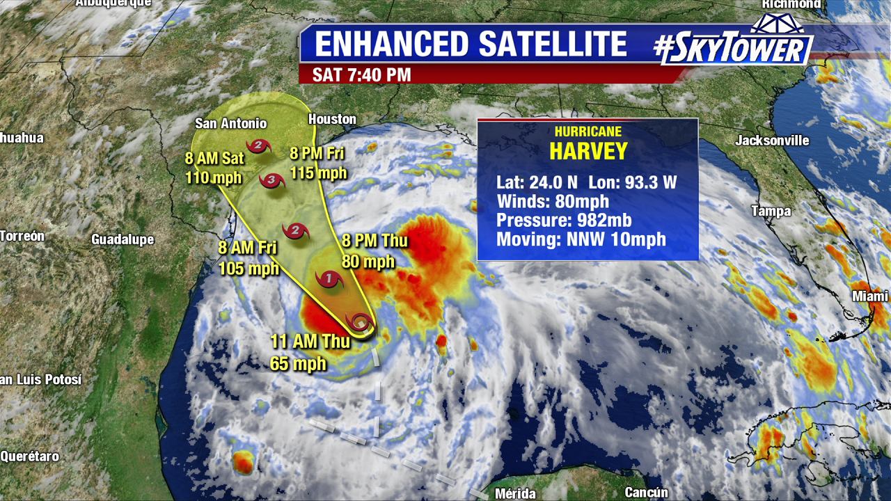
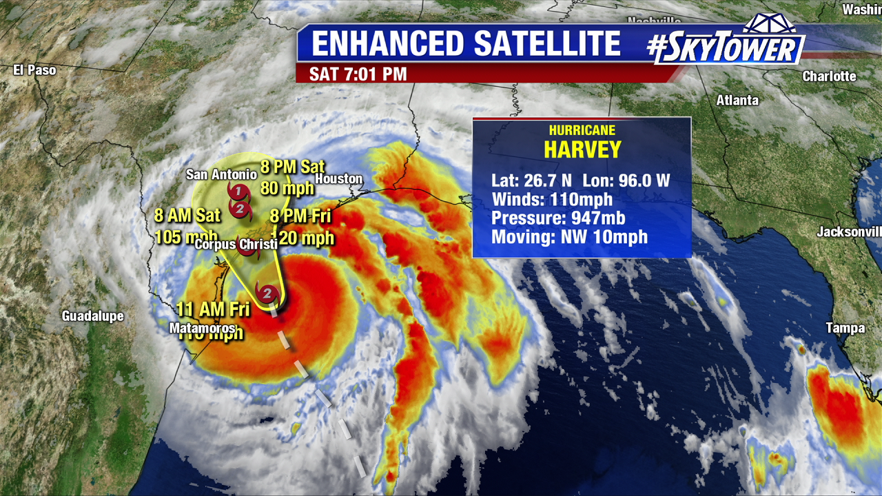
At 11am Friday, Harvey was located about 115 miles SE of Corpus Christi, Texas. Max sustained winds were at 120 mph, with tropical storm force winds (39+ mph) already reaching the Texas coastline. Harvey is a multi-threat system that will have devastating impacts across parts of Southeast Texas.
Here is the latest advisory information from the National Hurricane Center…
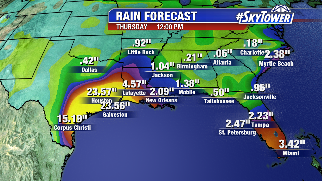
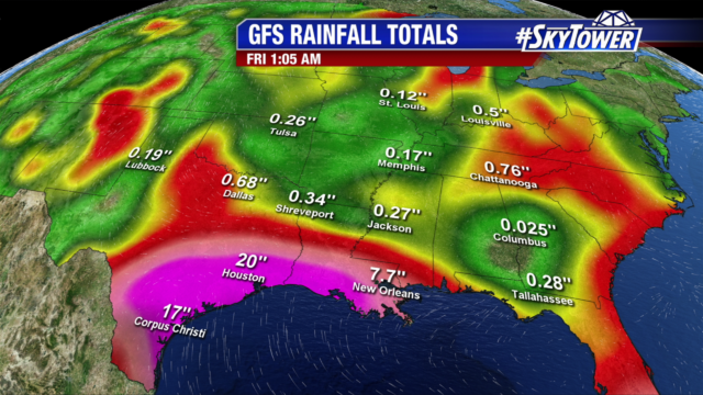
RAINFALL: Harvey is likely to produce total rain accumulations
of 15 to 25 inches and isolated maximum amounts of 35 inches over
the middle and upper Texas coast through next Wednesday. During
the same time period Harvey is expected to produce total rain
accumulations of 7 to 15 inches in far south Texas and the Texas
Hill Country eastward through central and southwest Louisiana, with
accumulations of up to 7 inches extending into other parts of Texas
and the lower Mississippi Valley. Rainfall from Harvey will cause
devastating and life-threatening flooding.
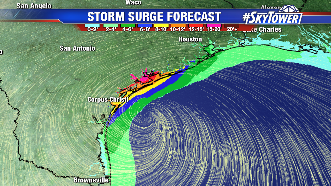
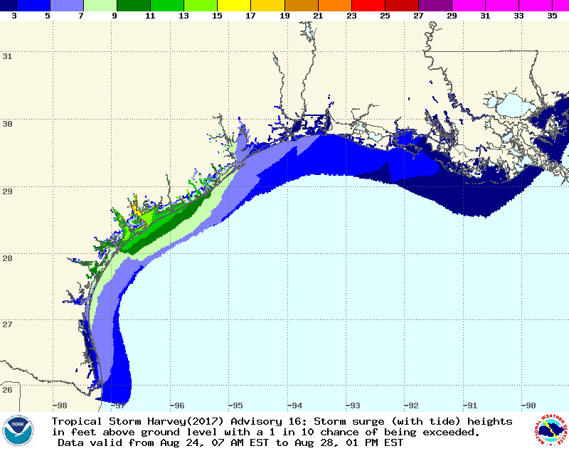
STORM SURGE: The combination of a dangerous storm surge and the
tide will cause normally dry areas near the coast to be flooded by
rising waters moving inland from the shoreline. The water is
expected to reach the following heights above ground if the peak
surge occurs at the time of high tide…
N Entrance Padre Island Natl Seashore to Sargent…6 to 12 ft
Sargent to Jamaica Beach…5 to 8 ft
Port Mansfield to N Entrance Padre Island Natl Seashore…5 to 7 ft
Jamaica Beach to High Island…2 to 4 ft
Mouth of the Rio Grande to Port Mansfield…2 to 4 ft
High Island to Morgan City…1 to 3 ft
The deepest water will occur along the immediate coast near and to
the northeast of the landfall location, where the surge will be
accompanied by large and destructive waves. Surge-related flooding
depends on the relative timing of the surge and the tidal cycle, and
can vary greatly over short distances.
WIND: Hurricane conditions are likely within the hurricane warning
area later today and tonight, with tropical storm conditions
expected to first reach the coast in the hurricane warning area
later this morning. These conditions are likely to persist
into Saturday in portions of the hurricane and tropical storm
warning area.
Current watches and warnings in effect include…
A Storm Surge Warning is in effect for…
* Port Mansfield to High Island Texas
A Storm Surge Watch is in effect for…
* South of Port Mansfield Texas to the Mouth of the Rio Grande
A Hurricane Warning is in effect for…
* Port Mansfield to Sargent Texas
A Tropical Storm Warning is in effect for…
* North of Sargent to High Island Texas
* South of Port Mansfield Texas to the Mouth of the Rio Grande
A Tropical Storm Watch is in effect for…
* South of the Mouth of the Rio Grande to Boca de Catan Mexico