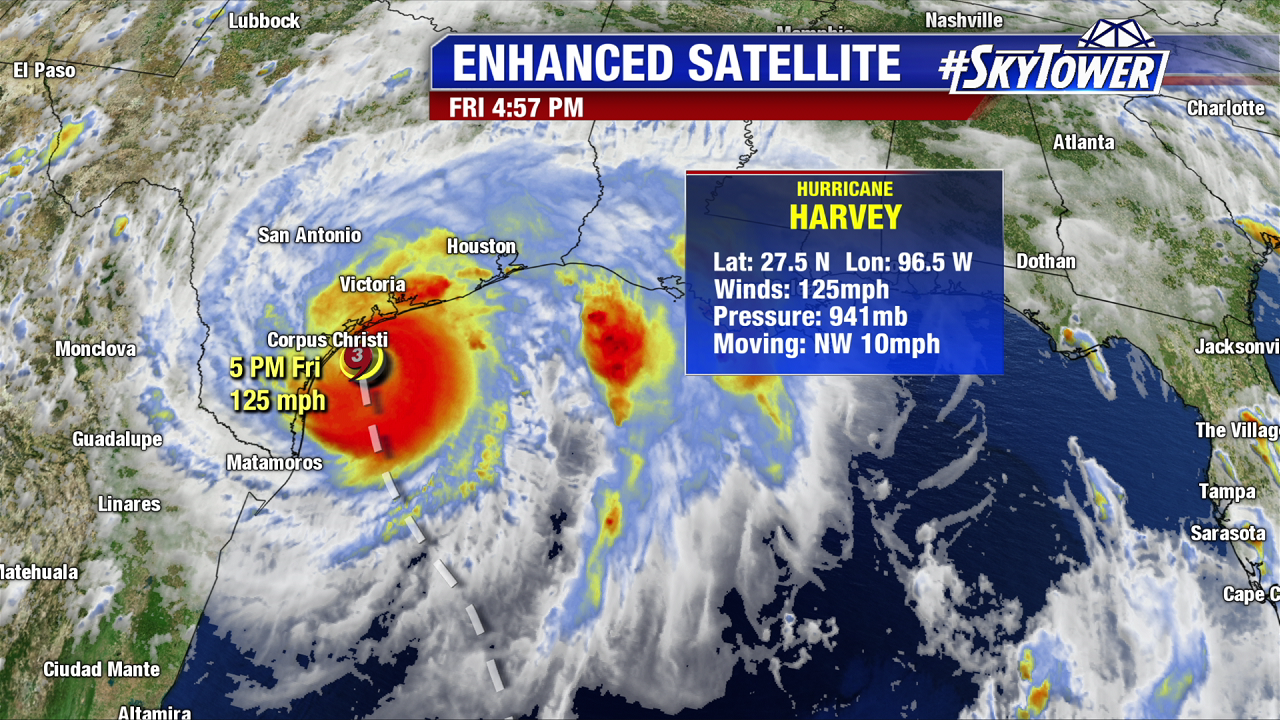
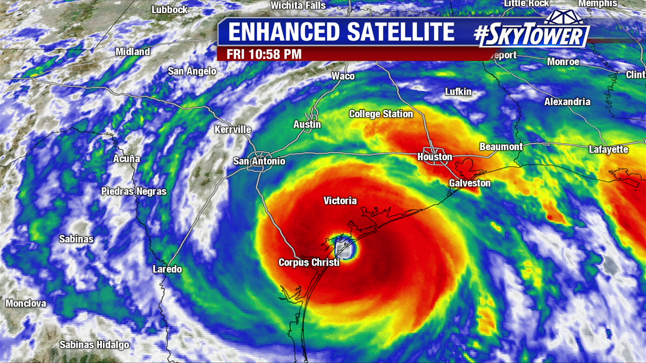
Harvey is one for the record books. It rapidly strengthened from a tropical depression to a category 4 hurricane in just two days over the warm Gulf of Mexico. It officially made landfall late Friday night as a category 4 hurricane with max winds of 130 mph and pressure down to 938 mb in Rockport Texas. This is northeast of Corpus Christi. A peak gust of 132 mph was recorded at Port Aransas. Harvey breaks the streak of no major hurricane landfalls in the U.S. It is the first major hurricane to strike the U.S. since Wilma in October 2005. It is the strongest hurricane to make landfall in the U.S. since Charley in August 2004. Harvey is also the strongest storm to hit Texas since Carla in 1961.
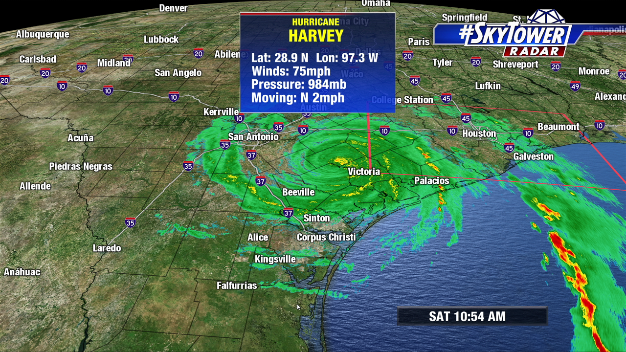
On Saturday morning Harvey weakens over land. While the winds will die down over the weekend the rain/coastal flood threat just gets started. There is nothing to guide Harvey out of Texas and it will linger through mid work week. Here is the 11 AM advisory from the National Hurricane Center. As of 11 AM Harvey is a minimal hurricane with 75 mph winds. It is nearly stationary and only crawls north at 2 mph. It will become a tropical storm Saturday afternoon. Heavy rain and coastal and inland flooding is likely through Thursday. This will be a catastrophic and life-threatening long-lived flooding event.
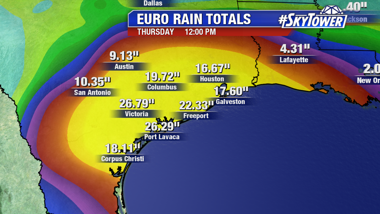
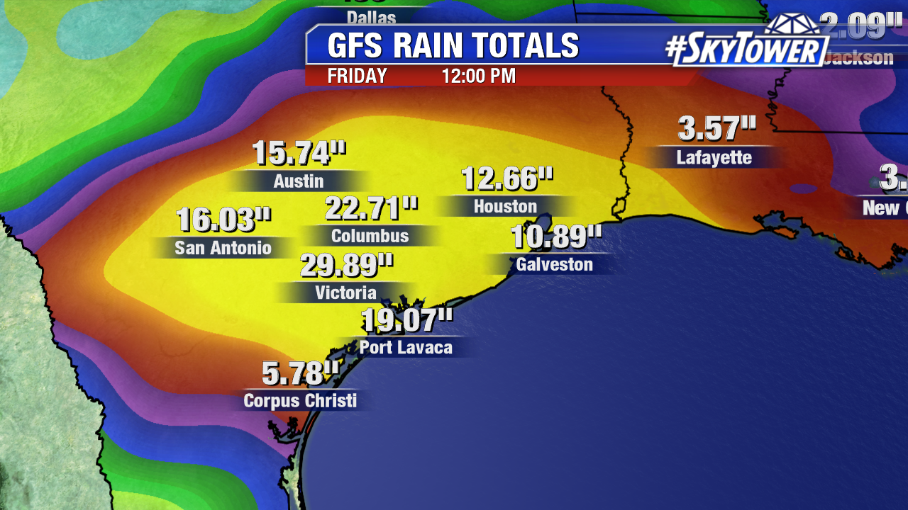
As of 11 AM Saturday over a foot of rain has fallen in parts of southeast Texas since Friday. The Weather Prediction Center constantly updates rainfall totals. So far Austwell, Texas has seen over 14″ of rainfall. Other hefty rainfall totals include Victoria, Texas at 9.37″ and the Houston Southwest airport at 6.40″. Models print out upwards of 20″ of rainfall by the end of the work week in spots. Below is the GFS forecast through Friday afternoon. 30″ in Victoria Texas is not unreasonable. The National Hurricane Center points out some isolated spots will see 30-40 inches of rain over the course of the next 5-6 days. Training bands will set up away from the center. Tornadoes may spin up in these bands, especially in the northeast quadrant. This includes the Houston area.
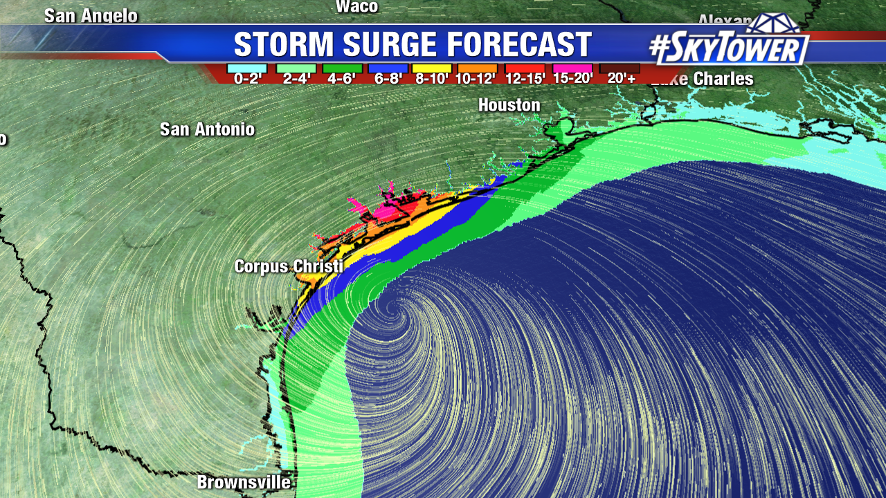
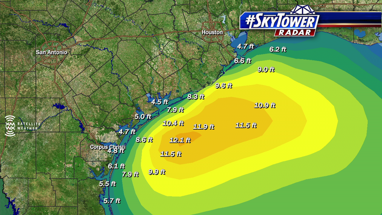
In addition to freshwater flooding coastal flooding will continue over the next few days. With a massive tropical system lingering near the Gulf a constant onshore wind will enhance coastal flooding/storm surge this weekend. Wave heights build up to 12 feet just offshore northeast of Corpus Christi Saturday morning. A storm surge of 4-7 feet is possible from Port Aransas to Sargent. Sargent to High Island, including Galveston Bay will see a 2 to 4 foot. High Island to Morgan City will see a storm surge of 1 to 3 feet.
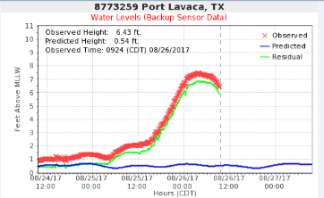
The sensor at Port Lavaca is just one example of the extreme rising waters in coastal Texas. A surge of over 6 feet has continued since late Friday night. The graphic below is courtesy NOAA.
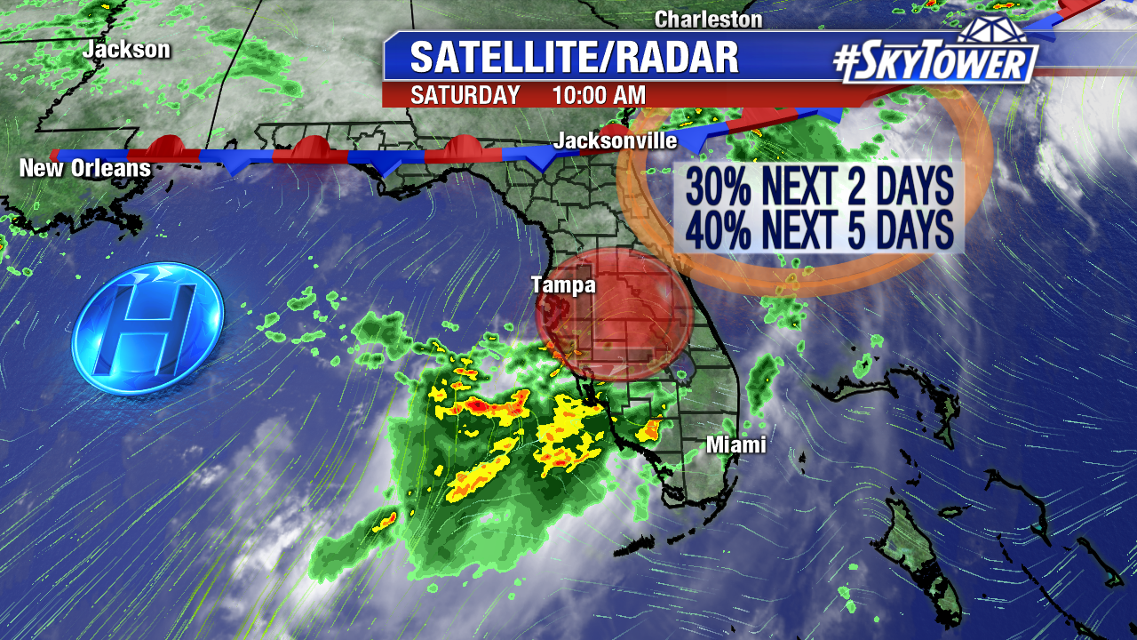
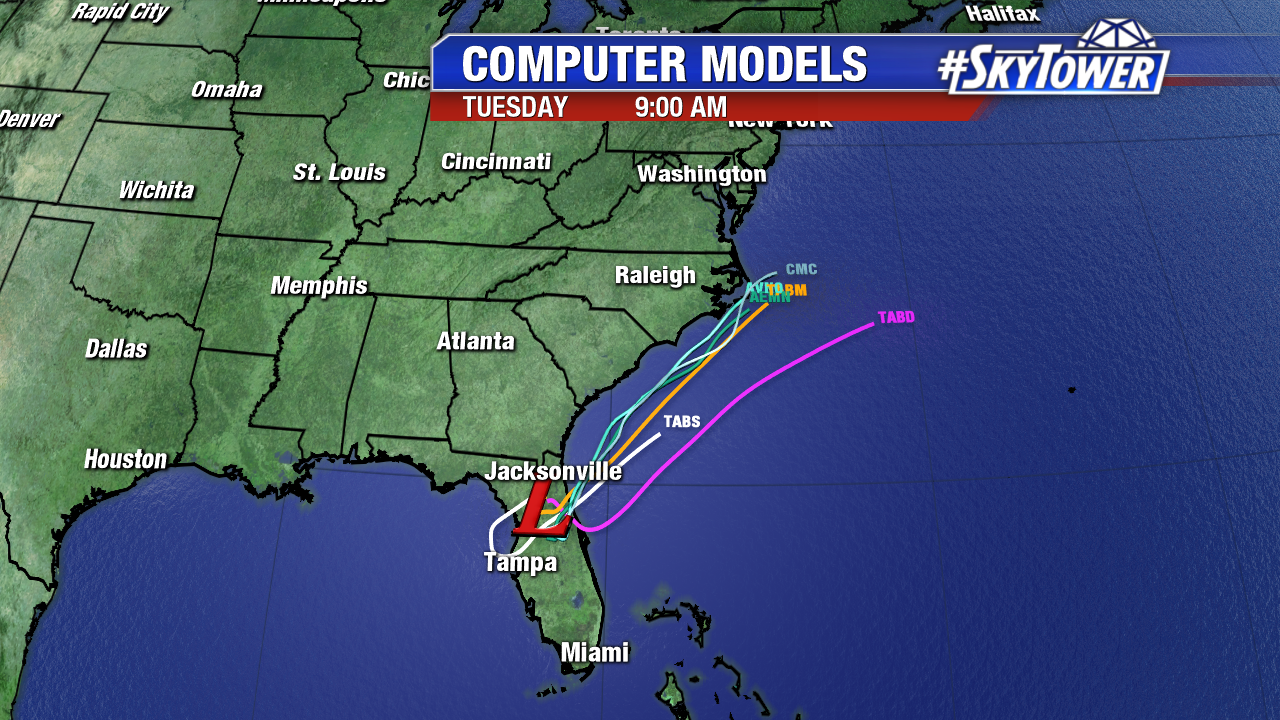
In addition to Harvey, an area of low pressure lingers over central Florida. It moves into the Atlantic late Sunday. Invest 92L may gain some tropical characteristics northeast of Florida (just offshore of the Carolinas) before it merges with a front early in the week. Those odds sit at 40% as of Saturday morning. This could enhance surf/rip currents in the coastal Carolinas early to mid work week.