Irma A Category 3 Again Sunday; Slight Westward Shift in Models

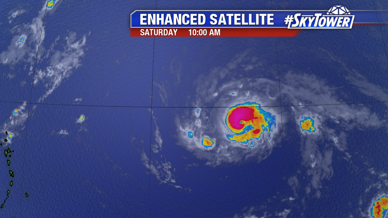
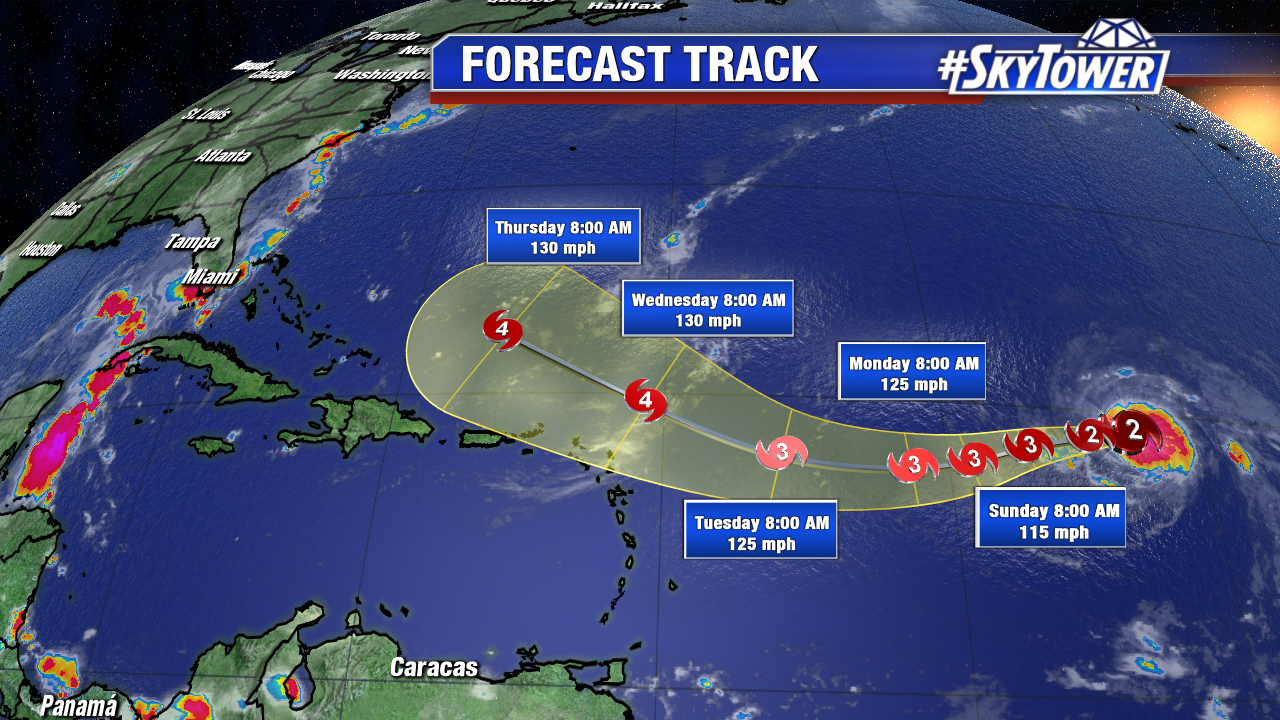
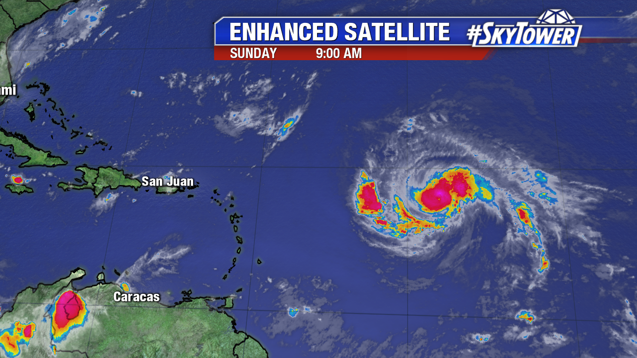
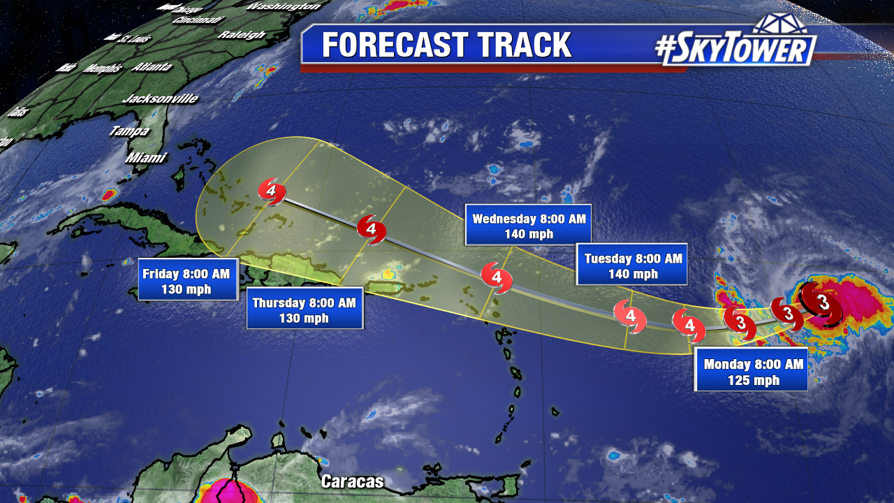
Hurricane Irma regains major hurricane strengthens early Sunday as it closes off on drier air aloft.  At 11 AM Sunday the eye has filled as yet another eyewall replacement cycle may be underway.  Some fluctuations in strength may continue over the next day or two. Max sustained winds are at 115 mph at 11 AM. The jog west-southwest is underway at 14 mph. Irma is still less 900 miles for the Leeward Islands, but the official NHC forecast is nudged closer to this region by mid-week. This is in line with a slight westward shift in computer models early Sunday morning. While the core of hurricane force winds extend only 25 miles from the center, the tropical storm wind field expands slowly. The Leeward Islands need to prepare for possible category 4 hurricane conditions Wednesday. Hurricane/Tropical Storm Watches could be issued on Monday. The major hurricane will ride the perimeter of a strong Bermuda High. It takes a northwesterly track late Tuesday, Wednesday, Thursday and Friday near Puerto Rico, Hispaniola, Turks and Caicos, and the Bahamas. Beyond the next 5 days, powerful Irma threatens the East coast of the U.S., including Florida, by late next weekend and early next week. During this time the dangerous major hurricane will be much larger in size too.

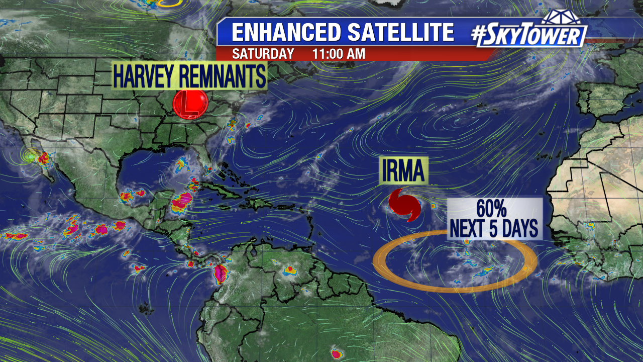
Multiple hurricane reconnaissance aircraft with investigate Irma and its surrounding environment starting Sunday afternoon. This data will be ingested into computer models and help with better model consensus. This is key, especially planning ahead for possible U.S. impacts. By Tuesday or Wednesday we will have a better grasp on the long-range track. Now is the time to prepare.

floater-enhanced-satellite-3

irma

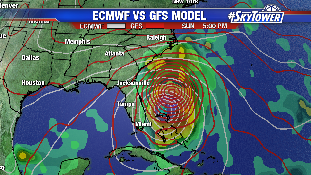
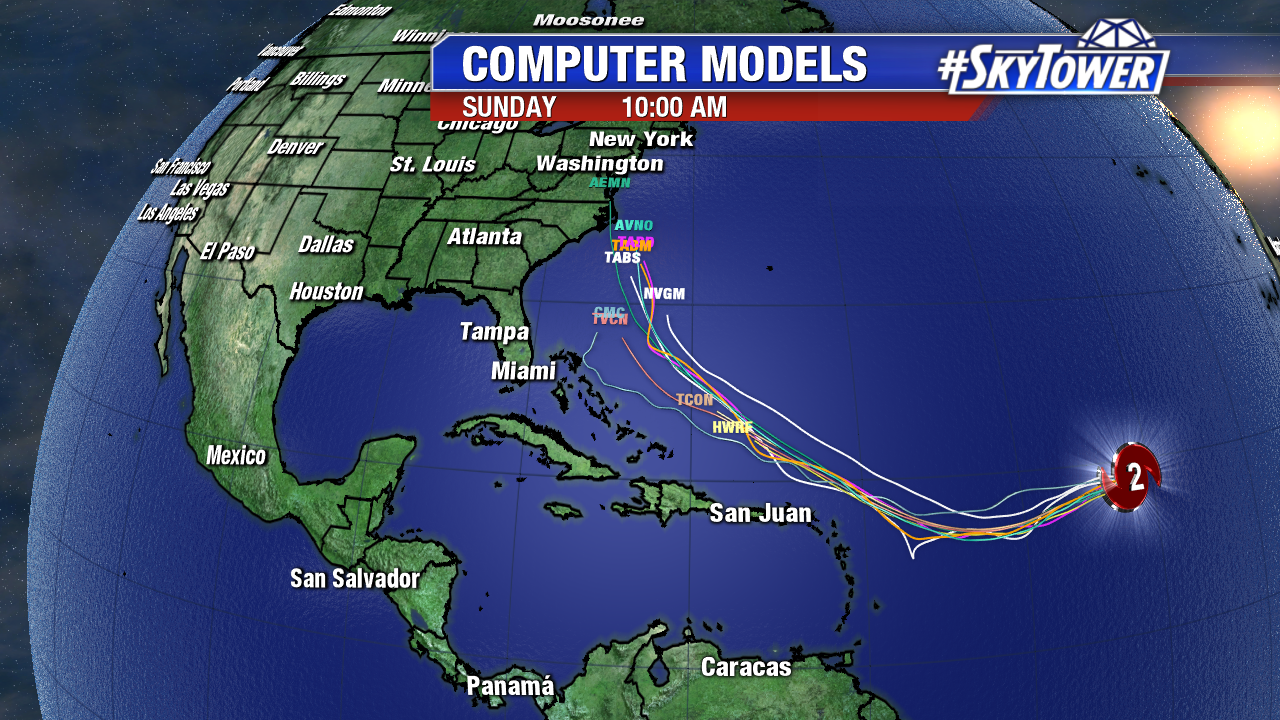
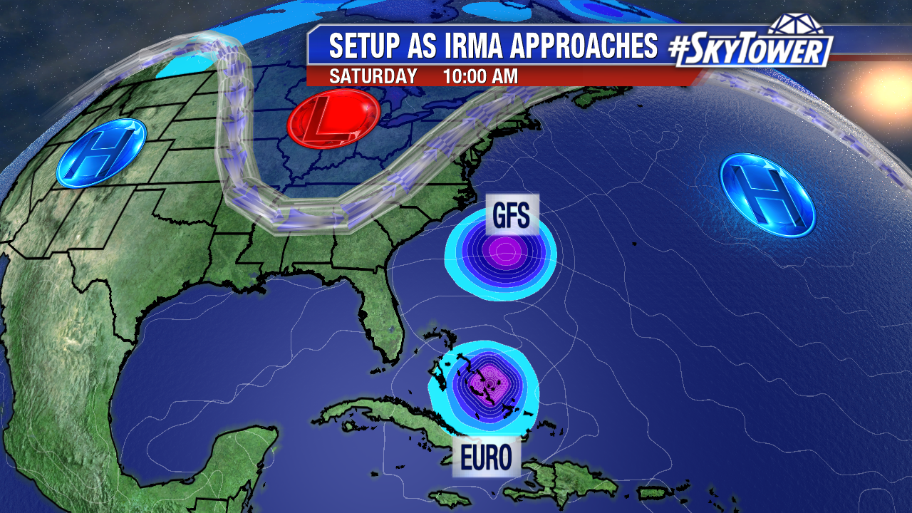
Late Saturday computer models trended a bit further east, however that changed early Sunday. A trip out to sea is still a possibility, but numerous models show a major hurricane landfall somewhere on the East coast. A Gulf track is the least likely path at this time.  While the majority of early Sunday computer models, Euro ensembles, GFS ensembles focus in on the Carolinas, there is a very large spread. Florida, the Carolinas and Mid Atlantic need to monitor the forecast closely. According to Dr. Klotzback from Colorado State University, the last hurricane landfall in the U.S. during the month of September is Jeanne in 2004.

invest-90l-models

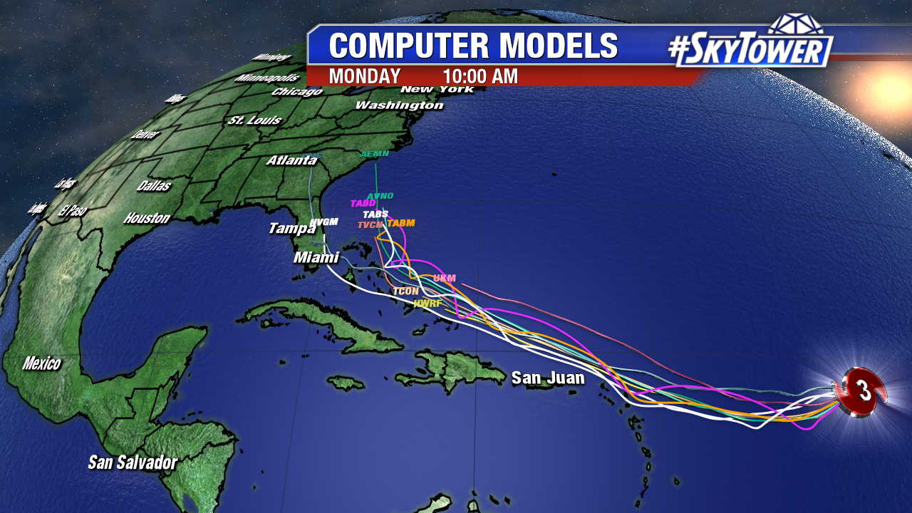
It is not uncommon for models to flip flop their solutions 7+ out from a possible landfall. The Euro has been back and forth. It was out to sea Saturday, but back into the U.S. near the Carolinas late Monday/early Tuesday. Interestingly enough, the GFS has been very consistent this weekend with a major hurricane in this vicinity by next Monday September 11th. Don’t focus in on a specific model run, but watch trends. Better model data in the days ahead will help us gain clarity on Caribbean and U.S. impacts down the road. Stay tuned.

ecmwf-vs-gfs-mslp-and-precip-rate-png2


Hurricane Irma Approaches the Caribbean Mid-Week

Hurricane Irma maintains intensity as a strong category 2 hurricane early Saturday. As of 11 AM max sustained winds are at 110 mph. Irma starts its slight wobble west-southwest at 15 mph. Irma has fluctuated between a category 2 and category 3 hurricane over the past 24 hours. These changes are due to eye wall replacement cycles. The tiny hurricane sits over marginally favorable water temperatures and there is some dry air nearby too. Irma should bounce back from these features and become a major hurricane again by Sunday or Monday. Under the influence of a strong Bermuda high it will  move west-northwest starting Tuesday. It will pass uncomfortably close to the Leeward Islands early Wednesday. While most models are trending north of the Leeward Islands and Puerto Rico, Irma may be larger during this time as it strengthens. As of 11 AM Saturday hurricane force winds only extend out 25 miles for its center, while tropical storm force winds extend out up to 70 miles. Interest in these locations need to prepare for possible major hurricane conditions late Tuesday, Wednesday, and Thursday.

floater-ir-enhanced-2

irma-png3434

Here’s the suite of computer models early Saturday. The forecast is highly subject to change, especially beyond 5 days (after Wednesday). The Bahamas and the entire East coast of the U.S. need to keep a close eye. As of early Saturday many models and their ensembles show a major hurricane landfall somewhere on the East coast in 8 or 9 days. A track out to sea is also a possibility. The less likely solution at this time is a track into the Gulf of Mexico. That of course is good news for those impacted by Harvey. Multiple hurricane reconnaissance missions are scheduled for Sunday and Monday. This includes a G-IV mission, which will assess the surrounding environment. These missions will help long-range models get a better grasp on the future track/intensity of powerful Irma.

invest-90l-models

We will likely gain some clarity on any Bahamas/U.S. impacts early this work week. The forecast is highly dependent on the timing and strength of the Bermuda high and an East coast trough late in the week. If the Bermuda high maintains intensity, a path closer to/or into the U.S. is most likely. If the deepening trough stays strong during this time, Irma would track further east, possibly head out to sea. The bottom line is it is about a week from the climatological peak of the Atlantic season. Now is the time to tweak any hurricane plans/preparations just in case. Prior to catastrophic Harvey last week, there was no major hurricane landfall in the U.S. since Wilma in October 2005.

explainer-1

Elsewhere, a tropical wave southwest of the Cabo Verde Islands bears watching. It is fairly close to the equator. There is a medium chance of tropical depression development by early next week as it moves westward. Our next named storms is Jose.

atlantic-wide-2d-ir-enhanced