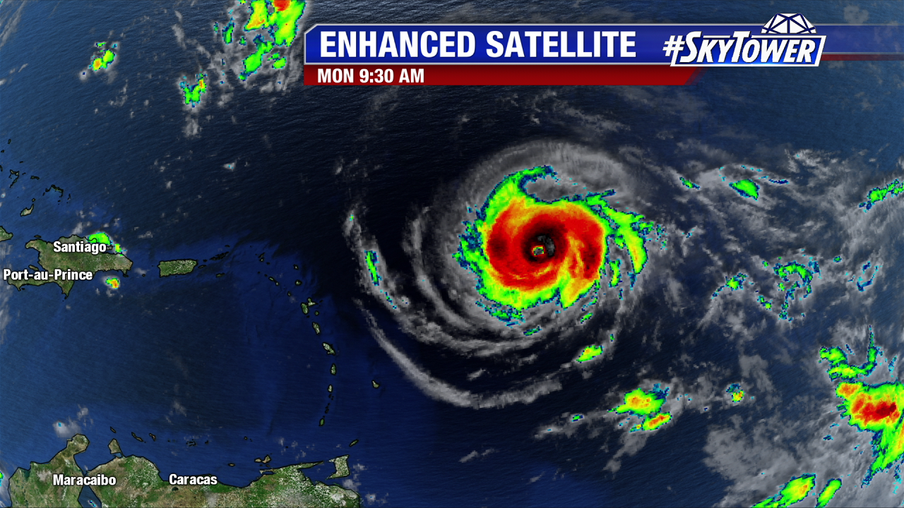
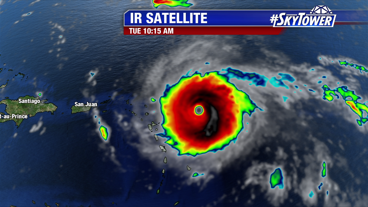
As of 11 AM Hurricane Irma is the strongest hurricane on record in the Atlantic Basin outside of the Caribbean Sea and the Gulf of Mexico with 180 mph winds (according to the NHC). Hurricane Hunters discovered the very dangerous hurricane ramped up to impressive strong category 5 strength at 8 AM. The strongest winds are in the outer eye wall north and east of its center. Irma is the strongest category 5 storm since Felix in 2007. It is a monster of a storm. The structure is of a textbook annular hurricane with a wall of intense convection surrounding a solid eye. It has completed shut out any surrounding dry air. This is bad news for the islands in its path as nothing holds Irma back from strengthening, or at least maintaining intensity. It will remain a very dangerous category 4 or 5 hurricane for the next several days. Irma is enormous and getting bigger. The catastrophic major hurricane force wind field grows to 60 miles from its center. Tropical storm force winds extend 160 miles from the center.
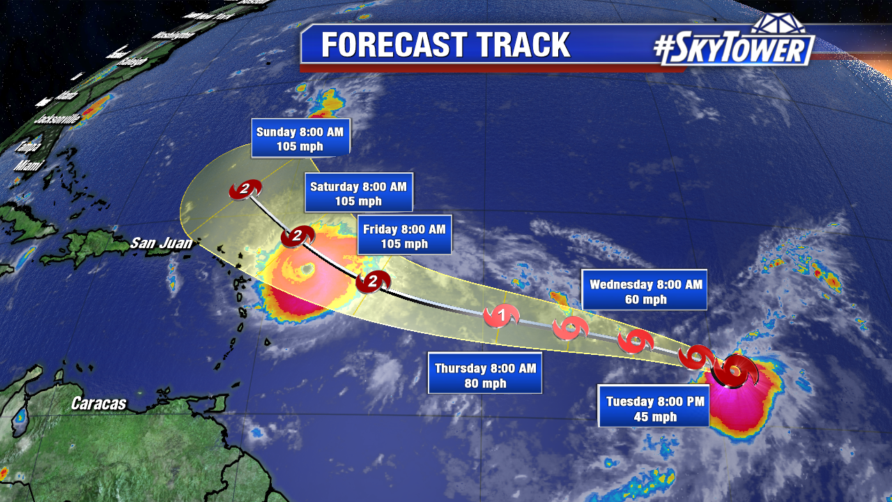
As of 11 AM max sustained winds are up to 180 mph and it heads west at 14 mph. At this pace tropical storm force winds reach the northern Lesser Antilles by early Tuesday evening with major hurricane force winds late tonight and overnight. Irma will plow through the U.S and British Virgin Islands early Wednesday as a category 5 hurricane. Next, enormous Irma will pass north of Puerto Rico, but the wind field is large enough for them to experience at least high end tropical storm force winds. Rainfall totals could peak up to a foot and a half across the northern Leeward Islands. The British and U.S. Virgin Islands, and northeast Puerto Rico could see 8 to 12 inches. Storm surge on the northern side of these islands will also be extreme, especially for the British and U.S. Virgin Islands. A storm surge of 7-11 feet is possible for the British and U.S. Virgin Islands, except St. Croix. The northern coast of Puerto Rico will see a storm surge of 3 to 5 feet. The southern coast of Puerto Rico and St. Croix will see a 1 to 2 foot storm surge. Thursday Irma could get disrupted by Hispaniola and by Friday it is near Turks and Caicos. The south Bahamas count experience a major hurricane Friday and early Saturday. South Florida and the Florida Keys are under the gun for major hurricane conditions by late Saturday and early Sunday. Irma is large enough to affect Cuba too. The mountainous island could also disrupt the storm and weaken it some.
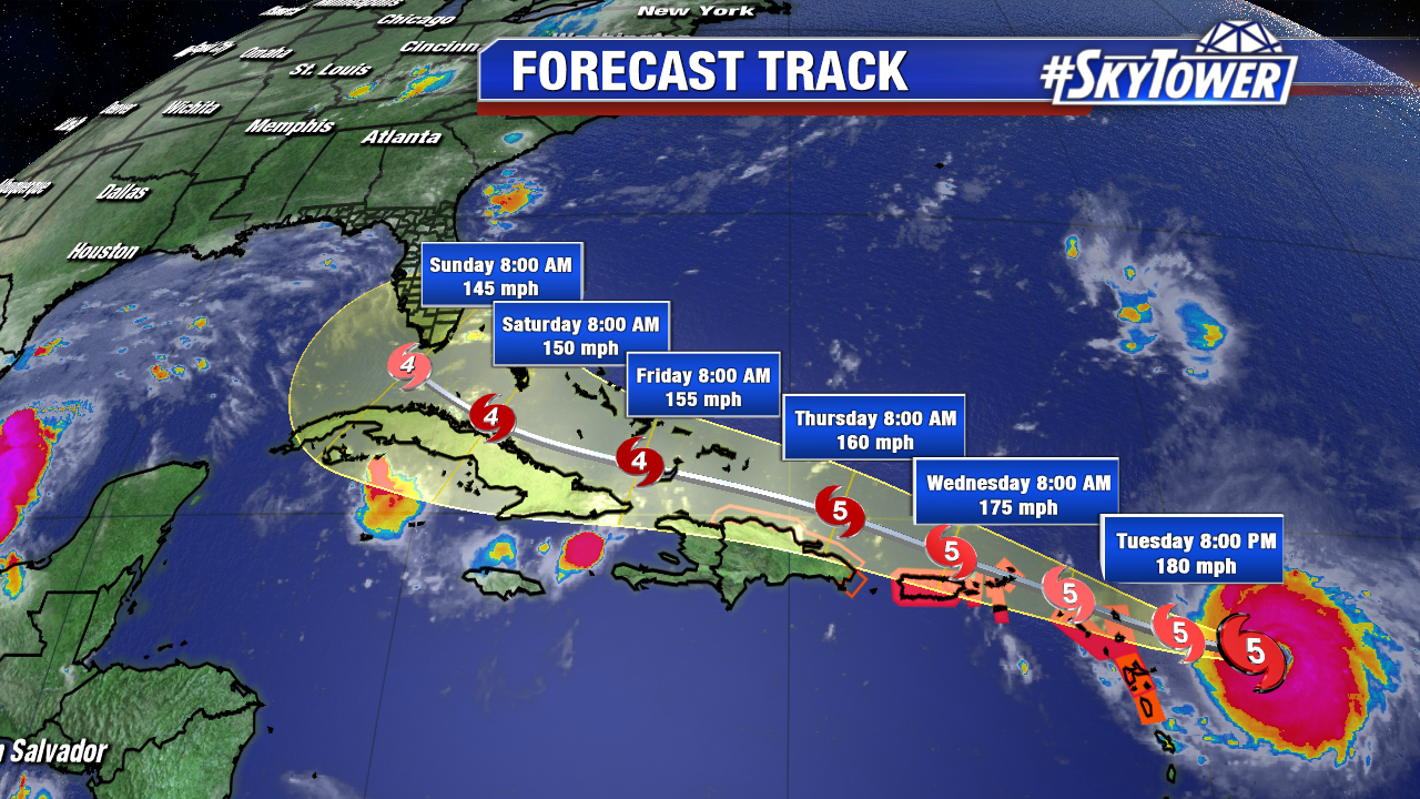
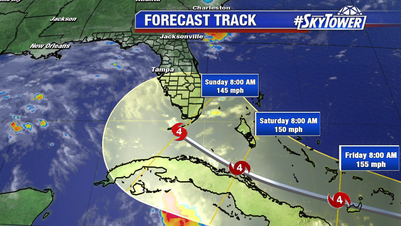
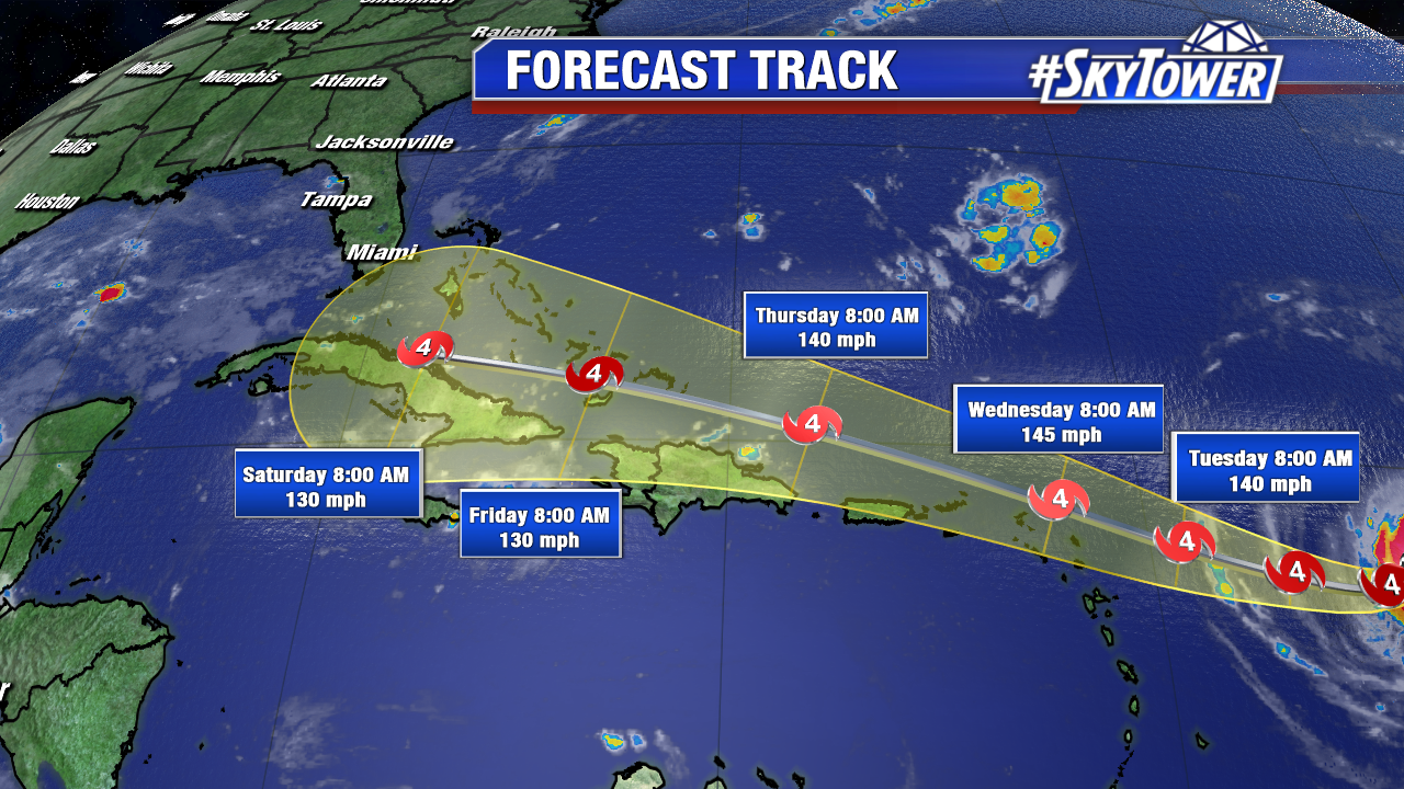
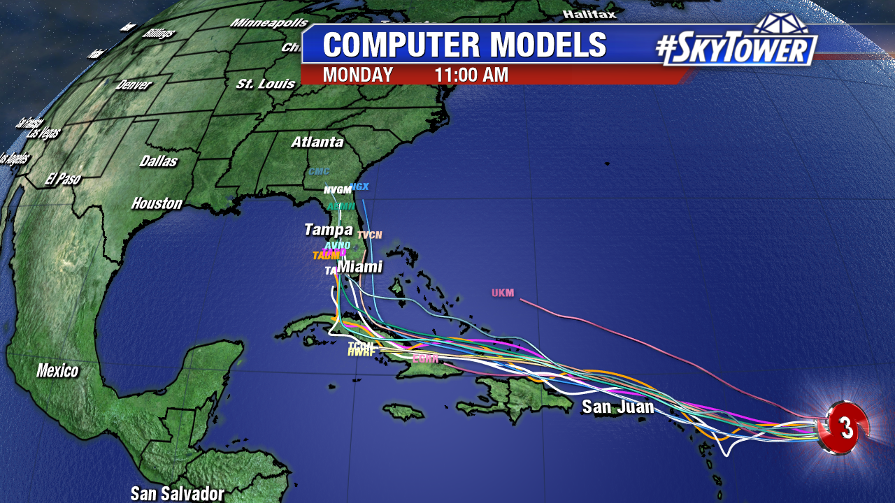
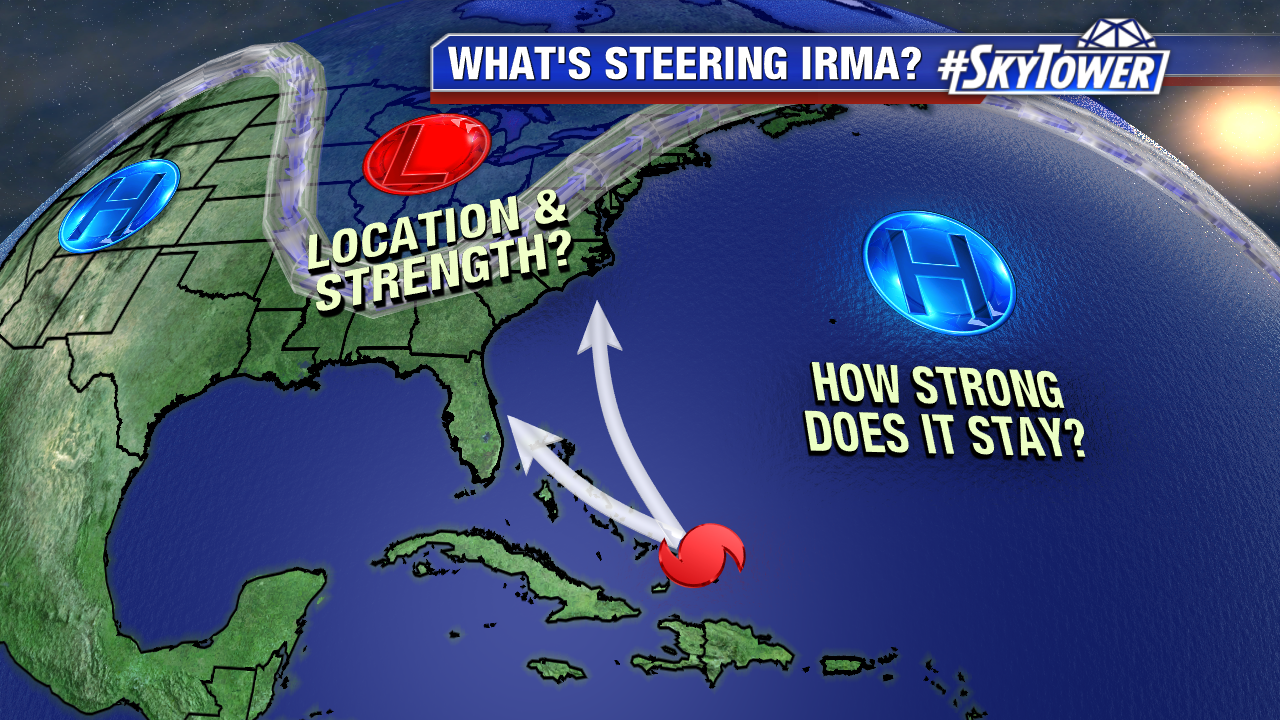
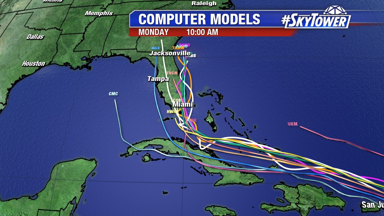
All eyes are on when Irma makes its northern turn, which could be a sharp one. As of Tuesday morning, models anticipate the northern turn at some point Saturday. The timing is key for Florida. It looks increasingly likely that Irma makes landfall in South Florida. The complicated upper level pattern could change in the upcoming days. This is the flow that steers Irma. As of early Tuesday the Bermuda will likely steer the powerhouse storm over the next 7 days. A strong trough sits over the east coast mid to late week. It looks to lift out and open the door for the Atlantic Ridge to build back in. This guides Irma northward near, or directly over the Sunshine State. While model consensus is not in Florida’s favor, a few more models are shifting slightly further east. Keep in mind the 4 and 5 day track record is 175 miles and 225 miles, respectively. If you haven’t done so already, make preparations for a possible major hurricane if you live in South Florida. It still too early to talk specific wind, rain and, storm surge impacts. We should have a better idea by Thursday. Hurricane Hunters are out there around the cloud. Their data will help computer models gain clarity on the long-range track. Additional upper air soundings across the central U.S. will also help models get a handle too.
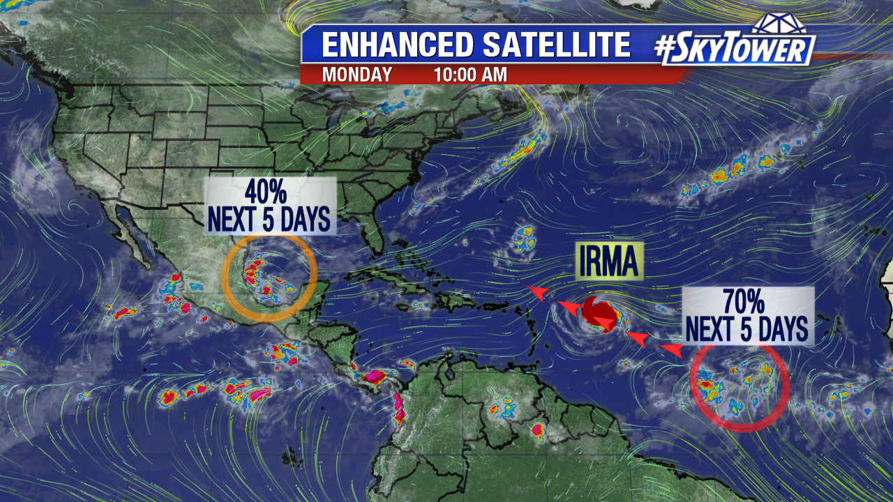
Elsewhere, Tropical Storm Jose forms at 11 AM in the central Atlantic. It is the 10th named storm of the 2017 Atlantic hurricane season. This is more than a month ahead of schedule. On average, the 10th named storm of the Atlantic season forms on October 19th. It will likely become a hurricane well east of the Lesser Antilles Thursday or Friday.