Irma Loses Tropical Characteristics-Cleanup Far From Over; Jose No Current Threat to the U.S.

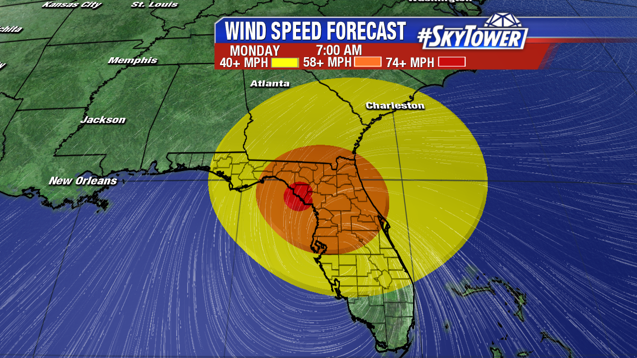
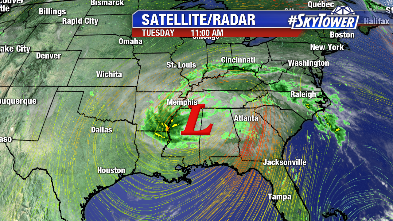
Irma lost tropical characteristics Monday evening, but cleanup efforts are only beginning. The massive former category 5 hurricane brought flooding, storm surge, hurricane force winds, isolated tornadoes, and off course millions of power outages to Florida and parts of the Southeast. Impacts were felt well from the center of circulation due to the massive size of Irma. The remnants of Irma bring lingering showers to the south central U.S. Tuesday.

florida-satellite-radar-weekend-am

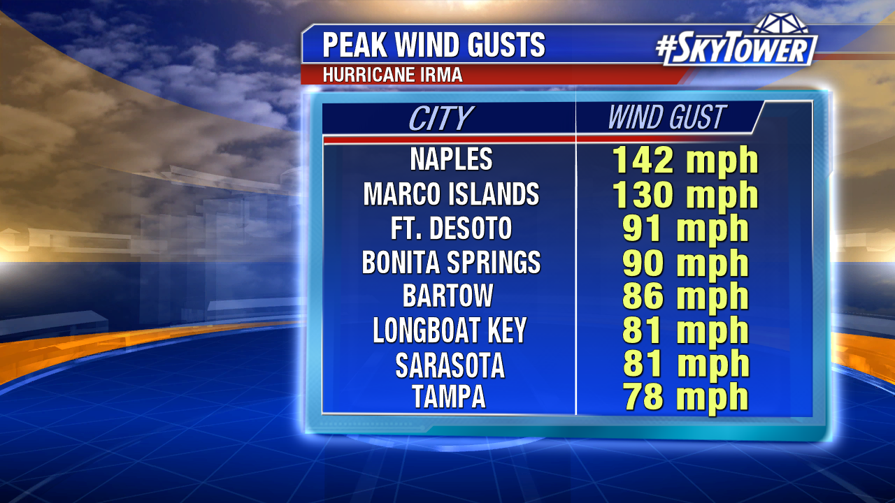
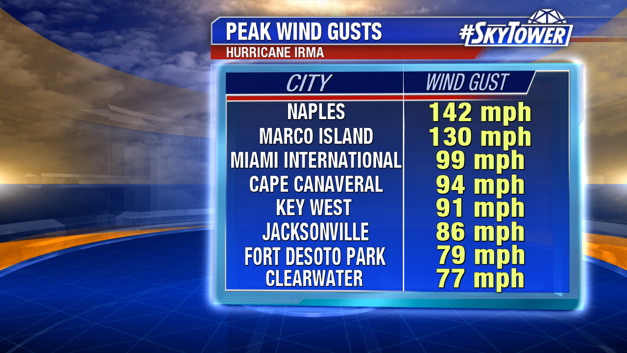
Here are some of the peak wind gusts across Florida.  Gusts well over hurricane force were felt throughout two-thirds of the state. A max gust of 142 mph was reported in Naples. Winds gusted to near 100 mph at Miami International Airport and to 77 mph in Clearwater.

peak-wind-gusts-2

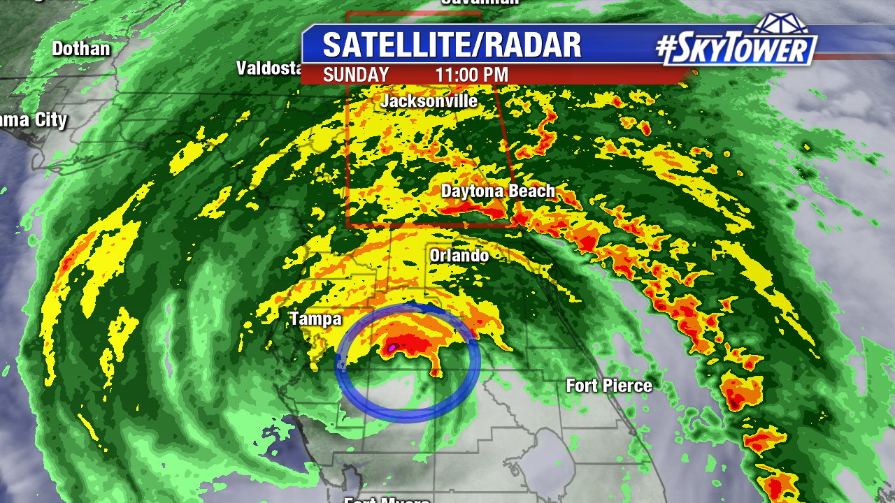
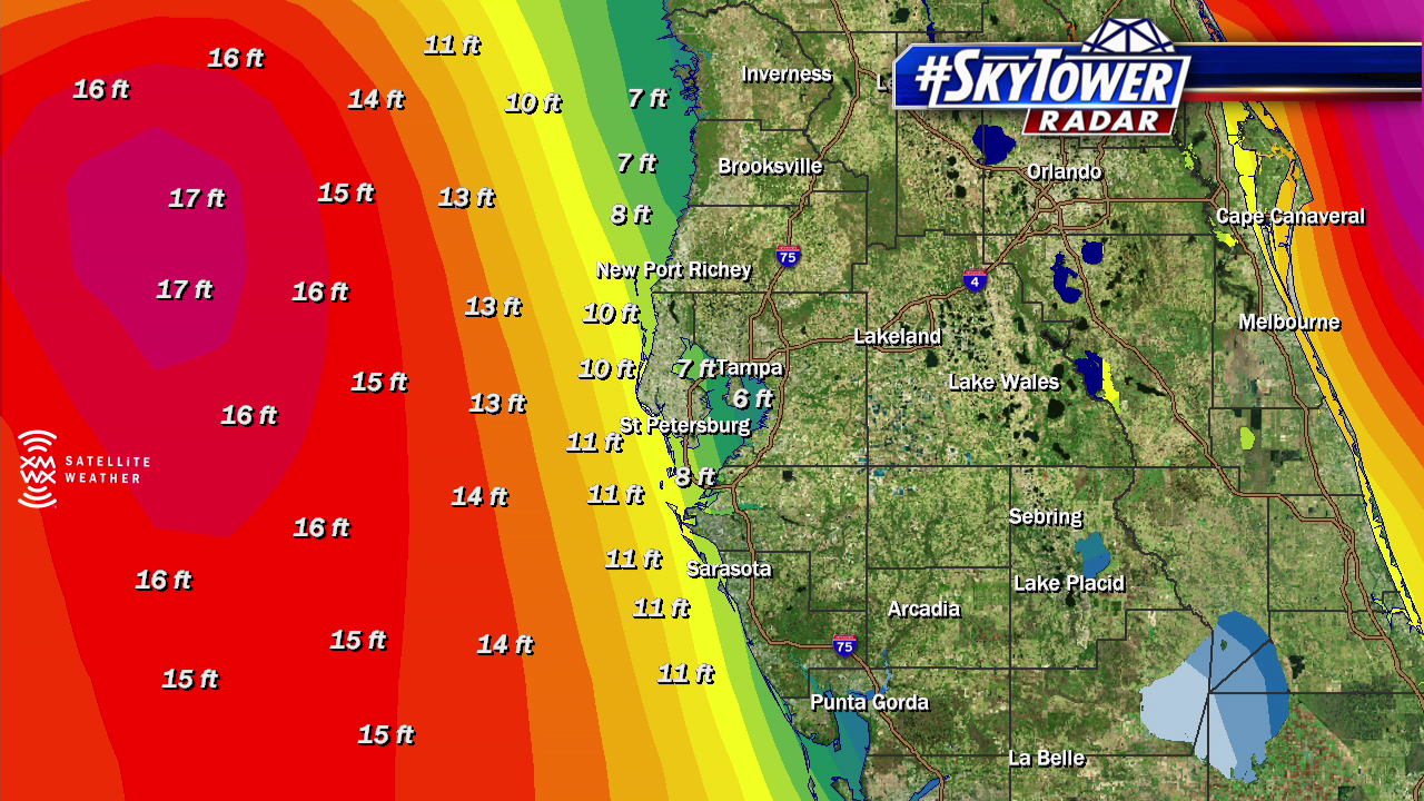
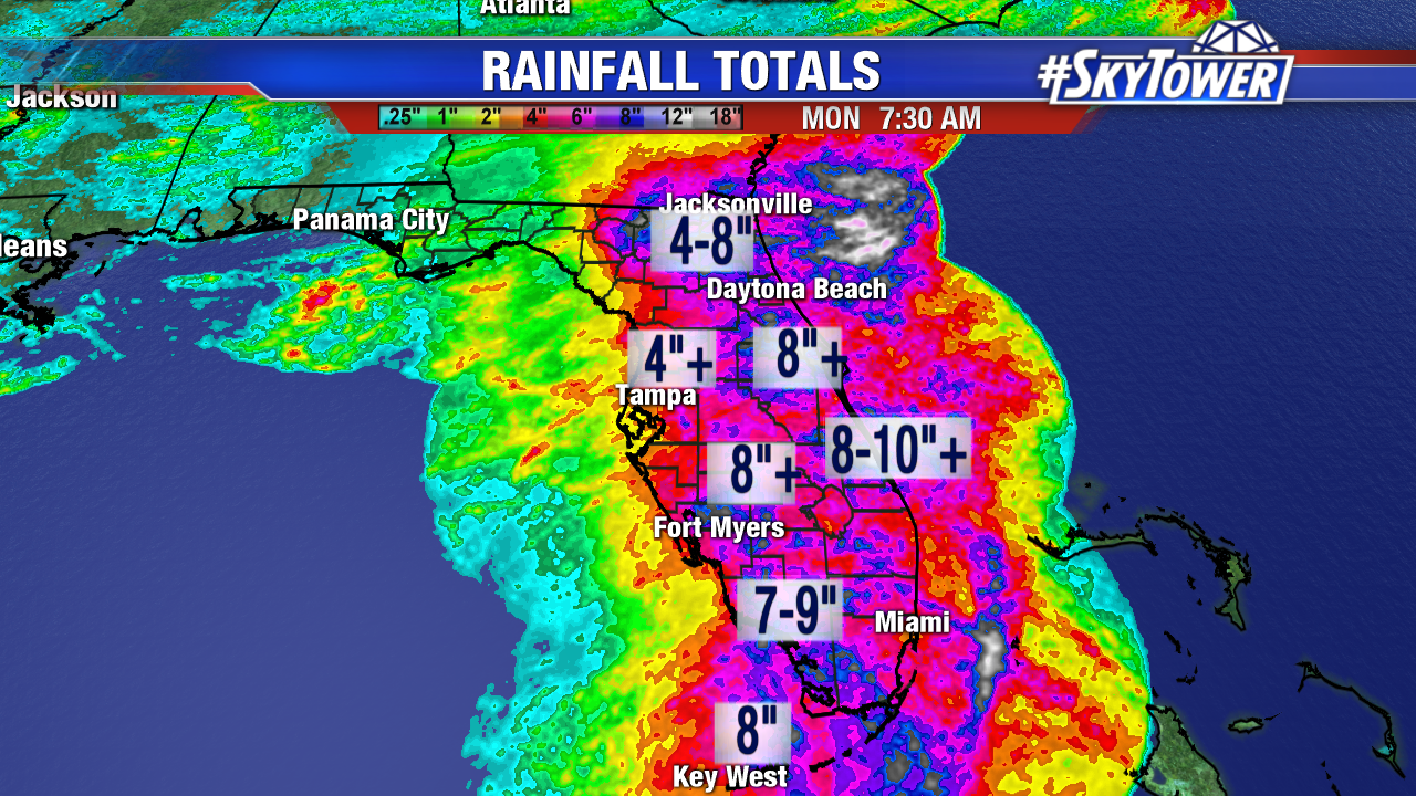
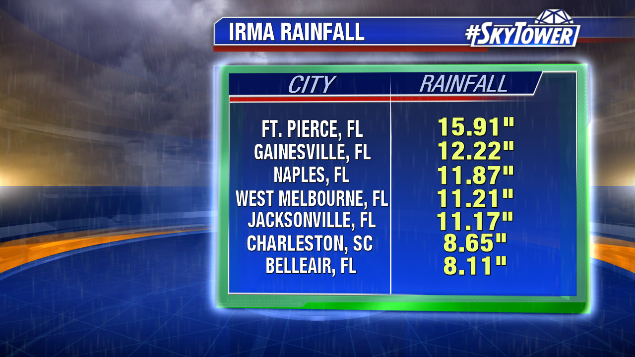
Freshwater flooding is ongoing due to tremendous rainfall. In combination with coastal flooding from storm surge, many river levels are at record heights. Fort Pierce, Florida saw nearly 16 inches of rain.  On the east side of the powerful former major hurricane West Melbourne and Jacksonville International Airport saw 11″+ of rain. Flooding also occurred in coastal Georgia and South Carolina Monday. The St Johns River near Downtown Jacksonville rose to a record 5.57 feet. According to the National Weather Service in Jacksonville, storm surge surpassed levels previously set during Hurricane Dora in 1964. Downtown Charleston, South Carolina was under water too. A surge of 9.92 feet was recorded there; it’s the third largest storm surge in the city’s history. Southeast Florida, including Miami, still recovers from coastal flooding too.

rainfall-totals-2

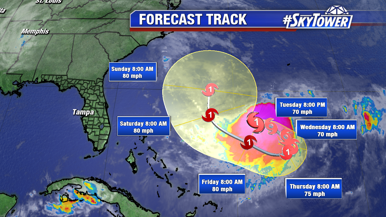
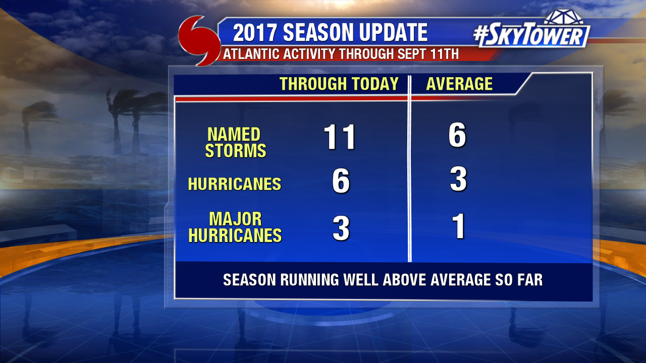
The 2017 Atlantic season is well above average. Two major hurricanes, Harvey and Irma, have made landfall in the U.S. in just two weeks. So far there are 11 named storms, 6 hurricanes, and 3 major hurricanes. That is pretty much the average number of storms we typically see in an entire Atlantic season.

2017-season-update

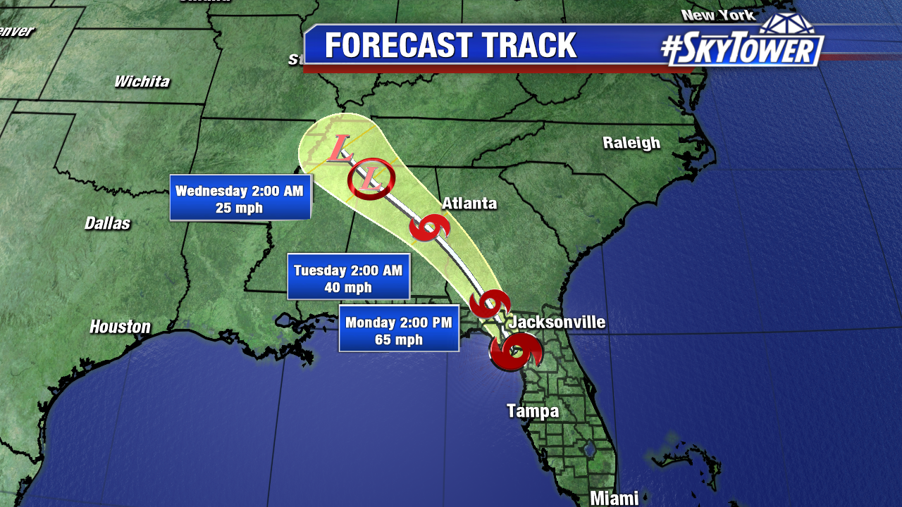
We are down to one named storm, Hurricane Jose in the Atlantic. There is not much to steer Jose in the coming days. Models keep Jose well east of the Florida over the weekend. As it lifts northward, it is likely to stay out to sea, but could bring some swells to the Mid Atlantic by mid-week. We’ll keep an eye on it.

jose

Irma Brings Hurricane Conditions to Tampa Bay; Area Spared From the Worst

Irma lashed Tampa Bay late Sunday and early Monday. After landfall in Naples as a major hurricane Sunday afternoon, it stayed on a northerly track. In combination with some higher wind shear and a disruption from Cuba, the storm was weaker than anticipated in Central Florida. The eye wall raked Hardee, Desoto and Polk county late Sunday/early Monday damaging structures with wind gusts of 80-100 mph. Populated areas like Sarasota, Tampa and St Pete missed the eye wall, but still saw hurricane force wind gusts.

florida-satellite-radar-png444

Southwest Florida was slammed with major hurricane force wind gusts. A peak gust of 142 mph was recorded in Naples. Fort Desoto in Pinellas saw a wind gust of 91 mph. Winds gusted 60-80 mph+ through most of Tampa Bay, including a gust of 78 mph in Tampa.

peak-wind-gusts-2-png1212

After Irma made landfall, its wind field grew substantially. As of 8 AM Monday the tropical storm wind field is over 400 miles from the center. This includes most of Florida, parts of southeast Alabama, Georgia, and South Carolina.

wind-radii-png3

The center of Irma passed well inland, with eye passing through Hardee and Polk county. The massive storm exits and an early Monday morning high tide has passed. Gusty westerly winds stir up the Gulf of Mexico. While a significant storm surge is unlikely, there could still be some minor coastal flooding as waves moves back in (especially when winds veer southwest). As of 9 AM, wave heights build to 6-10 feet near shore. Higher waves settle in throughout the day. It will stay choppy the next few days.

fastrac

Rainfall totals were substantial around the state, but this was not a long lived rain event. Most of the rainfall from Irma fell within 24 hours. Up to 8-10″ fell in Southeast Florida with 4-8″+ in the Tampa Bay area.

24-hr-rainfall-totals

Irma moves into the Southeast the next two days and brings with it gusty winds and steady rain.

irma-track-png34