Jose Set To Flirt With East Coast; Two Other Areas To Watch In Atlantic

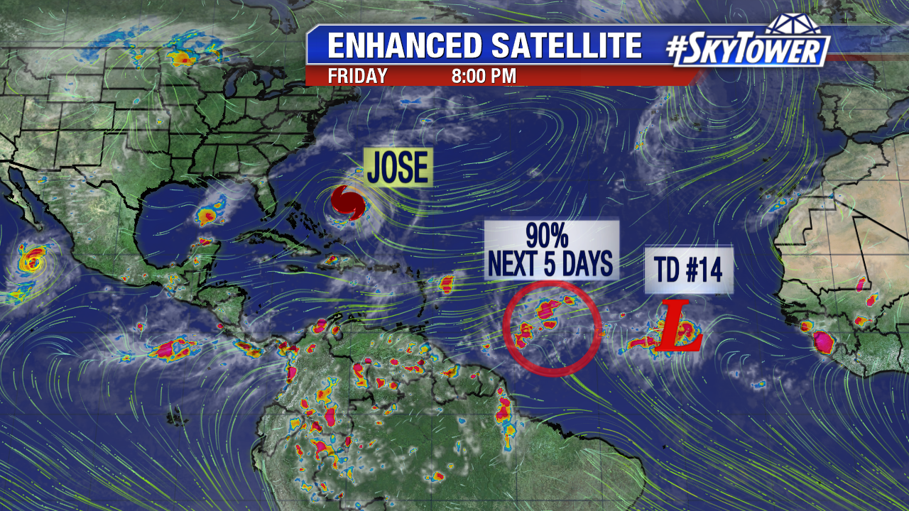
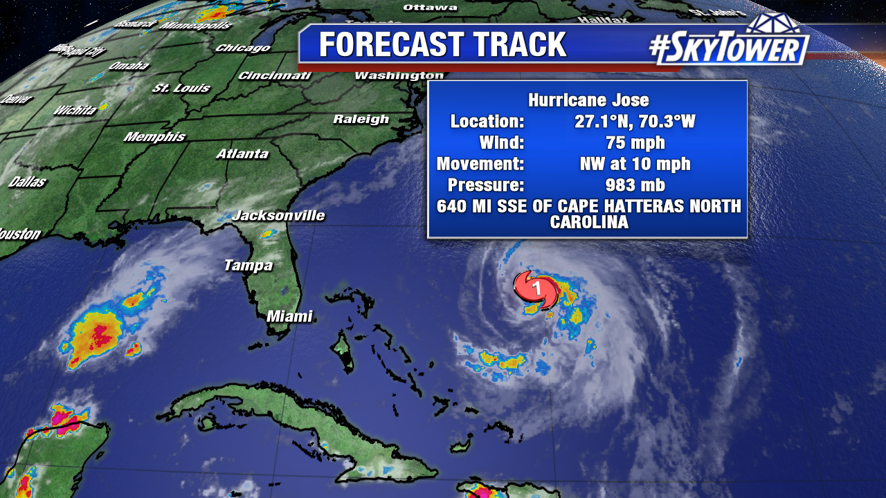
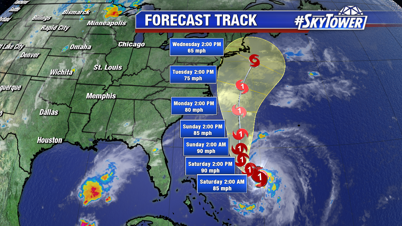
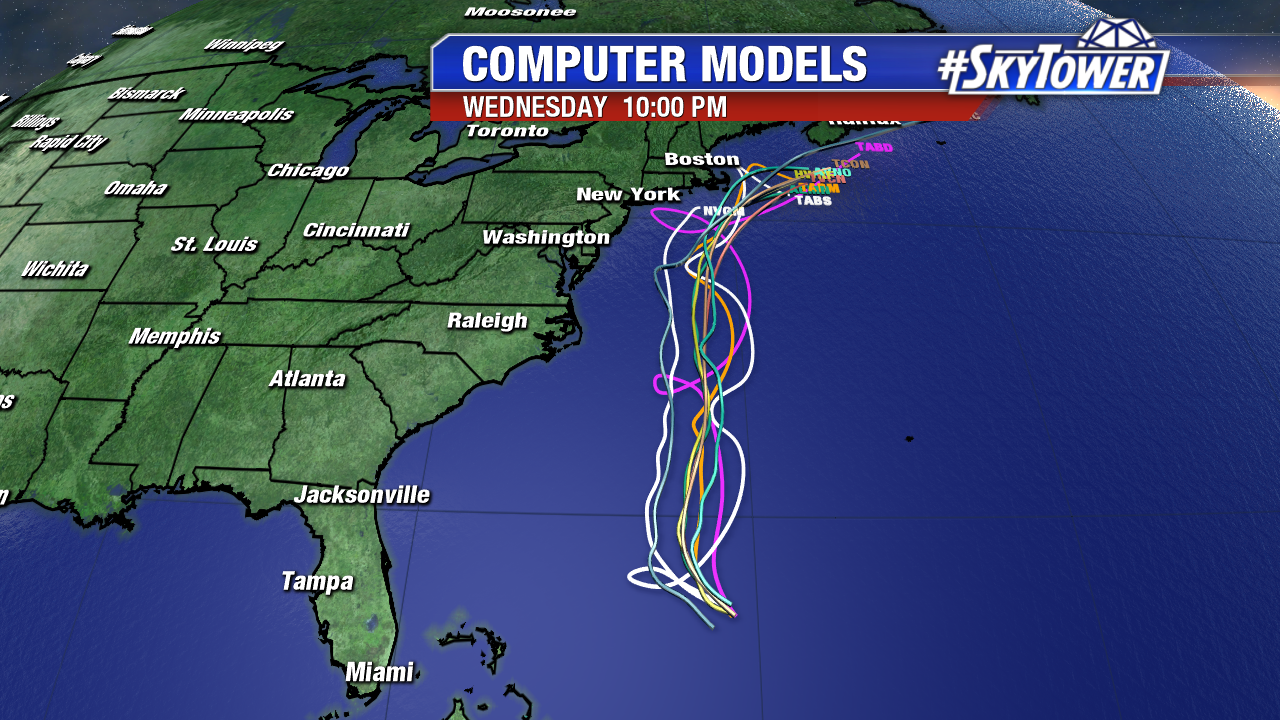
As we close out the work week, Jose is back to hurricane status. As of Friday evening sustained winds were at 75 mph and it was moving NW at 10 mph. This system won’t have an impact on anyone through the weekend, other than kicking up the surf a bit from the east coast Florida up through the Carolinas. Looking ahead to next week, folks in coastal New England will be watching this closely as it moves up from the south.

jose

jose-2

invest-91l-models

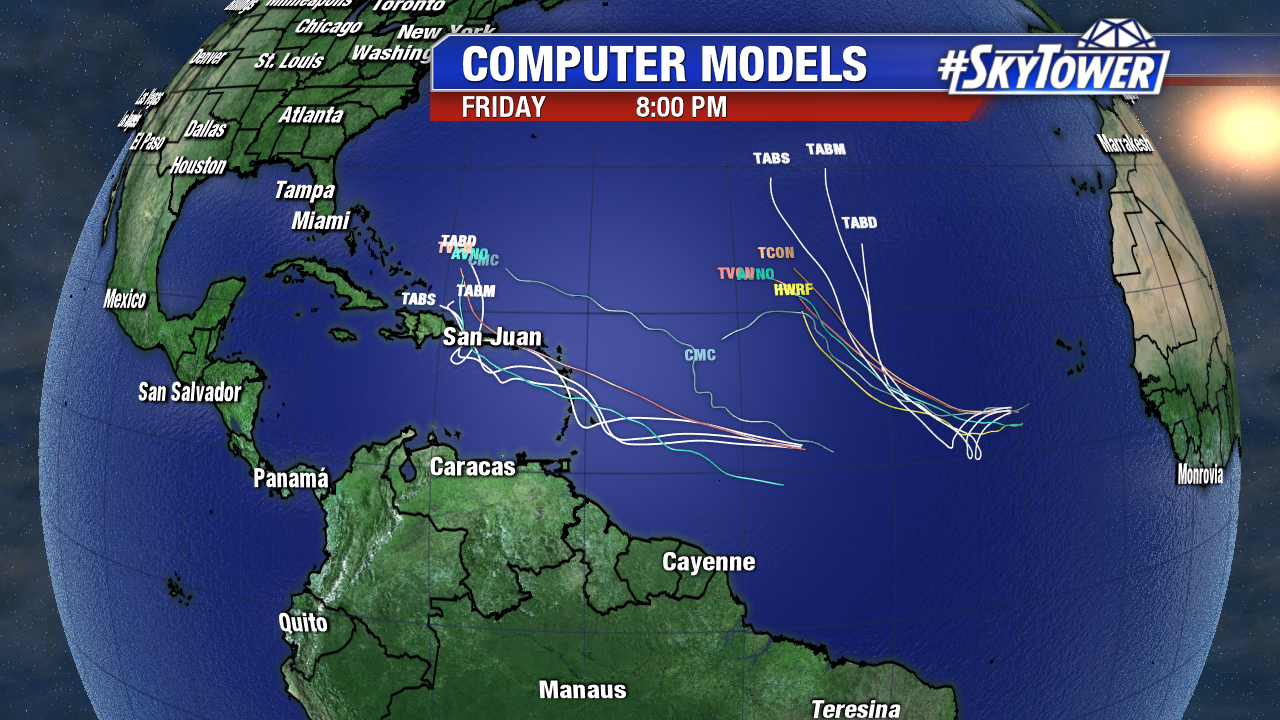
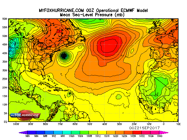
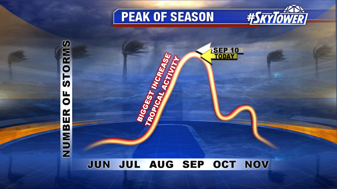
Elsewhere in the Atlantic we have two systems to watch, no surprise given the fact that we are only a few days past the peak of hurricane season. Invest 96-L and Tropical Depression 14 are likely to become Maria and Lee, respectively, over the next few days. TD 14 looks to stay over open ocean, but Invest 96 will need to be watched closely as it moves WNW over the next week. Tropical storm or hurricane watches are possible for portions of the Lesser Antilles over the weekend.

atlantic-wide-2d-ir-enhanced

invest-97l-model


Jose Meanders in the Atlantic; No Immediate U.S. Threats

Hurricane Jose meanders well east of the Bahamas Wednesday. It interacts with some higher shear and is a minimal hurricane at 11 AM. Jose will make a slow clockwise loop the next few days before paralleling the east coast as a tropical storm. It will not impact the U.S for at least the next 5 days, if at all. The long-range Jose steering is quite complex, so keep an eye on it in the Mid Atlantic and Northeast next week. Interest in Bermuda should also monitor the progress of Jose.

floater-ir-enhanced-2

jose-png-2

After two back to back U.S. major hurricane landfalls, there are no other areas of immediate concern. The Euro suggests a tropical storm may develop near the Lesser Antilles early next week. Fortunately, wind shear looks to keep this possible future tropical cyclone weak. It’s worth watching.

ecmwf_atl_mslp_9

It is the peak of the Atlantic hurricane season and the potential for more strong hurricanes exists. There is a secondary peak in October. Fronts are more active during this time and tropical systems can be guided northward towards Florida/the Southeast U.S..

peak-of-hurricane-season-with-season-recap