Tropical Depression 16 Forms-To Become Nate; Headed For the Gulf This Weekend

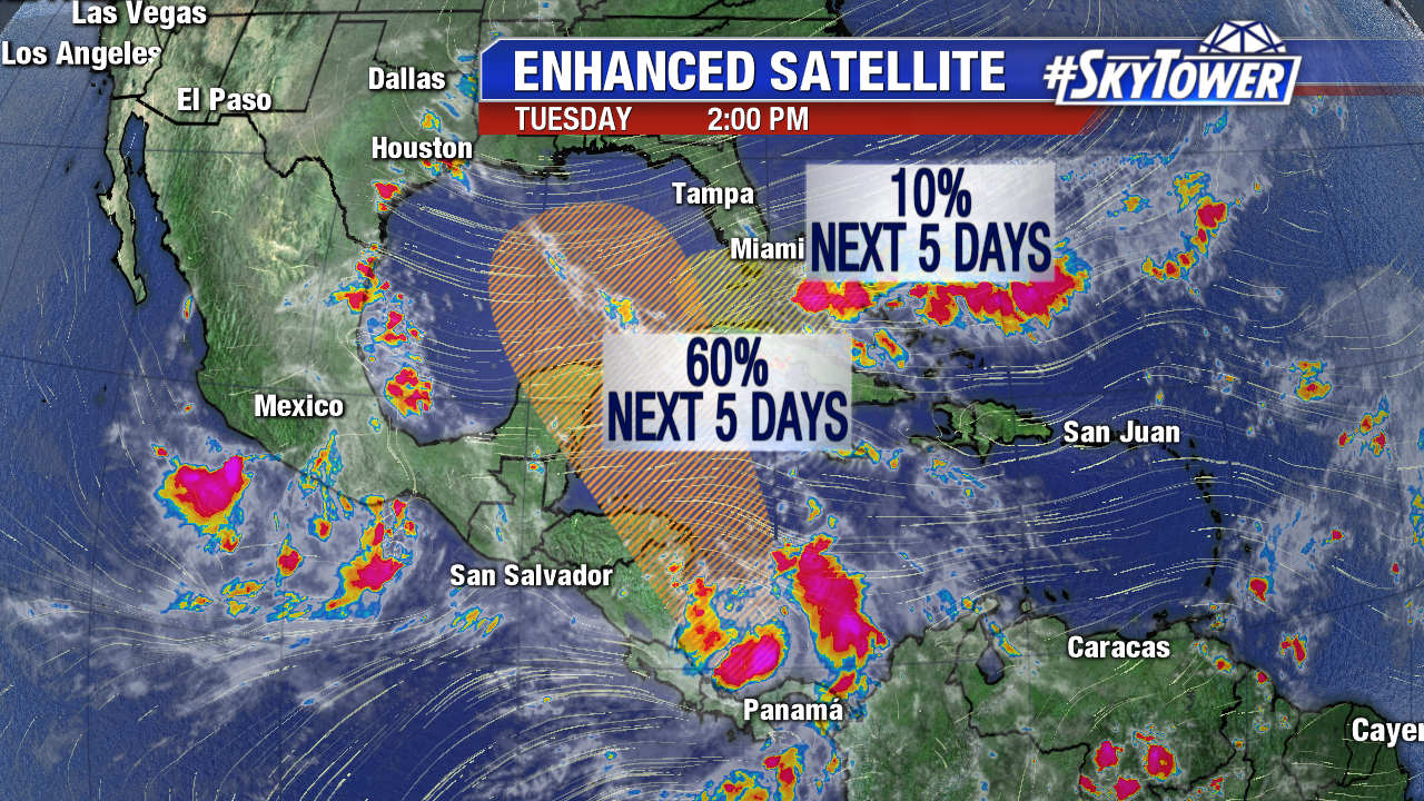
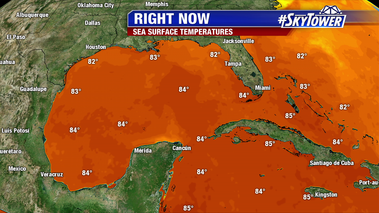
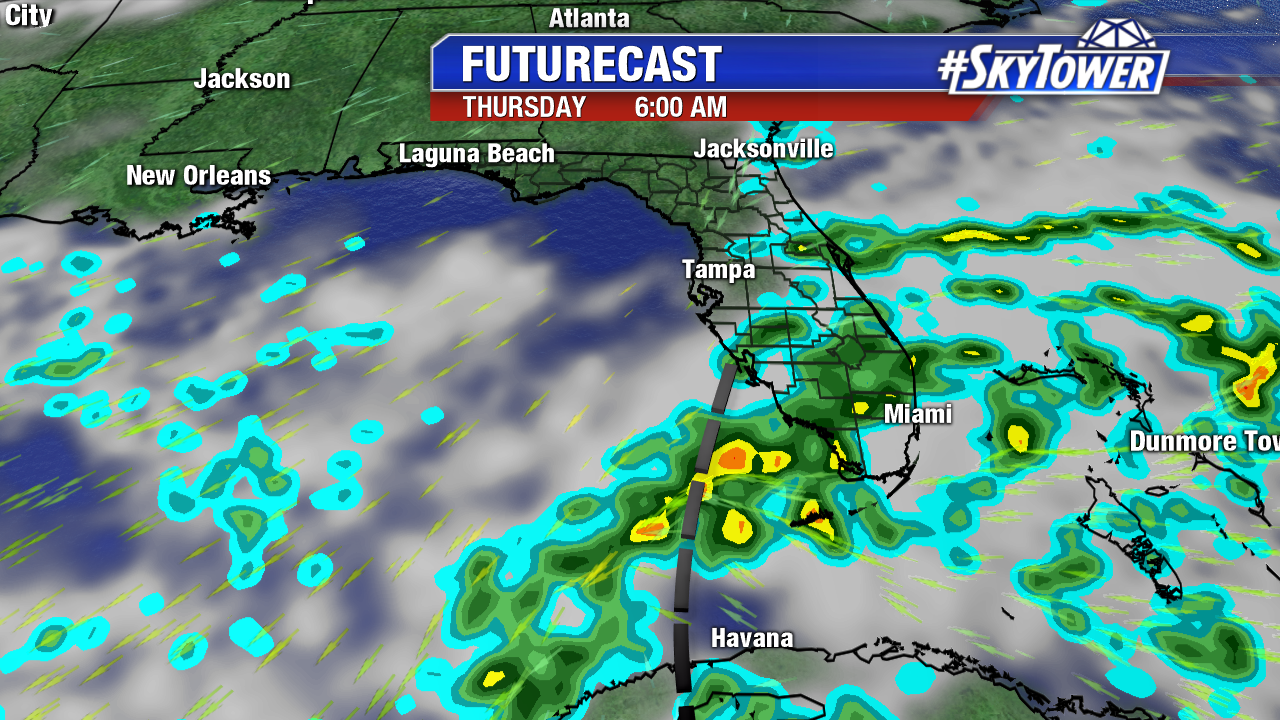
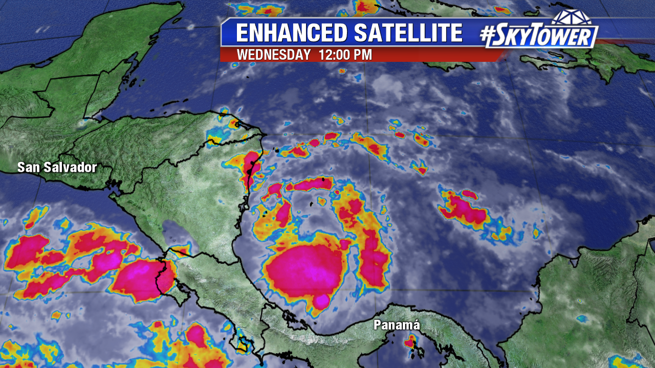
Tropical Depression 16 forms in the southwest Caribbean at 11 AM Wednesday and an upgrade to Tropical Storm Nate is likely. Hurricane Reconnaissance Aircraft are en route to investigate the new tropical cyclone midday Wednesday. The data from the afternoon mission will be ingested into Wednesday evening computer models. This data is much needed, as Nate will threaten the northern Gulf coast, including Florida, as a strengthening storm. A hurricane is on table at this point.  As we’ve seen multiple times this season, systems are prone to strengthen rapidly this year. Water temperatures in the future path of Nate are in the low to mid 80s. Wind shear remains favorable for steady intensification in the Caribbean. By the time future Nate enters the Gulf late Friday/early Saturday, hostile upper level winds maybe much lower too. Interest along the northern Gulf coast from Louisiana to Florida need to pay close attention to the forecast, as a Gulf landfall appears likely. It is too early to talk specifics, but heavy rain, strong winds, spin up tornadoes, and storm surge are all expected. Even if Nate makes landfall west of Tampa Bay, the flood prone area is on the messy east side of future Nate. A southwest wind would induce coastal flooding/storms surge, as was the case with Hermine in 2016.

floater-ir-enhanced-2

nate

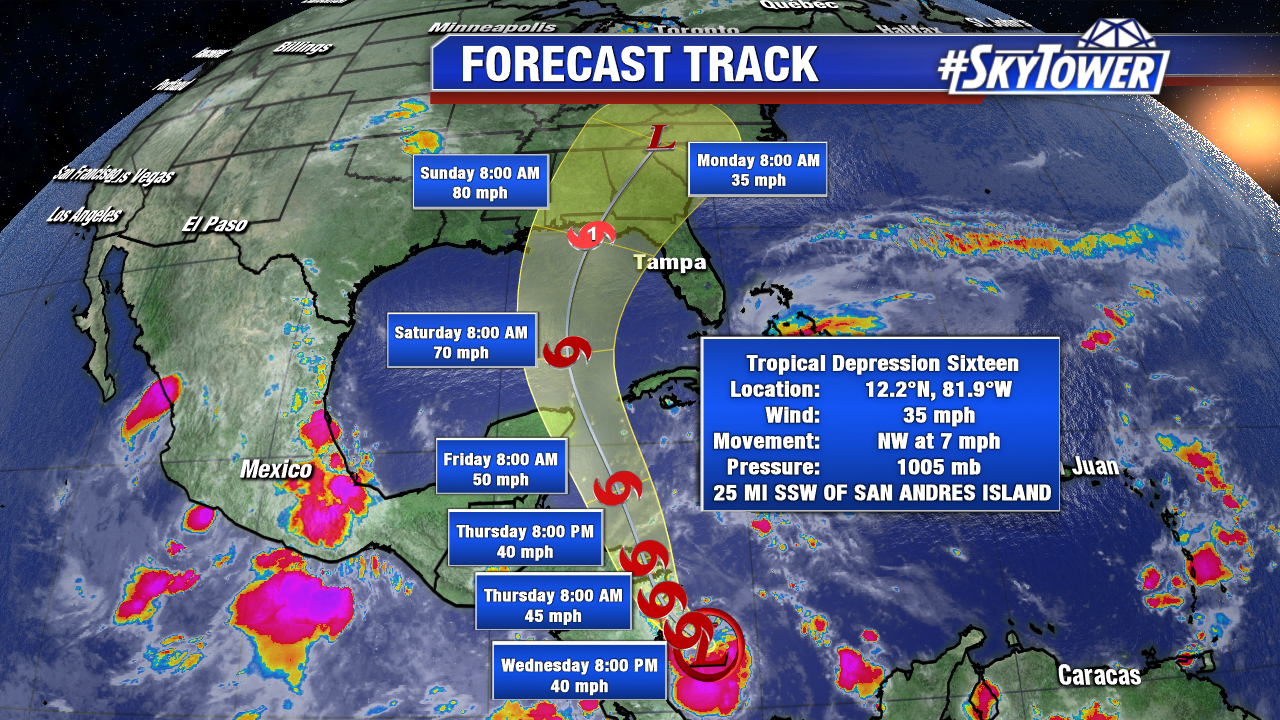
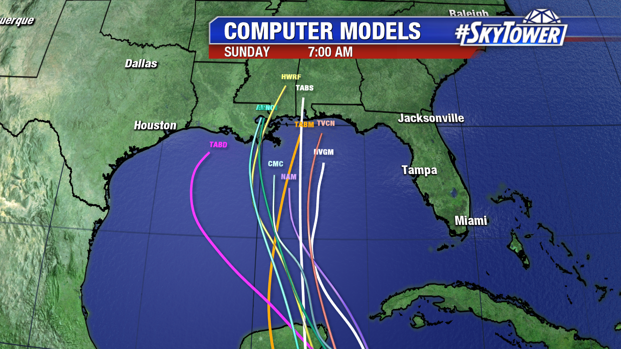
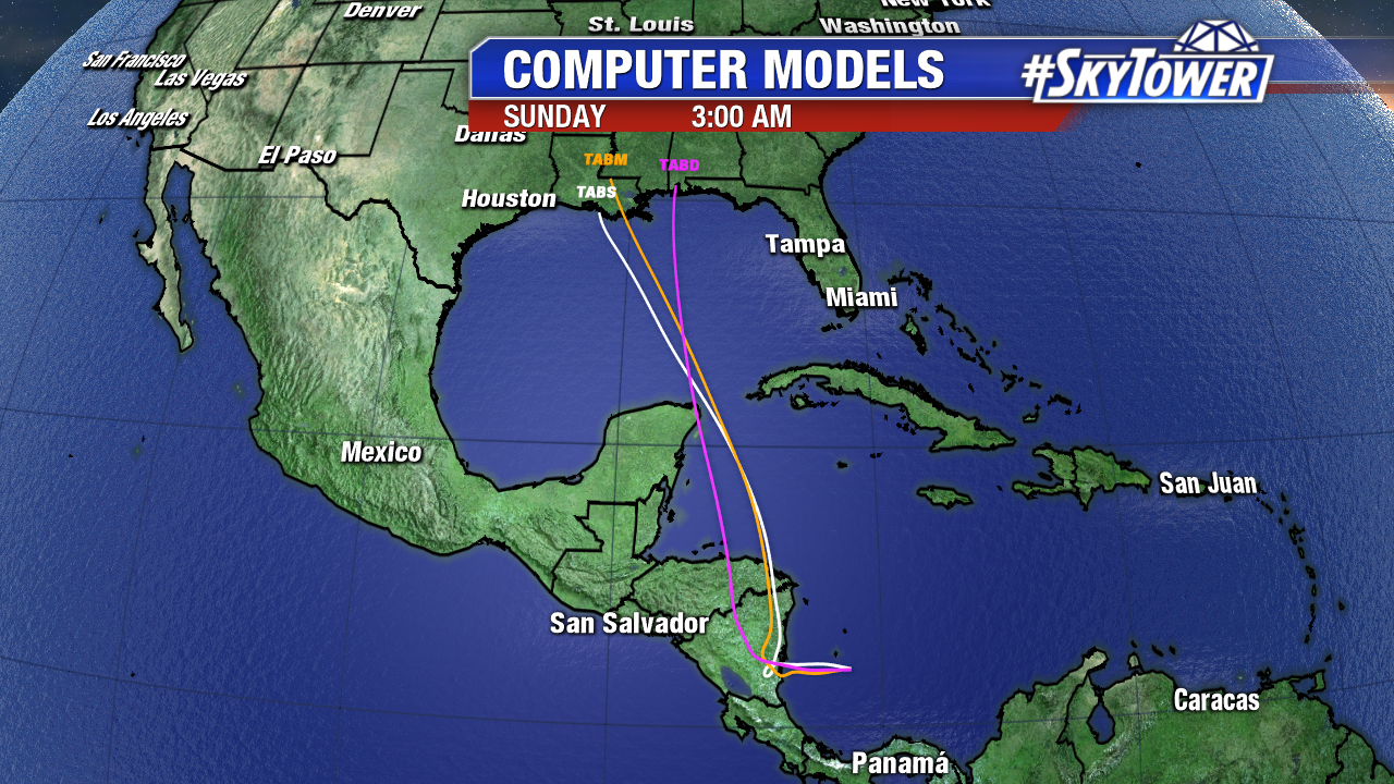
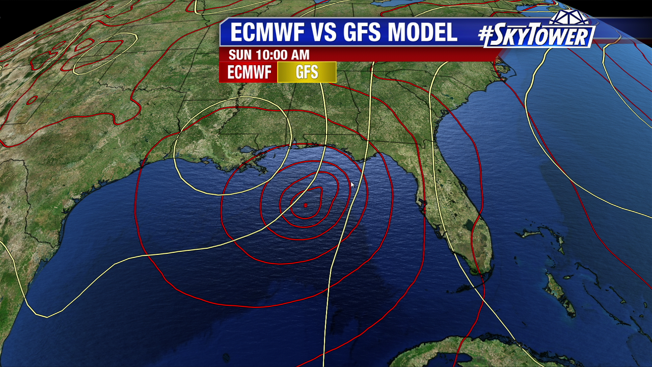
There is quite a spread in Wednesday morning computer models. This is very common, with a weak, newly formed tropical depression. The time frame for greatest Gulf coast impacts will be Saturday and especially Sunday. Coastal Louisiana to the Panhandle of Florida are all on the table for a possible landfall. Intensity is still in question too. The GFS is further west than the ECMWF. The GFS hints at Louisiana while the Euro eyes the Florida Panhandle. Stay tuned and informed.

invest-90l-models


Watching Invest 90L in the Caribbean; Headed for the Gulf by Saturday

While there are no named storms Tuesday, it looks increasing likely that Tropical Storm Nate will form in the Caribbean over the next few days. A broad area of low pressure, now pinned Invest 90L forms in the southwest Caribbean. Wind shear is incredibly high in the Gulf and portions of the western Caribbean. It is much lower in the southwest Caribbean near Invest 90L. This favors gradual organization. Invest 90L will lift northward through the end of the work week. While upper level winds will be elevated during this time, water temperatures are plenty warm for tropical cyclone development. Invest 90L heads for the Gulf of Mexico by Saturday morning. It is too early to say where future Nate will head, but interest in the northern Gulf coast from Louisiana to Florida need to stay informed.

Also of note is tropical wave near Cuba and southeast Florida. High westerly shear keeps the slug of moisture disorganized as it moves westward. It has a low chance of become a tropical depression/named storm over the next 5 days. Regardless of tropical development, wind gusts could approach weak tropical storm force in south Florida through Thursday. Heavy rain is also likely through late work week.

tropical-explainer-png1

invest-90l-models-png1

As high pressure slips east in the Atlantic, future Nate lifts northward in the Gulf of Mexico and threatens the northern Gulf states Sunday and Monday. The European model has trended a little stronger over the past 24 hours. As of Tuesday afternoon, it suggest a hurricane moves into the Florida panhandle Sunday night. The GFS isn’t as strong as the EURO. It’s also further west with a coastal Louisiana track. Intensity and track will likely change in the coming days. There is no center or circulation for models to initialize on just yet. One thing for sure is we’ve seen how named storms can strength rapidly this season, if the upper level winds are favorable.

lynx-pngmodel-comparison

This is why October is a vulnerable month for Florida and Southeast U.S.. Water temperatures are still in the low to mid 80s, which is plenty warm for storms to strengthen. Much of these waters have been untouched by named storms this season.

lynx-pngwater-temps

The RPM model/Futurecast shows the tropical wave near Florida moves in the Gulf Thursday and Friday. As it does so, it yanks tropical moisture over south Florida.

florida-12km-rpm-futurecast-weekend-am-png1