Nate Headed North; Yucatan Peninsula Up Next; Central Gulf Coast This Weekend

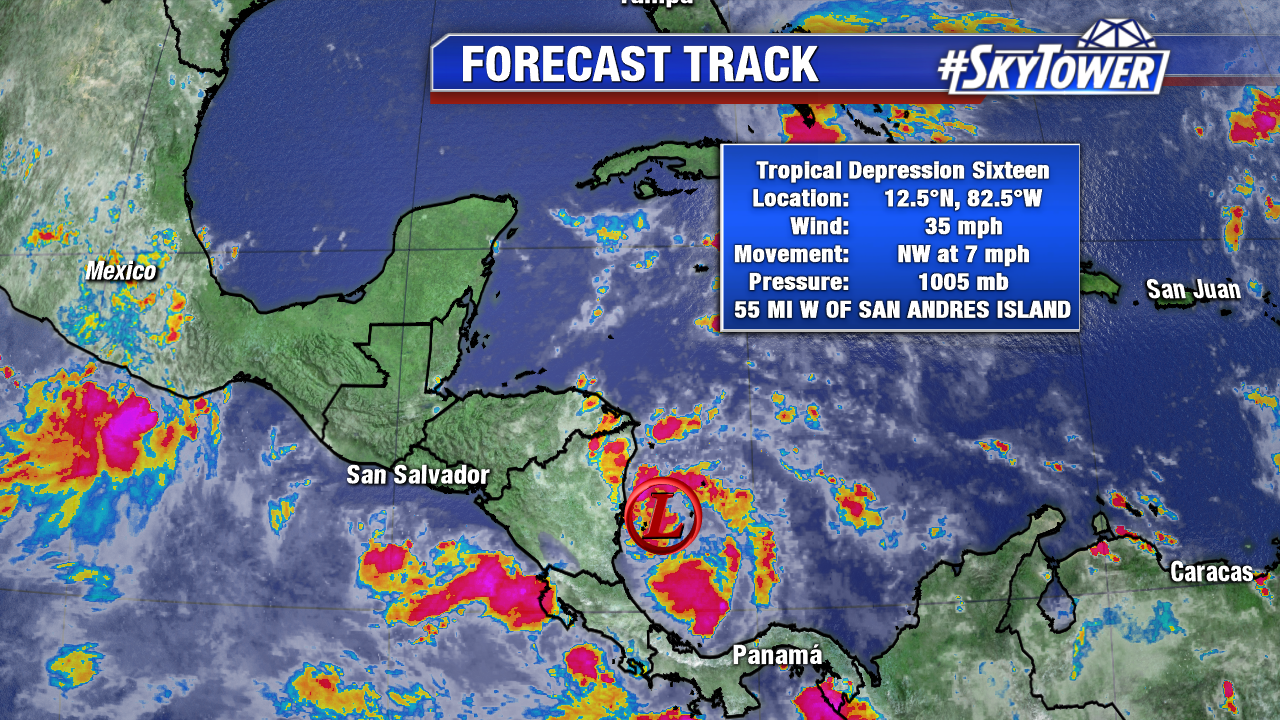
As of 8pm Thursday, Tropical Storm Nate was located near the coast of Honduras. Sustained winds were at 40 mph. The system has been battling some wind shear today, as well as land interaction with Central America, but it will once again move into open water in the western Caribbean late tonight. Further organization is strengthening is likely over the next 24 hours.

nate

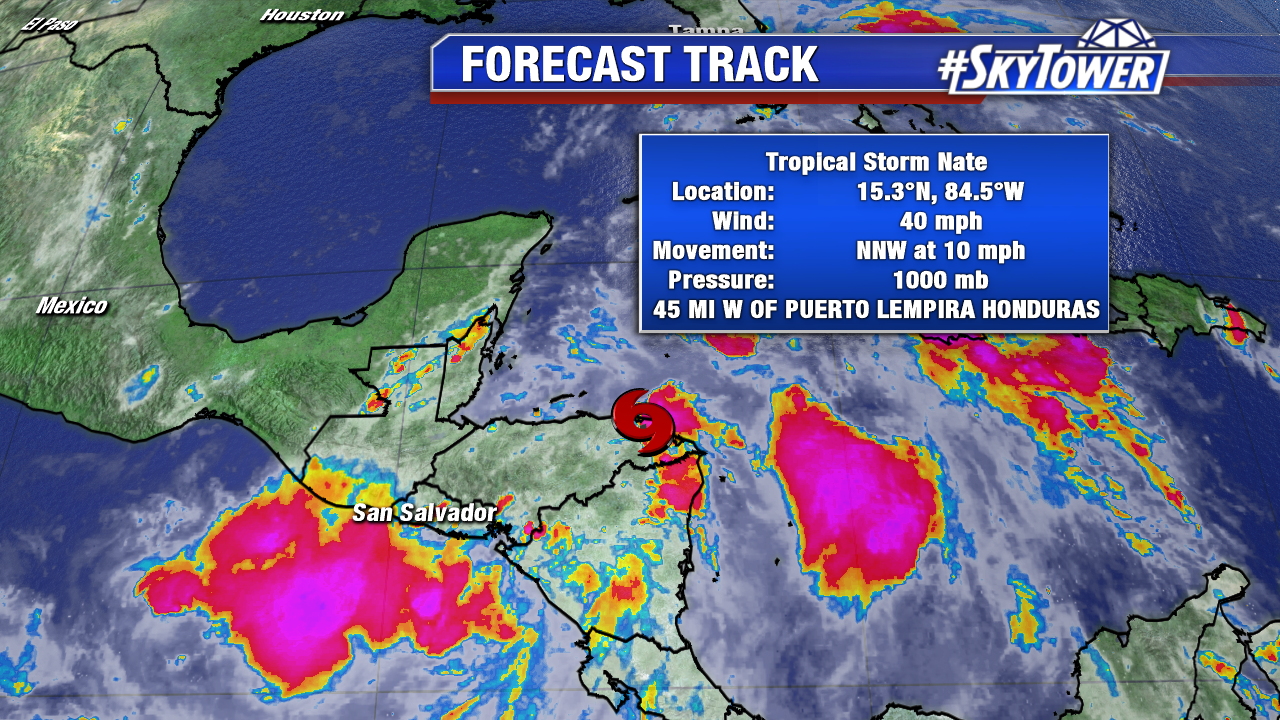
Heavy rains have fallen across parts of Nicaragua and Honduras. Flash flooding and mud slides remain a possibility in these areas over the next day or so.

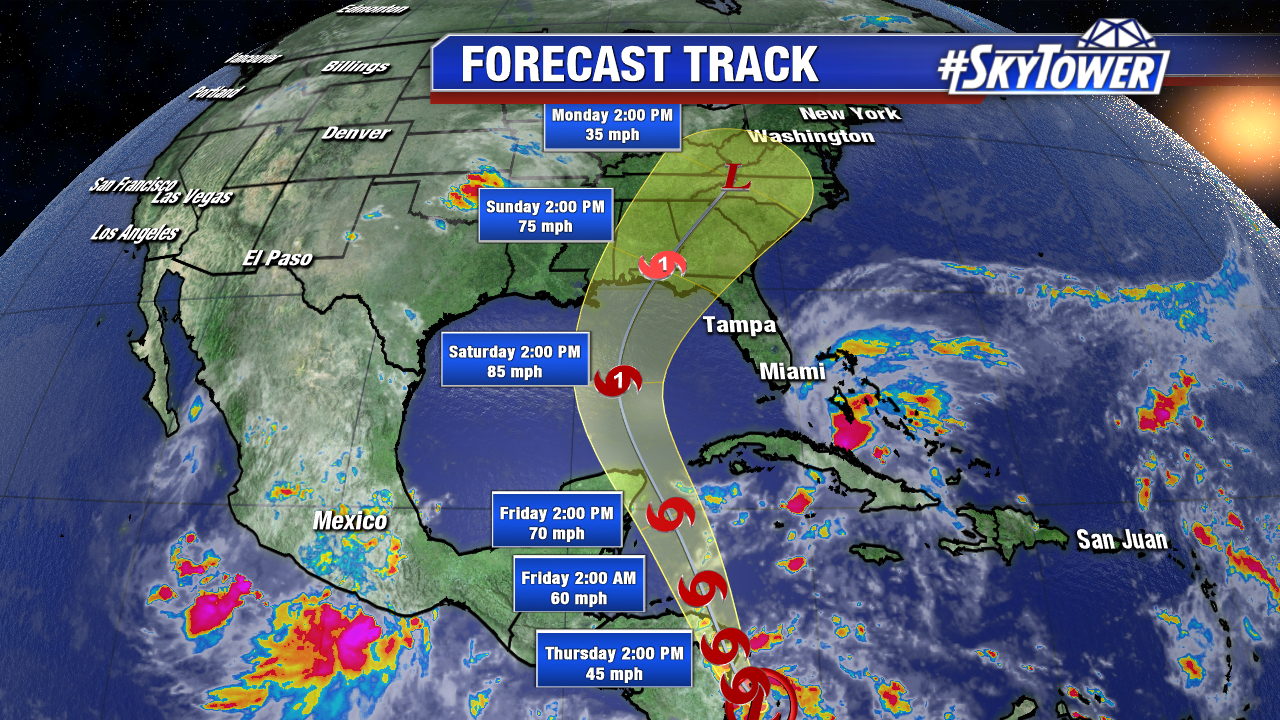
Up next is the Yucatan Peninsula. Nate is forecast to be near hurricane intensity when it approaches the Yucatan late Friday, bringing direct
impacts from wind, storm surge, and heavy rainfall. A tropical storm
warning and a hurricane watch are in effect for a portion of this
area.

nate-1

invest-90l-models

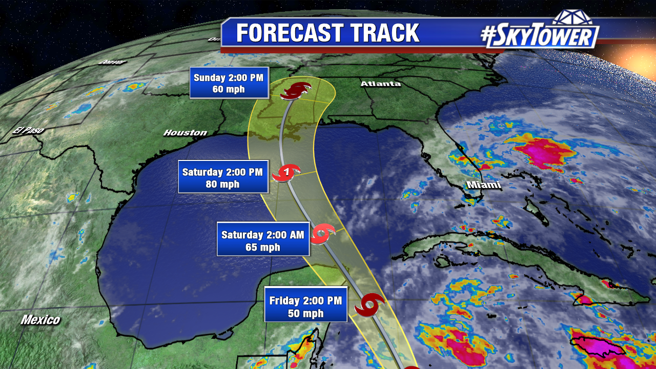
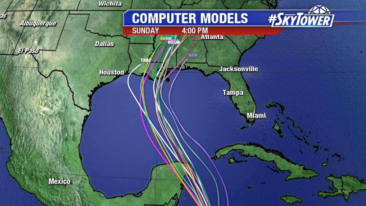
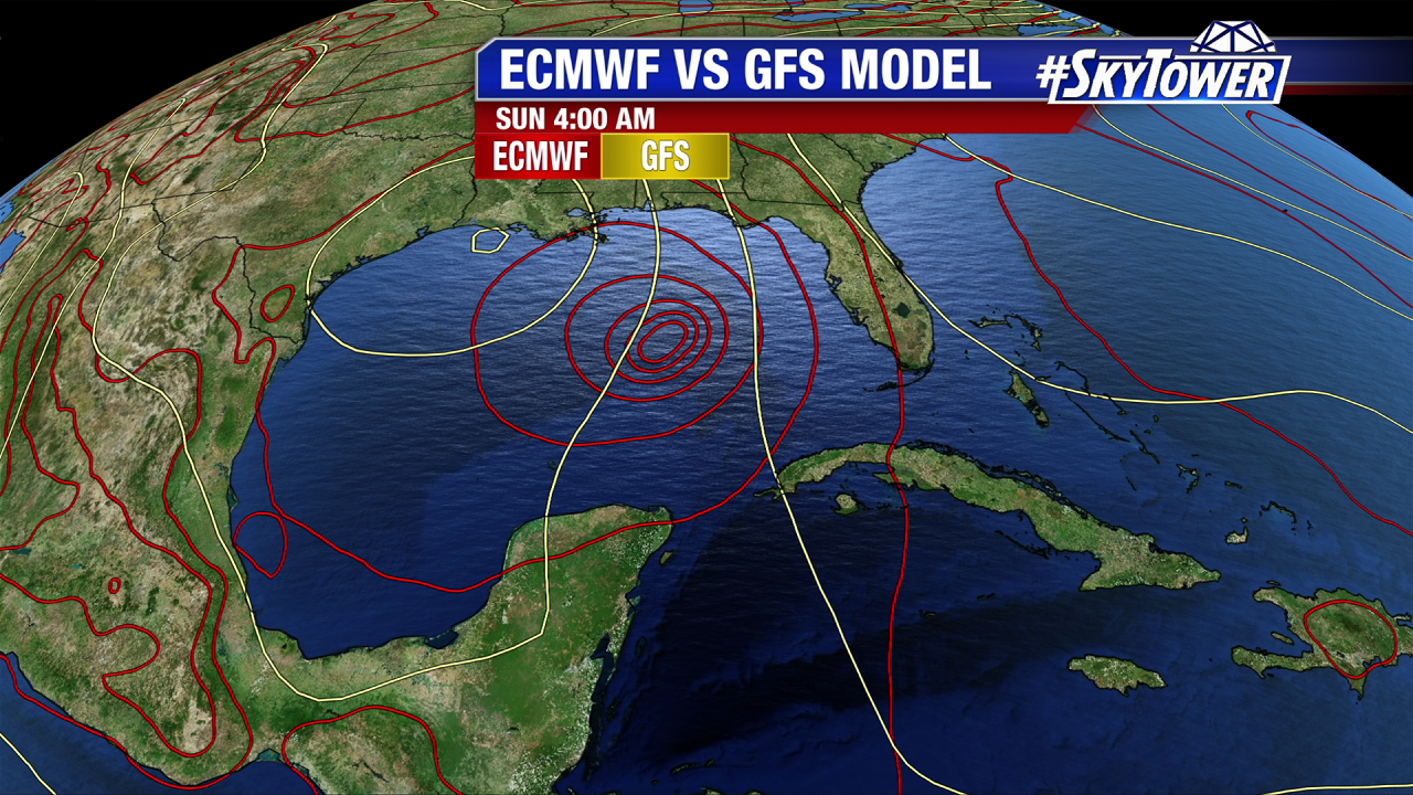
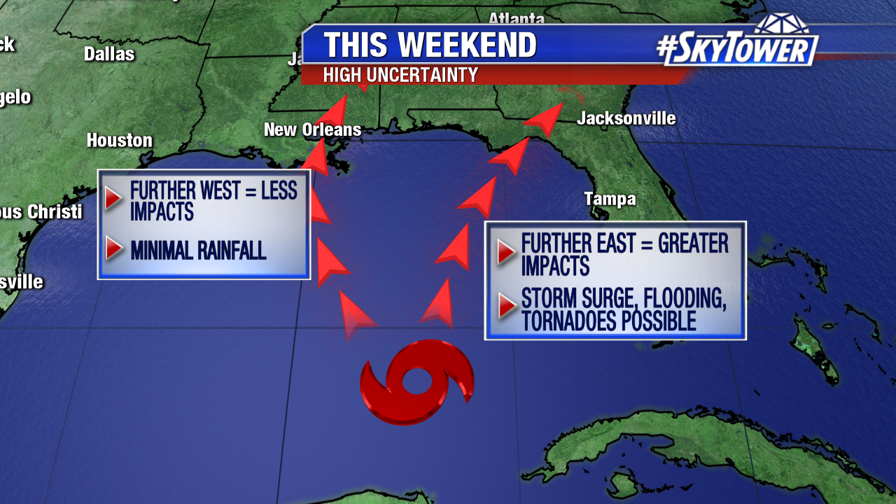
Over the last 24 hours models have come into much better agreement regarding Nate’s track into the U.S. this weekend. The 12Z Euro run today actually fell more into line with the GFS, which all along has indicated a weaker storm tracking further west into Louisiana. While there are still some questions in regard to intensity, the National Hurricane Center is still expecting Nate to become a hurricane in the Gulf before making landfall along the central Gulf coast late Saturday night/early Sunday morning. Those along the Louisiana coast, eastward into the Florida Panhandle, should monitor the progress of Nate closely as we head into the weekend.

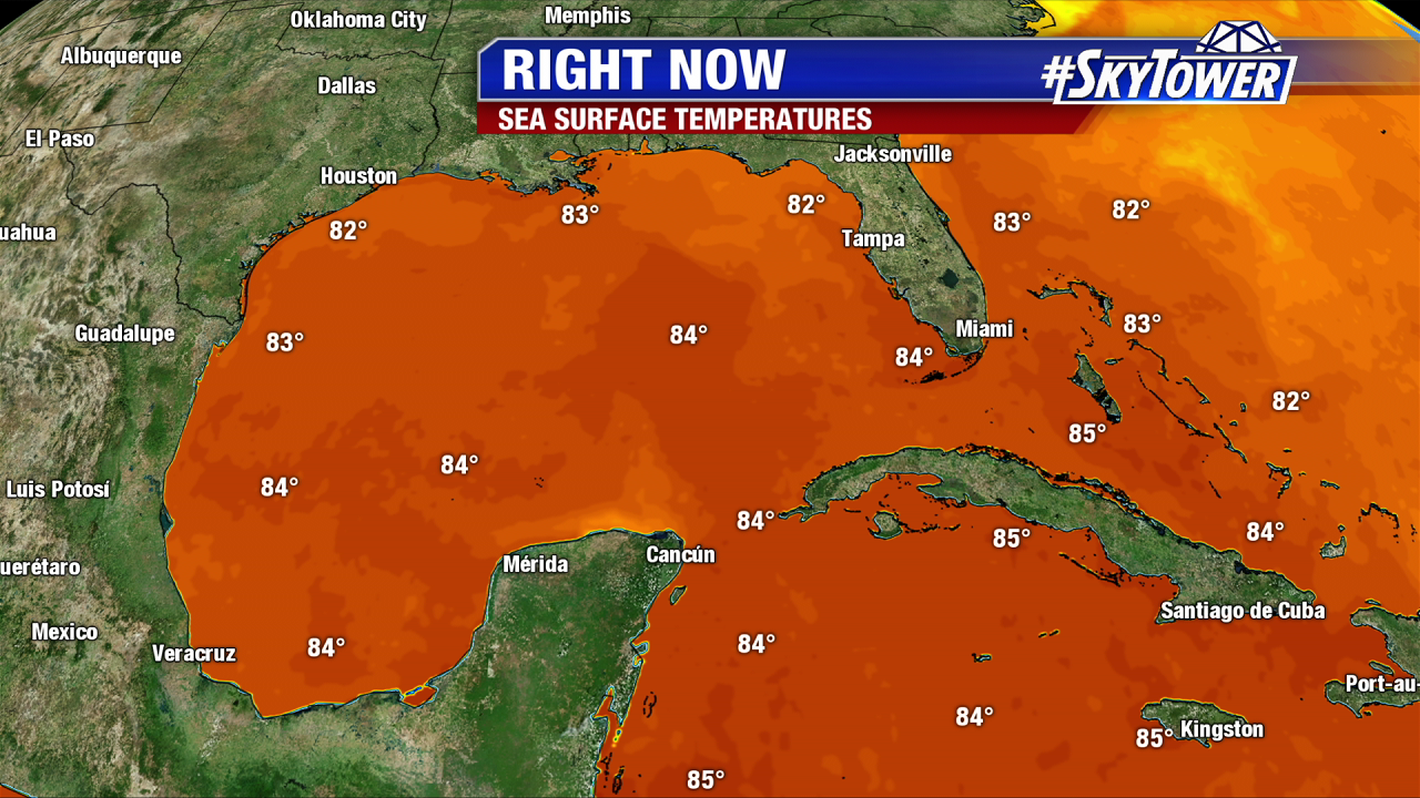
Other than churned up seas along Florida’s west coast and breezy SSE winds, Nate will have no direct impacts across the Florida Peninsula. However, scattered showers and storms are in the forecast through the weekend.

Soon-To-Be Nate Headed For Gulf This Weekend

At 5pm Wednesday, Tropical Depression 16 was located just off the coast of Nicaragua in the western Caribbean and was moving NW at 7 mph. This system is expected to become Tropical Storm Nate within the next 24 hours.

nate-png-close

nate-png-big

Through the end of the work week, Nate will head north, past the Yucatan Peninsula, and into the southern Gulf by early Saturday. Other than some land interaction with Central America, there isn’t a lot working against this system in the short-term. Water temperatures are in the mid 80s and upper-level winds are favorable for further strengthening over the next 2-3 days. Nate is currently forecast to become a hurricane by Saturday afternoon and move into the Panhandle on Sunday.

lynx-pngwater-temps

There has been a pretty wide-spread between our two most reliable models, the GFS and Euro so far. The GFS currently favors a faster moving, weaker system, tracking further west into Louisiana. The Euro has been insisting on a stronger storm, tracking further east into the Florida Panhandle. The differences between the two are understandable, given the fact that this is still a fairly weak system. Over the next day or two, we can expect to see better agreement between the two as the storm develops further.

ecmwf-vs-gfs

tropical-explainer

A track further west would greatly reduce impacts in the Tampa bay area, while a track further east would bring storm surge, heavy rain and the possibility of tornadoes. Stay with us over the next few days as we fine tune the forecast over the next few days.