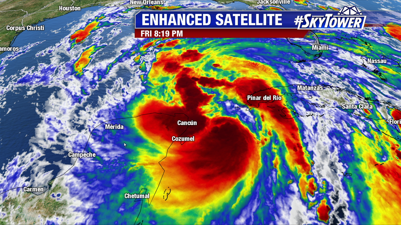
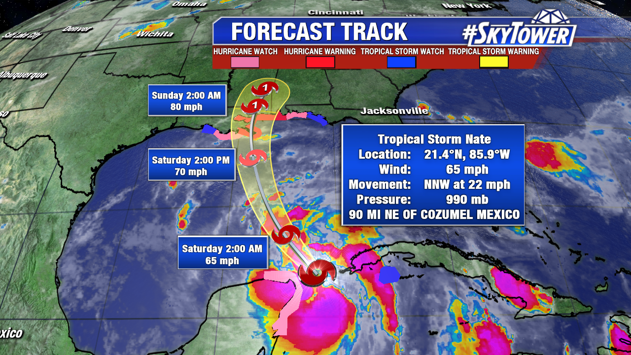
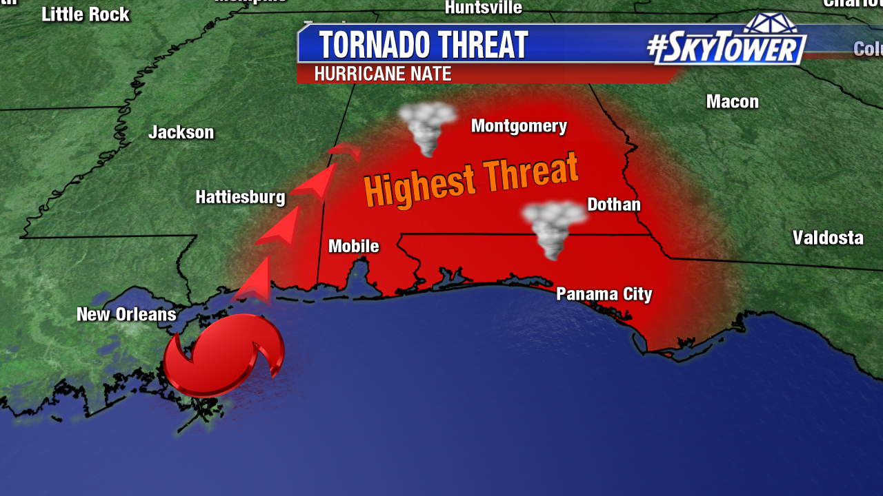
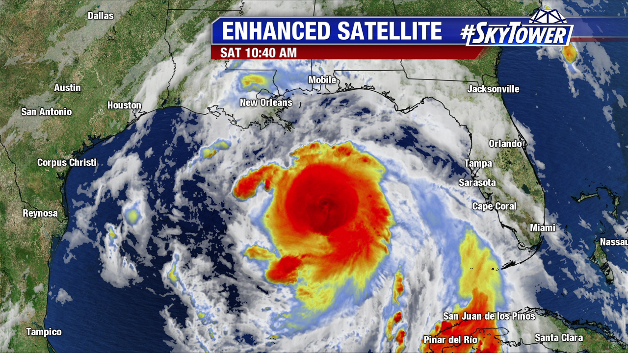
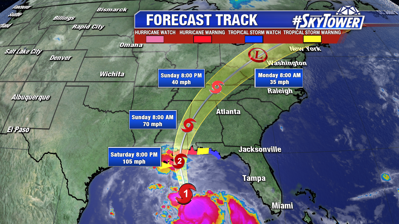
Nate became the 9th consecutive hurricane of the 2017 Atlantic season Friday night. According to Dr. Klotzbach of Colorado State University this is the most consecutive hurricanes in the Atlantic since 1893. Nate continues to intensify over the warm Gulf of Mexico with a defined central dense overcast. An eye may be forming Saturday morning. Upper level winds favor further intensification too, and Nate is now projected to make landfall in southern Mississippi late Saturday evening as a category 2 hurricane. As of 11 AM, max sustained winds are at 90 mph as Nate races north-northwest at 26 mph. The only saving grace for Nate is that there is not much time left before landfall for long-term further strengthening. Hurricane Hunters are out there non stop. Data shows the strongest winds are felt east of its center. Hurricane force winds only extend out 25 miles from the center. This spares New Orleans from the worst wind. Spin up tornadoes are likely through Sunday morning in the right northeast quadrant. Tropical storm conditions will reach the Tennessee Valley by Sunday night. Nate will become a depression by Monday and bring a stream of steady rain through the Northeast through early Tuesday.
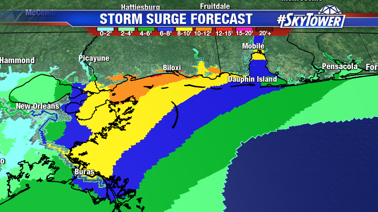
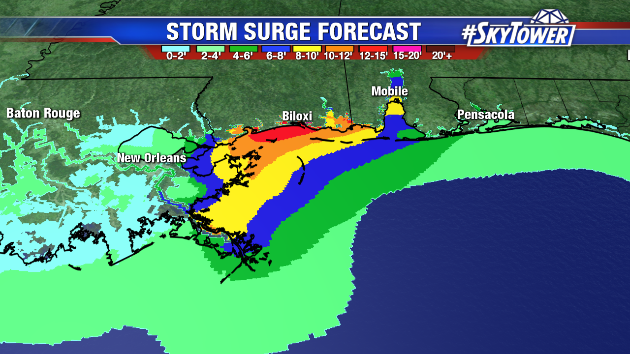
Nate will bring life threatening storm surge to the central Gulf coast. The greatest storm surge will be near landfall and to areas just east. This includes coastal Mississippi, Alabama, and the western Florida Panhandle. Here is a breakdown of the significant storm surge threat as of the 11 AM advisory from the National Hurricane Center:
Mouth of the Mississippi River to the Mississippi/Alabama border-7
to 11 feet
Mississippi/Alabama border to the Alabama/Florida border, including
Mobile Bay-6 to 9 feet
Morgan City, Louisiana to the mouth of the Mississippi River-4 to
6 feet
Alabama/Florida border to the Okaloosa/Walton County Line-4 to 6
feet
Okaloosa/Walton County Line to Indian Pass, Florida-2 to 4 feet
Indian Pass to Crystal River, Florida-1 to 3 feet
Gulfport and Biloxi are especially vulnerable to coastal flooding. A storm surge of 12-15 feet is possible here.These areas are no stranger to big coastal flooding events from hurricanes, including Katrina in 2005 and Camile in 1969.
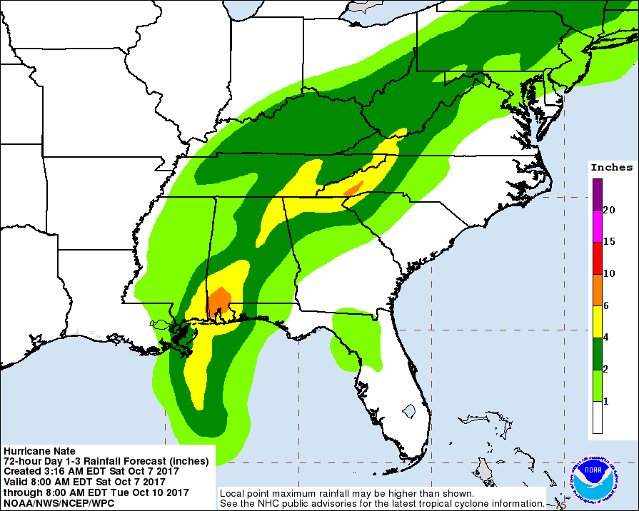
Nate will also bring freshwater flooding to the U.S. It is a fast mover, though. While southeast Louisiana will see 1-4″+, southern Alabama could pick up 6-10 inches of rain. The potential for heavy rain moves through the Tennessee Valley Sunday and the Northeast Monday. The graphic below is courtesy NOAA. It shows possible rainfall totals through Tuesday morning.