Ex Hurricane Ophelia Lashes Ireland; Invest 92L May Pass Near Bermuda

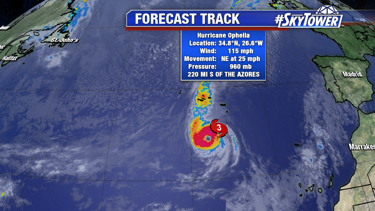
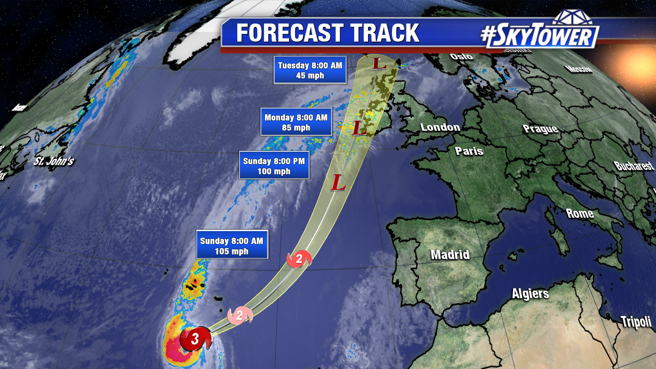
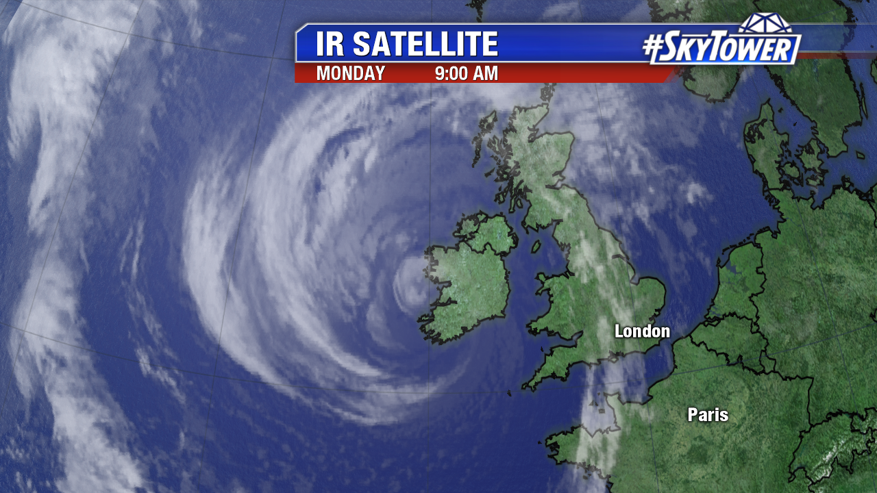
Former Hurricane Ophelia brought heavy rain, gusty winds, and coastal flooding to Ireland Monday. It is the strongest storm of its kind to hit Ireland since Debby in 1961. The core of the non tropical low moved ashore in southwest Ireland Monday morning EDT. According to the Irish Meteorological Society a gust of 97 mph was reported in Roches Point Co. Cork. Fastnet Rock, about 4 miles offshore of the coast, saw a gust of 109 mph. The remnants of Ophelia will brush the western United Kingdom late Monday EDT.

floater-ir-enhanced

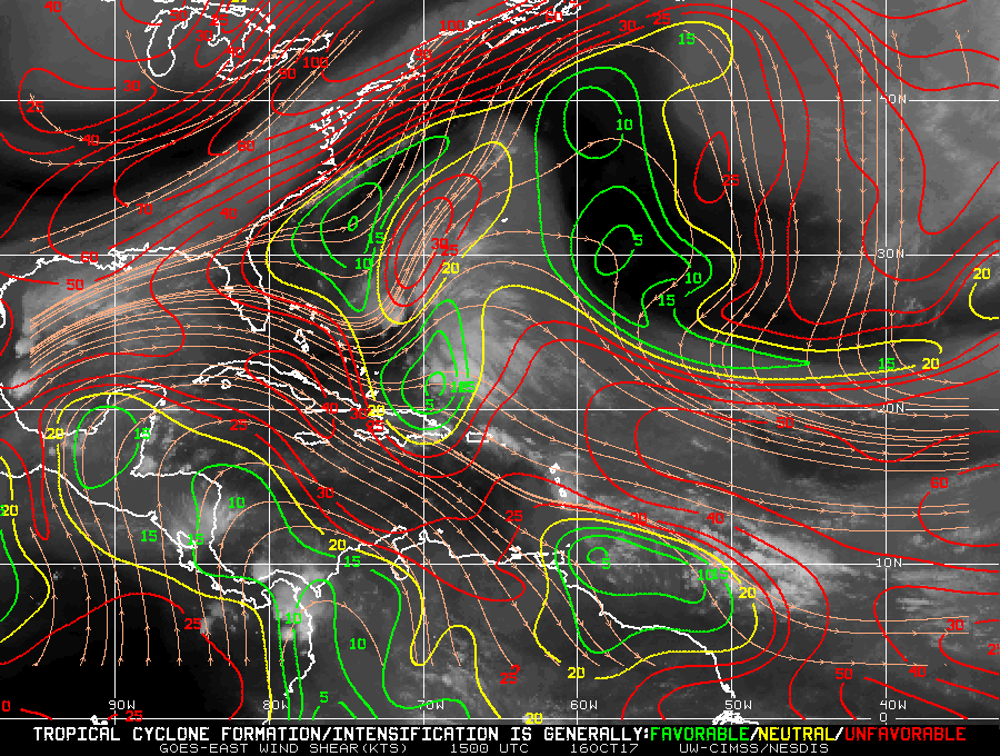
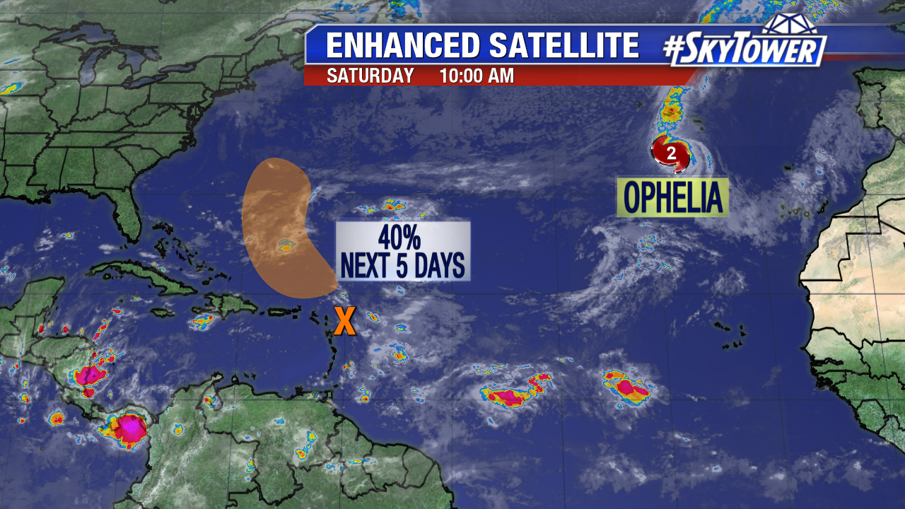
Closer to home Invest 92L shows some signs of life early Monday. The area of low pressure east of the Bahamas is broad in nature, but it is producing wind gusts near tropical storm force. Convection increases early Monday under moderate westerly shear. Upper level winds become even less conducive for development mid-week as Invest 92L lifts northward and merges with a frontal boundary. This energy may pass near Bermuda late Tuesday. If this feature gains tropical characteristics it will called Philippe.

atlantic-wide-2d-ir-enhanced-png45

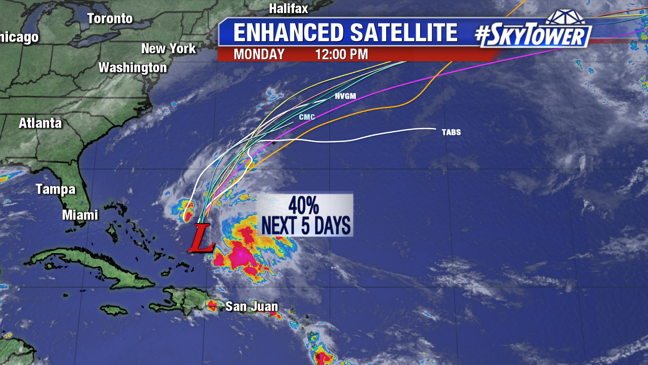
Upper level winds become less favorable for organization of Invest 92L Tuesday and Wednesday. Notice all the red indicating high shear around the southeast U.S.. These hostile upper level winds shift east into the western Atlantic mid-week. The graphic below is courtesy NOAA/The University of Wisconsin at Madison.

wg8shr


Ophelia Headed For Ireland; Watching Caribbean Disturbance

Ophelia became the 10th consecutive hurricane of the hyperactive 2017 Atlantic hurricane season mid-week over the north Atlantic. It is rare for hurricanes to form this far east. On Saturday morning Ophelia is the furthest east Atlantic major hurricane in history. This is according Dr. Phil Klotzback of Colorado State University. Ophelia is the sixth major hurricane of the season. As 11 AM EST Saturday max sustained winds are at 115 mph. The core of the storm will pass south of the Azores Saturday evening and early Sunday, but squalls will reach the Southeast Azores. Ophelia will transition to a non tropical system over cooler waters as it approaches Ireland Monday. While it will be an extra tropical system during this time, it will still bring tropical impacts. Hurricane force wind gusts and heavy rainfall are likely Monday and early Tuesday EST.

ophelia-png1

ophelia-png3

We’re also watching a broad area of low pressure near the Leeward Islands. Upper level winds are hostile in the short-term. As of Saturday morning there is a 40% chance this becomes a tropical depression/Tropical Storm Philippe over the next 5 days. It may pass near Bermuda this work week, but is no threat to the U.S..

atlantic-wide-2d-ir-enhanced