Tropical Storm Rina Races Towards Cooler Waters

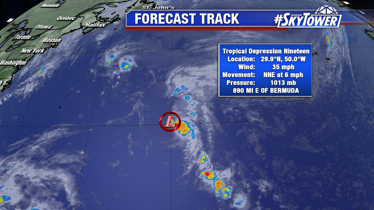
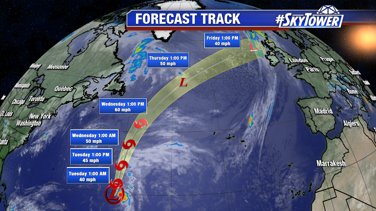
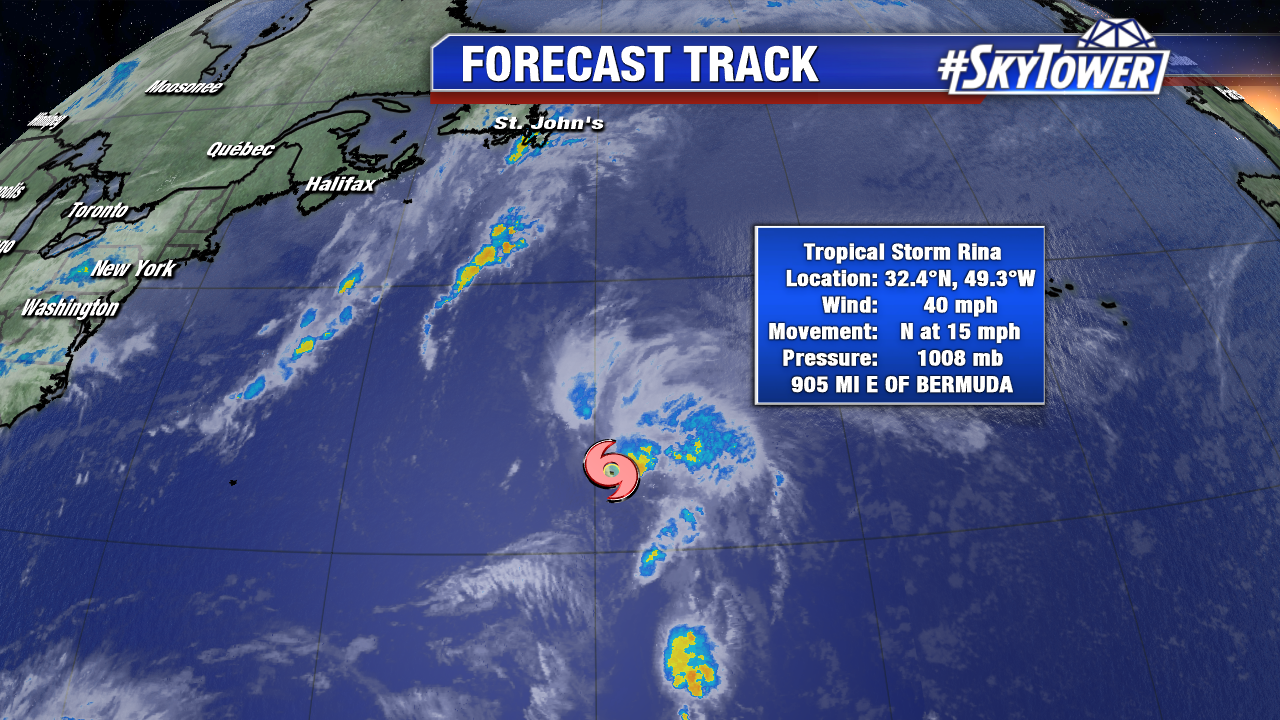
Rina became the 17th named storm of the active 2017 Atlantic season Monday night. Rina is still a minimal tropical storm at 10 AM AST with 40 mph winds. Despite hostile upper level winds, convection increases on the northeast side of Rina. If this continues, Rina may increase a bit in intensity over the next 24 hours. The disorganized tropical storm will transition to an extra-tropical system by Thursday morning over the cooler north Atlantic. It is no threat to land.

ophelia-png1

ophelia-png2

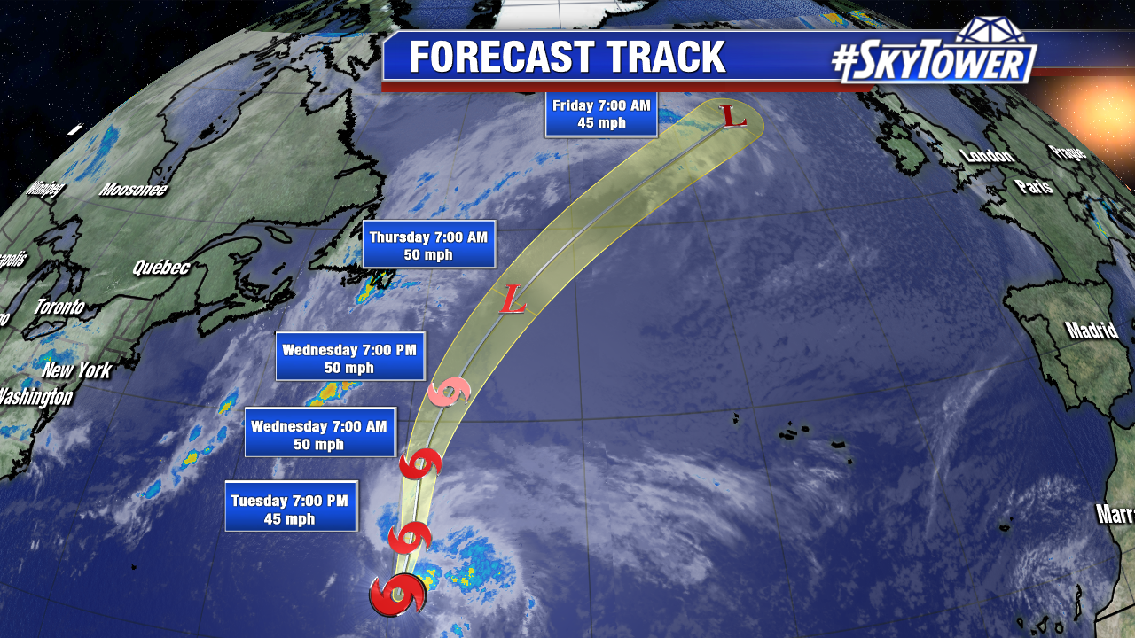
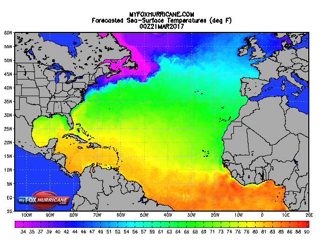
RIna sits over luke warm Atlantic waters Tuesday. It moves into an even cooler environment over the next 48 hours. During this time it will lose tropical characteristics. Beyond Rina, there are no areas of interest for the next 5-7 days+.

sst_atl_1


Tropical Depression 19 Forms in the North Central Atlantic; No Threat to Land

Tropical Depression 19 forms over the open north central Atlantic Monday morning. As of 5 PM AST max sustained winds are at 35 mph as it slowly moves north-northeast well east of Bermuda. The depression is disorganized as it battles some nearby dry air in the mid levels of the atmosphere. Westerly wind shear exposes the center of circulation. Tropical Depression 19 will likely become the 17th named storm of the 2017 Atlantic season, Rina, by early Tuesday morning. While gradual strengthening is expected, it will transition to an extra-tropical system over the cooler north Atlantic by Thursday afternoon. It is no threat to land, but the remnants of future Rina could bring squalls to Ireland/the United Kingdom by Friday or Saturday.

ophelia-png1

ophelia-png2