Disturbance Will Continue Rain Into Memorial Day Weekend

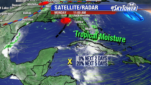
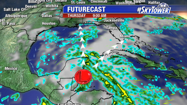
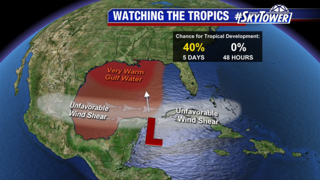
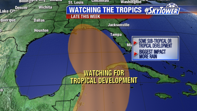
We are watching a disturbance near Belize for potential late week sub-tropical or tropical development. Over the next 48 hours development is not expected as it remains disorganized and in an area of unfavorable wind shear. Later this week as it moves into the gulf waters it may gradually develop.

Models still diverge on whether it will take a more northerly or easterly track. Right now, either track will increase showers and thunderstorms through the holiday weekend, bringing more heavy rain to already saturated ground.

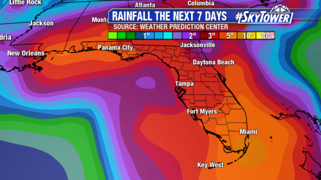
Deep tropical moisture remains over Florida for the next several days with daily rain and thunderstorms continuing. Several more inches of rain are possible, especially where the sea breeze sets up. The Alafia, Manatee and Little Manatee rivers are already above flood stage.


Potential Development Late This Week, Main Impact More Rain

We are keeping an eye on a disturbance in the northwestern Caribbean. Right now it is disorganized and only has a 20% chance of tropical development over the next 5 days.

Models are not in good agreement on the path of this disturbance. The European model takes it north into the central Gulf and stalls it along the northern gulf coast. While the GFS tracks it east across southern Florida and then north along the east coast of the state. The biggest question is how much more rain we will get from the system.

It is too early to tell what the strength and track of the system will be. But either way it means more rain for the state and a soggy Memorial Day weekend. Some areas have already picked up to 7-10″ of rain since Mother’s day, wiping out the drought for most of the state. Additional heavy rain over the next several days could lead to flooding on area rivers, as some are already at flood stage.