Chances of Memorial Day Weekend Tropical Development Increasing

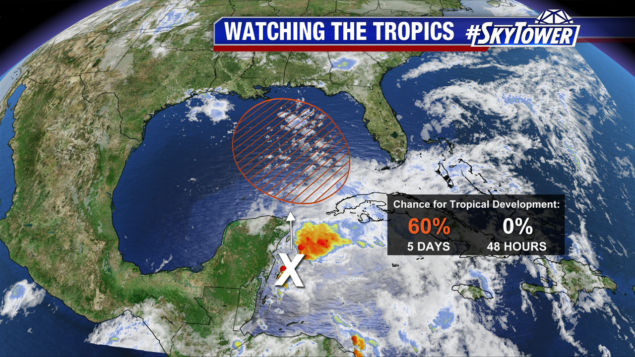
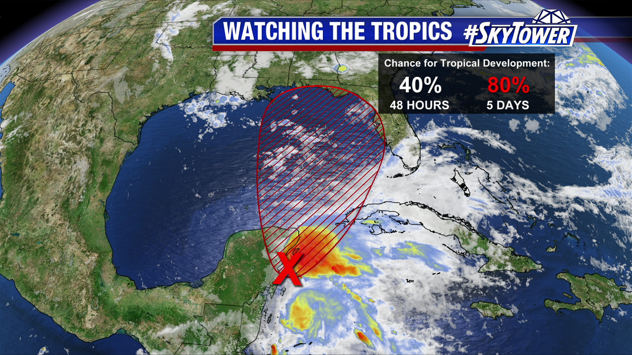
On Thursday morning, a broad area of low pressure was located over the southeastern Yucatan Peninsula. As expected, land interaction and strong upper-level winds have prevented further organization thus far. However, as this disturbance starts to move north on Friday and through the weekend, environmental conditions will be much more favorable for a subtropical or tropical depression to form. At this point, a weak Tropical Storm Alberto is not out of the question. The National Hurricane Center now has development odds at 40% over the next 48 hours and 80% over the next 5 days.

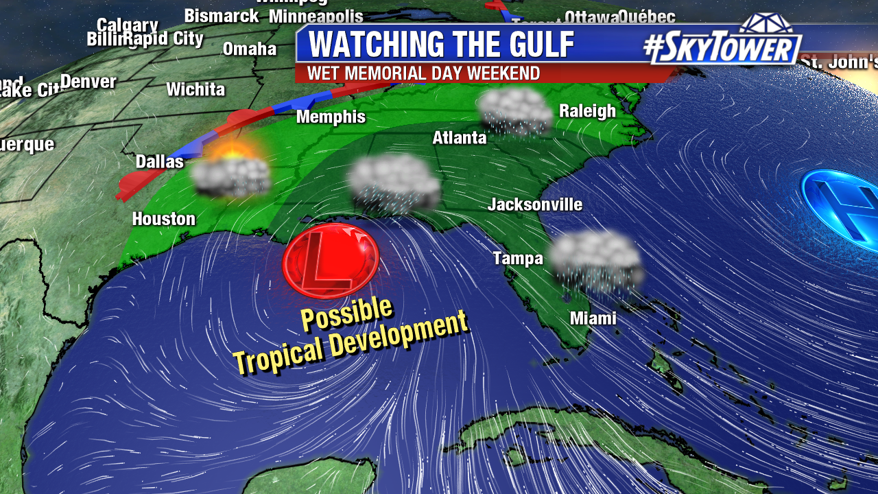
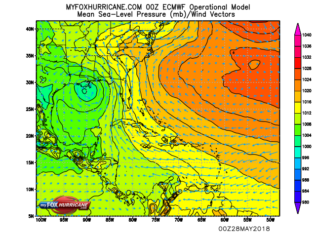
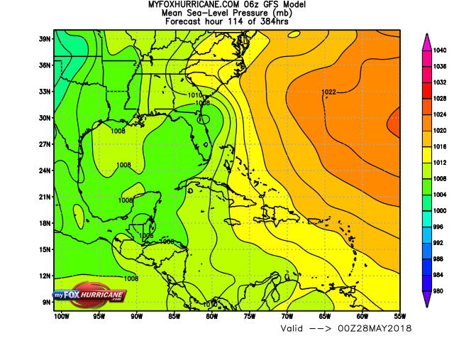
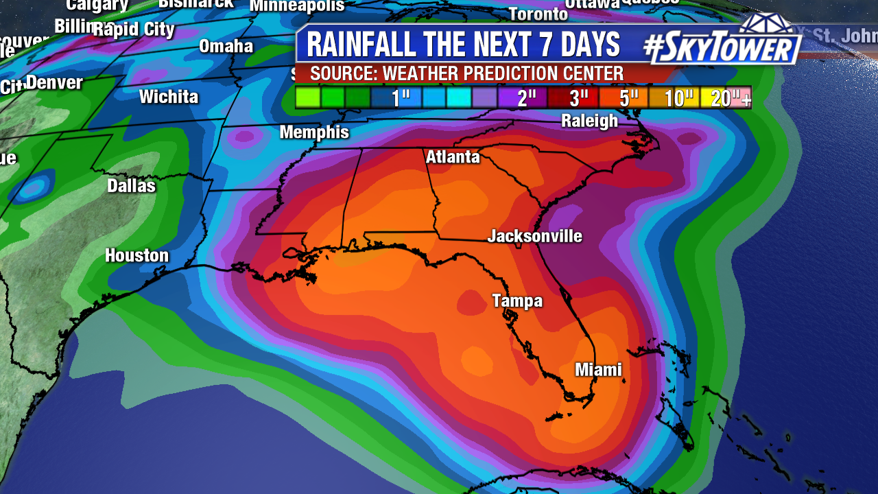
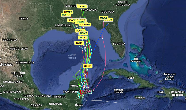
We’ve finally started to see some better model agreement over the last 24 hours. The consensus solution seems to be a slowly strengthening area of low pressure moving north through the east-central Gulf of Mexico through the weekend before stalling on the northern Gulf Coast early next week. Since we’ve been trending our forecast the last few days toward this type of scenario, it really doesn’t change the forecast much. The big impact will be rounds of heavy, in some cases flooding, rainfall for the central and eastern Gulf Coast, as well as parts of the Southeast, for several days.

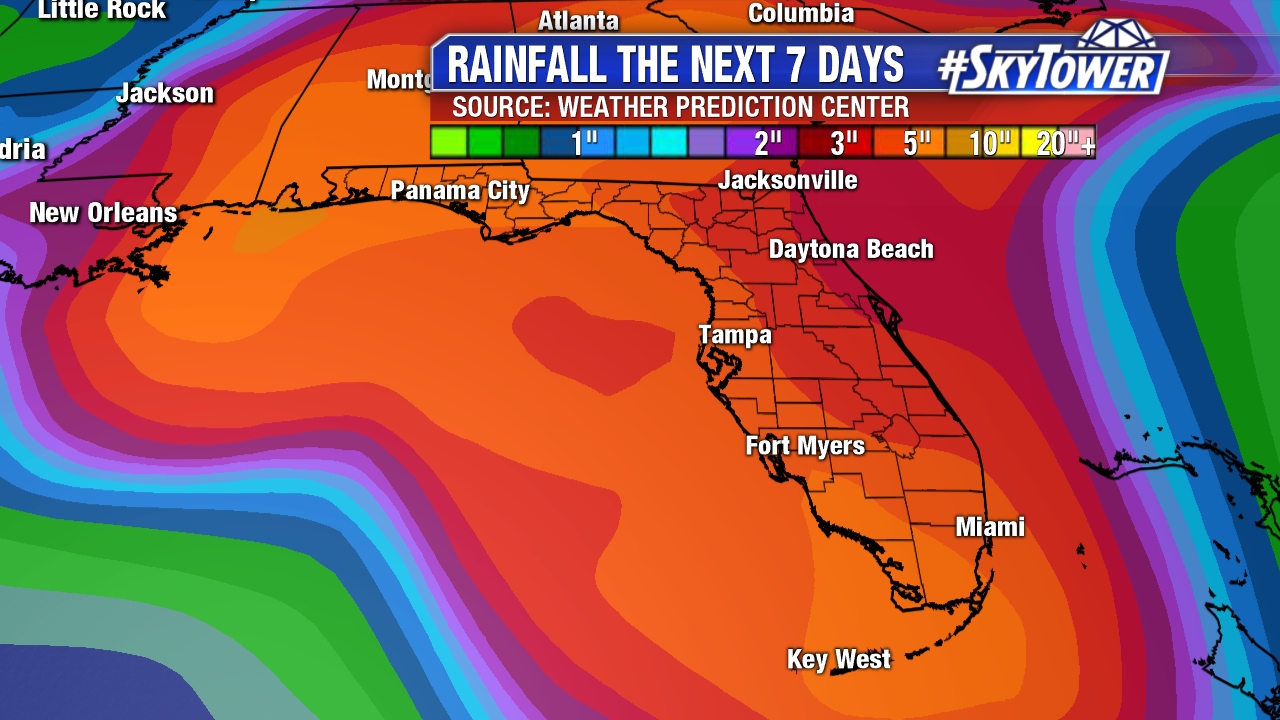
One other thing we’ll be keeping an eye on is the potential for waterspouts and tornadoes. This is often the case with rain bands on the eastern side of a deepening area of low pressure. A lot of factors will play into that threat, and it may not materialize at all. Stay with us as we continue to fine tune the forecast over the next day or two. Safe to say, don’t count on many outdoor activities this holiday weekend.

Watching The Gulf This Week; Potential For A Very Wet Memorial Day Weekend

As of Wednesday morning, not much has changed with the disturbance (Invest 90L) in the far western Caribbean Sea. Very little development is expected over the next day or two thanks to strong upper-level winds and land interaction with the Yucatan Peninsula. However, conditions are expected to become a little more favorable for development as this system moves north into the central or eastern Gulf by late Friday/early Saturday. At that point, a tropical depression may form. The National Hurricane Center currently puts the chance for development at 60%.

We’re still not seeing much model agreement as to how things will ultimately play out. The overnight Euro run continued to suggest a slow-moving, stronger system heading toward the central Gulf Coast.

00Z Euro valid for Sunday evening:

The GFS, however, essentially keeps this an open wave and takes the slug of moisture across central and south Florida. While the track, speed, and development of this system will determine who has the highest threat for heavy rainfall, the end result either way is going to be a wet Memorial Day Weekend for many folks along the Gulf Coast and across the Southeast.

06Z GFS valid for Sunday evening:

It’s a little too early to be pinpointing exact rainfall totals, but the latest precipitation forecast from the Weather Prediction Center (below) puts down several inches from New Orleans to Miami and up through the Carolinas through early next week. Depending on how things play out, these totals may be on the conservative side. Stay tuned as we iron out the details over the next couple days.