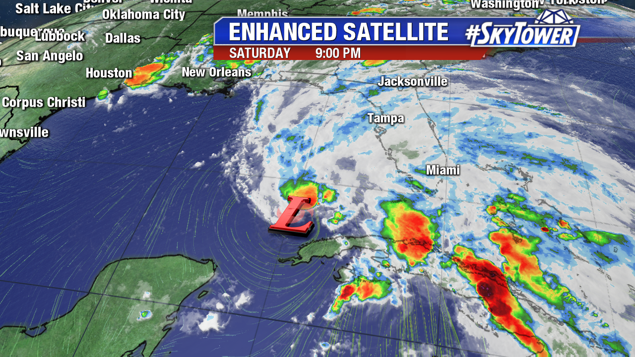
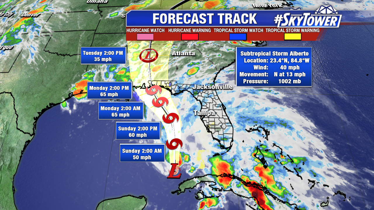
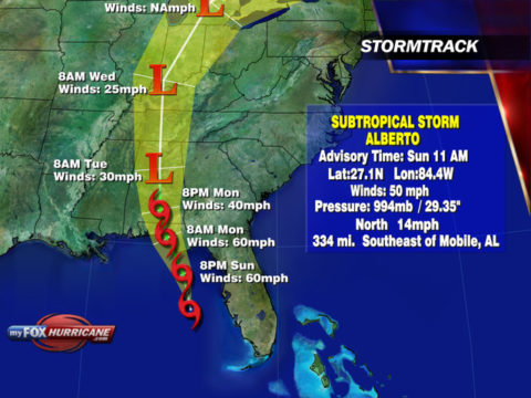
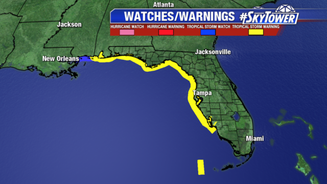
Alberto has strengthened to 50 mph winds, but is still a subtropical system. It will continue to move north and then northwest heading towards the northern Gulf coast. Alberto will likely strengthen to 60 mph winds before making landfall Monday morning.
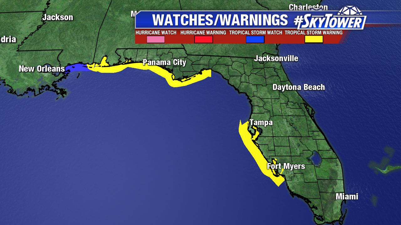
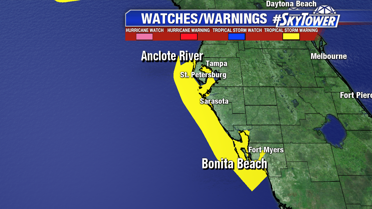
Tropical Storm Warnings remain in place along the Gulf coast. Along the coast a few wind gusts to 40 mph are possible, while the rest of the area will be breezy with winds of 20-35 mph.
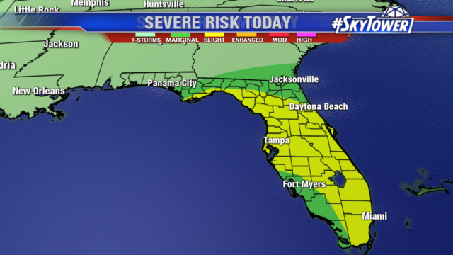
After a round of steady rain this morning, we will see periods of dry time in the afternoon as drier air briefly moves into the upper levels from the southwest. Thunderstorms are still possible, fueled by an unstable atmosphere and daytime heating. Tampa Bay is under a slight risk of severe weather today, a few tornadoes are possible along with tropical downpours.
Boating conditions remain dangerous through Memorial day. Boaters are encouraged to wait until Tuesday to head out on the water when conditions improve. There is also a high risk of dangerous rip currents and extremely rough bay waters.

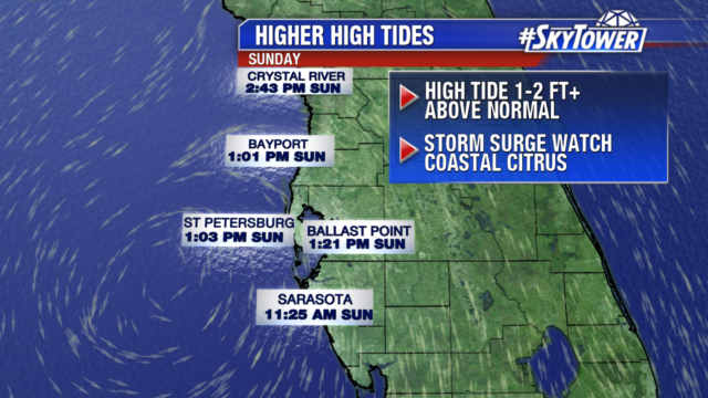
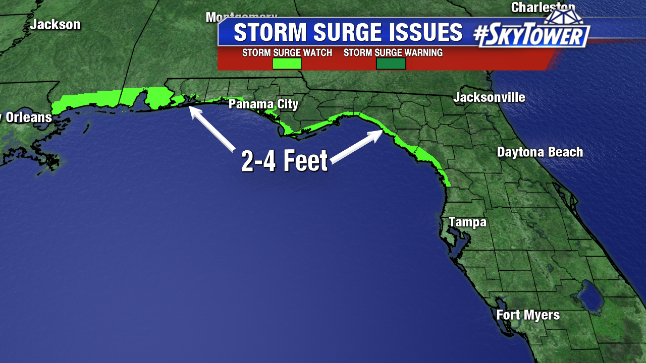
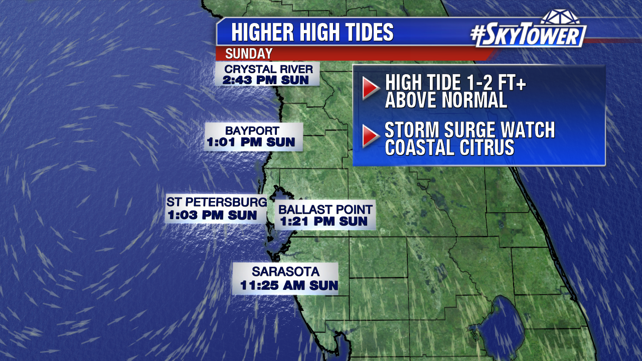
A storm surge watch remains in place for Coastal Citrus county. High tide around midday today will run 1-2 feet above normal.